purduewx80
-
Posts
1,705 -
Joined
Content Type
Profiles
Blogs
Forums
American Weather
Media Demo
Store
Gallery
Everything posted by purduewx80
-
Getting, by far, our strongest gusts of the event right now - estimating near 50MPH at times. The power has been flickering off and on, which I've never had happen in the city.
-
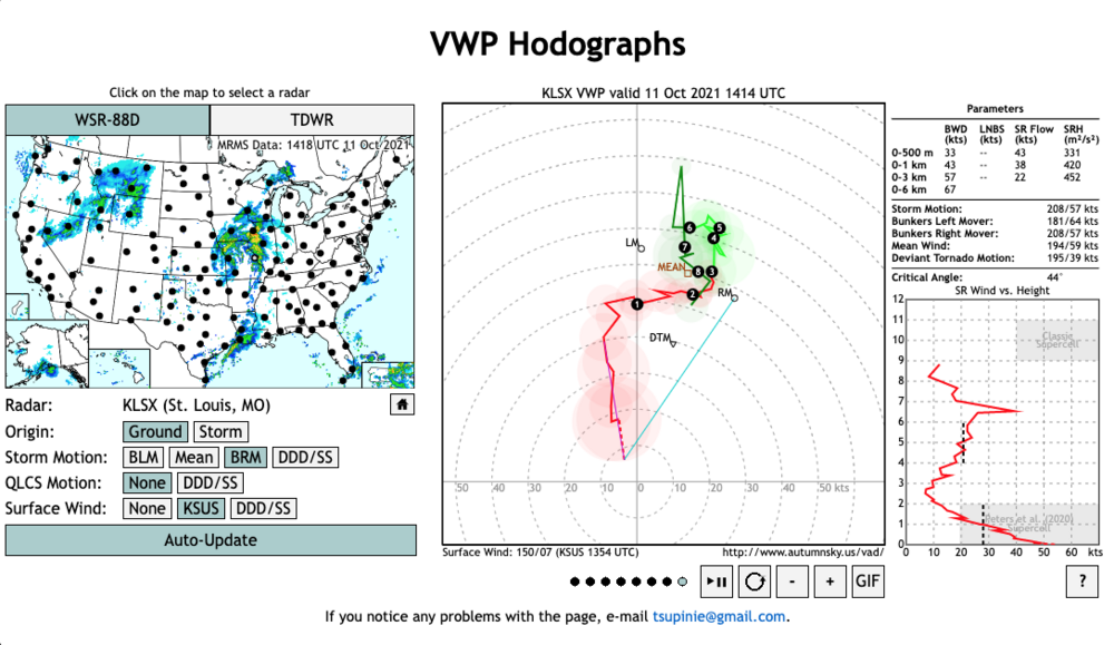
The referenced St. Louis VAD below.
-
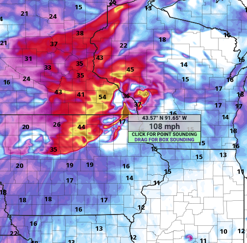
Storm motions will be on the order of 50-60MPH+.
-
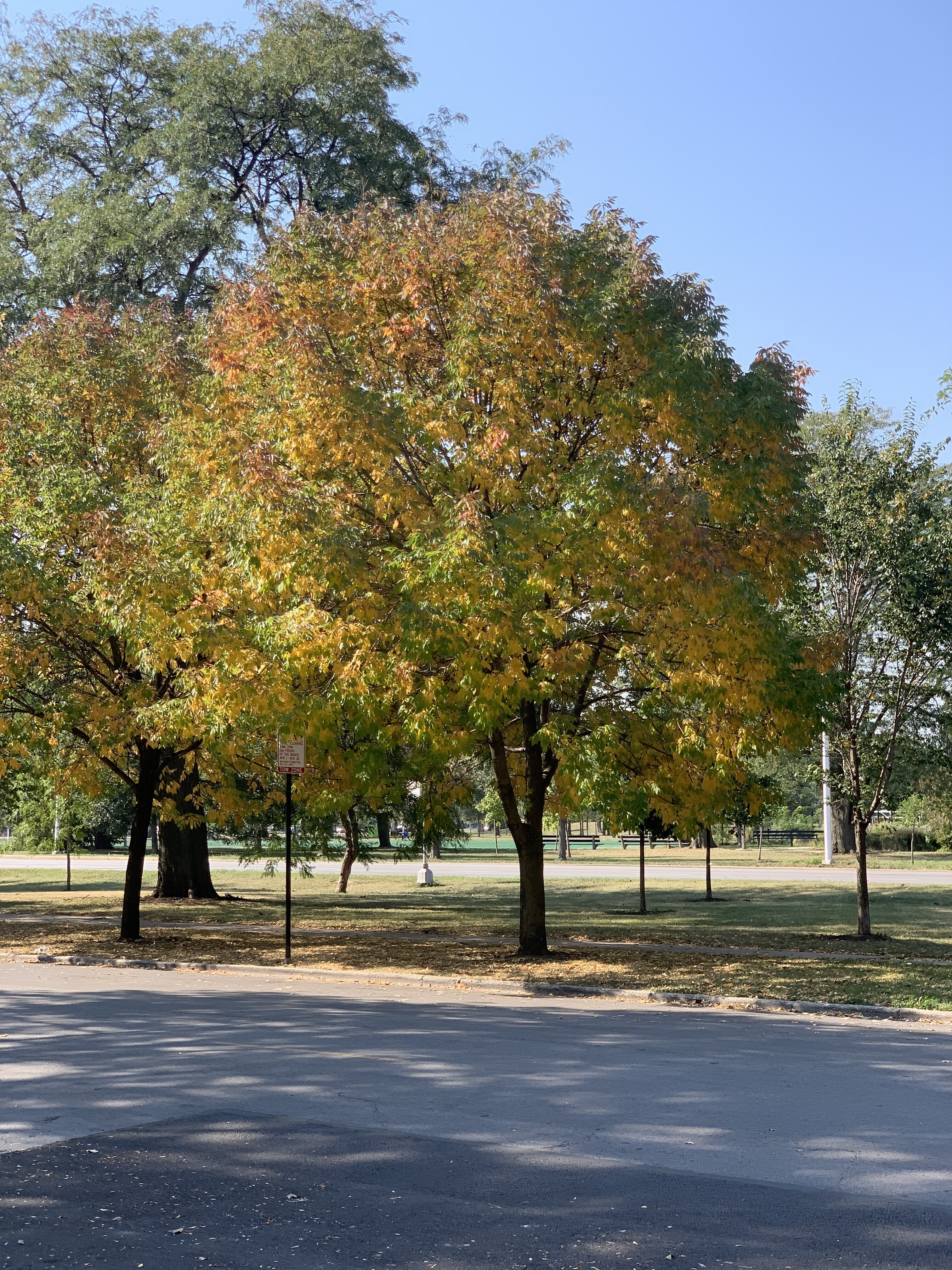
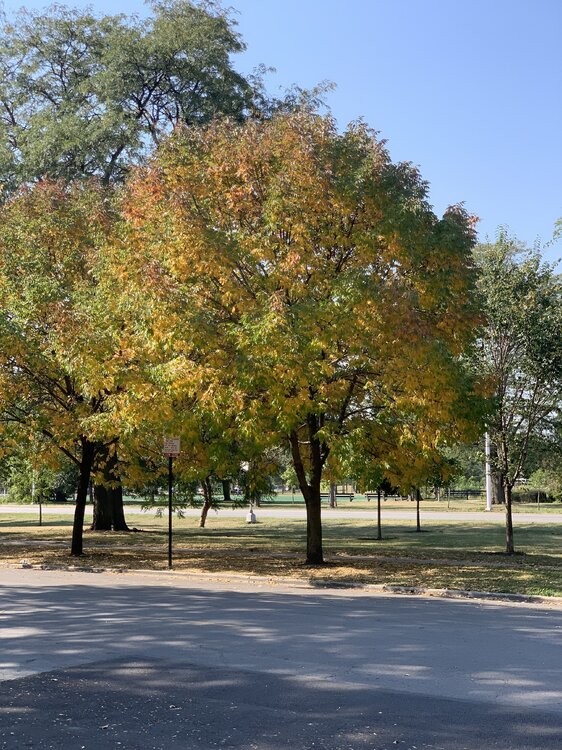
Chicago has a program in place to treat what they estimate to be 85,000 ash trees on public property. You can even report suspected infections on the city's 311 site. That pic was on a boulevard w/ ~20 of them, all treated, tagged and healthy. In some ways I guess it's easier to take care of them in a city than in large, rural groves. My dad has saved a few on his property in southern IN, as they're one of his favorites.
-
Ash trees have been slowly turning here for a couple weeks. Probably muted colors this year with the drought hangover and late warmth. Looking forward to a few downpours later, if everything goes right.
-
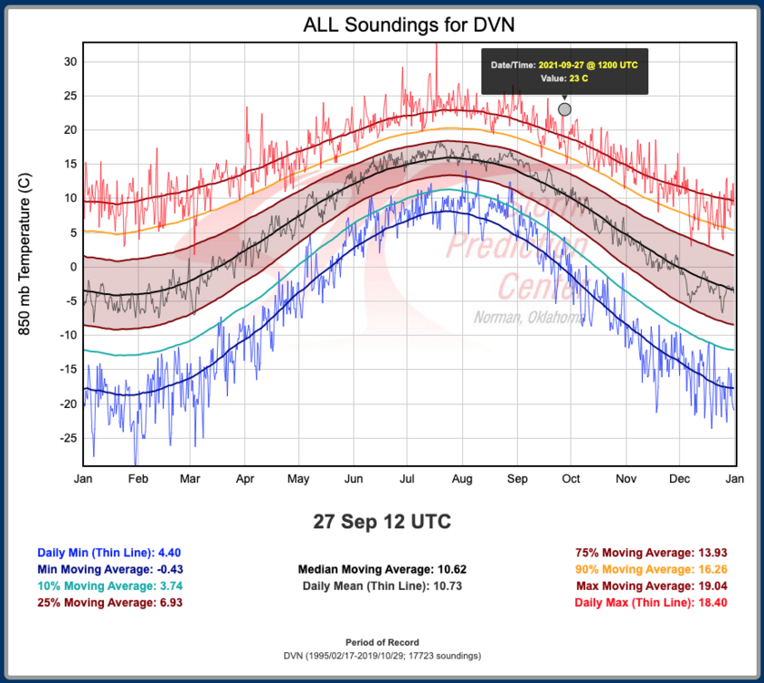
Many should make a run for 90 deg today, though ORD could get 89'd again depending on how fast the front sneaks down the lake. DVN's 850 T was 23C at 12Z, which is the warmest so late in the year (by one day). Full sun, dry soils and good mixing potential all favorable for overachieving even the warmest of guidance.
-
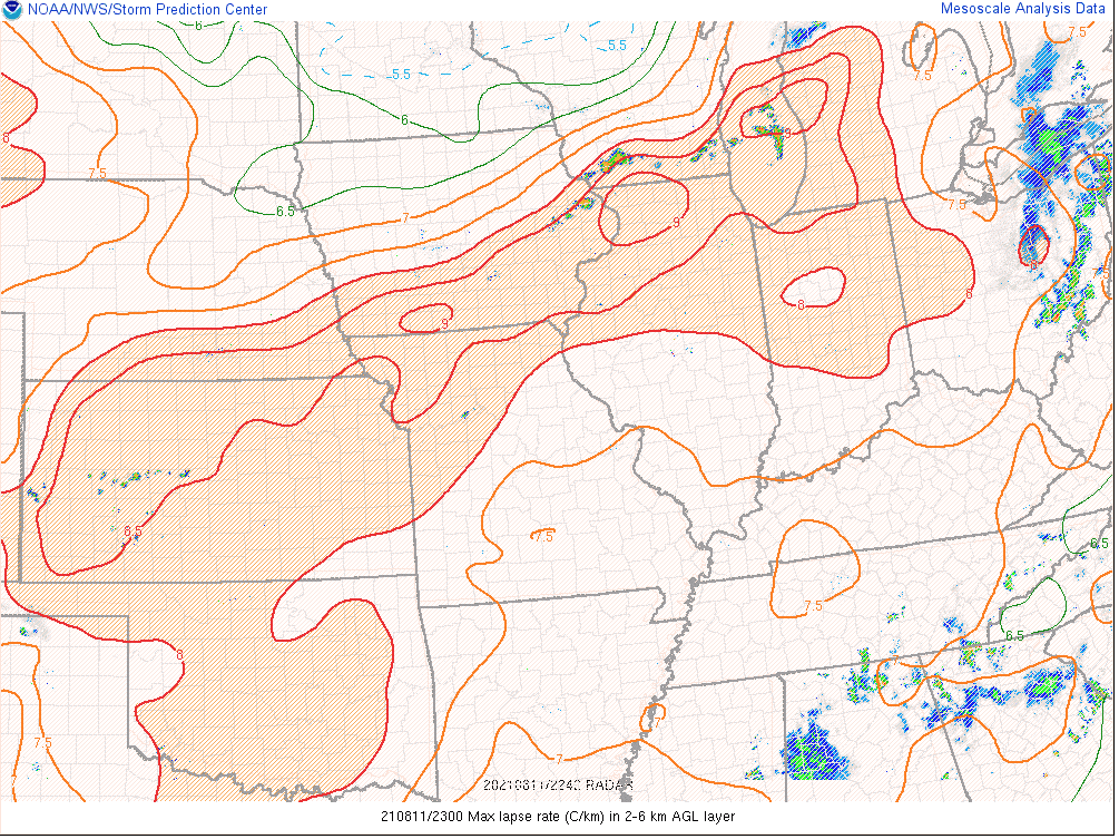
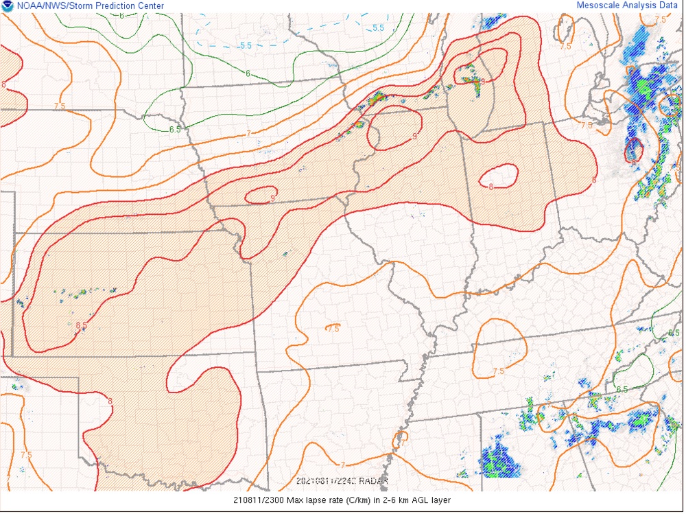
tennis-ball-sized hail in WI in the general thunder outlook (one unconfirmed photo showing a stone 3"+). 12Z soundings indicate mid-level lapse rates of 7-8.5C/km. shear 40-50KT+. pretty good indication to me the outlook is underplaying today.
-
That is most definitely not how you read that. It's the altimeter, which was 29.22" or around 989.5mb. Looks like he deleted both tweets fortunately.
-
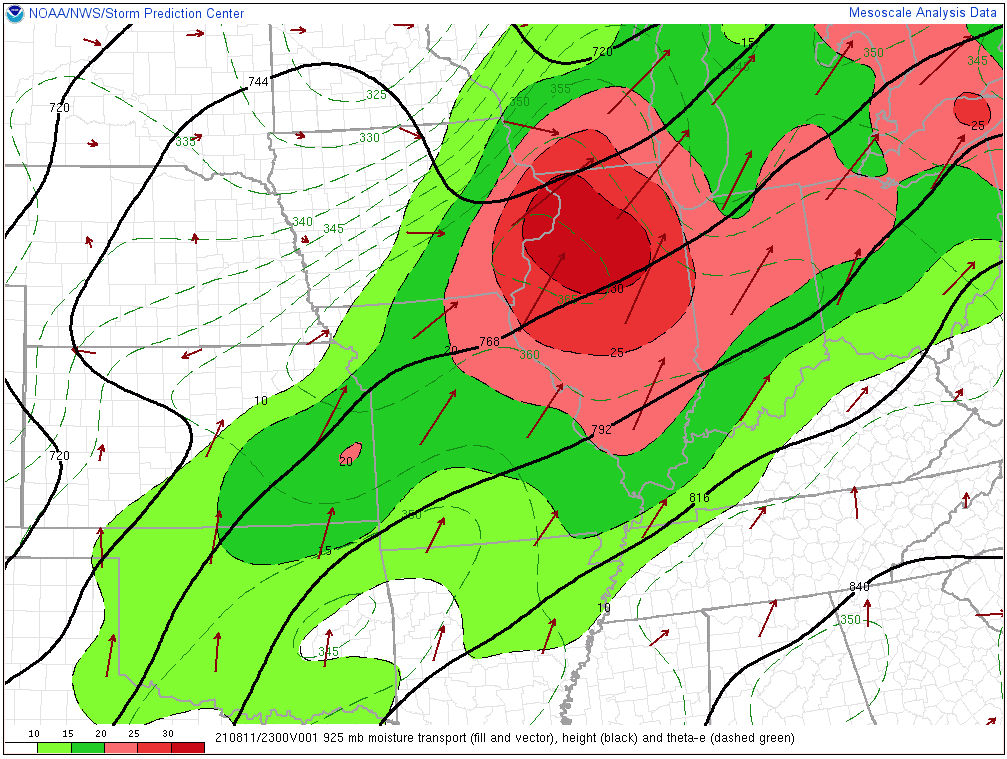
The HRRR late-CI bias is in full effect today given TS in the QC already. Its coverage is probably too low given the lake breeze boundary and strong MCV moving in during peak heating, but it overall seems to have the right idea for IL/IN this eve. Probably some pulse severe wind but mainly heavy rain given the weak shear and slow storm motions. Definitely some uncertainty tomorrow on the best overlap of shear and CAPE - SPC seems to be playing the farther S scenario for now which make sense if the effective front is shoved south by TS tonight. On the other hand, the 18Z HRRR is definitely showing a D-word scenario up into SE MN. IMO the training/flood setup tomorrow night has a pretty high ceiling in parts of the region.
-
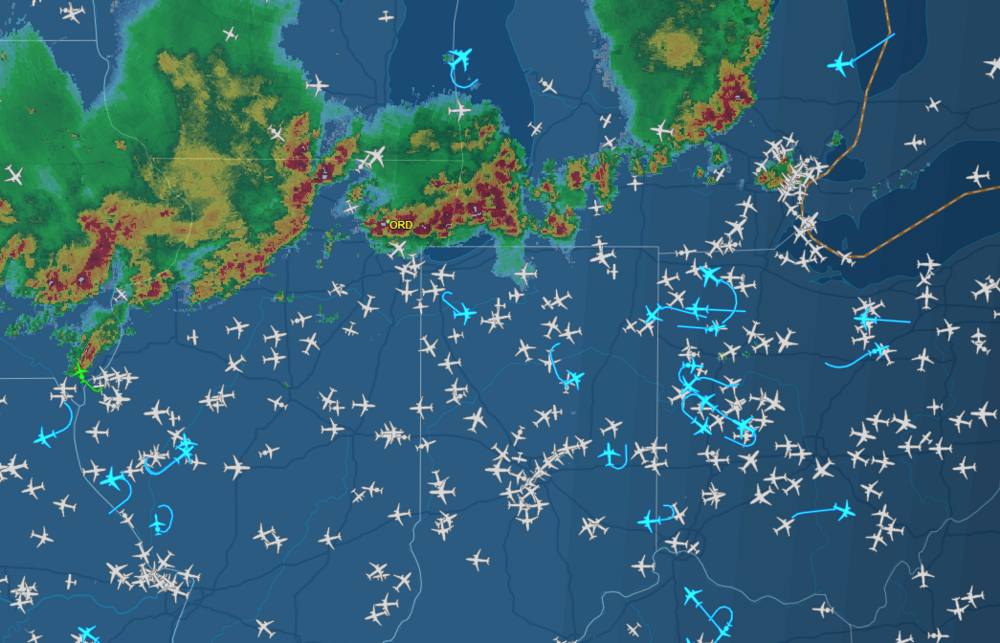
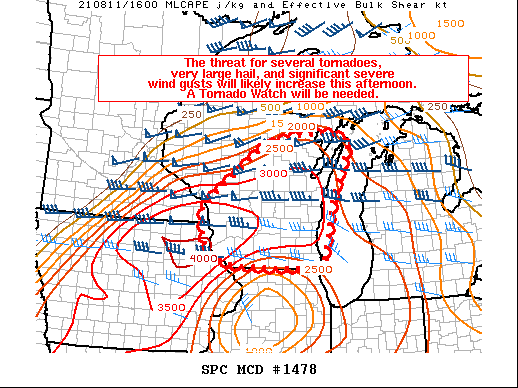
Today has definitely been an interesting setup that relied 100% on nowcasting. In aviation we try to come up with a convective forecast that helps the FAA plan routes in and out of the area (mainly for ORD) - been one of the lower confidence days of the summer given zero model support. If you read through all of LOT's AFDs today, you'll see how the forecast has been evolving back and forth as conditions change. At one point we thought the dry air observed on the 12Z OAX sounding would inhibit TS this far south, but it seems to me the corn belt helped with moisture flux from the surface up to the 925-800mb level. This all resulted in MLCAPE rapidly increasing this afternoon (which the NAM has done well with despite mostly missing the actual wx). Definitely not the best time to be flying into O'Hare today.
-
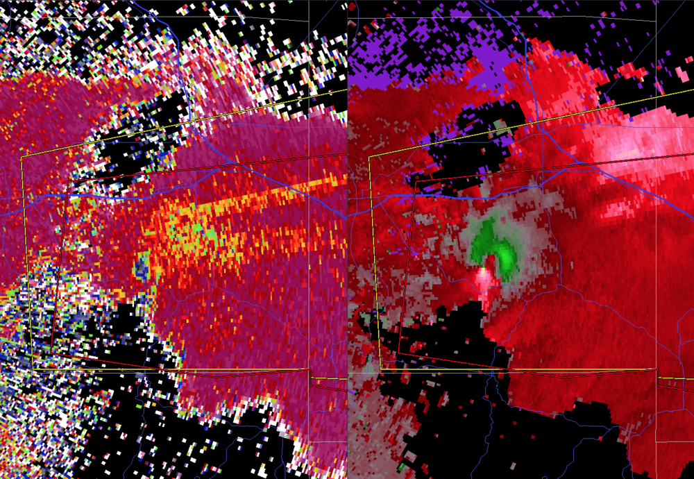
Supercells on the N side of the outflow boundary are pretty interesting. Looks like a fairly narrow corridor of extreme low-level shear w/ NNE winds on the cold side of the boundary and SSW winds just above.
-
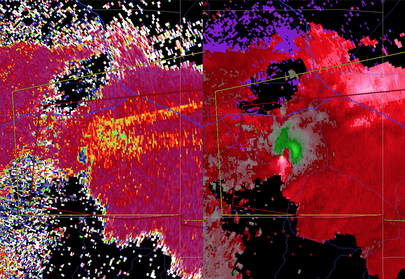
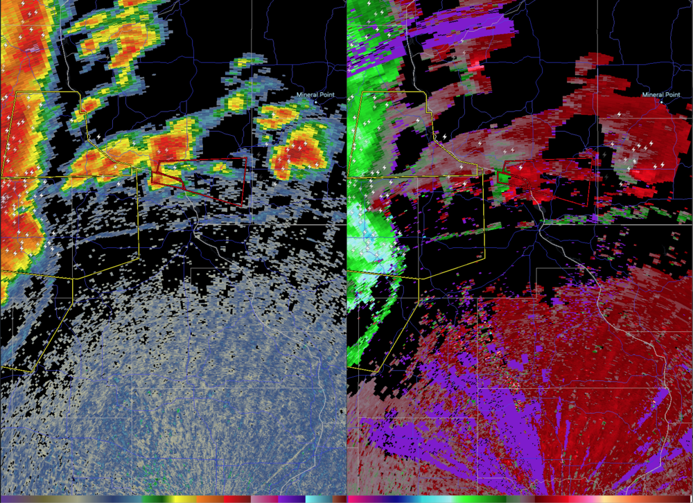
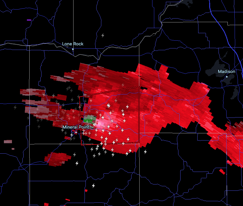
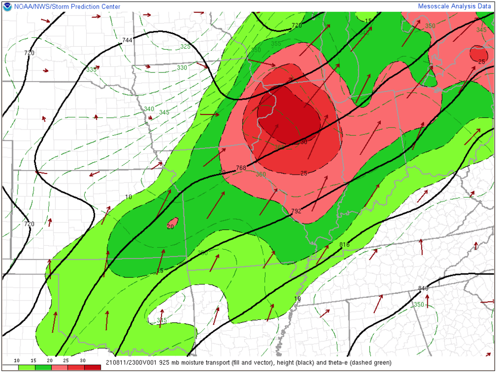
Destabilizing very quickly now thanks to incredibly steep mid-level lapse rates and strong low-level moisture transport. I don't really see the stratus the SPC mentions in their latest discussion as a hindrance to an increase in TS development this evening given the advective processes ahead of several well-established mesocyclones. Confirmed tornado east of Mineral Point now - in the worst spot for radar detection, but the meso is obviously impressive (via KDVN).
-
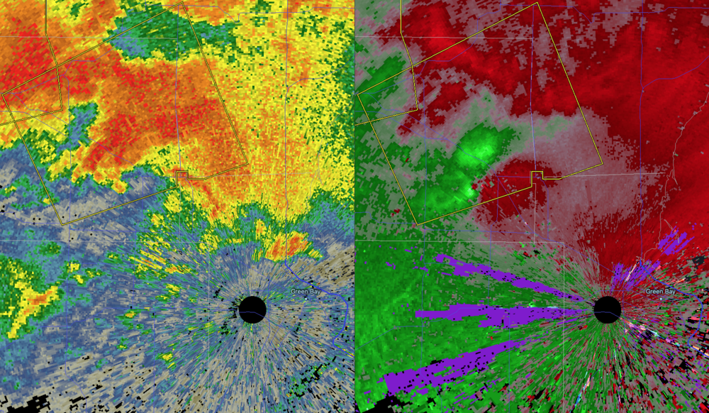
TDS near Green Bay now, too.
-
-
that one is so close. once it moves right and interacts with the boundary in the next hour, look out. Any of these tail-end charlies have the best chance of remaining more discrete and interacting with the outflow from this morning.
-
-
Tornado watch forthcoming in WI.
-
Looks like a wake low is developing behind the line. Pressure falls in the western burbs now with gusty SE winds developing.
-
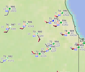
Impressive rear inflow jet and cold pool - ARR dewpoint down to 62F with 40KT winds continuing well behind the outflow. SPC may need to adjust the ENH to southern MI and another farther W into NE IA. 12Z guidance has the cold pool but they all handle it differently. Some show rapid recovery like the HRDPS, others show the recovery around the bubble high taking longer, which may lower the severe risk in some areas of IL/IN if true.
-
Definitely a cold pool developing with it. I wonder if the synoptic fields being stronger today will help trigger a quick recovery behind it. Lapse rates and shear are more impressive today, which could help make up for a potential lack of 75-80 dews. As some mentioned last night, the boundary this sends north towards the front should locally enhance sfc vorticity and the wind field, probably in S WI. The 06Z HRDPS is doing well with that cluster this morning and shows a quick recovery during the mid- to late afternoon.
-
Higher sup/tornado risk may be getting into North Woods territory but could be decent in central WI over to Green Bay. Probably a conditional risk closer to us depending on boundaries/destabilization, but at least for now anything local may be in the south-moving QLCS overnight.
-
This turned out to be the best way to see where and when things would pop today. Pretty much nailed the timing of things coming into ORD if you just followed that vort.
-
Don't see how tomorrow isn't at least an enhanced risk day. Whatever convection is around through the morning will lay out boundaries ahead of the front and increasing shear dropping south. Even the guidance w/ AM storms destabilizes things quickly behind it.
-
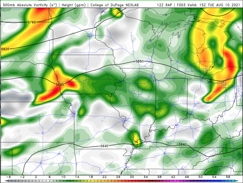
There's a well-defined MCV/shortwave over western IA that the RAP has adequately analyzed. That will easily promote development across the area this afternoon. Seems like the 12Z models all have a similar evolution but with significant timing differences.
-
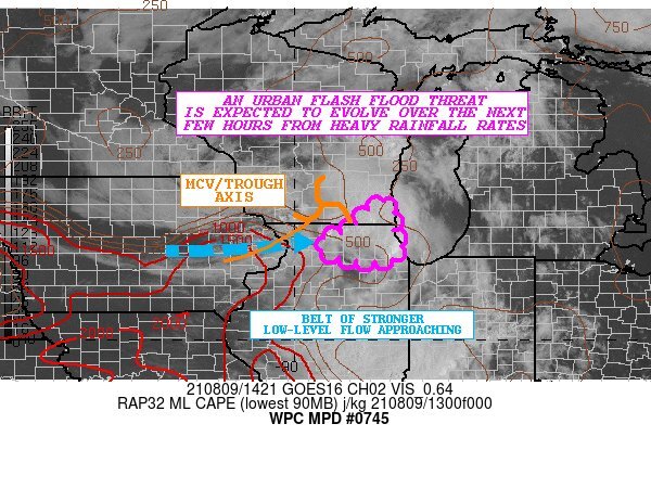
Flooding probably going to be newsworthy in addition to the severe threat. Radar estimating some 3" totals near and east of Rockford this morning. The real urban flood threat is this evening imo when we'll have HP sups in the area. WPC MD out.