purduewx80
-
Posts
1,705 -
Joined
Content Type
Profiles
Blogs
Forums
American Weather
Media Demo
Store
Gallery
Everything posted by purduewx80
-
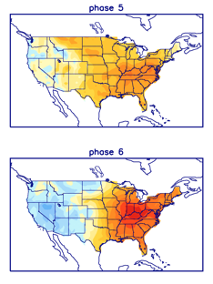
7 is still warm in Feb.
-
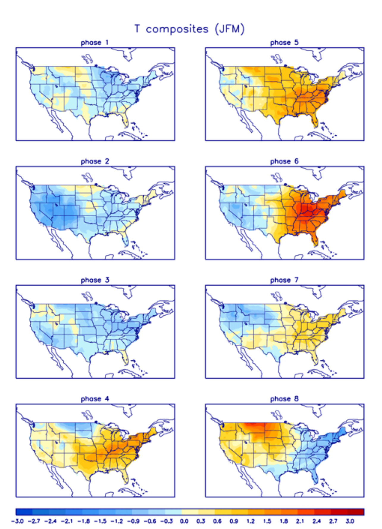
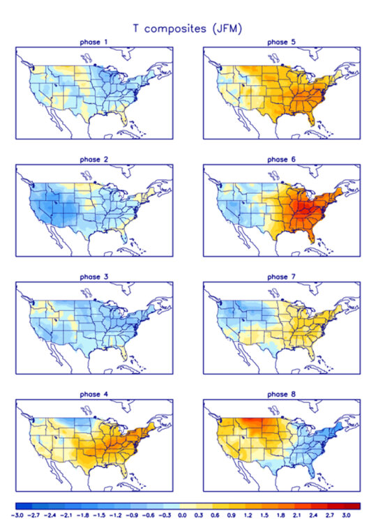
5-7 are the warm phases this time of year, not sure where some of you are getting your info.
-
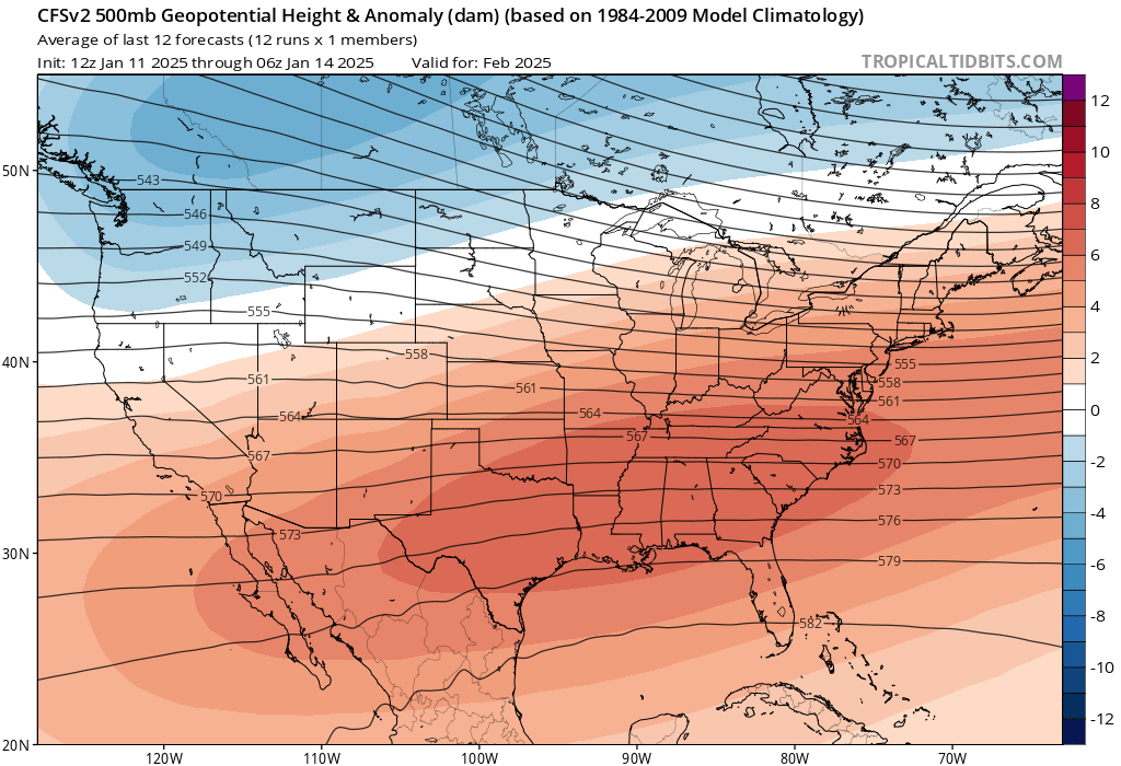
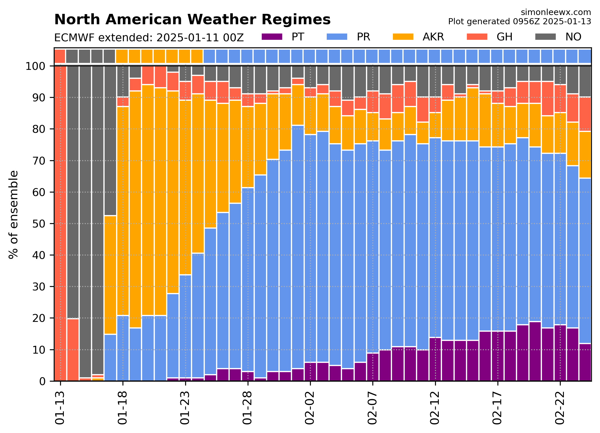
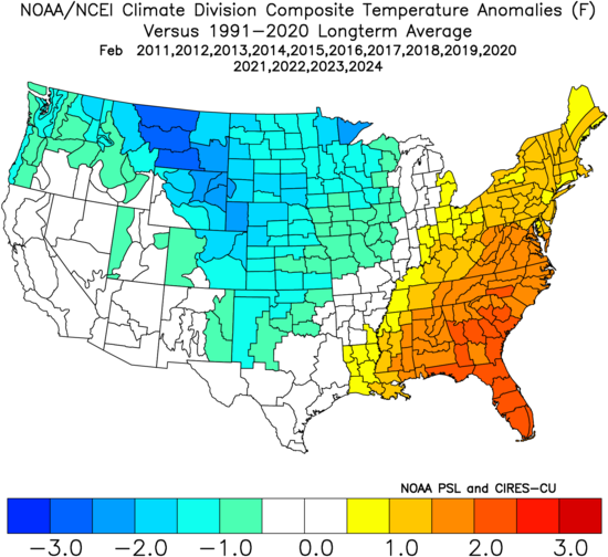
~Decadal February climo may be hard to beat in the Southeast and Northern Rockies/Plains.
-
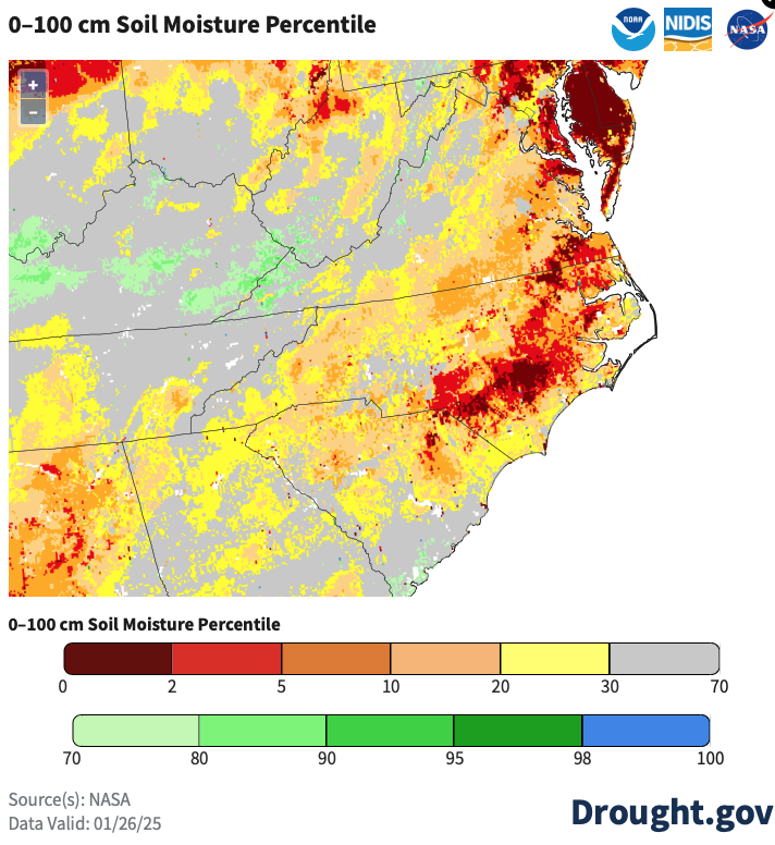
Soil moisture is pretty dire in the coastal plain. Really need these areas to catch up prior to consistently warmer weather, which seems unlikely at this point.

-
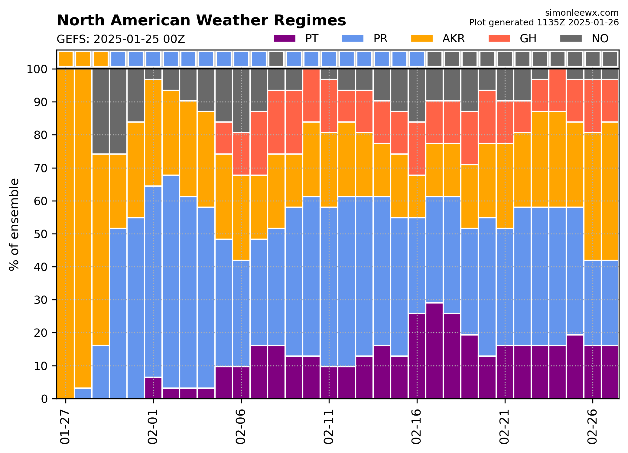
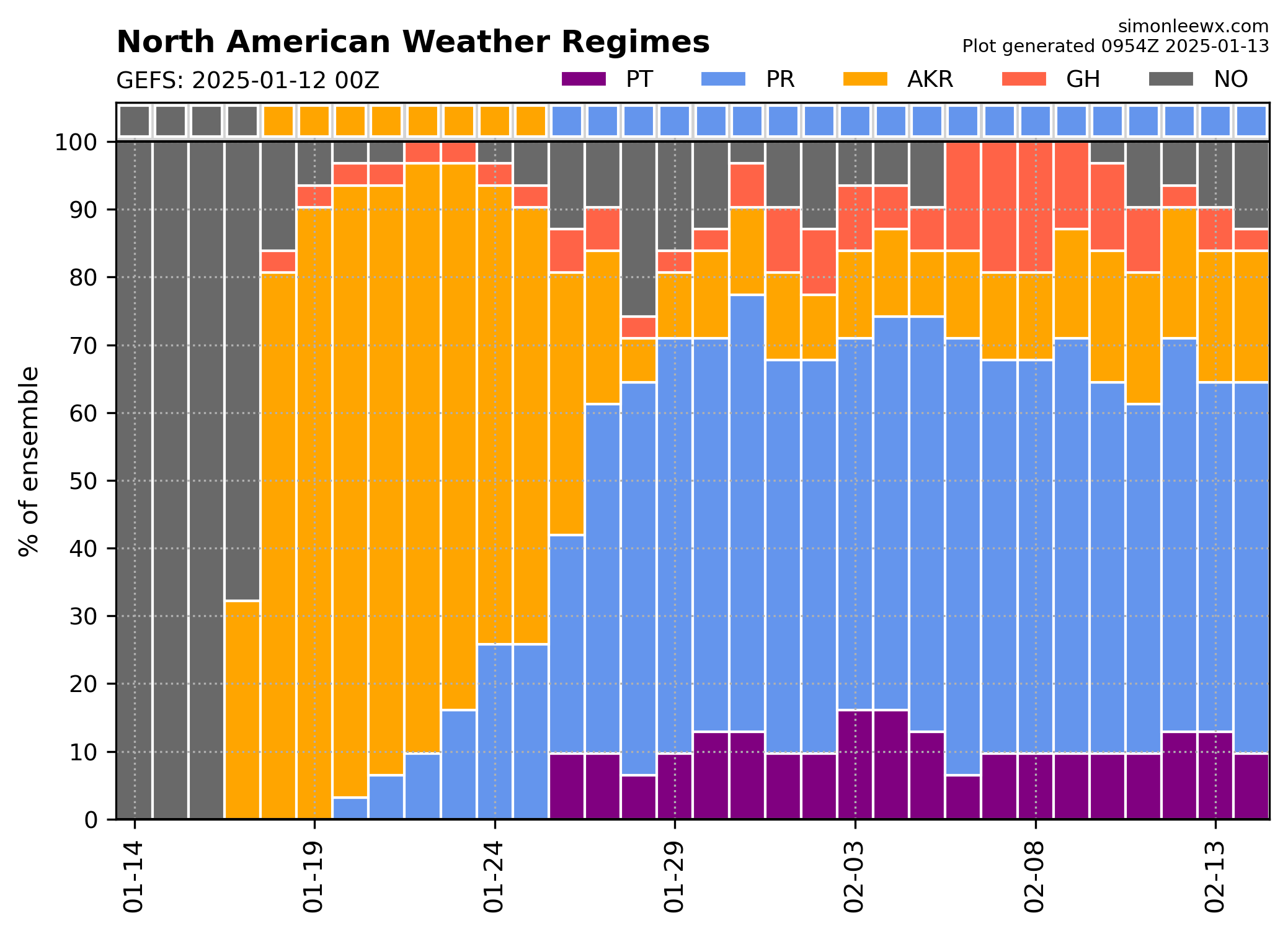
We're probably going to need the -NAO (GH) to return in some form to get any wintry precip chances outside of the mountains and/or Piedmont in fleeting CAD setups. Ridging at the edge of the Pacific(PR) and Alaska(AKR) domains will continue to bring Arctic air into North America, but it seems destined to spend the most time in the typical Niña spots from New England to the Rockies and PacNW. Gonna be hard to avoid a top 10 warmest February in parts of the Southeast imo.

-
Looking forward to off-and-on highs in the 70s and an early spring here in ATL.
-
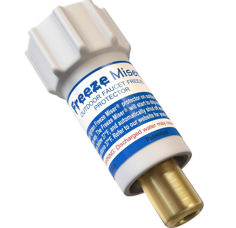
The Freeze Miser work great on outdoor faucets. Makes more sense to use these (or allow drips) in the South because we don't have lengthy periods of super cold weather; otherwise, they probably would freeze up. You leave the faucet on, and this allows a very slow drip when temperatures drop below about 35. Mine have worked well with temps in the teens a few nights in a row - both froze up solid prior to grabbing these from Amazon.
-
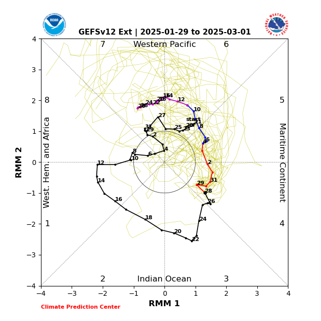
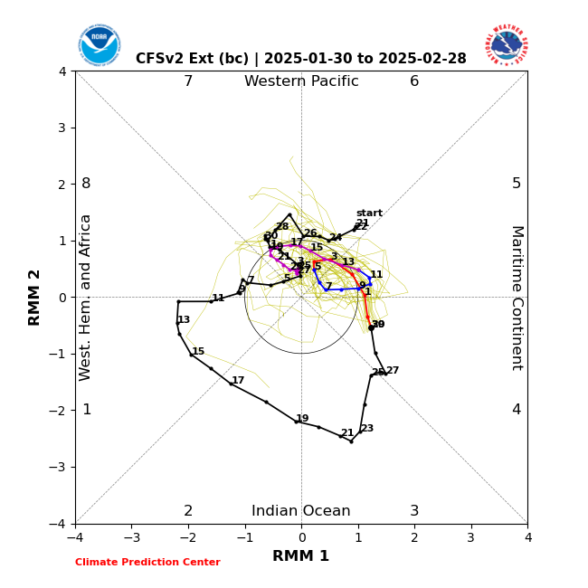
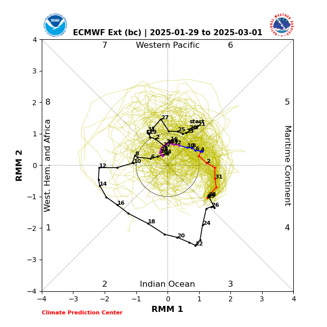
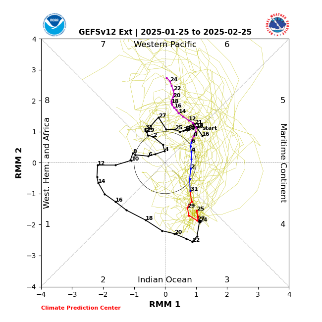
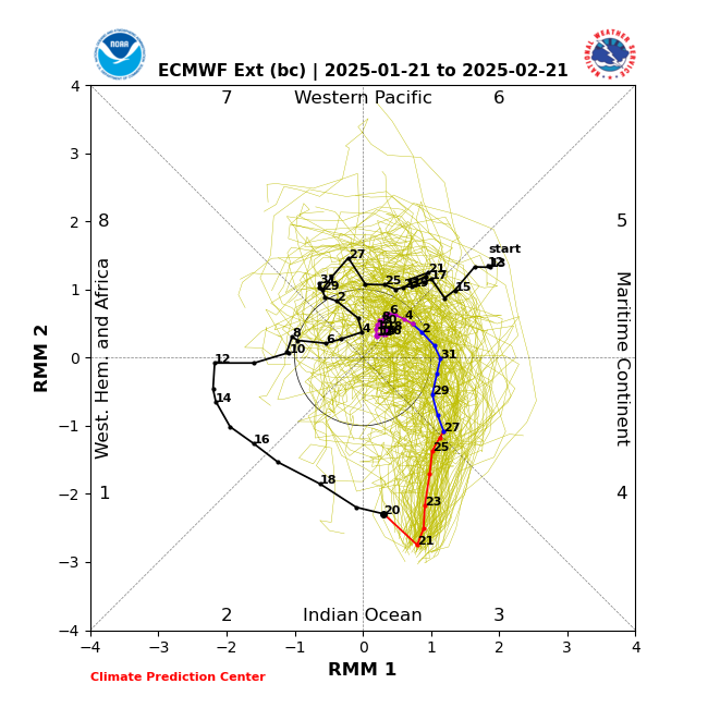
The bias corrected Euro sits and spins in the warm phases, which is similar to the CFS.
-
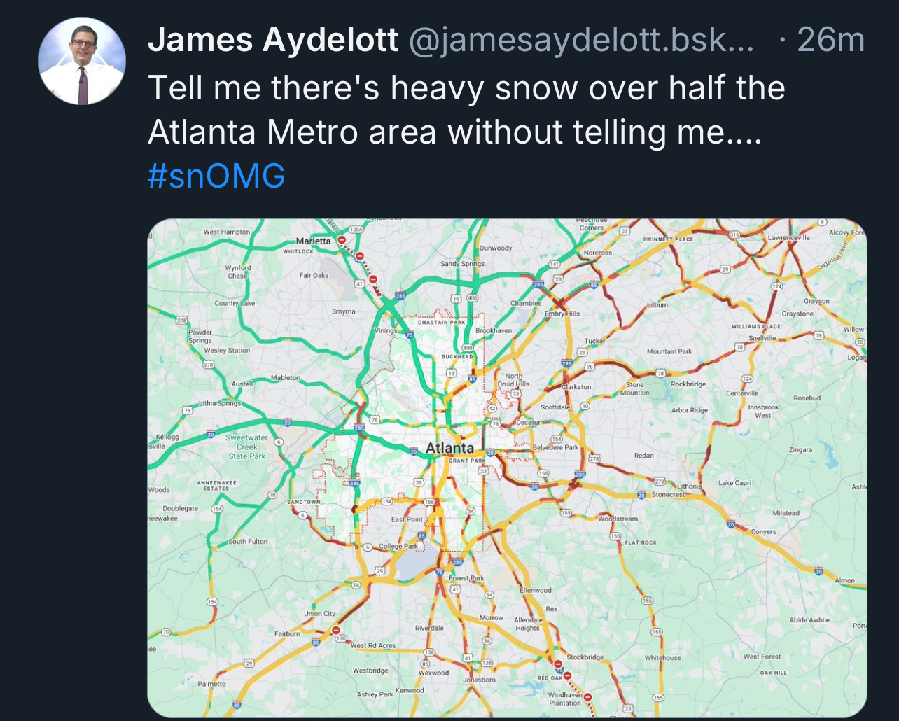
Weird expansion of advisories and warnings today, snow is over for most of Atlanta but the “damage” is done.

-
Yep, looks like 85 will be the rough dividing line between mood flakes and minor impacts.
-
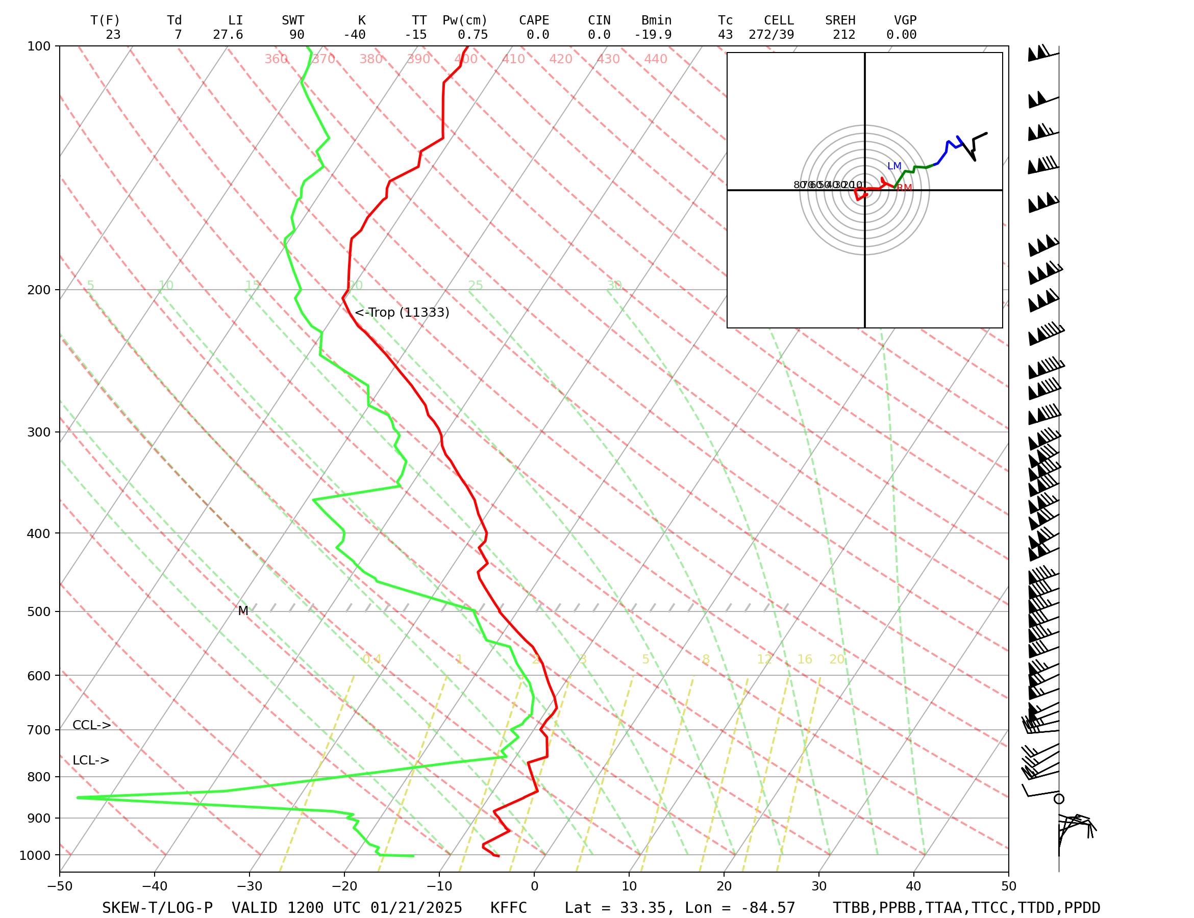
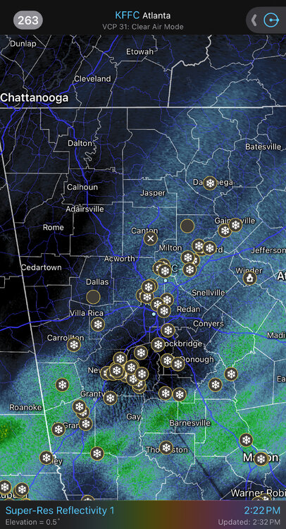
NWS Atlanta will do an 18Z sounding. Most of the 12Z models appear to have initialized too moist at 850mb, and it still appears to be a struggle to saturate looking at the higher scans from BMX and FFC radars.
-
6th driest 850 dewpoint on record at the Atlanta office this morning, last night’s was the 4th driest. gonna take a bit to saturate.
-
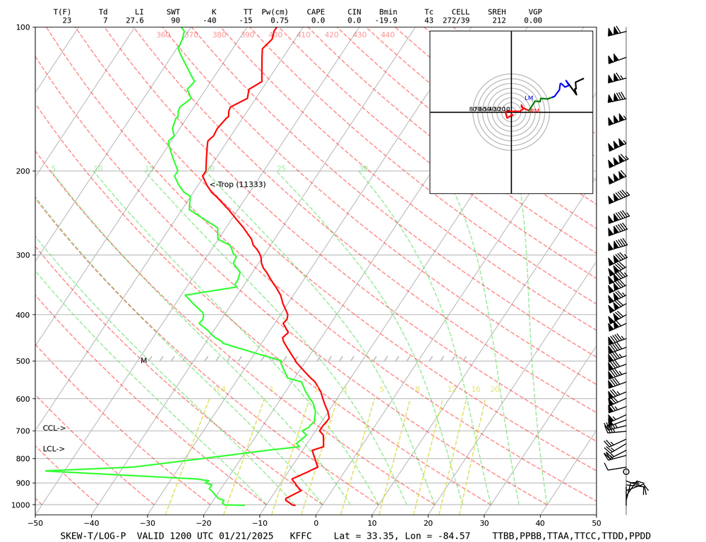
These squalls are a good indicator of the true Arctic air coming in. Much steeper low level lapse rates develop as 850s tank.
-
AIFS has been more or less consistent for days. Upper jet dynamics look great but deep moisture peeling off to the east Saturday night and the wave’s fast progression should limit amounts outside of a mesoscale heavier band.
-
good luck with that
-
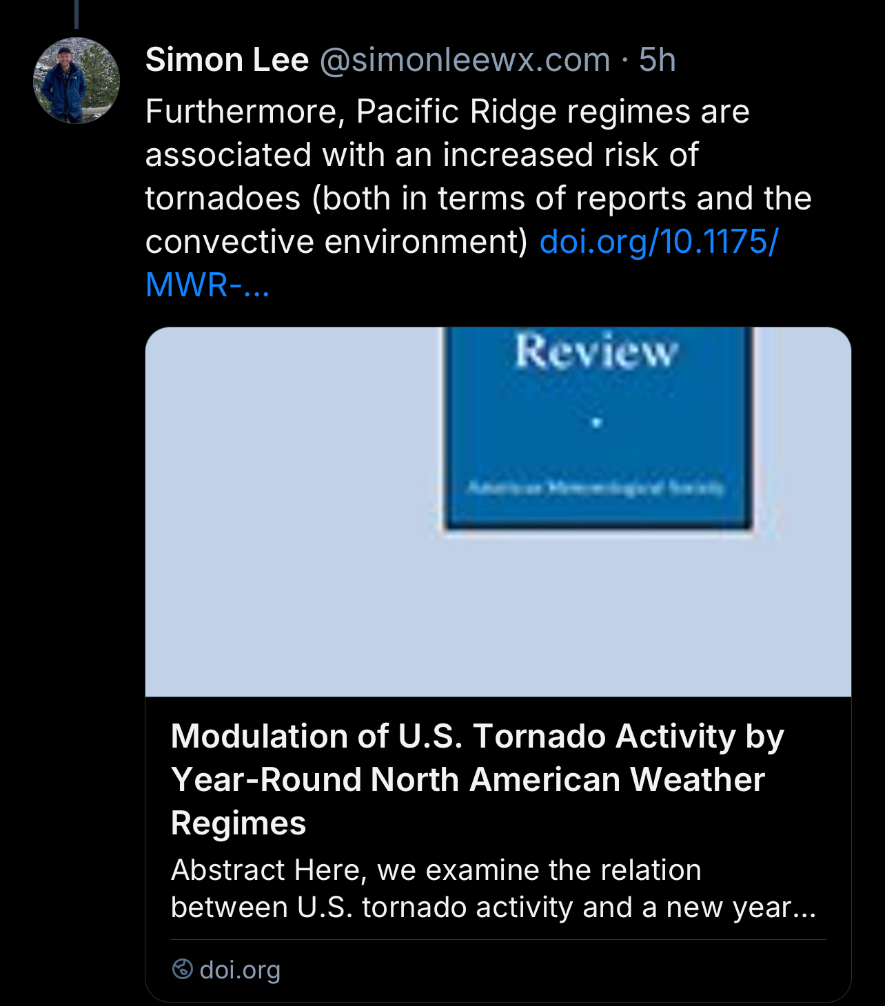
Re: February, most of the Gulf is still balmy so severe wx is gonna pick up in a hurry https://doi.org/10.1175/MWR-D-24-0016.1

-
It has consistently shown a modest snowfall for the mountains into VA Sunday-Monday, but it’s nowhere near a monster anywhere. After that it overwhelms the Southeast with cold/dry weather.
-
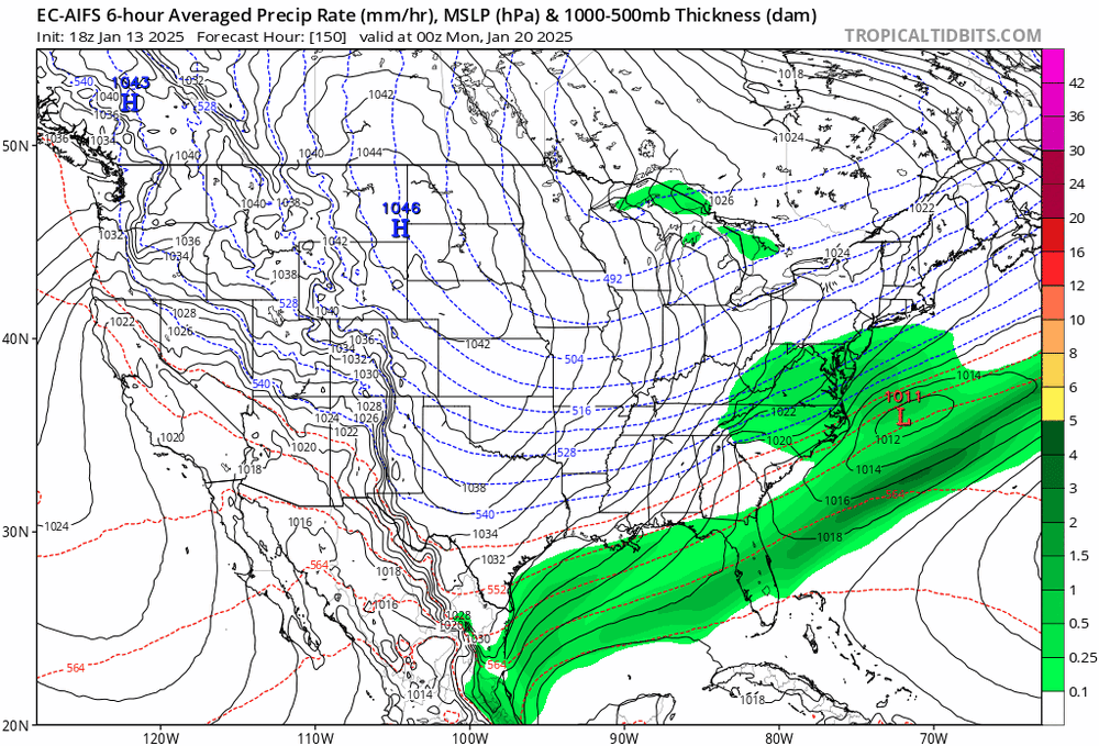
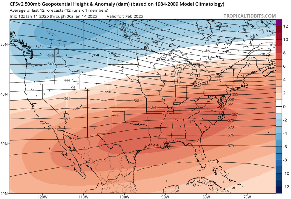
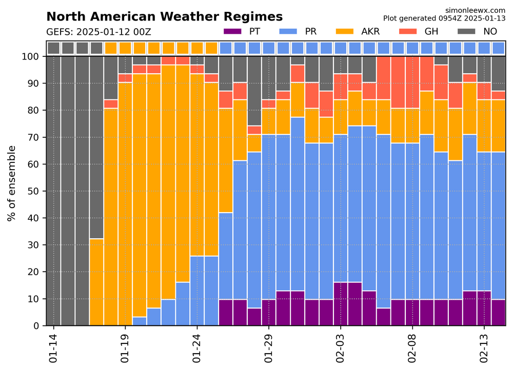
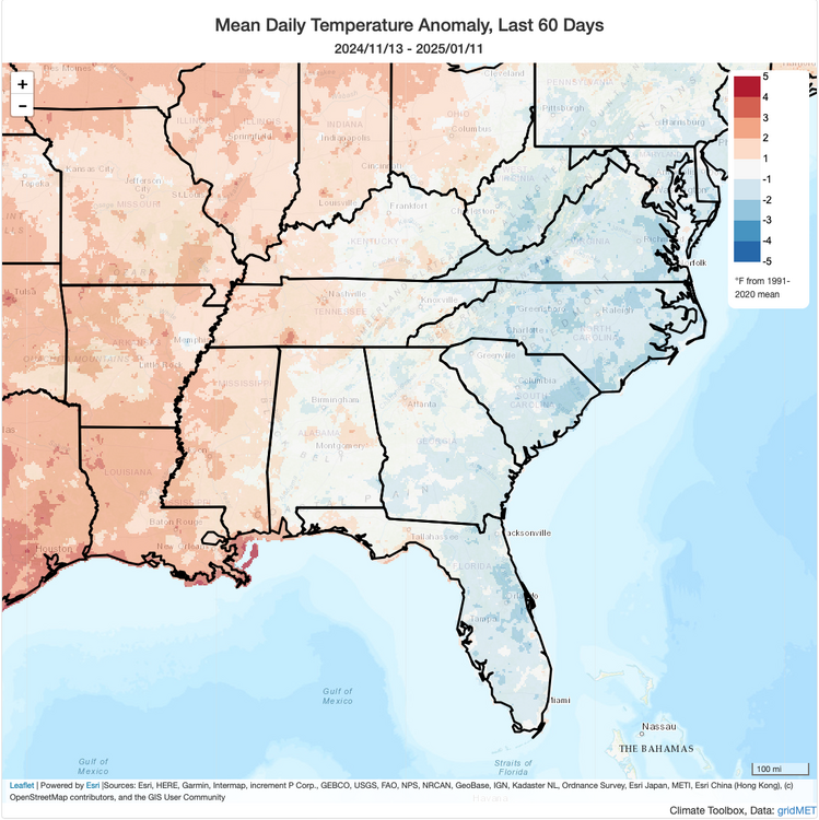
It's probably going to be hard to avoid a robust Southeast ridge in the extended, with high confidence that the Pacific Ridge (PR) dominates from the end of January through February - GEFS and EPS are both showing this. What could help earlier in the period is the Alaska Ridge (AKR), since that will dump Arctic air into the heart of the continent. Overrunning events may still occur, especially northern parts of the Southeast into the Mid-Atlantic, but it looks like most 00Z guidance further suppressed the storm track with the AKR pattern and Arctic cold overwhelming things later next week before a more significant warmup occurs. Curious to see if we'll be able keep the relatively cooler (or less warm) anomalies along the East Coast that have occurred in both December and January so far (last 60 days depicted at the bottom).

-
1/10-11 super awesome winter SE OBS thread
purduewx80 replied to strongwxnc's topic in Southeastern States
2.1” of snow/sleet at ATL and 0.25” of freezing rain so far. -
1/10-11 super awesome winter SE OBS thread
purduewx80 replied to strongwxnc's topic in Southeastern States
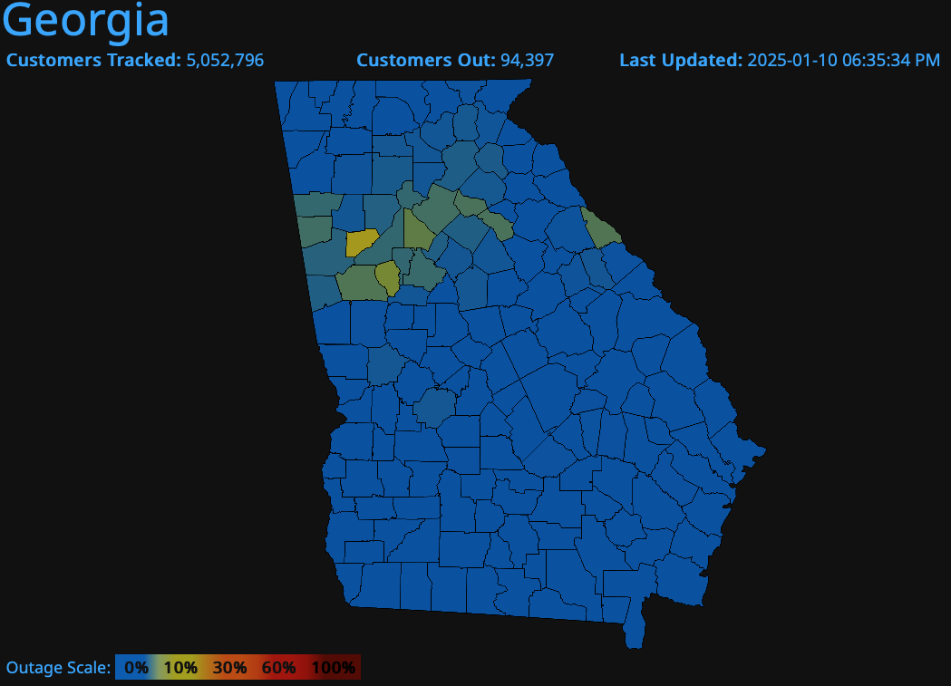
GA closing in on 100k outages. Winds beginning to ease after the indicated peak gusts over the last few hours.

-
1/10-11 super awesome winter SE OBS thread
purduewx80 replied to strongwxnc's topic in Southeastern States
Definitely have a thickening glaze on everything elevated now after a little melting midday. Power outages have quickly surged on the NW/W side of metro Atlanta into northeast Alabama with some gusts of 25-35 mph. Good setup for freezing drizzle much of the night after the main precipitation shield exits, which is more efficient at accretion. -
The Carolinas are increasingly under the convergent quadrant of the upper jet, which diminishes the lift needed to maintain the band of heavier snow. Low level dynamics will kick in this afternoon but the DGZ is too high up for most areas to see the snow rates observed this morning.

-
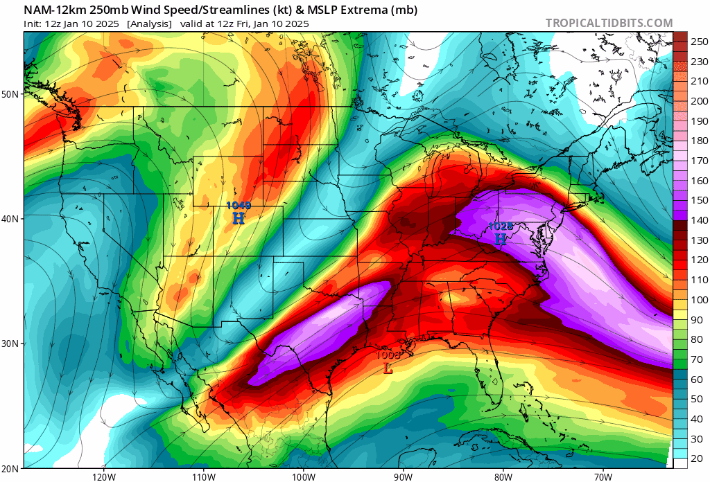
That has little to nothing to do with it. The jet dynamics are becoming more unfavorable with time, resulting in weakening frontogenesis near and above 700mb, which had been tapping into the dendritic growth zone earlier this morning. The bulk of our moisture with this higher up forcing came from the Pacific. Low level winds out of the E or SE are also bringing in drier air out of the weakening surface high.
-
1/10-11 super awesome winter SE OBS thread
purduewx80 replied to strongwxnc's topic in Southeastern States
3.1” here prior to the sleet we have now. Some -FZRA mixing in. Will be curious to see if the “unmodeled” snow cover will maintain freezing temps at the surface despite SE winds. Models seem to be handling winds ahead of the inverted surface trough well, as gusts of 25-35 mph are being reported in central MS. -
1/10-11 super awesome winter SE OBS thread
purduewx80 replied to strongwxnc's topic in Southeastern States
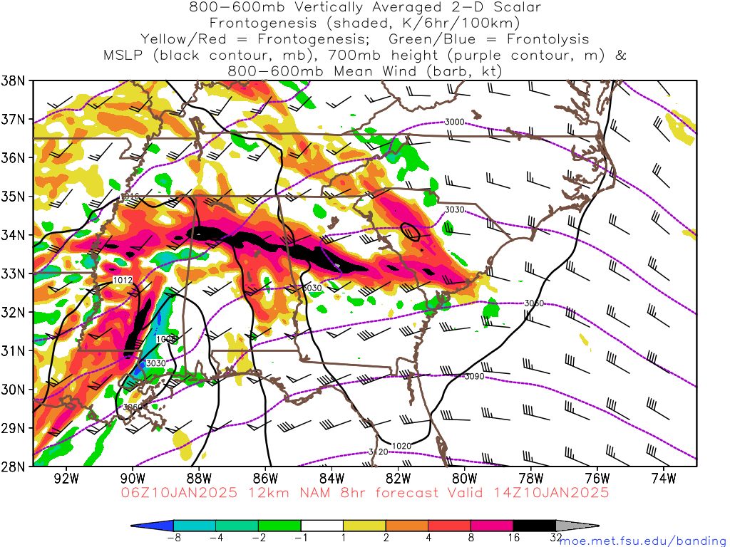
No surprise there’s heavy snow occurring across Atlanta with this intense forcing from frontogenesis. Will be progressive but could pivot as it weakens over TN and western NC. http://moe.met.fsu.edu/banding/