midatlanticweather
-
Posts
4,884 -
Joined
-
Last visited
Content Type
Profiles
Blogs
Forums
American Weather
Media Demo
Store
Gallery
Everything posted by midatlanticweather
-
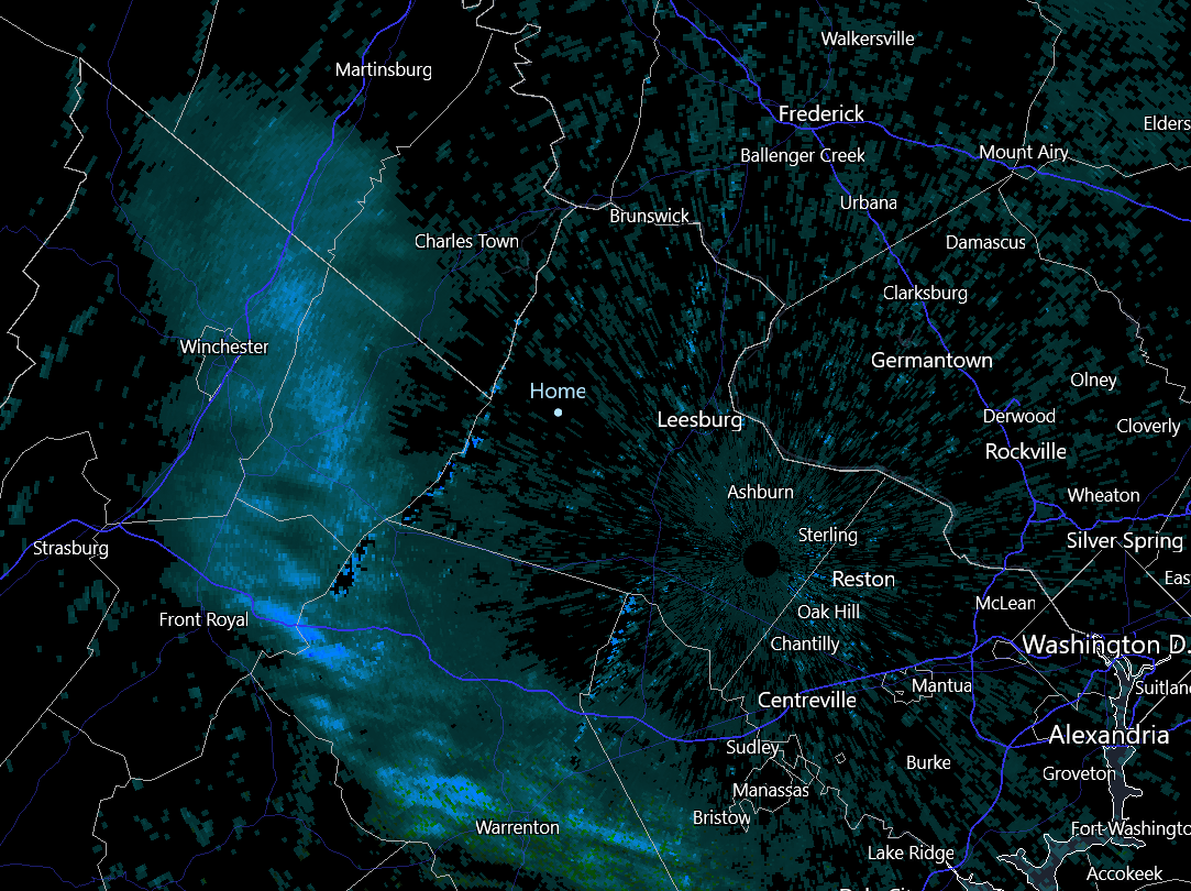
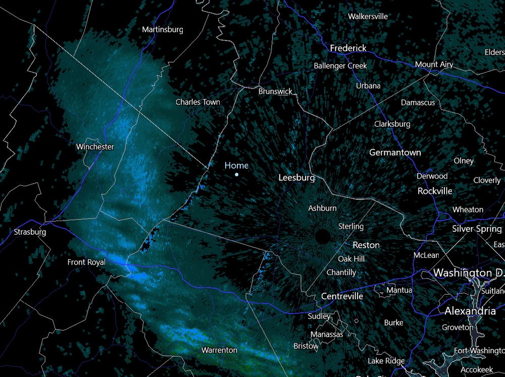
Can confirm small flakes here in Purcellville!
-
That is Radar Scope... an app! A nice one too!
-
Is any of this reaching the ground? While out a bit ago I was saying it smelled like snow!
-
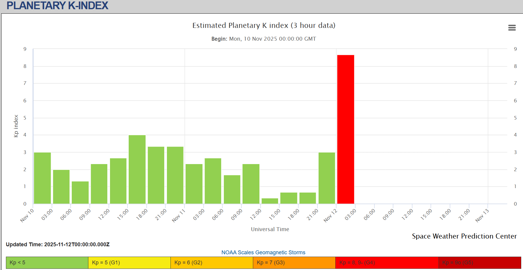
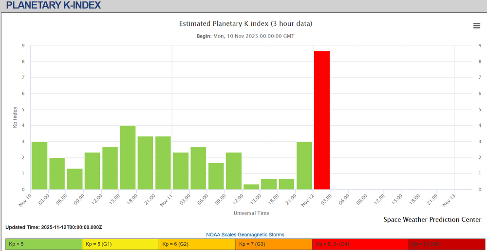
This chart is wild!
-
Coldest of the season! 26.4 degrees for the low in Purcellville
-
I know it is ridiculously out there, but I do like the idea of a follow up wave on an arctic front as any chance for the area. Nothing amped will make anything happen unless it is crazy ideal like the old Veteran's Day storm. I like seeing them show up on long ranges, even if it is all fantasy
-

12th Annual Mid-Atlantic Snowfall Contest
midatlanticweather replied to RodneyS's topic in Mid Atlantic
BWI: 19.2 DCA: 14.7 IAD: 23.3 RIC: 15.3 Tie Breaker SBY: 6.3 -
Man Euro was amped!


-
GFS paints a snow flurry next Wednesday. This GFS rub seems to show a few more cooler shots after brief warm ups, but not as dramatic as next week. At the end of the run it looked like warmth was coming, but it is way out there.
-
Ha - He did an update today to look at the years as well
-
Spot On Weather has had some good analysis and is liking 2000 - 2001 for an analog. Sorry if this was posted - I thought it was interesting
-
Ya!! I see.. Holy cow.. Matches 1935 Florida Keys.. Right?
-
31.3 for the low!! We did it in Western Loudoun. Based on Dulles readings, Eastern Loudoun too. I guess that will end the growing season.
-
October Medium/Long Range Discussion
midatlanticweather replied to Eskimo Joe's topic in Mid Atlantic
Gfs is a southern slider end of next week. Wow. I mean the trend was there on the models but long range forecasting is a challenge. We will see if the Euro folds -
32.7 for the low. Close!
-
34.9 degrees on my frosty morning walk! Brilliantly nice!
-
Was great day to mow the grass for the last time this season! Will be swapping the garage for the Christmas decorations by the front door and the lawnmower packed in the back! 77 for a high today was quite warm! Probably do it again tomorrow!
-
Not much - but something
-
36.3 for the low. Frosty in the shaded spots
-
October Medium/Long Range Discussion
midatlanticweather replied to Eskimo Joe's topic in Mid Atlantic
Maybe some more freezes? -
October Medium/Long Range Discussion
midatlanticweather replied to Eskimo Joe's topic in Mid Atlantic
Euro is much more interesting Sunday/Monday for rain and some windy showers. Pretty consistent about a bit more than just a quick passing front with some showers. Hope it is correct. -
About time for the Animal House quoting
-
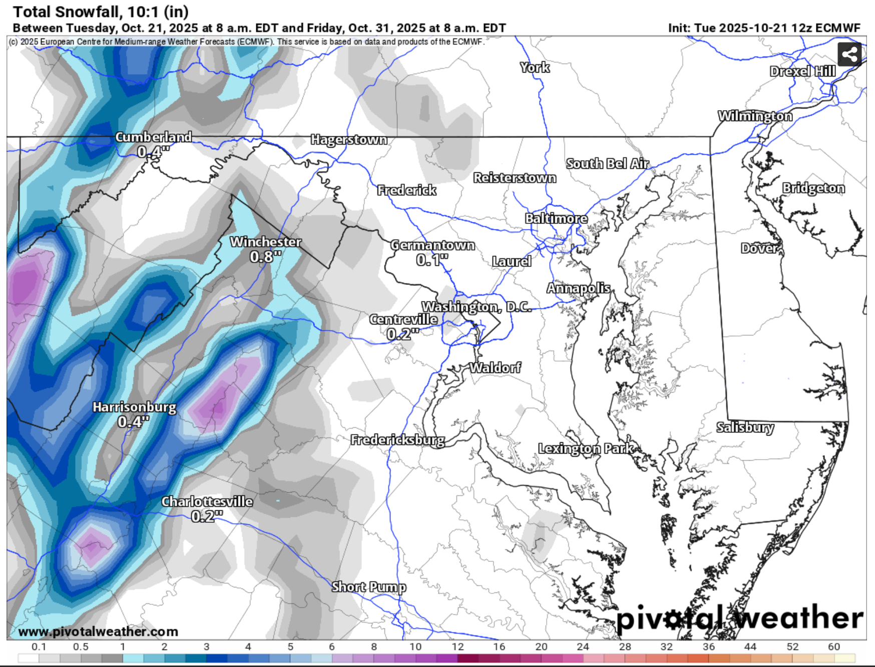
I am like 5 miles from the red bullseye in Loudoun! LOL! What an odd model depiction.. I suspect there should be a lot more smoothing than that
-
38 this morning in Purcellville, and when I went out, shaded spots had some patchy frost. So good call on the advisory, it was all about location, shady spots, and good clear conditions.