All Activity
- Past hour
-
Looks like one is trying on Connor C.’s stream
-
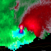
Tornado looks imminent heading towards Abilene.
-

May 2024 Discussion - Welcome to Severe Season!!!!
powderfreak replied to weatherwiz's topic in New England
Guess the dog shoulder deep in snow and birch trees bent to the ground do it in much fewer words. A photo is worth a thousand words they say? -

May 2024 Discussion - Welcome to Severe Season!!!!
powderfreak replied to weatherwiz's topic in New England
Nah those are just general weather observations in a weather observation thread… you always think those are trolling posts. It’s just what is happening outside like everyone else does . -

May 2024 Discussion - Welcome to Severe Season!!!!
Damage In Tolland replied to weatherwiz's topic in New England
Nice storm what thru S Wey .. maybe.30? - Yesterday
-
Good lord.
-

Central Pa. Spring 2024
Itstrainingtime replied to mahantango#1's topic in Upstate New York/Pennsylvania
90 here today- and 82 at 8pm. -
Du Pont?
-
2024 Short/Medium Range Severe Weather Discussion
largetornado replied to Chicago Storm's topic in Lakes/Ohio Valley
Surface winds look fairly backed. Care to post a sounding or two from the euro? -

Central Pa. Spring 2024
mahantango#1 replied to mahantango#1's topic in Upstate New York/Pennsylvania
My High today was 91. -
It's not even that anything really special is happening.. The way we are easily beating these records since that 80* in January is pretty amazing. I think we on a macro-level are entering a time with less cloud cover, so maybe that's contributing, or will contribute in the future.. there was a time in February this year where we went 24/28 days with no clouds.
-
Also on Freddy McKinney's live stream. 6 of the last 7 days have had tornadoes now.
-
Tornado in progress on the Anson TX supercell and there was one earlier near Ballinger as well.
-
High of 93.3 at 5:31pm.
-
MDT officially hit 90 for the first time this year I got to 91.
-
Stepped outside of Dulles airport coming back from relentless SE Asian heat, hoping for some refreshing cool weather… NOPE!
-
May 2024 Discussion - Welcome to Severe Season!!!!
Snowedin replied to weatherwiz's topic in New England
Pouring cats and dogs here. Pretty sure I just heard a quick rumble too! -
May 2024 Discussion - Welcome to Severe Season!!!!
Typhoon Tip replied to weatherwiz's topic in New England
If it stays overcast, it won’t be that warm -

May 2024 Discussion - Welcome to Severe Season!!!!
Torch Tiger replied to weatherwiz's topic in New England
still looks like chit mid-month -

May 2024 Discussion - Welcome to Severe Season!!!!
Damage In Tolland replied to weatherwiz's topic in New England
65-70 tomorriw and partly sunny is still AN. It’s been like that all week . Theres only one bad day thru day 10 and that’s Sunday. It’s been a remarkable nice spring in general -
May 2024 Discussion - Welcome to Severe Season!!!!
Typhoon Tip replied to weatherwiz's topic in New England
You actually can see the back door on high resolution radar as it’s sweeping southwest through the area should be entering north eastern Connecticut over the next hour overtaking Kevin mid evening… Not sure what it’ll mean for tomorrow’s temperatures again it’ll come down to how much sun -
May 2024 Discussion - Welcome to Severe Season!!!!
Typhoon Tip replied to weatherwiz's topic in New England
It’s all gone tomorrow -
Who the fuck cares about Du Bois? Sent from my motorola edge 5G UW (2021) using Tapatalk
-
The region experienced a wide range of temperatures. At Islip, the high was 63°. Central Park reached 79° Meanwhile, Newark hit 90° and Philadelphia reached 90° (old record: 89°, 2010). Tomorrow will be noticeably cooler than today across most of the region with the temperature rising mainly into the upper 60s across the region. Overall, the first week of May should wind up warmer than normal, even as there will be considerable variability in the daily temperatures. Showers and periods of rain could arrive during the weekend. Sunday into Monday could be the wettest period. The ENSO Region 1+2 anomaly was 0.0°C and the Region 3.4 anomaly was +0.8°C for the week centered around April 24. For the past six weeks, the ENSO Region 1+2 anomaly has averaged -0.23°C and the ENSO Region 3.4 anomaly has averaged +0.98°C. The ongoing basinwide El Niño event is fading. Neutral conditions could develop later in the spring. The SOI was -0.52 today. The preliminary Arctic Oscillation (AO) was -2.648 today.
- 109 replies
-
- spring
- dry weather
-
(and 3 more)
Tagged with:
-
For some slight good news at least for now: the Atlantic MDR is for the first time in 11 months no longer the warmest on record as 2010 has barely overtaken it.


