All Activity
- Past hour
-
89/50 for only a +1 at CON today. Yore August keeps on rolling.
-

2025-2026 ENSO
PhiEaglesfan712 replied to 40/70 Benchmark's topic in Weather Forecasting and Discussion
There were warm winters before 2011-12, but they were fewer and further between. Like if one happened, the pendulum would have almost certainly swung the other way the following year. But after 11-12, it's been warm winter after warm winter after warm winter (with the obvious exceptions of 13-14 and 14-15). I wouldn't say 21-22 was decently cold/seasonable. Only one month was (January), but the rest of that winter was well above average temperature. 24-25 was for the first time since at least 17-18 (and you could argue 14-15) colder than average more often than not. -
SACRE BLEU! Special Message from NHC Sat, 23 Aug 2025 20:03:20 +0000 NHC will initiate advisories on Tropical Storm Fernand, located in the southwestern Atlantic, at 500 PM EDT (2100 UTC).
-
I was sitting in my classroom with a clear view down a 100’ hallway, and I swear you could see the rippling floor approaching from the front of the building towards me. Same with the noise from the roof. It approached and then passed overhead. I can’t believe that its been 14 years.
-
A hurricane is possible by Mon:Tropical Storm Fernand Discussion Number 1NWS National Hurricane Center Miami FL AL062025500 PM AST Sat Aug 23 2025The trough of low pressure (AL90) located a few hundred miles south-southeast of Bermuda has become better organized today. An Air Force Reserve Hurricane Hunter aircraft found a well-defined center during the past couple of hours, with a central pressure of about 1010 mb. The initial intensity is set to 35 kt, based on earlier scatterometer data which had a few believable tropical-storm-force wind vectors, and a Dvorak classification of 35 kt from TAFB.The initial motion is north or 010/13 kt. A north-northeastward motion is anticipated during the next couple of days with a slow increase in forward speed due to Fernand moving around the western periphery of the subtropical ridge. The storm will likely accelerate to the northeast thereafter as the system gets caught up in faster mid-latitude flow, well to the southeast of Newfoundland. The global models are in good agreement on this scenario, and the NHC forecast is on the eastern side of the guidance, closest to the HFIP Corrected- Consensus Model (HCCA).Fernand has about 48 hours over warm waters within generally light shear to intensify. There is a fair bit of mid-level dry air, however, which could hinder any rapid strengthening, so the intensity forecast will just show a more gradual increase in winds. All of the models peak the system as an upper-end tropical storm or category 1 hurricane, and the NHC forecast is just shy of a hurricane as a peak. After Monday, Fernand should weaken due to the influences of cooler waters and increasing shear, and the storm will likely become post-tropical in 3-4 days. FORECAST POSITIONS AND MAX WINDSINIT 23/2100Z 27.2N 61.4W 35 KT 40 MPH12H 24/0600Z 29.0N 61.0W 40 KT 45 MPH24H 24/1800Z 31.4N 60.3W 50 KT 60 MPH36H 25/0600Z 33.6N 59.5W 55 KT 65 MPH48H 25/1800Z 35.8N 58.5W 60 KT 70 MPH60H 26/0600Z 38.2N 56.7W 55 KT 65 MPH72H 26/1800Z 41.3N 54.0W 50 KT 60 MPH96H 27/1800Z 47.0N 44.0W 40 KT 45 MPH...POST-TROP/EXTRATROP120H 28/1800Z...DISSIPATED$$Forecaster Blake
-
I've had two days of measurable rain (0.01, 0.04) since the last half decent rain (0.38) on July 22.
-
The NWS drops POP from 60% to 30% for Sunday. The drought returns with very low Pops the next 15 days...............................
-
It’s looking pretty good to be honest with convection continuing to fire and clear spin. It’s a robust disturbance.
-
Not much of a breeze in the city iso it feels warmer than the 83 it is
- Today
-
Yeah this place is a sausage party. At least the weather is nice!
-
Pretty nicely organized LLC per recon.
-
I did not have that happen to me. That must’ve been quite an experience.
-
Blasphemy
-
 This strong breeze is so nice
 -
The trend is your friend. The 12z EPS picking up some intense outcomes is quite interesting. I'm wondering if the 18z GEFS shows more. I think this could be the most interesting storm to keep an eye this season so far...
-
Did you get the weird blurry vision? I was sitting at a red light. I thought my vehicle was breaking down. Than my eyes got blurry when I noticed everything dancing like a mushroom trip. I jumped out of the vehicle so I could feel the earth under my feet. I encouraged others and a couple other dudes jumped out too lol
-
We’re apparently about to have TS Fernand a few hundred miles SSE of Bermuda. Also, Invest 99L is significantly more active on the 12Z Euro ens as it gets to the W Caribbean in ~a week. If it actually does develop there, watch out!
-
It appears they’re going right to TS Fernand based on this: AL, 06, 2025082318, , BEST, 0, 266N, 617W, 35, 1010, TS, 34, NEQ, 0, 90, 0, 0, 1015, 110, 90, 0, 0, L, 0, , 0, 0, FERNAND, S, 0, , 0, 0, 0, 0, genesis-num, 019, TRANSITIONED, alB02025 to al062025,
-
 Clouded up a bit here in CNJ in the last hour. As seen on the vis loop, should move through S->N
 -
Hotter than expected. High of 86f Sent from my SM-S921U using Tapatalk
-
I just remember my cup of water shaking like it was Jurassic Park.
-
It’ll be a nice and warm fall and I’m sure we’ll have some hot days in there, but we’ve stepped down. It’s undeniable.
-
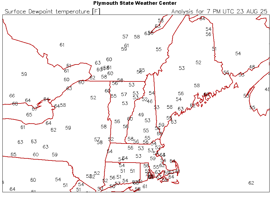
These dews are just the chefs kiss on the day.
-
That’s why so many people are moving out to the Desert Southwest. Many people are OK with the extreme summer heat and drought. Then they can take weekend ski trips during the winter to get their fill of snow and cold.


