All Activity
- Past hour
-

Augdewst 2026: Summer's Last Stand
HIPPYVALLEY replied to Prismshine Productions's topic in New England
Usually, we are good WOR for at least a few decent bangers in the summer. This has been one of the quietest summers I can’t remember except for the silent light show a few weeks ago. -

Central PA Summer 2026 Discussion/Obs Thread
WmsptWx replied to Voyager's topic in Upstate New York/Pennsylvania
I think the aliens are here. Or will be.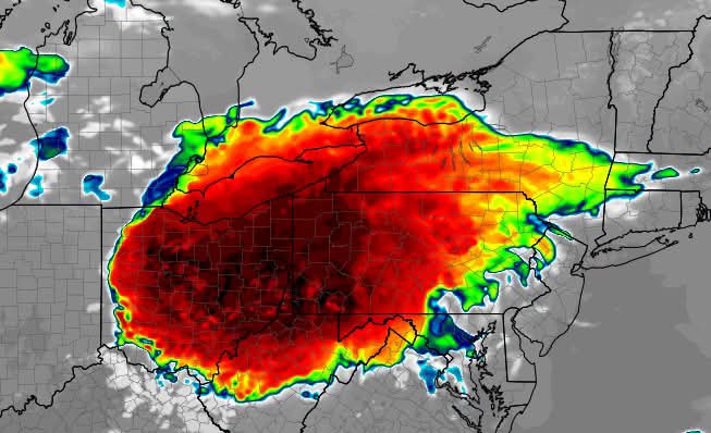
-

Augdewst 2026: Summer's Last Stand
ineedsnow replied to Prismshine Productions's topic in New England
We do it all we try to come here once a year and the kids love it.. -
Don't waste your money on the train ride. There's never any elk.
-
After yesterday's surprise uptick, figured creating a thread might be good for what models have really highlighted-- consistently-- as being the most active stretch, is warranted.
-
It's wild how fast the plants will chew threw that and we've been lucky that each time they've filled up this summer, the next round has taken it's time or ended up just north/south of the same area. It does look like the other two have some remaining capacity but if central cook gets smoked, we'll likely see the first combined sewer overflow situation in some time As an engineering project it has certainly been a major factor in the large improvements seen on our waterways but it has taken way too long coming online and the system capacity is only a fraction of what it needs to be for the size of the modern metro area and our modern wetter climate. The county and region really does need to start planning on next generation strategies for managing runoff from rains that seems to increasingly come in large 2"+ deluges pretty massive
-

Augdewst 2026: Summer's Last Stand
vortex95 replied to Prismshine Productions's topic in New England
No talk of tstm potential today? HRRR shows discrete supercells in VT early this evening. 0-6 km shear 45-50 kt kt, so there you go. Small looped hodographs as well. Surprised SPC does not have MRGL across NNE. It's a decent s/w trof, so no reason why there not should be some svr. CAPE maxes only around 1500, but that's misleading. When the deep layer shear is good, that make a big difference, and you don't need honkin' CAPE values for sold storms. Then a SQLN evolves that sweeps through NH/ME, and then some last min cells psbl for 1-3am far ern MA. I think @CoastalWx's sullied attitude towards convection is a factor here!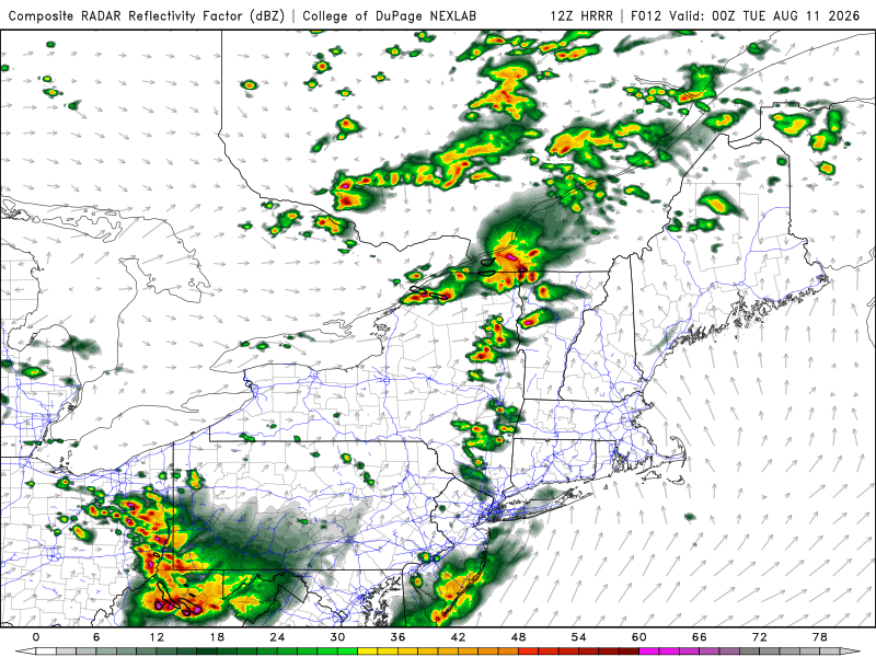
-
E PA/NJ/DE Summer 2026 Obs/Discussion
Albedoman replied to PhiEaglesfan712's topic in Philadelphia Region
The mesoscale storm system that brought this morning’s clouds and rain across eastern Pennsylvania is finally beginning to fizzle out and move away. That could actually set the stage for a more active afternoon. For the first time in several weeks, the stubborn all-day cloud cover is beginning to break, allowing some afternoon sunshine to return. If we get several hours of heating, the atmosphere could destabilize fairly quickly given the abundant moisture already in place. That means the Lehigh Valley and eastern Pennsylvania could see thunderstorms redevelop later this afternoon and into the evening. Any stronger storms that form could produce torrential downpours, frequent lightning, strong to potentially damaging wind gusts, and localized flooding. The big thing to watch over the next few hours is how much sunshine and heating we get behind the departing morning system. The more clearing we see, the greater the potential for stronger convection later today. I would not be surprised to see the National Weather Service issue a Severe Thunderstorm Watch later this afternoon, especially if instability builds as expected. Keep an eye on the sky and radar this afternoon. The morning storms may be ending, but they may only be setting the table for round two. -
Yeah the HREF probs for TS here are not that high 22-01z...especially once east of W NJ
-
August 10 2004: Cool Canadian air is ushered in on strong northwest winds. International Falls has its record coldest high temperature for this date with 49 degrees. The Twin Cities only saw a high of 59. 1939: Very heavy rain falls at Two Harbors, accumulating to 5.2 inches of rain. For Monday, August 10, 2026 1856 - The Isle Derniere (Last Island) disaster occurred off the coast of Louisiana. A storm tide drowned 140 vacationers as a five foot wave swept over Low Island during a hurricane. (The Weather Channel) 1882 - Sandusky OH noted a four minute snow squall during the morning, frost was reported in the suburbs of Chicago, and a killing frost was reported at Cresco IA. (The Weather Channel) 1884 - An earthquake, centered near New York City and registering a magnitude 5.5, hit the region a little after 2 PM. The tremor made houses shake, chimneys fall, and residents wonder what the heck was going on, according to a New York Times article two days later. 1886 - An estimated F3 tornado moved southeast from 10 miles northwest of Aberdeen, South Dakota. This massive tornado destroyed four homes and a dozen barns. This is the earliest significant tornado on record for Brown County. 1898 - The temperature at Pendleton OR climbed all the way to 119 degrees at set a state record. (The Weather Channel) 1924 - Colorado's deadliest tornado killed a woman and nine children in one house along its twenty-mile path east southeast of Thurman. Mennonite men had left the farm to provide possible aid, as the 200-yard wide storm was first seen while far away.(The Weather Channel) 1936 - The temperature soared to 114 degrees at Plain Dealing, LA, and reached 120 degrees at Ozark AR, to establish record highs for those two states. (The Weather Channel) 1980 - Hurricane Allen came ashore above Brownsville, TX, dropping fifteen inches of rain near San Antonio, and up to 20 inches in the Lower Rio Grande Valley. Tidal flooding occurred along the South Texas coast. Hurricane Allen packed winds to 150 mph, and also spawned twenty-nine tornadoes. Total damage from the storm was estimated at 750 million dollars. (David Ludlum) 1987 - Unseasonably hot weather continued in the southeastern U.S. Ten cities in Florida, Georgia and South Carolina reported record high temperatures for the date. Macon GA hit 101 degrees. A tropical depression deluged southeastern Texas and southwestern Louisiana with torrential rains. (The National Weather Summary) 1988 - Citizens of Bluefield, WV, where the Chamber of Commerce provides free lemonade on days when the temperature warms into the 90s, were able to celebrate their record high of 90 degrees. Eight other cities also reported record high temperatures for the date, including Bismarck ND with a reading of 102 degrees.(The National Weather Summary) 1989 - Thirty-eight cities in the south central and southeastern U.S. reported record low temperatures for the date, including Asheville NC with a reading of 48 degrees, and Victoria TX with a low of 63 degrees. Oklahoma City OK reported a record cool afternoon high of 71 degrees, and the daily high of 64 degrees at Raleigh NC established a record for August. In Arizona, a record sixty-four day streak of 100 degree days at Phoenix came to an end.(The National Weather Summary) Observances: 10 Mon National Spoil Your Dog Day 10 Mon Lazy Day 10 Mon Victory Day 10 Mon Ascent of Saint Dominic 10 Mon Dean Day 10 Mon International Biodiesel Day 10 Mon National Connecticut Day 10 Mon National Lazy Day 10 Mon National Shapewear Day 10 Mon National S’mores Day 10 Mon National SKI Citrus Soda Day 10 Mon Update Your Bio Day 10 Mon Vlogging Day 10 Mon World Lion Day 10 Mon Herbert Hoover Day
-

Augdewst 2026: Summer's Last Stand
weatherwiz replied to Prismshine Productions's topic in New England
It's interesting for sure. I think alot of it comes down to the mindset many people have of, "it won't happen to me". At least when it comes to lightning, I don't think people truly respect how deadly it can be. Same goes with flooding, most people don't realize how powerful moving water is. It's hard to totally fault people this because the education on this is lacking but it's definitely become better over the years with the awareness provided by local TV mets, NWS, etc. But there needs to be another element to this. It's probably something that should be incorporated into sciences courses beginning at the middle school level - I'm sure it probably is in some districts but how in-depth, not sure. At least for myself, I am extremely cautious when I am outside when there is an approaching storm. Even if the storm is a good 15-20 miles away. If I am outside with the camera I am right next to the car door with the door open or if I'm at home I'm very close to the door. I'm pretty mindful of the objects around me and what they are. But all of this of course comes with my knowledge of thunderstorms and lightning. So I am thinking of things that most people don't even realize. -
Was just checking in on the TARP situation...I'm sure it'll be fine
-

Augdewst 2026: Summer's Last Stand
CoastalWx replied to Prismshine Productions's topic in New England
Convection means quiet weather now lol. All I have are memories. -

Spring/Summer 2026 Pattern Discussion Thread
nrgjeff replied to Carvers Gap's topic in Tennessee Valley
yeah @Weatheriscool our lawn has been remarkably green since it started raining again in late July. 'Twas getting pretty brown before July 4. Quite the reverse of most summers. We'll see how long it lasts, ha!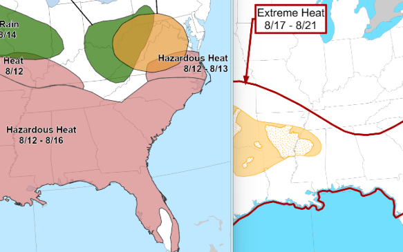
-
If that. Rrfs dries out the 2nd one as well giving us nothing
-
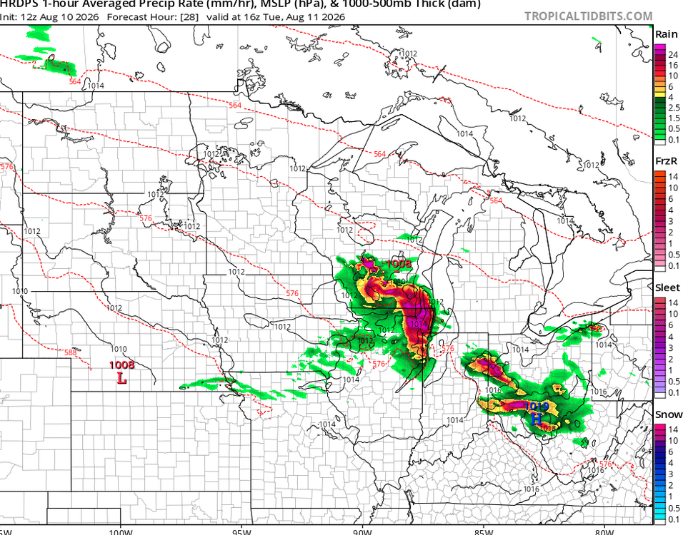
riding this
-
Augdewst 2026: Summer's Last Stand
vortex95 replied to Prismshine Productions's topic in New England
And yet how many times do you see ppl come out to walk the dog, jogging, or just causally strolling from the pool from their apartment complex when CGs are near and the thunder is wicked loud? I know this sounds callous, but they are just asking for it. You'd think thunder that loud would galvanize ppl. A mere flash I get not doing it, but the sound wave decibel level alone, you''d think that would do it! Any sudden loud noise typically will make anyone jump. And I am not talking about the typical thunder rumbles/crashes, you know what I mean -- the ones you are never quite ready for even when you know it's coming! Yes, the odds you yourself would get hit are extremely low, but when you give LTG millions of targets daily, that odds become 100% some will be hit. -
2026 Severe Wx - General Thread
CheeselandSkies replied to largetornado's topic in Lakes/Ohio Valley
Unfortunately more recent HRRR runs pointing toward more of an after dark event again. -
we keep rolling, a great summer locally and a tor season IL will likely never top
-
Augdewst 2026: Summer's Last Stand
vortex95 replied to Prismshine Productions's topic in New England
@CoastalWx gets more impressed w/ a sunset now? My how have the standards have fallen! No problem ragging on convection though! He likes pleasant and quiet wx it seems now! -

Augdewst 2026: Summer's Last Stand
Damage In Tolland replied to Prismshine Productions's topic in New England
Hot and humid for you and the animals! -
I'm here for it
- Today
-
Sounds like some sort of Mortal Kombat finishing move I'm unfamiliar with...
-
Probably just sprinkles for us from that.
-
2026 Severe Wx - General Thread
CheeselandSkies replied to largetornado's topic in Lakes/Ohio Valley
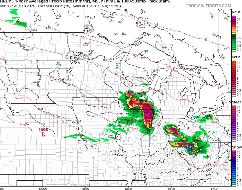
12Z HRRR and nest both became rather interesting for this evening from the state line into Chicagoland. Maybe what I thought might happen (in daylight) yesterday, will happen today.