All Activity
- Past hour
-
We were practically neighbors during the last storm, you can do better back here. I'm guessing they just don't think enough moisture gets back this way
-
Doesn’t care*
-
Nam looks damn good
-
Pounding*
-
I had 7" vs 20+ 20 miles east... this storm reminds me of that one but not as powerful,
-
Absolutely pouring right now dad spent care for some reason
-
It’ll probably have the same water content as Jan 25th’s.
-
That was a true Miller A with a big, deep trough that cutoff over the TN Valley, however the abrupt cutoff is similar to what we will see with this storm.
-
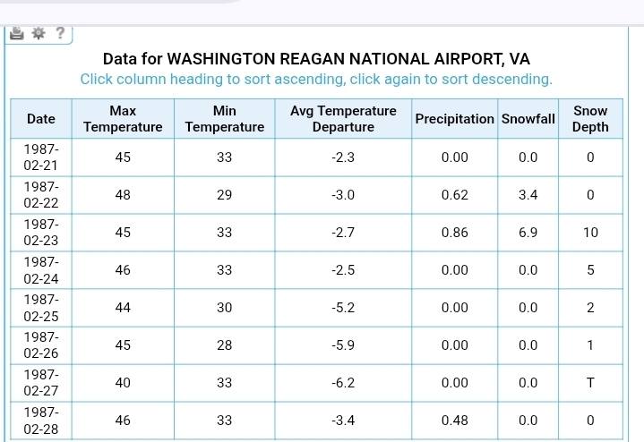
Yep! I just remember holding at 32.5-33.0 with BIG dumping aggregate flakes! 11" or so for me in West Springfield VA, and even DCA did well. Less than 10-1 ratio certainly, so you'll want to look at Kuchera or cut the 10-1 by 20-30% to be safe. Hoping that the inverted trough banding would be mostly at night.
-
our moment will come
-

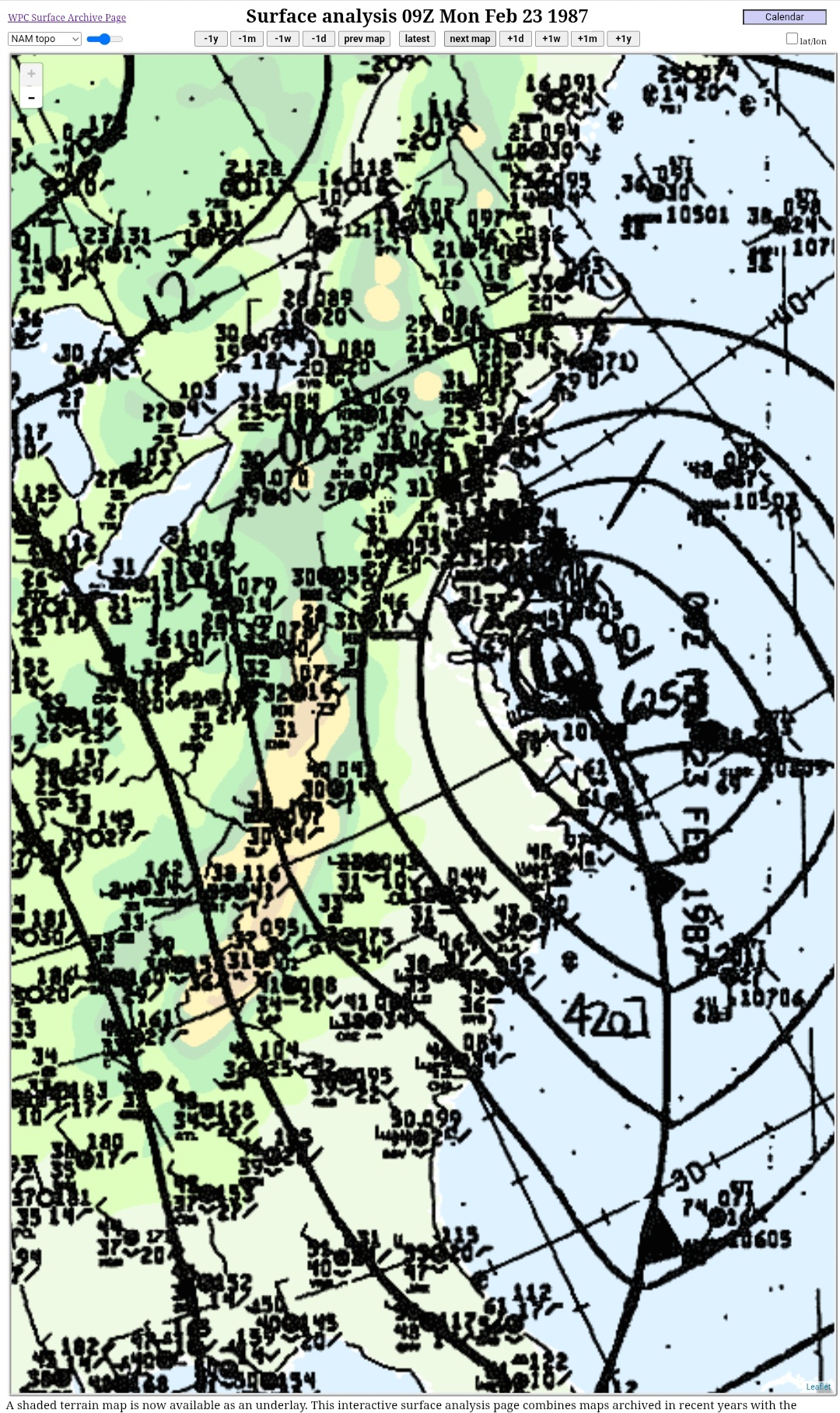
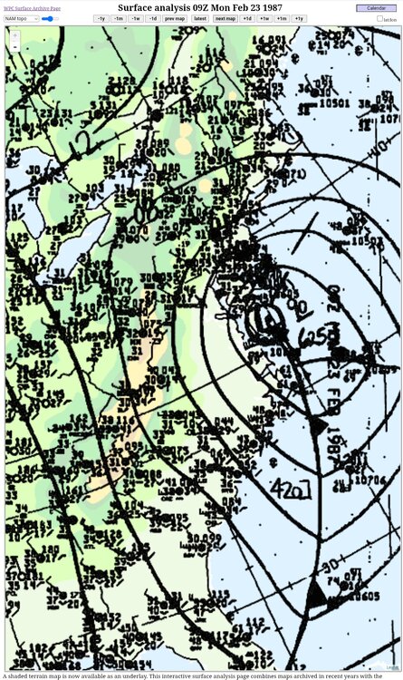
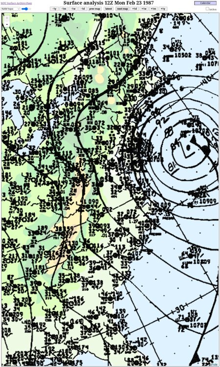
The February 22-23 Late Season Miracle: JV Disco/Banter Thread
ravensrule replied to bncho's topic in Mid Atlantic
Nothing like bantering to yourself. -
The Nam is just digging the northern stream smoothly this run. Its not doing a wonky meander. What fun is that?
-
30dBZ and not a flake yet
-
I had 30 inches on Staten Island
-
What a nasty western cutoff from nothing to glory in about 60 miles
-
I like the "high end" amounts (10% chance) from Upton
-
At least no sleet
-
it's still a mess here with large piles everywhere-even another 6-8 inches will make them even bigger and be around til may lol
-
Hopefully -10 right through September
-
Finally saturated. The first few flakes to make it down were beefy. Went to SN quick but still melting on the warm surfaces.
-
Kick on that AC.
-
Very February 25-26 2010 like storm coming a tepid low 30's snowfall Delivered an 11" wet paste bomb imby with 35-40mph gusts this won't drift
-
when radar does look like this, I will bump.
-
When is the last west of forecast coastal - i truly cant remember in the last 7 - 8 years.? When it used to be a routine occurrence. Not a southwest flow event - i mean true miller a/b or c.
-