All Activity
- Past hour
-
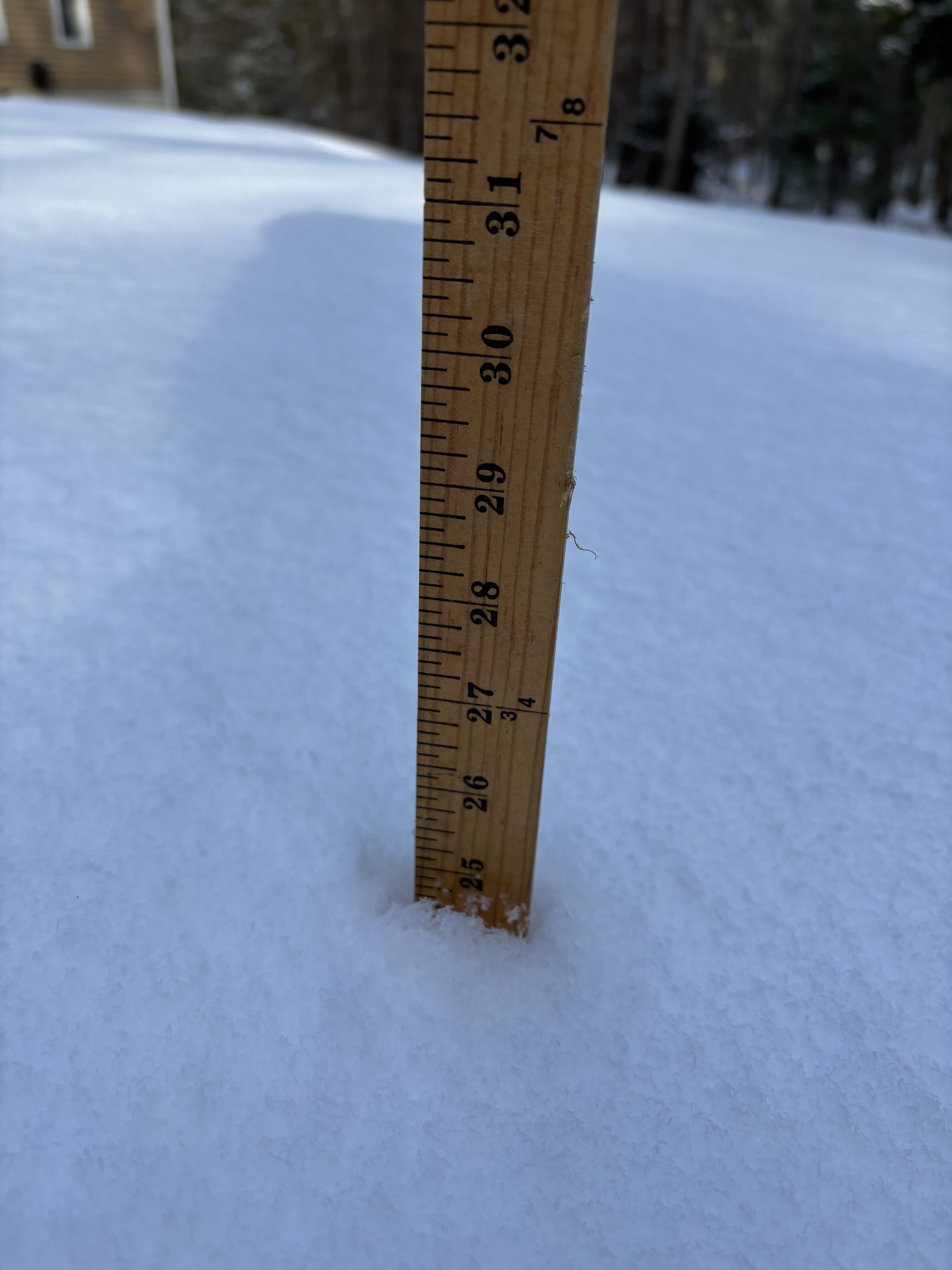
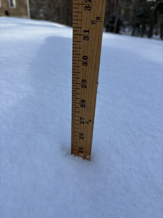
Down at my parents for dinner. Deep pack and
-
Translated … look at all this snow I’m progged to get while you all get cold rain and misery.. I’m looking forward to tracking several snow events
-

Late February/Early March 2026 Mid-Long Range
Stormchaserchuck1 replied to WxUSAF's topic in Mid Atlantic
What's up with March for the last 6 (now 7), years? -
We’re riding the edge up here…even the gfs is a period of snow late week before mixing. But it could easily end up mostly taint. That H7-85 layer will be pretty warm.
-
Surprised 02-03 isn't in the top 20. It definitely is for the New Brunswick area.
-
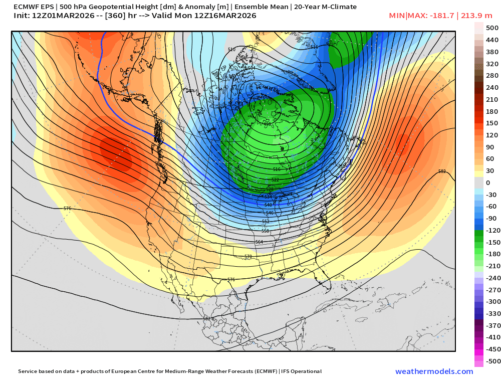
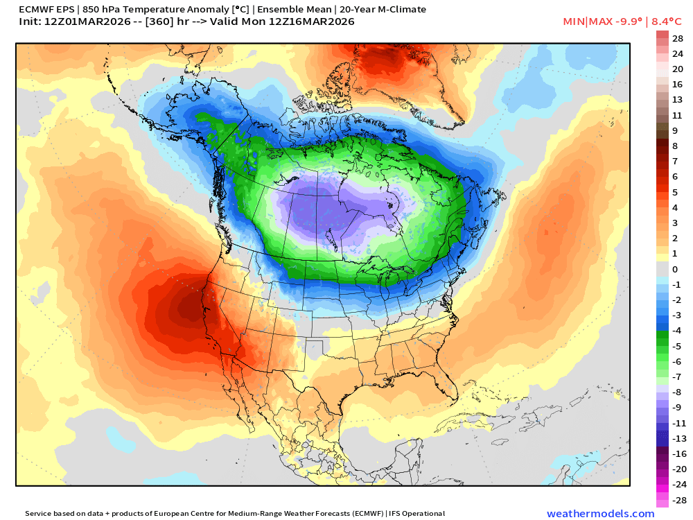
I would think the precip opportunity is definitely there for a lot of the Western and Central US for at least the next week or two, as subtropical ridging has been forecast (for over a week now) on both Euro and GFS models & ensembles to move off to the Eastern US. Which would obviously open the door for more troughing to come in.
-
Hey @stormtracker could we fix the pinning in this sub? The last El Niño from like 3 winters ago is somehow still pinned, lol
-
ugghh, well why not....but maybe it can dump all of the cold, all at once. Leaving no cold behind it and Spring can come rushing in afterwards
-
I'm even sitting at 37, in the valley under full sun and even some grass patches showing
-
This would be a fun birthday present for me.
-
All the forecast that I’ve looked at give us like 3 inches of snow on Tuesday night and then just mixing with rain the rest of the week. WPC has over an inch of QPF. But none of the forecast seemed to be very high confidence.
-
Late February/Early March 2026 Mid-Long Range
Stormchaserchuck1 replied to WxUSAF's topic in Mid Atlantic
Since I moved 30 minutes north of Baltimore in 1998, 13/28 April's have had snow (flurries or more). Unfortunately, it's 0 for the last 5 though. -

Late February/Early March 2026 Mid-Long Range
NorthArlington101 replied to WxUSAF's topic in Mid Atlantic
I think we’ve got at least one window in us after the thaw. We’re overdue April snow to some extent too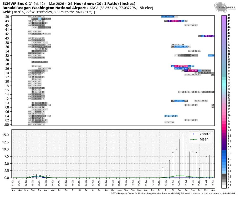
-
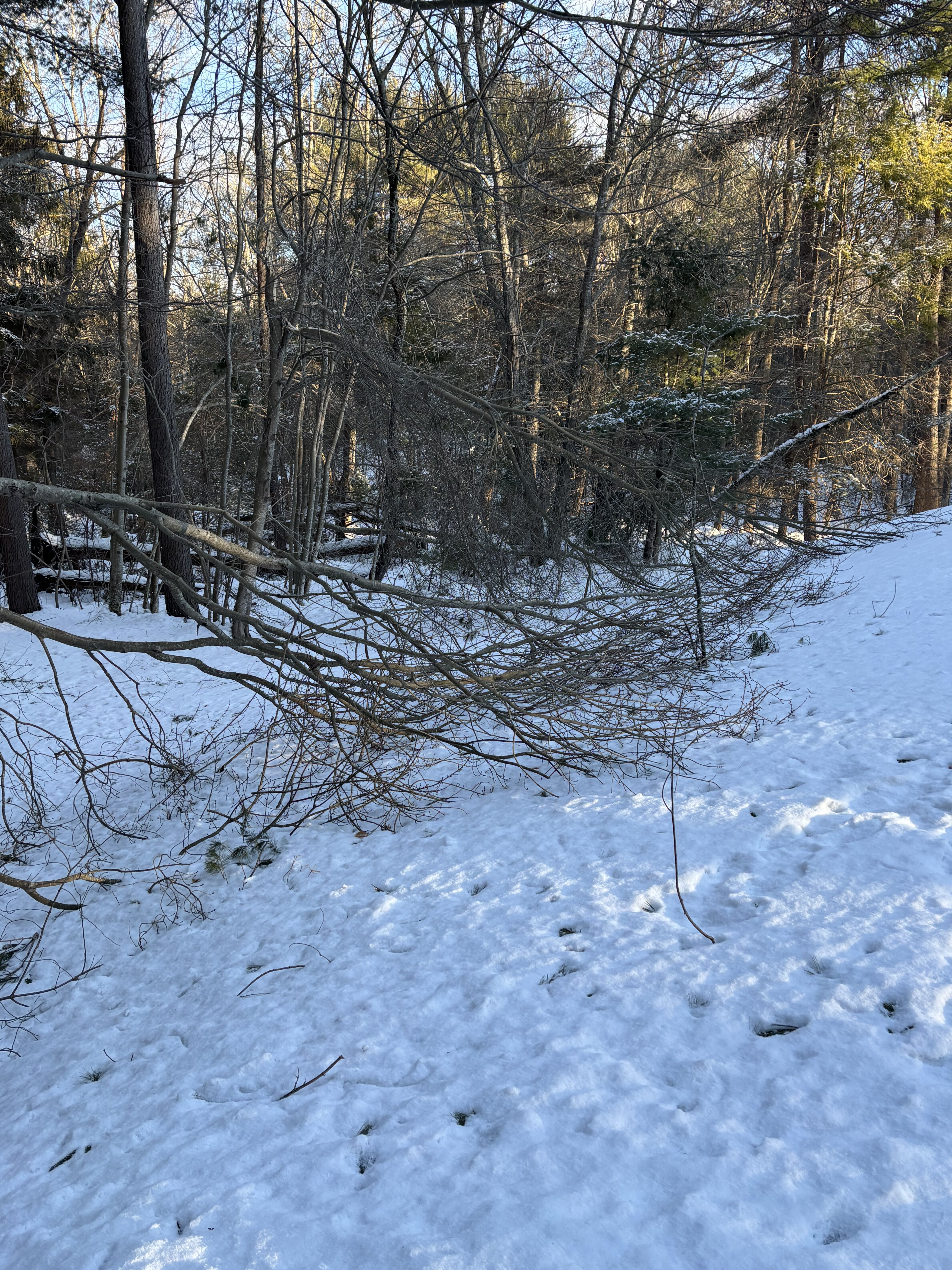
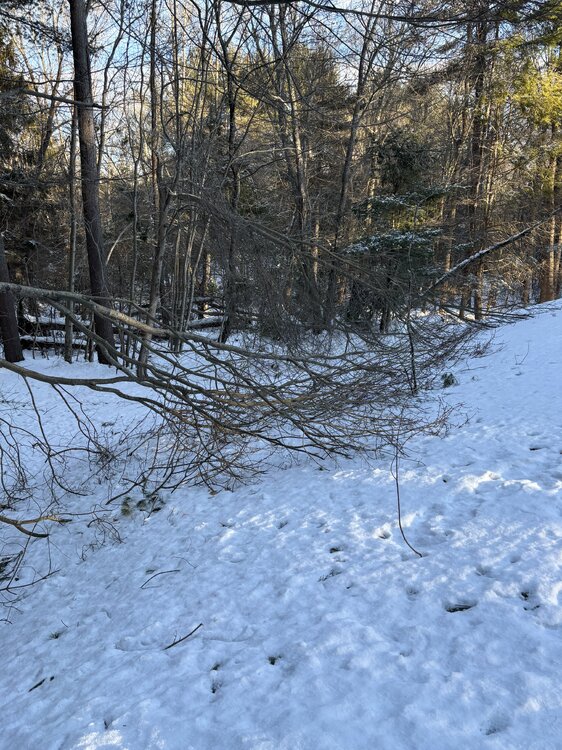
I vividly remember reading the posts in here from Northeast mass as that was starting, at least until most lost power out that way That was some crazy weather and I remember a kid I worked with in the summer show me what over 30 inches of snow looked like in SE New York.
-

Winter 2025-26 Medium/Long Range Discussion
michsnowfreak replied to michsnowfreak's topic in Lakes/Ohio Valley
I understand. My entire point was that snowfall potential us nowhere near done. -
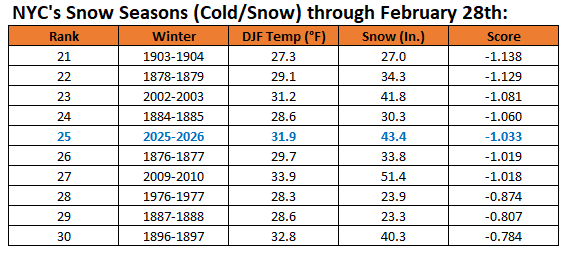
Here it is through February 28th:
-
Tomorrow will be blustery and cold. After an early morning low in the upper teens or lower 20s, New York City will see the temperature out near freezing. Clouds will increase tomorrow night and cloud cover could impede viewing of the lunar eclipse near sunrise Tuesday. Periods of mixed precipitation giving way to periods of rain is likely later Tuesday and Tuesday night. The temperature will reach the upper 30s and lower 40s. A sustained warming trend will commence on Wednesday. The second week of March could feature springlike readings. Long Island and coastal sections could be noticeably cooler than interior sections on a number of days on account of a chilly onshore flow. The ENSO Region 1+2 anomaly was +1.2°C and the Region 3.4 anomaly was -0.1°C for the week centered around February 11. For the past six weeks, the ENSO Region 1+2 anomaly has averaged +0.37°C and the ENSO Region 3.4 anomaly has averaged -0.32°C. Neutral ENSO conditions have now developed. Neutral ENSO conditions will continue through at least mid-spring. The SOI was +17.10 today. The preliminary Arctic Oscillation (AO) was -0.211 today.
-
If this verifies, this is where we’ll likely have multiple threats during the 3/15-3/25 period. That’s not a rotted out polar airmass. But if it backs off, then no dice.
-
Late February/Early March 2026 Mid-Long Range
Stormchaserchuck1 replied to WxUSAF's topic in Mid Atlantic
It's going to be pretty interesting, because we'll be transitioning from weak La Nina to more El Nino conditions late March into early April. Completely new pattern has the potential to build at that time vs the consistency of what has been all Winter. The pattern right now is for things to cool down a little as they get closer, it should be interesting to see what happens as El Nino starts to build! -
We often are muchly different from the US averages. 2009-10 was one of the coldest met winters for the country, and one of the mildest here. Colder now than the morning minimum and headed down under full sun.
-

Outta gas and Outta Time: Early March Winter Storm finale
Imgoinhungry replied to Ji's topic in Mid Atlantic
I agree. But districts love to overreact. . -
It’s not final, as snow season isn’t finished. I will post it shortly.
-
I'll believe it when I see it. We hit 81 today, +4 over predicted. We shall see. I'll take anything though in the 60's at this point. I'm done with winter.
-
Thanks man ! Good to know.
-

Late February/Early March 2026 Mid-Long Range
stormtracker replied to WxUSAF's topic in Mid Atlantic
I hope you’re cool/cold rainy and miserable well into April.