All Activity
- Past hour
-
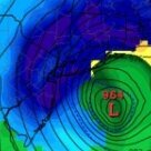
That was the sentiment at the time AREA FORECAST DISCUSSION..FINAL AFTN.. NATIONAL WEATHER SERVICE TAUNTON MA 414 PM EST SUN MAR 4 2001 ...SEVERE STORM COMPARABLE OR WILL EXCEED THE BLIZZARD OF 78 FOR SNE WITH 60 HR DURATION OF SNW AND MAX INTENSITY OF WORST CONDS 18Z TUE-00Z WED AND HURRICANE FORCE WIND GUSTS ARE HIGHLY LIKELY TO OCCUR PARTS OF E MA COAST...DRAG
-
Pittsfield FTW!! Or the bright blue skies.
-

Is we back? February discussion thread
RUNNAWAYICEBERG replied to mahk_webstah's topic in New England
Bruh… -
Eta, Avn, NGM, NOGAPS People think the NAM and HRRR is bad, they have idea about the NGM
-

Central PA Winter 25/26 Discussion and Obs
canderson replied to MAG5035's topic in Upstate New York/Pennsylvania
Interesting- it’s water streams and puddles everywhere around HBG/Camp Hill. I actually splashed my pant leg walking into Costco tonight -

E PA/NJ/DE Winter 2025-26 Obs/Discussion
MGorse replied to LVblizzard's topic in Philadelphia Region
The Global High-Resolution Atmospheric Forecasting (GRAF) model is a propriety, physics based, numerical weather prediction system developed by The Weather Company (an IBM Business) in collaboration with the National Center for Atmospheric Research (NCAR). -
Definitely looks north. H36 streams are oriented closer to each other, may show some interaction in the later frames.
-
0Z HRRR is going to be north and wetter. At least we will get some rain out of this I think.
-

Is we back? February discussion thread
WeatherGeek2025 replied to mahk_webstah's topic in New England
maybe for you but not for coastal sections, also that bermuda High Pressure has been trending stronger the last few runs, watch it send the Low pressure way north and have it rain up to Toms River and Snow up to Pittsfield MA! Itll also make the Low pressure go through a phenomena called Bombogenesis! -
Storm is gone more interested in the 18th beyond
-
KakashiHatake2000 started following February 2026
-
https://www.facebook.com/story.php?story_fbid=1433143008178881&id=100044495856962&http_ref=eyJ0cyI6MTc3MTAyODYxNzAwMCwiciI6Imh0dHBzOlwvXC93d3cuZmFjZWJvb2suY29tXC9zdG9yeS5waHA%2Fc3RvcnlfZmJpZD0xNDMzMTQzMDA4MTc4ODgxJmlkPTEwMDA0NDQ5NTg1Njk2MiZodHRwX3JlZj1leUowY3lJNk1UYzNNVEF5T0RVNE1qQXdNQ3dpY2lJNklpSjkifQ%3D%3D&hpir=1 See I told you it’s a possibility but not likely or guarantee six more weeks is coming back from vacation well except i didnt really read the text
-
You guys think my post is over the top. Thats fine. But what I mentioned, isn't even one billionth of what is ACTUALLY gonna transpire. By the time this is over with, the entire Sierran landscape will in effect, be The New Greenland. Three times what the models are saying just with this first storm starting Monday morning over the Sierra, may turn out to be extremely conservative. They will have to shut Mammoth Resort down for 7 days just to do avalanche mitigation work, and those conditions will be possibly the very WORST ever since they started building western ski resorts! The western ski resorts got delayed but not denied. Because of the incredible hyper intensity of these incoming storms, the severe season will begin rather early. The warm side of these storms will mean serious, serious bisnass! Get ready to track! https://www.msn.com/en-us/weather/topstories/meteorologist-says-get-ready-because-a-winter-storm-train-is-coming/ar-AA1WdzmJ
-
Calling this winter "relatively short" ...don't know about that, Dec and Jan both with -3.5° temp departures and double normal snowfall for many of us. Feb with a -9° departure so far. Of course we've been so dry this month however.
-

Is we back? February discussion thread
Damage In Tolland replied to mahk_webstah's topic in New England
Tiny https://x.com/weatherprof/status/2022473348706377898?s=46&t=dhcbvkjmRcyBVQtDxJ3lRg -
Imagine going on live TV and saying a storm will rival the Blizzard of '78 with 2001 NWP at your disposal
-
Seasonal models did pretty good this year. I remember you pointing out the much drier than average forecast. They were also colder than the 10 and 30 year averages. We were lucky to get that 1 STJ storm out of nowhere. It was Boston's 8th biggest snowfall on record, and the low pressure wasn't even that strong.
-
Oh I know lol
-
The 18z GFS yet again advertises a snow storm inside of d10 around Feb 21....slider.
-
it snowed over a weekend iirc.....my son was supposed to have surgery that almost got canceled. that melted and then it snowed again on sunday i think....both around 5-6 inches...
-

Winter Storm Threat *Technical* Discussion. No Op Run PBP or Snow maps
Terpeast replied to CAPE's topic in Mid Atlantic
If we remember the seasonals’ DJF precip anomaly forecast, it was bone dry and I was thinking “no STJ this winter then?” We’re lucky to get 8-11” frozen from a STJ wave that drove into the OHV. -
Ed Gein laughing. Mudvayne, nothing to gein @Cold Miser
-
Last time I saw it used was 2020 storm and it did well. Obviously we’re not getting 20” unless this is a jan25 2000 bust This has been one of the more interesting storms I’ve tracked. The high end ensemble members kind of make me depressed because it just shows what a full phase could have done
-
so its a false alarm then....
-

Is we back? February discussion thread
Damage In Tolland replied to mahk_webstah's topic in New England
So I goes in my cruiser .. I says yeah .. he says oh yeah.. I said look man …come down here .. he got down there .. -

Is we back? February discussion thread
Damage In Tolland replied to mahk_webstah's topic in New England
Disturbed


