All Activity
- Past hour
-
Statistically speaking, most Miller A storms are coastal scrapers or total misses. The only recent exception I can think of was 2/1/21.
-

E PA/NJ/DE Winter 2025-26 Obs/Discussion
Kevin Reilly replied to LVblizzard's topic in Philadelphia Region
Arctic front moving through kiss the warm air goodbye lol. -
Looks like a Jan 2018 redux.
-
ICON looking better to anyone at 78?
-

Possible coastal storm centered on Feb 1 2026.
Ginx snewx replied to Typhoon Tip's topic in New England
Fisher lol -
we need this storm to dig a little more to the sw to get in on a big snowstorm
-
All coated up here with trucks back out.
-
The orientation of the trough coming down from SE Canada continues to trend more and more NW to SE as opposed to E to W as it lowers in the Upper Midwest. I think this is being caused by a lobe in SE canada but cant confirm. Its on the EC and not GFS as shown below EC-AIFS Model – Z500, Vort, & Wind for Eastern U.S. | Tropical Tidbits AIGFS Model – Z500, Vort, & Wind for Eastern U.S. | Tropical Tidbits
-

The “I bring the mojo” Jan 30-Feb 1 potential winter storm
Tacoma replied to lilj4425's topic in Southeastern States
we need this to dig a little further sw to become a bigger snow for everyone in NC -

The “I bring the mojo” Jan 30-Feb 1 potential winter storm
stormwatcherJ replied to lilj4425's topic in Southeastern States
My “zone area forecast” for Orange County from NWS has potential snow chances starting at 1p Friday afternoon, then 50% chance Friday night. Seems they might be thinking an earlier start. -

Possible coastal storm centered on Feb 1 2026.
SouthCoastMA replied to Typhoon Tip's topic in New England
That was a massive blue ball. IIRC it was a sub 960mb behemoth east of benchmark, which got the outer cape/ACK into warning criteria -
It needs to feel the fear. .
-
may be hopium, but I remember bluewave posting a year or so ago a 3-run animation of the Euro that had a 2021 (or 2022? can't remember) storm 1000 miles OTS in one run, and then a NYC bullseye hit 2 runs later.
-
E PA/NJ/DE Winter 2025-26 Obs/Discussion
Kevin Reilly replied to LVblizzard's topic in Philadelphia Region
Looked like on the Euro there was a kicker vort dropping through central Canada into the Dakotas knocking things east off the east coast. Now not sure but I wonder if the gfs picks up on northern stream vorts better? Friday 12z gfs had a 977 mb low east of New Jersey so maybe it was onto something then and it’s bringing back. We shall see but the Euro had it fir a few runs too especially 0z Sunday into Monday. -

The “I bring the mojo” Jan 30-Feb 1 potential winter storm
SUNYGRAD replied to lilj4425's topic in Southeastern States
GSP is taking this potential storm seriously with their point forecasts this far out. I clicked on Davie Co. Friday NightA 50 percent chance of snow after 7pm. Mostly cloudy, with a low around 15. SaturdayA 40 percent chance of snow before 5pm. The snow could be heavy at times. Mostly cloudy, with a high near 24. I highlighted the heavy snow -

Possible coastal storm centered on Feb 1 2026.
TauntonBlizzard2013 replied to Typhoon Tip's topic in New England
Gross -

The “I bring the mojo” Jan 30-Feb 1 potential winter storm
Silver Meteor replied to lilj4425's topic in Southeastern States
You should have enough evidence by tomorrow afternoon. If it appears a dangerous storm at hand, cancel the trip. Your daughter should understand. If she doesn't, don't make her problem your whole family's problem. -
Agreed! That is pretty positive at this point.
-

Possible coastal storm centered on Feb 1 2026.
Damage In Tolland replied to Typhoon Tip's topic in New England
Getting some light snow -
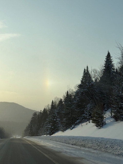
A snowbow?
-
Roads are still pretty brutal here (although markedly better now than early this morning) so makes sense. Surprised they called Thursday so soon tbh
-
Harford County schools closed on Wednesday.
-
You can leave it ….There’s no year in the title. As always …..
-
.thumb.jpg.6a4895b2a43f87359e4e7d04a6fa0d14.jpg)
Central PA Winter 25/26 Discussion and Obs
Yardstickgozinya replied to MAG5035's topic in Upstate New York/Pennsylvania
There's a few flakes flying out here. I'm out at the Animal Hospital of Rye in Blizzard's neck of the woods. -
I suggested Thursday depending on sampling


