All Activity
- Past hour
-
-

Feb 22nd/23rd "There's no way..." Obs Thread
AmericanWxFreak replied to Maestrobjwa's topic in Mid Atlantic
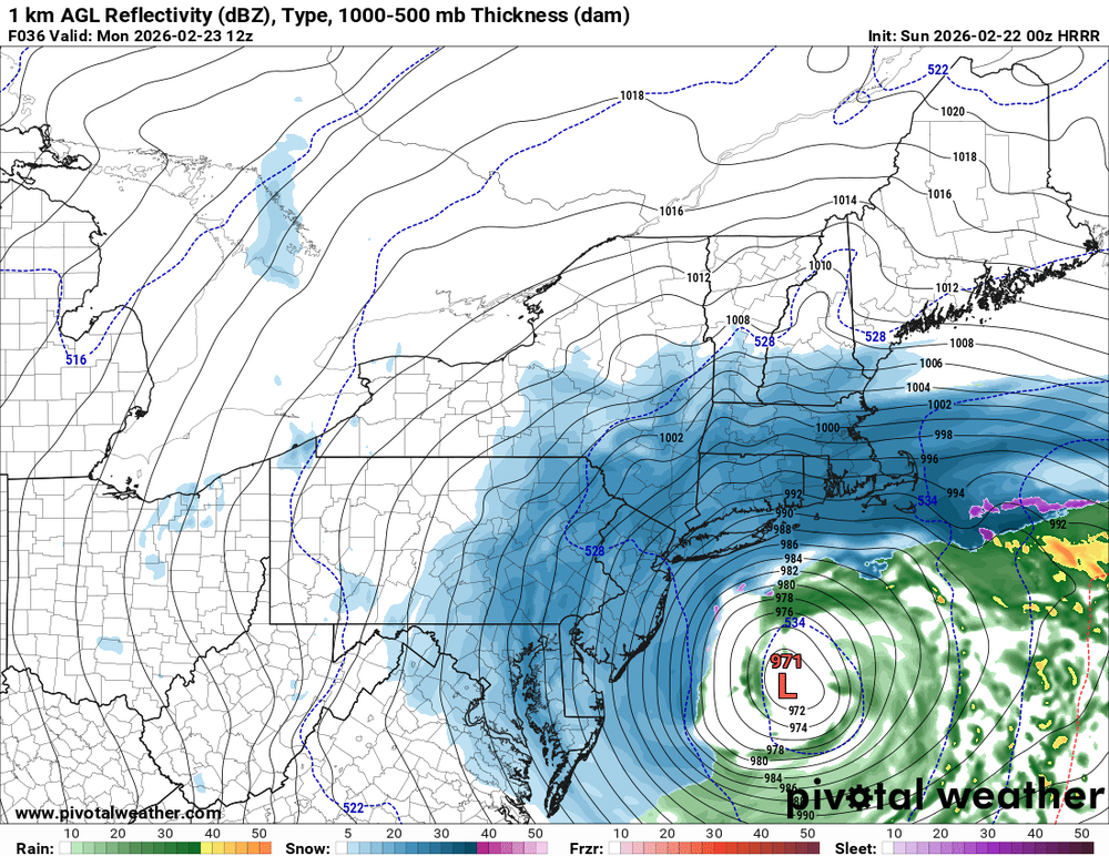
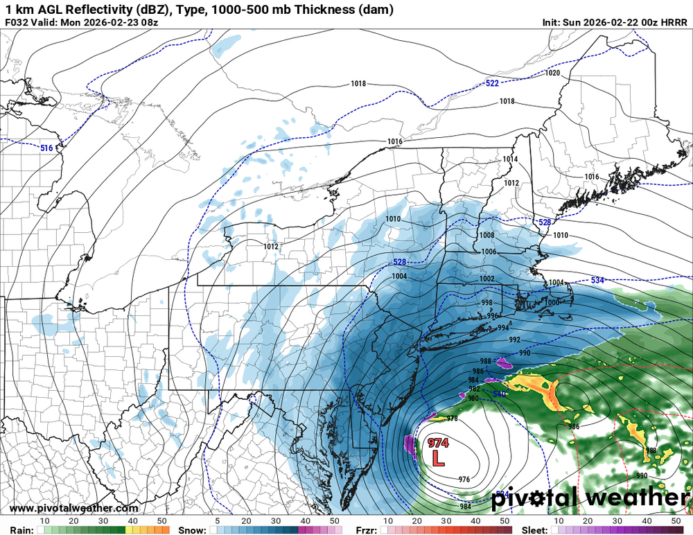
HRRR was slower with the northern peice of energy . -
That’s not a massive jump east lol. It’s just weaker
-

The February 22-23 Late Season Miracle: JV Disco/Banter Thread
kurtstack replied to bncho's topic in Mid Atlantic
LFG - Time to reel this one in! . -

Blizzard of 2026 Storm Thread/OBS
MickeyTim6533 replied to Mikeymac5306's topic in Philadelphia Region
DOOM in the "other" forum that the HRRR is very East? anyone seeing it? -

Central PA Winter 25/26 Discussion and Obs
CarlislePaWx replied to MAG5035's topic in Upstate New York/Pennsylvania
At hour 30 which is 06z or 1:00am the HRRR has given me 0.46" of qpf with only 2.7" of snow. -
NAMing incoming soon if the latest SREFs are the indicator. 0z HRRR not as good as 18z
-

“Cory’s in NYC! Let’s HECS!” Feb. 22-24 Disco
40/70 Benchmark replied to TheSnowman's topic in New England
Dynamic weighting, too...if you're on the fringes like I am, it's 80% SREFS, but if you fear taint...it's GFS/NOGAPS-heavy. -
Feb 22nd/23rd "There's no way..." Obs Thread
AmericanWxFreak replied to Maestrobjwa's topic in Mid Atlantic
-
 NYC 18.9 LGA 19.7 ISP 26.2 JFK 23.7 EWR 24.4
 -

“Cory’s in NYC! Let’s HECS!” Feb. 22-24 Disco
weatherwiz replied to TheSnowman's topic in New England
ka-boom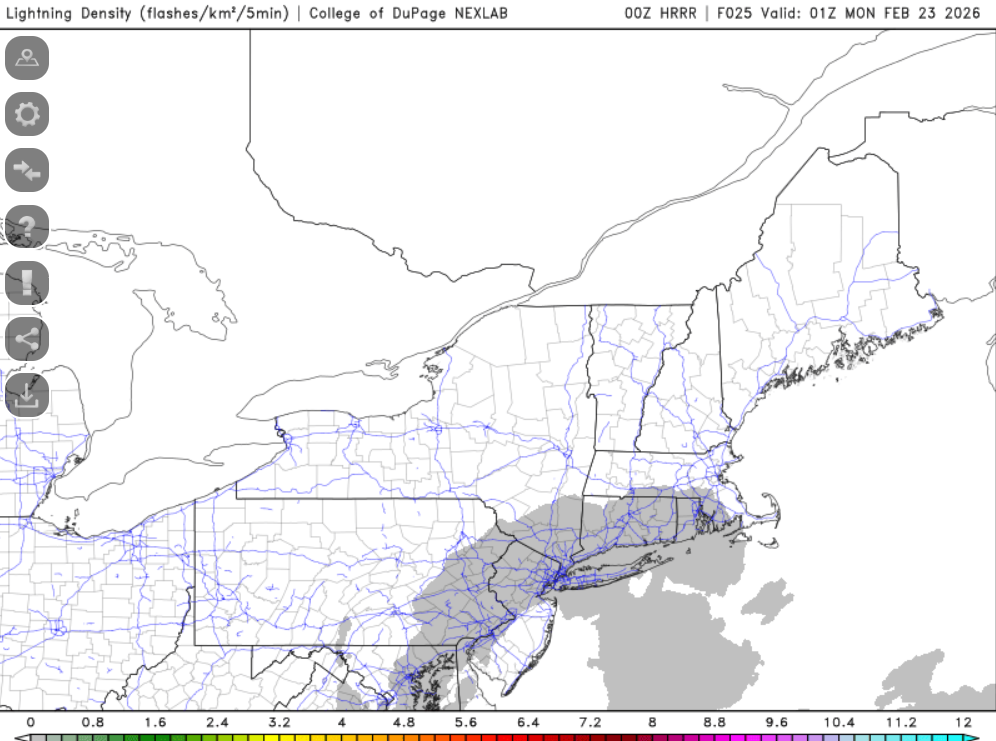
-
okay sorry I was just asking Tony cause he's a better forecaster than you
-

Feb 22nd/23rd "There's no way..." Obs Thread
StormyClearweather replied to Maestrobjwa's topic in Mid Atlantic
Drier and thus warmer for many. And maybe east too. -

Feb 22nd/23rd "There's no way..." Obs Thread
mitchnick replied to Maestrobjwa's topic in Mid Atlantic
I'll take a drive or 2 up to Pigeon Hills and I guarantee you they'll be all snow with temps so close as what's progged. Happened several times since I've been up here. -
Bombing out again
-

Feb 22nd/23rd "There's no way..." Obs Thread
paulythegun replied to Maestrobjwa's topic in Mid Atlantic
Compared to 18z, 00z HRRR is a MASSIVE jump east. -
Do I need to get the snowblower out?
-

Feb 22nd/23rd "There's no way..." Obs Thread
baltosquid replied to Maestrobjwa's topic in Mid Atlantic
HRRR looks either east or drier to me tbh -
someone way smarter than me should make a board approved weenie model blend
-
Freehold, NJ is my guess. I worry about the beach towns getting started later with accumulating snows when winds turn from off the water to the north as air temps are much warmer with this storm. I think central NJ does best and starts cutting dramatically NW. I feel my area of the Lehigh Valley is 6-10”.
-
I think most the accumulation doesn’t come to after 3pm no matter what anyways. If we can get anything during the day that will just help boost totals.
-
If you're going to go fishing for feedback on your gambling project can you take it to DMs please?
-

Winter 25/26 General Obs
Holston_River_Rambler replied to Holston_River_Rambler's topic in Tennessee Valley
Winds are cranking up here on the plateau. Cold air rushing in. -

Pittsburgh/Western PA WINTER ‘25/‘26
Rd9108 replied to Burghblizz's topic in Upstate New York/Pennsylvania
Im guessing what was it Juno where it was a complete whiff still gives them nightmares. This looks a little bit more of a slam dunk imo. -
And I’m not trying to pigpile on the hires stuff. I think they have a purpose and are good in some areas. But too often they seem to start getting synoptically off when you start getting past 12hr.


