All Activity
- Past hour
-
 Could be worse. 3/4sm smoke in Duluth KDLH 151153Z 02003KT 3/4SM R09/P6000FT FU FEW006 BKN060 OVC110 21/13 A3016 RMK AO2 TWR VIS 1
 -
 13 hail reports >= 1.25" last night. That's pretty damn impressive for the region
 -
 Dude, this is terrible
 -

Central PA Summer 2026 Discussion/Obs Thread
mahantango#1 replied to Voyager's topic in Upstate New York/Pennsylvania
US National Weather Service State College PA Favorites ·sotpSrndoeaihc7u709m917g0gg799hl62f2af7c18c8u16a1h5h52aulg54 · HERE COMES THE SMOKE Massive wildfires erupted in Ontario & northern Minnesota on Monday. NW winds will carry that smoke across the Great Lakes, Northeast, & Mid-Atlantic today & tonight. Reduced visibility & degraded air quality may persist through the end of the week. https://www.facebook.com/100064725904699/videos/pcb.1458510112983172/1665007804603396 -
 Inhale, exhale, just got an ounce in the mail
 -
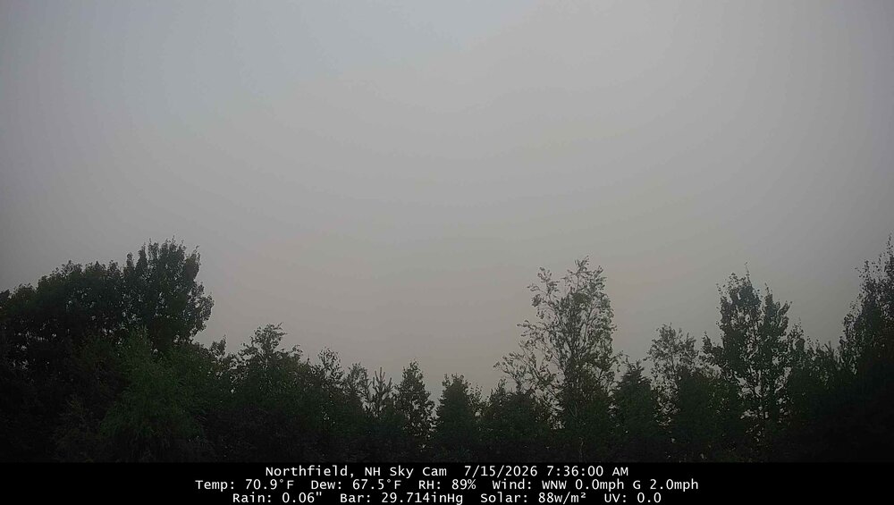
It’s dark
-
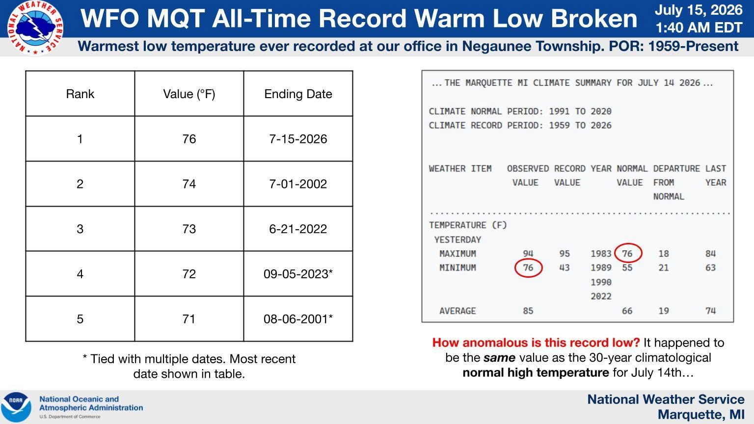
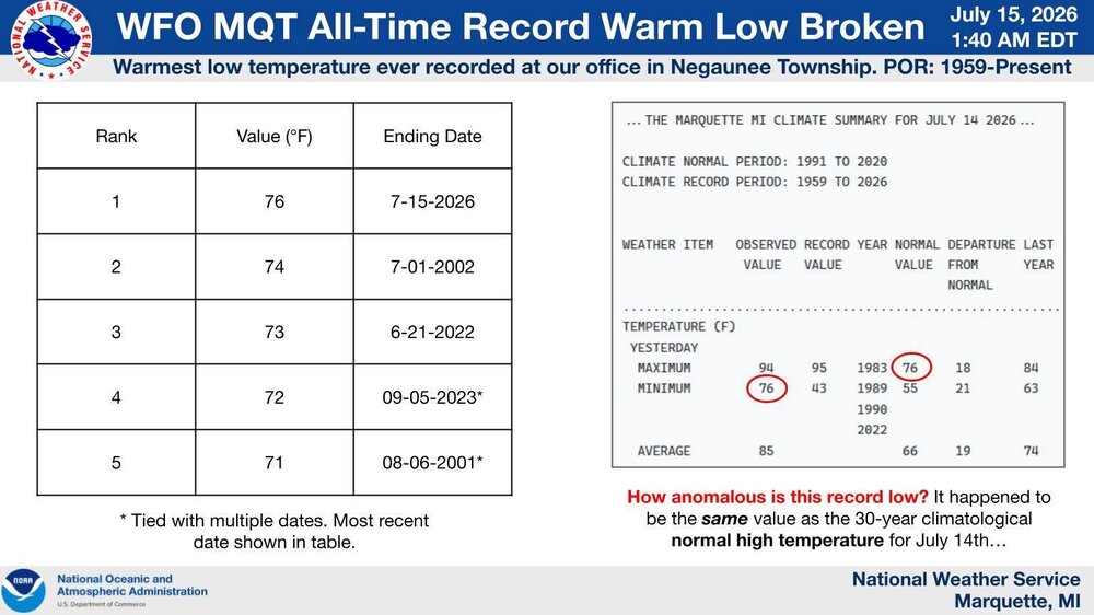
The all-time warmest low temperature was set at our office today in Negaunee Township at 76°F. This breaks the previous record warm low of 74°F set in July of 2002. Records for our office date back to 1959 with an observational period of midnight to midnight EST (1 AM to 1 AM EDT). What makes this record exceptional is that it happens to be the same value as the 30-year normal high temperature for this time of year.
-
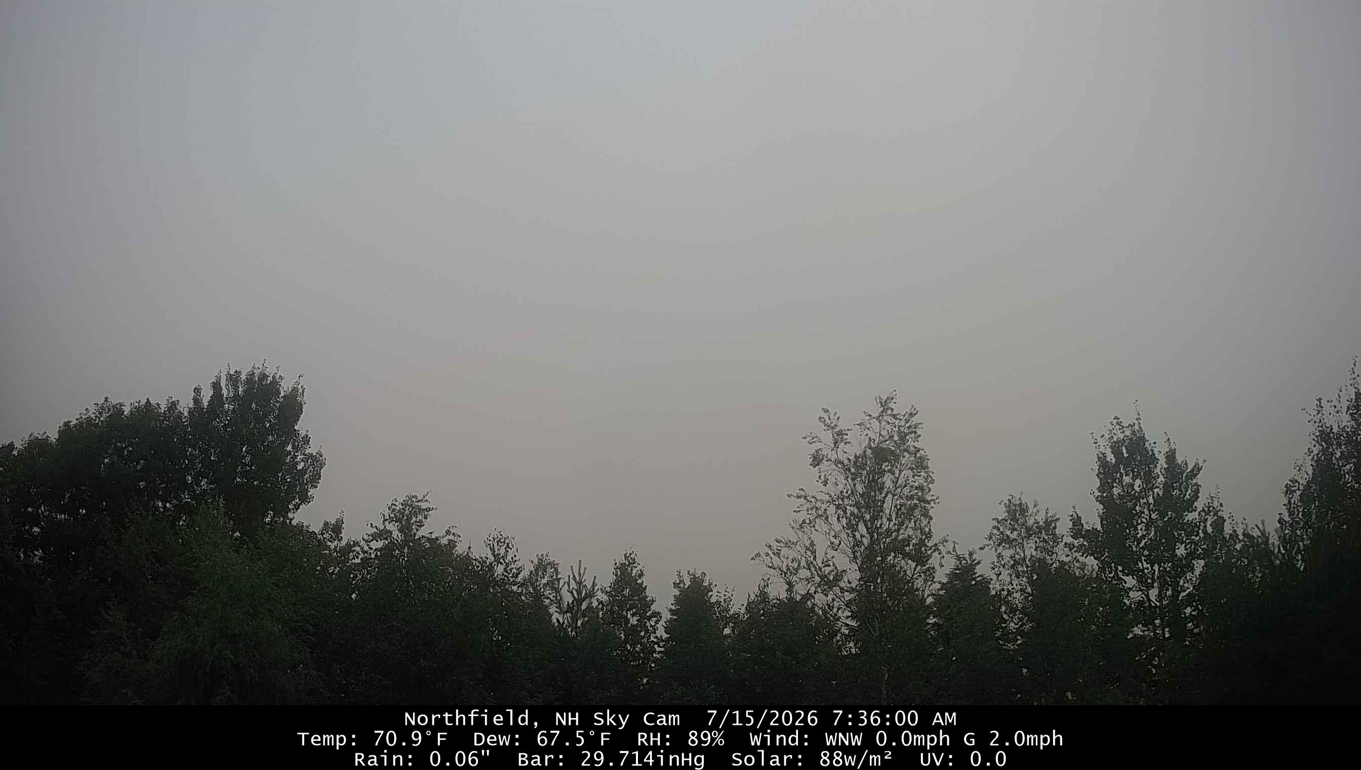
Haven’t gone outside yet, but is that smoke down here at the surface? Looks miserable.
-
Are Saturday evening showers expected to be scattered?
-
It’s just 80’s and humid . High heat comes back late month into early Augdewst
-
 There could be two or three days over the next week that are below normal. Especially if it rains. It’s definitely a cooler look so I don’t see like 90/74 stuff.
 -
80° at 5:30am up here in the sticks is just plain stupid.
-
We had the classic HHH summer days in the 70s and 80s from pollution, but I never remember having wildfire smoke. I hope we don't get it like a couple years ago - that sucked
- Today
-

2026-2027 Super El Nino
bluewave replied to Stormchaserchuck1's topic in Weather Forecasting and Discussion
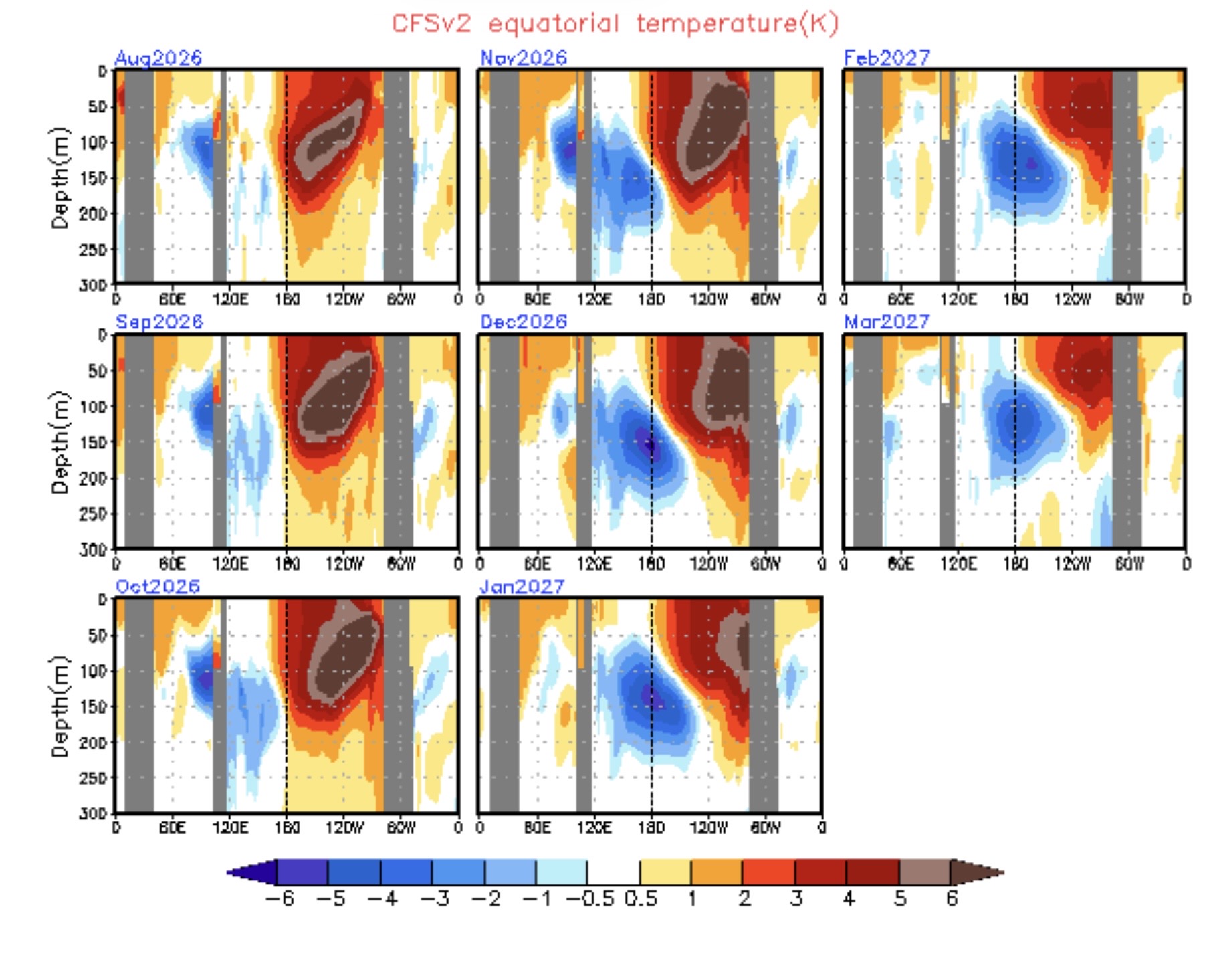
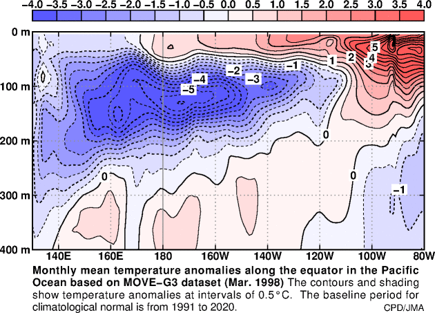
While these long range subsurface charts from the CFS can lose skill, it’s impressive that the El Niño is still going strong in Nino 1+2 by March. The model is trying to show this taking time to weaken due to how strong it gets. The developing cold pool to the west isn’t as strong as 1998 was.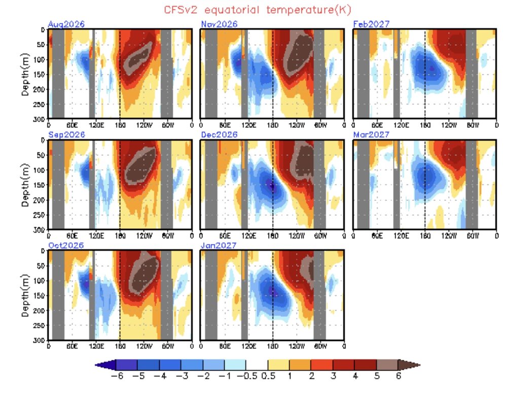
-

E PA/NJ/DE Summer 2026 Obs/Discussion
Birds~69 replied to PhiEaglesfan712's topic in Philadelphia Region
Smoke, triple digit temperatures and high dew points today....woo hoo! -
 not a bad summary of reports here https://www.wcax.com/2026/07/15/tuesday-nights-storm-damage-reports/
 -
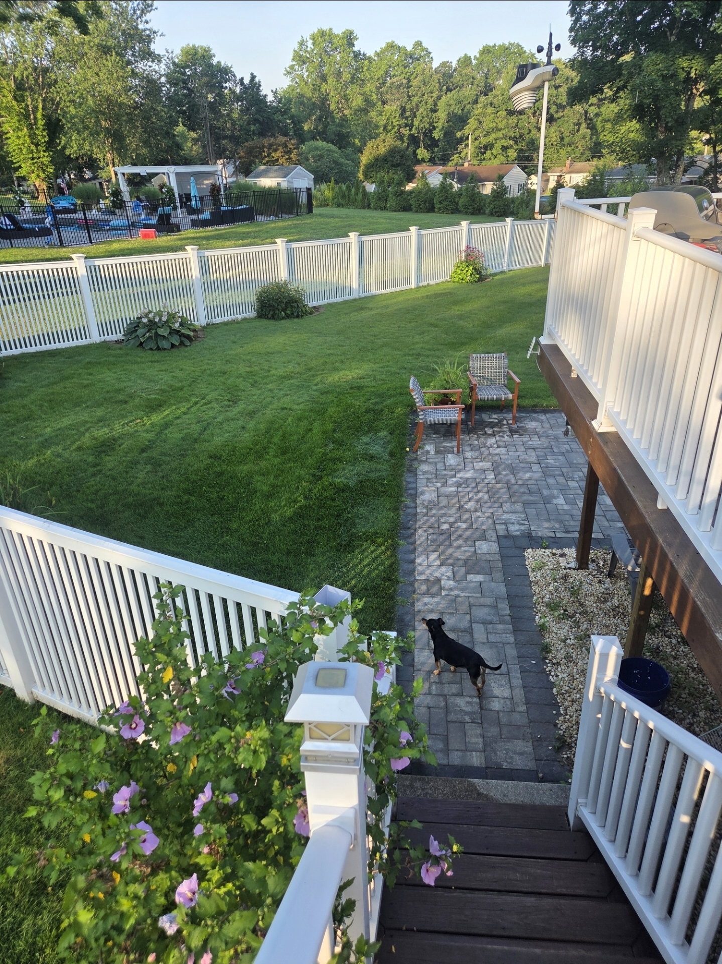
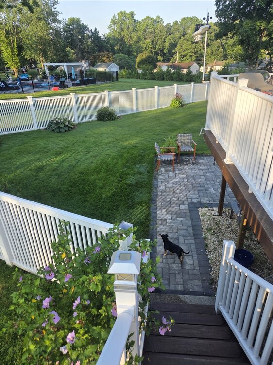
Pretty crazy how green it is around the New Haven area that got 3-5 inches back on the 6th/7th. Took like a week for lawns to really respond and green up to all that rain. Zero rain since and lawns are still going wild. Been having to mow like evey 3-4 days.
-
I spent the first 25yrs of my life in Michigan (born 1980) and not once do I recall anything about wildfire smoke. I didn't even know it was a thing until after I move out here.
-
Less snow means more drought means more needle fall means more fuel load.
-
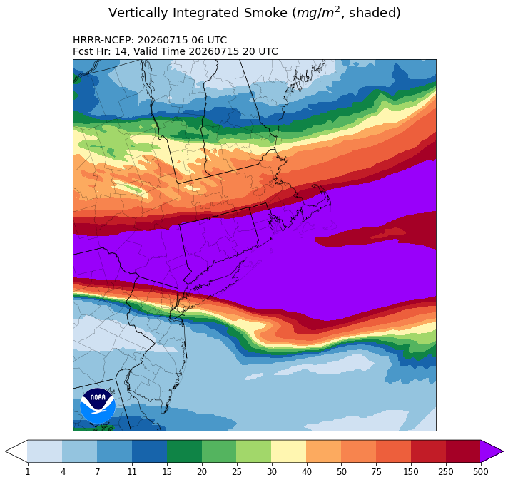
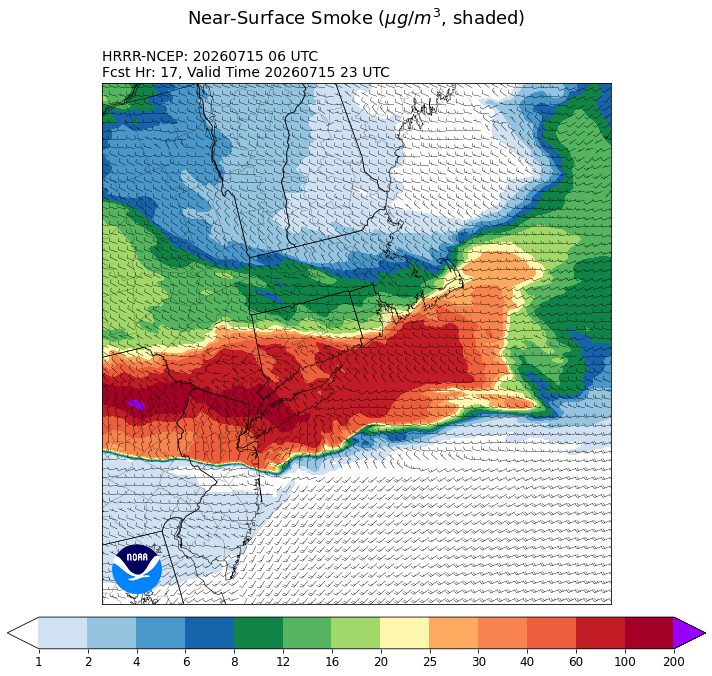
Unfortunately, the near surface smoke is forecast to get thicker later. https://rapidrefresh.noaa.gov/hrrr/HRRRsmoke/Welcome.cgi?dsKey=hrrr_ncep_smoke_jet&domain=NYC-BOS&run_time=15+Jul+2026+-+06Z
-
Yeah I’m seeing these odd posts about a cool pattern . When the ensembles are building the WAR and dews . Hopefully a few storms Saturday afternoon.
-
Holy smokes. Stepped outside to run and it smelled like I was in Ginx’s bong tray .That stuff is thick and heavy at ground level. Def could feel it running
-
Low of 81 at LGA, the king of the heat island. Still a decent Southerly vector to the wind should keep the beaches reasonable today .
-
 Nada. Nice cell approaching Sebago at 10pm must have fallen apart. 0.00" Sent from my SM-S921U using Tapatalk