All Activity
- Past hour
-

First Legit Storm Potential of the Season Upon Us
SouthCoastMA replied to 40/70 Benchmark's topic in New England
looks good. -

E PA/NJ/DE Winter 2025-26 Obs/Discussion
RedSky replied to LVblizzard's topic in Philadelphia Region
Euro is south and a day later=split the difference apply e=mc squared and it's a snowstorm -

Storm potential January 17th-18th
Jersey_Snowhole replied to WeatherGeek2025's topic in New York City Metro
Where can one find the noaa weather model? -
Models say you might be able to sneak it in. The mid-level clouds that will be coming in from the south look like they'll hold off until midnight or so (look at the 700 RH on the GFS). Higher level (500mb) RH still gives you a window before 11pm or so. Going to the mesos, the HRRR/NAM Next look good through 10pm while the NAM parent has some clouds moving in closer to 8pm. All-in-all, you'll have to make a call on how much risk your group is willing to take.
-
URGENT - WINTER WEATHER MESSAGE National Weather Service Wakefield VA 134 PM EST Sat Jan 17 2026 VAZ064-075>078-521-522-180300- /O.NEW.KAKQ.WW.Y.0001.260118T1500Z-260119T0000Z/ Caroline-Westmoreland-Richmond-Northumberland-Lancaster-Western Essex-Eastern Essex- 134 PM EST Sat Jan 17 2026 ...WINTER WEATHER ADVISORY IN EFFECT FROM 10 AM TO 7 PM EST SUNDAY... * WHAT...Wet snow expected. Total snow accumulations up to two inches. * WHERE...Portions of east central, eastern, and north central Virginia. * WHEN...From 10 AM to 7 PM EST Sunday. * IMPACTS...Plan on slippery road conditions. * ADDITIONAL DETAILS...The advisory may need to be expanded southward with future updates if the snow forecast continues to trend upward.
-

E PA/NJ/DE Winter 2025-26 Obs/Discussion
Birds~69 replied to LVblizzard's topic in Philadelphia Region
With tonight's Lows and receiving 2" tomorrow will look pretty cool out there Monday morning. I still have past frozen junk piles as well. So in essence, leftover street junk lingering plus snow on snow events plus incoming freeze....not bad. -

Central PA Winter 25/26 Discussion and Obs
AccuChris replied to MAG5035's topic in Upstate New York/Pennsylvania
Latest HRRR looks good for early morning tomorrow . -
That's more like it.
-
Wakefield issuing WWAs
-

January 2026 regional war/obs/disco thread
40/70 Benchmark replied to Baroclinic Zone's topic in New England
You'e been all over that John, nice. -
-

First Legit Storm Potential of the Season Upon Us
Baroclinic Zone replied to 40/70 Benchmark's topic in New England
15z SREF basically held serve. Orientation of precip adjusted somewhat and maybe a hair wetter over eastern areas. -
I'm going to simply hope the Euro Ai, which has been really great, is correct. The Euro would probably cause me to check out for winter if it happened.
-
FFC updating to WSW.
-

First Legit Storm Potential of the Season Upon Us
Damage In Tolland replied to 40/70 Benchmark's topic in New England
I mean WTF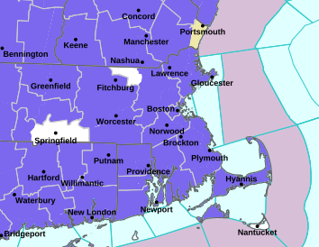
-
This shouldn't have been much of a surprise. This was well signaled for days as a short duration, high intensity event. And models were showing near or just below freezing wetbulb temps even to the coast. That's not a terrible antecedent airmass.
-

Jan 17-18 Sunday Funday Storm
neatlburbwthrguy replied to NorthHillsWx's topic in Southeastern States
Winter storm warning for parts of south central Georgia including Macon. Heavy snow and up to 3 inches. -
I'm closing in on 5 inches as is most of Orange County in the 4-5 range. Kudos to the HRRR from yesterday.
-

E PA/NJ/DE Winter 2025-26 Obs/Discussion
Duca892 replied to LVblizzard's topic in Philadelphia Region
The 12z GFS has a colossal slop storm next weekend. -
That's the best...when we've got something on the doorstep and other potential events to follow after!!! Better than grasping at shreds of hope during shit the blinds periods, by showing week 4 Euro weeklies and MJO charts!
-
Approaching 4" here. Might be the best event of the year locally!
-

Another Coating of Snow Saturday - "It's all we Got"
WeatherGeek2025 replied to Sey-Mour Snow's topic in New England
tomorrow will be even colder so this could be a very snowy weekend! -

First Legit Storm Potential of the Season Upon Us
WinterWolf replied to 40/70 Benchmark's topic in New England
Coming down real nice here again..roads covered again. We add to todays 1 inch. Beautiful wintry appeal. Snowy weekend. -

Another Coating of Snow Saturday - "It's all we Got"
DomNH replied to Sey-Mour Snow's topic in New England
Looks like 1-2'' on the colder surfaces. Struggling to stick to the pavement. -
Another Coating of Snow Saturday - "It's all we Got"
Damage In Tolland replied to Sey-Mour Snow's topic in New England
Poundmetown now


