All Activity
- Past hour
-
September 1 1926: Perhaps the most intense rainfall rate ever in downtown Minneapolis falls on this date. 1.02 inches of rain is recorded in six minutes, starting at 2:59pm in the afternoon according to the Minneapolis Weather Bureau. The deluge, accompanied with winds of 42 mph, causes visibility to be reduced to a few feet at times and stops all streetcar and automobile traffic. At the intersection of Second and Sixth Streets in downtown Minneapolis, rushing water tears a manhole cover off, and a geyser of water shoots 20 feet in the air. Hundreds of wooden paving blocks are uprooted and float onto neighboring lawns, much to the delight of barefooted children seen scampering among the blocks after the rain ends. 1894: The Great Hinckley Fire. Drought conditions start a massive fire that begins near Mille Lacs and spreads to the east. The firestorm destroys Hinckley and Sandstone and burns a forest area the size of the Twin Cities Metropolitan Area. Smoke from the fires brings shipping on Lake Superior to a standstill. 1807: The earliest known comprehensive Minnesota weather record begins near Pembina. The temperature at midday is 86 degrees, with a 'strong wind until sunset.' For Tuesday, September 1, 2026 1894 - A forest fire driven by high winds burned down the town of Hinkley, MN, killing 418 persons. (David Ludlum) 1897 - Hailstone drifts six feet deep were reported in Washington County, IA. (The Weather Channel) 1914 - The town of Bloomington, MI, was deluged with 9.78 inches of rain in 24 hours to establish a state record. (31st-1st) (The Weather Channel) 1955 - The temperature at Los Angeles, CA, soared to an all-time high of 110 degrees during an eight day string of 100 degree weather. (David Ludlum) 1979 - A home in Centerville TN was hit by lightning and totally destroyed. It marked the third time that the house had been hit by lightning since being built in 1970. (The Weather Channel) 1987 - Cool Canadian air invaded the Midwest. Six cities reported record low temperatures for the date, including Indianapolis IN with a reading of 44 degrees. Hot weather continued in the northwestern U.S. Five cities reported record high temperatures for the date, including Hanover WA, where the mercury soared to 106 degrees. (The National Weather Summary) 1988 - Thunderstorms produced heavy rain in the Upper Mississippi Valley. Ely, MN, was drenched with three inches of rain in two hours, and pelted with one inch hail. The heavy rain flooded streets and basements, and the high water pressure which resulted blew the covers off manholes. (The National Weather Summary)(Storm Data) 1989 - Thunderstorms developing ahead of a cold front produced severe weather in Oklahoma during the late afternoon and evening hours. Thunderstorms produced hail two inches in diameter west of Arapahoe, and wind gusts to 70 mph at Luther and south of Harrah. Early morning thunderstorms over Indiana drenched Kokomo with five to eight inches of rain, and spawned a tornado which injured three persons at Bruce Lake. (The National Weather Summary) (Storm Data) Observances: 1 Tue Emma M Nutt Day 1 Tue world alzheimer's month 1 Tue World Letter Writing Day 1 Tue National Chicken Month 1 Tue American Chess Day 1 Tue National Suicide Prevention Month 1 Tue National Recovery Month 1 Tue Ovarian Cancer Awareness Month 1 Tue Acne Positivity Day 1 Tue Building and Code Staff Appreciation Day 1 Tue Cherry Popover Day 1 Tue Chicken Boy Day 1 Tue National Child Identity Theft Awareness Day 1 Tue National Little Black Dress Day 1 Tue National Monterey County Fair Day 1 Tue National No Rhyme Nor Reason Day 1 Tue Pink Cadillac Day 1 Tue Ginger Cat Appreciation Day
-
 medication in mexico and mexico pharmacy order from mexico https://www.google.gr/url?sa=t&url=https://mexiph.com farmacia online usa and https://www.liveviolet.net/user/rnmyqmtfxe/videos mexico city pharmacy [url=https://images.google.com.co/url?q=https://mexiph.com]online drugs order[/url] mexican rx pharm or [url=https://lifnest.site/user/vcnqwjkqchvcnqwjkqch/?um_action=edit]pharmacies in mexico that ship to the us[/url] is mexipharmacy legit
 -

Central PA Summer 2026 Discussion/Obs Thread
Mount Joy Snowman replied to Voyager's topic in Upstate New York/Pennsylvania
August ended as my third wettest month ever with 13.46", bringing my yearly total to an even 36". For comparison, MDT ended August with only 3.67" and sits at 22.91" for the year. -

Occasional Thoughts on Climate Change
donsutherland1 replied to donsutherland1's topic in Climate Change
Given the literature, a climate change contribution appears likely. As I replied to Larry, that doesn't mean that climate change was the main or leading cause. A lot more research will be needed for that determination, as well as to estimate the magnitude of climate-related contribution. Your theoretical point is a fair argument. My conclusion is based largely on the body of literature. -
Occasional Thoughts on Climate Change
donsutherland1 replied to donsutherland1's topic in Climate Change
Climate change is likely a contributing factor. It's too soon to know whether it was the main cause. A lot for research will be needed to pin down the main cause. The only thing that appears extremely unlikely given the literature is Martz's contention that it had no impact. -

Septorcher 2026 Discussion - Endless Summer
dendrite replied to Damage In Tolland's topic in New England
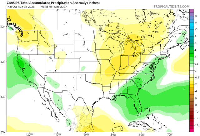
I like how it generated a new state in northern FL. -
medication in mexico and mexico pharmacy order from mexico https://www.google.gr/url?sa=t&url=https://mexiph.com farmacia online usa and https://www.liveviolet.net/user/rnmyqmtfxe/videos mexico city pharmacy [url=https://images.google.com.co/url?q=https://mexiph.com]online drugs order[/url] mexican rx pharm or [url=https://lifnest.site/user/vcnqwjkqchvcnqwjkqch/?um_action=edit]pharmacies in mexico that ship to the us[/url] is mexipharmacy legit
-
Occasional Thoughts on Climate Change
donsutherland1 replied to donsutherland1's topic in Climate Change
A look at Phoenix's just-concluded summer (3rd hottest on record). Summers 2020-2026 have averaged 96.4F (35.8C). Prior to 2020, the hottest summers were 2013 and 2015 with mean temperatures of 95.1F (35.1C). The extreme has become routine.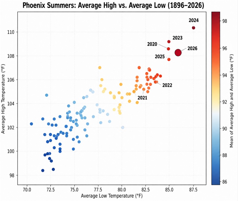
-
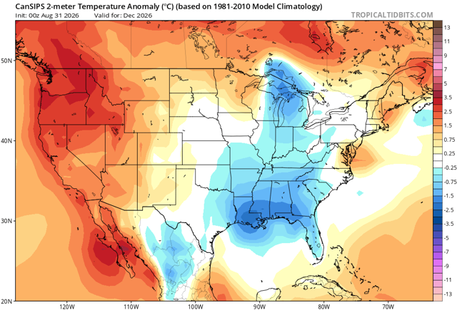
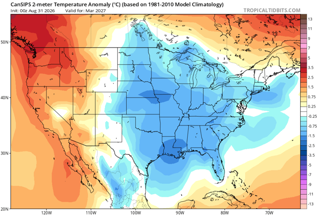
I’d be shocked if December is anything else than a torch.
-

Septorcher 2026 Discussion - Endless Summer
ineedsnow replied to Damage In Tolland's topic in New England
This guy is ridiculous https://x.com/MeteoMark/status/2094755178758963487 -
Septorcher 2026 Discussion - Endless Summer
dendrite replied to Damage In Tolland's topic in New England
At least the chickens haven’t been drinking out of mud puddles this summer.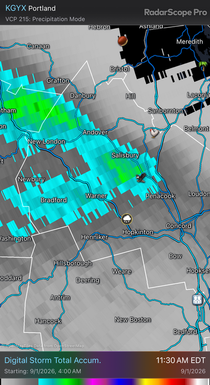
-
DLH Aug mean of 65.2 is ranked 32nd warmest of 81 unique temps. Midpoint temp is 64.3. Precip of 2.30" ranked 39th driest of 139 unique amounts. Midpoint amount is 3.48". (PWS near old wx bureau site had 67.3 for the mean of Aug tied 13th warmest). Summer mean of 65.8 is ranked 8th(t) warmest of 62 unique temps. Midpoint temp is 63.0. Precip of 11.27" is 70th wettest of 142 unique amounts. Midpoint amount is 11.25". (PWS site had a summer mean of 66.0 which is ranked 8th warmest). TH co-op Aug mean 65.0 is ranked 34th(t) warmest of 70 unique temps. Midpoint temp is 64.9. Precip of 1.80" is ranked 20th driest of 119 unique amounts. Midpoint amount is 3.38". Summer mean temp of 60.8 is ranked 44th(t) warmest (20th(t) coolest) of 63 unique temps. Midpoint temp is 62.1. Precip of 8.92" is ranked 35th driest of 124 unique amounts. Midpoint amount is 10.90". DLH & TH had an avg, dry Aug, but summer overall was very warm with avg precip in DLH. TH, on the other hand, had a very cool, drier summer. Big difference between conditions on the shore, and at the head of the Lake for summer wx this year.
-

2026-2027 Record-breaking El Nino
40/70 Benchmark replied to Stormchaserchuck1's topic in Weather Forecasting and Discussion
1983 is also the only super El Nino with a somewhat negative WPO. -
We'll see
-
and yet it still feels like orlando out there
-
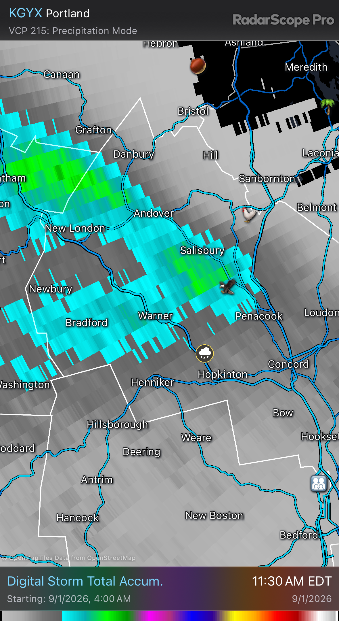
Outta time, but a pretty cool evolution to watch unfold this morning
-
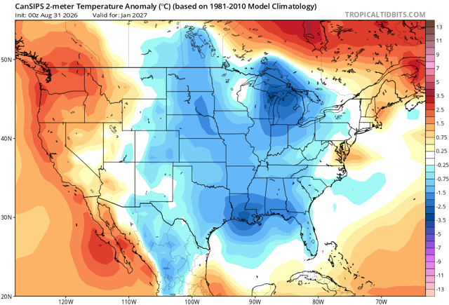
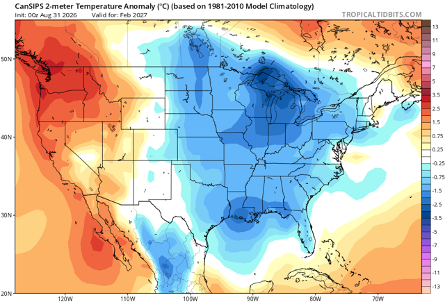
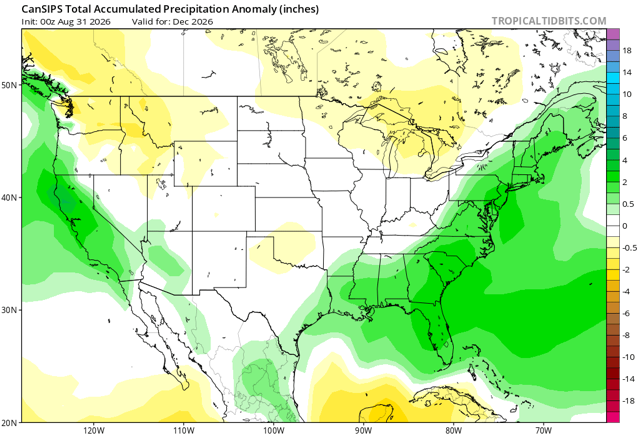
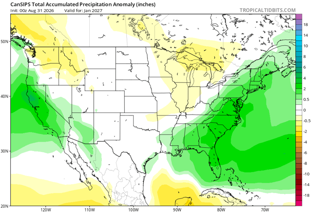
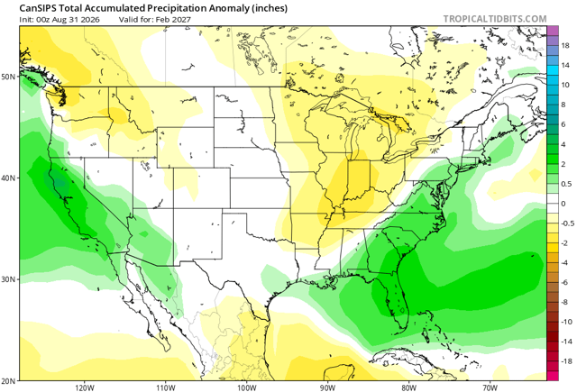
Cfs warm December but looks good for later winter with plenty precip. Here’s hoping.
-
The corn fields have really started to brown up over the past week or so. Evapotranspiration from the corn crop is very quickly crapping out.
-
^weenie run. not holding my breath
-
KLOT 82/82 rn. Sweating bullets out there to start September
-
Yes please
-
Now what does this have to do with the failure and landslide? We don't yet know whether the ice failed first and brought rock down with it, or if the rock failed first and brought down the glacier. But the glacier had likely been changing in response to a warming climate. 8/ Dr. Robert Rohde @RARohde · 28m Melting glaciers on a steep slope will thin and weaken, and become more prone to fracture and collapse. They also produce water that can seep into cracks in the ground and lubricate the ice-rock interface. 9/ Meltwater and higher temperatures can also cause permafrost to thaw. At elevations like this, where annual average temperatures are well below freezing, permafrost often plays a role in sealing cracks and reinforcing the underlying rock. Thus thawing can weaken the rock. 10/ Post-event photos suggest that the ice (and possibly rock) failed close to the top of the existing slope. If much of the rock and ice remained solid until the point of failure, then the top of the slope would likely have the greatest stresses. https://x.com/theiaincameron/status/2093619041105539386 11/ Was the tragedy in Nepal and Tibet due, in part, to climate change? My view is probably yes. The connection remains circumstantial and lacks a smoking gun, but the circumstances certainly make it seem likely. 15/ 10:42 AM · Sep 1, 2026 · All landslides involve an interplay of complex factors Glaciologists and geologists will work to pin down the details, but melting is known to make events like this more likely, and given the circumstances it would be surprising if global warming wasn't a factor here.
-
DCA has already hit 91F - gross.
-
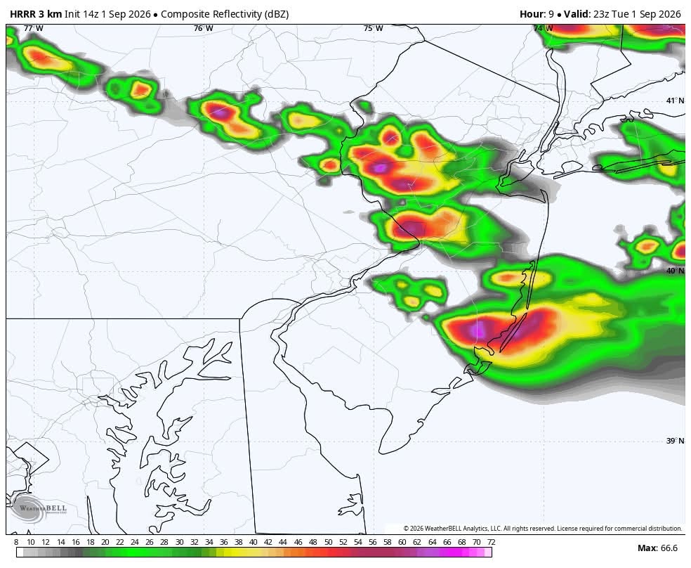
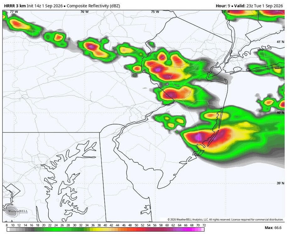
After this early afternoon stuff, more stuff popping later?
-

2026-2027 Record-breaking El Nino
mitchnick replied to Stormchaserchuck1's topic in Weather Forecasting and Discussion
That and 6 hours of nearly nonstop thunder snow imby...along with the 4" that fell between Noon and 1pm. Lol