All Activity
- Past hour
-
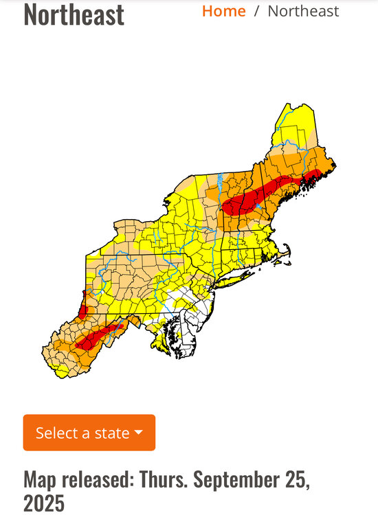
After nearly 6 weeks of nothing... picked up just under an inch in the past 24 hours. Feast or famine has been the theme for the last couple years. Prolonged dry is followed by too much lol. I doubt the 0z euro for down here (10 inches over 6 days lol) but i have a hunch my area will get peppered pretty good. Dust bowl to mud bowl in a blink lol
-
I was skeptical of the 2-4” mesos had for most of interior SNE. HREF was awful
-
That stuff in PA will pillage NNE. Scattered Stein for the rest in SNE with some downpours flying around.
-
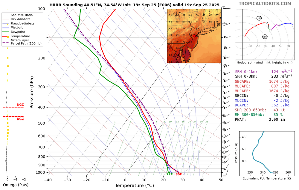
12z models had barely anything here, including HRRR. Over an 1" in the last 2 hours.
-
September 2025 OBS-Discussion centered NYC subforum
jm1220 replied to wdrag's topic in New York City Metro
I have the maybe 0.5” now from the one batch of rain. Lucky swath through Nassau has about 1”. Looks like maybe a few showers to go then done. -

2025-2026 ENSO
40/70 Benchmark replied to 40/70 Benchmark's topic in Weather Forecasting and Discussion
I do not think it will be as extreme, though....yes, the west PAC is still warm, but the warmth has spread east...think of it as kind of like a the RONI effect with respect to ENSO. Remeber the 2023-2024 El Nino and how the west warm pool mitigated and altered the warm ENSO impression around the hemisphere. I think that warmth further east will act to neutralize things to an extent. -
As far as the WPO goes….I have to agree with you there. The WPAC SST pattern over the last couple of months up to now is matching past years that had predominantly +WPO winters. If that doesn’t change in a big way between now and the end of November, a +WPO winter would not surprise me
-
That SE New England convection Steined the rest of SNE. Robbed all the moisture
-

September 2025 OBS-Discussion centered NYC subforum
bluewave replied to wdrag's topic in New York City Metro
-

2025-2026 ENSO
40/70 Benchmark replied to 40/70 Benchmark's topic in Weather Forecasting and Discussion
WPO I am less confident in. -

2025-2026 ENSO
donsutherland1 replied to 40/70 Benchmark's topic in Weather Forecasting and Discussion
I don't expect that outcome either. -
Yeah new seed happy today. Good soaking. Great weather for growing heading into Growtober.
-
Had 0.37" in gauge at 7 am CoCoRaHS report this am. Planted grass is really coming along. The 60.0 low was warm, but for 2nd morning in a row last year's number (62.9) beats it. Sun is trying to break thru the fog and clouds and it has warmed to a miserably muggy 71.8/68.6 at 10:30 am.
-

E PA/NJ/DE Autumn 2025 Obs/Discussion
LVblizzard replied to PhiEaglesfan712's topic in Philadelphia Region
Not feeling too optimistic about the severe threat today. There are hardly any breaks in the clouds on visible satellite. Some storms still seem likely but I’d be surprised if we saw a lot of wind/tornado reports. -
Mid to long range discussion- 2025
WinstonSalemArlington replied to wncsnow's topic in Southeastern States
-
September 2025 OBS-Discussion centered NYC subforum
AdMC replied to wdrag's topic in New York City Metro
I'm not so sure its the models that are bad, but rather the (lack of) initialization data that is being fed into them: https://www.cbsnews.com/news/doge-cuts-nws-balloon-sites-leave-us-without-crucial-weather-data-some-meteorologists-say/ -
Invest 94L—70% 2 day and 90% seven day odds of development
shaggy replied to WxWatcher007's topic in Tropical Headquarters
Better spin looks north of the island to me. Might take a while for a center to settle and write could see some jumps and relocations -
September 2025 OBS-Discussion centered NYC subforum
Rmine1 replied to wdrag's topic in New York City Metro
And we have sun. Who woulda thunk -
About 0.55" so far for the last 2.5 days.
-
-
E PA/NJ/DE Autumn 2025 Obs/Discussion
mcwx replied to PhiEaglesfan712's topic in Philadelphia Region
Way south of Cuba in the Caribbean. Sandy hit Jamaica as a hurricane -

September 2025 OBS-Discussion centered NYC subforum
Brian5671 replied to wdrag's topic in New York City Metro
Have to hope for some convection later with the pre-frontal trough -
The models steining this area today were wrong wrong wrong. 1.75" total, 0.60"+ and counting today


