All Activity
- Past hour
-
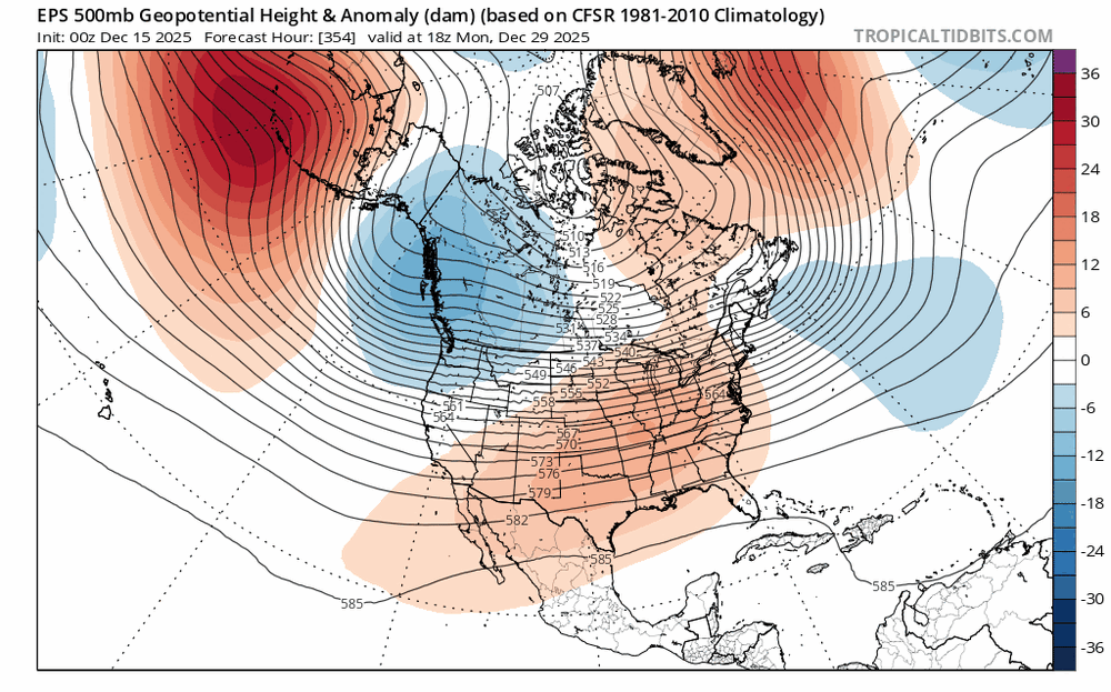
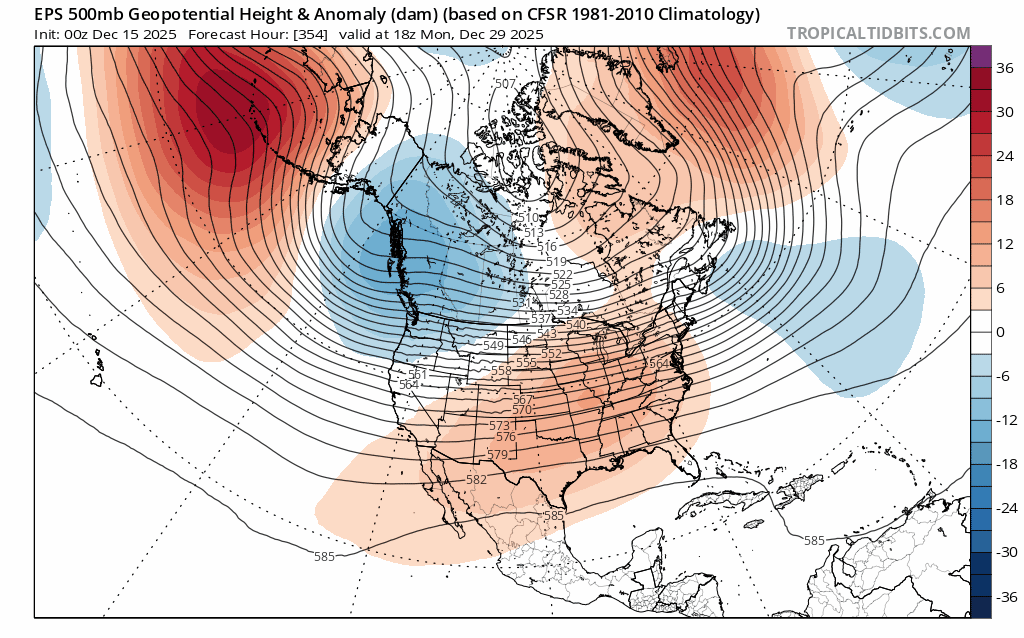
Chris, are there even any analogs for what the models are projecting for next week into the first few days of January? It’s extremely anomalous like you said…huge Aleutian ridge (-WPO), out of phase +EPO, strong -PNA, -NAO, neutral/negative AO and a massive omega ridge/omega block dead center of the CONUS?
-
Yeah, we would want the ridge in a similar position to what we got with the recent clipper to make things interesting. I am just not sure yet whether the Pacific Jet can relax enough to allow for sufficient retrogression. The time to watch would probably be early in January.
-
can’t say this isn’t becoming a bit more interesting. can see the ridge axis go from the OH Valley -> Plains as the -NAO cranks if you get that Pacific trough to retro a bit and allow the ridge axis to sit more near Montana, you reach a bit of an inflection point and you have legit coastal potential. we’ll see
-

December 2025 regional war/obs/disco thread
brooklynwx99 replied to Torch Tiger's topic in New England
can’t say this isn’t becoming a bit more interesting. can see the ridge axis go from the OH Valley -> Plains as the -NAO cranks if you get that Pacific trough to retro a bit and allow the ridge axis to sit more near Montana, you reach a bit of an inflection point and you have legit coastal potential. we’ll see
-
if you retro that Pacific trough a bit more and allow for the ridge axis over the Plain to shift 100mi towards Montana, things become very interesting
-
For example, these:
-
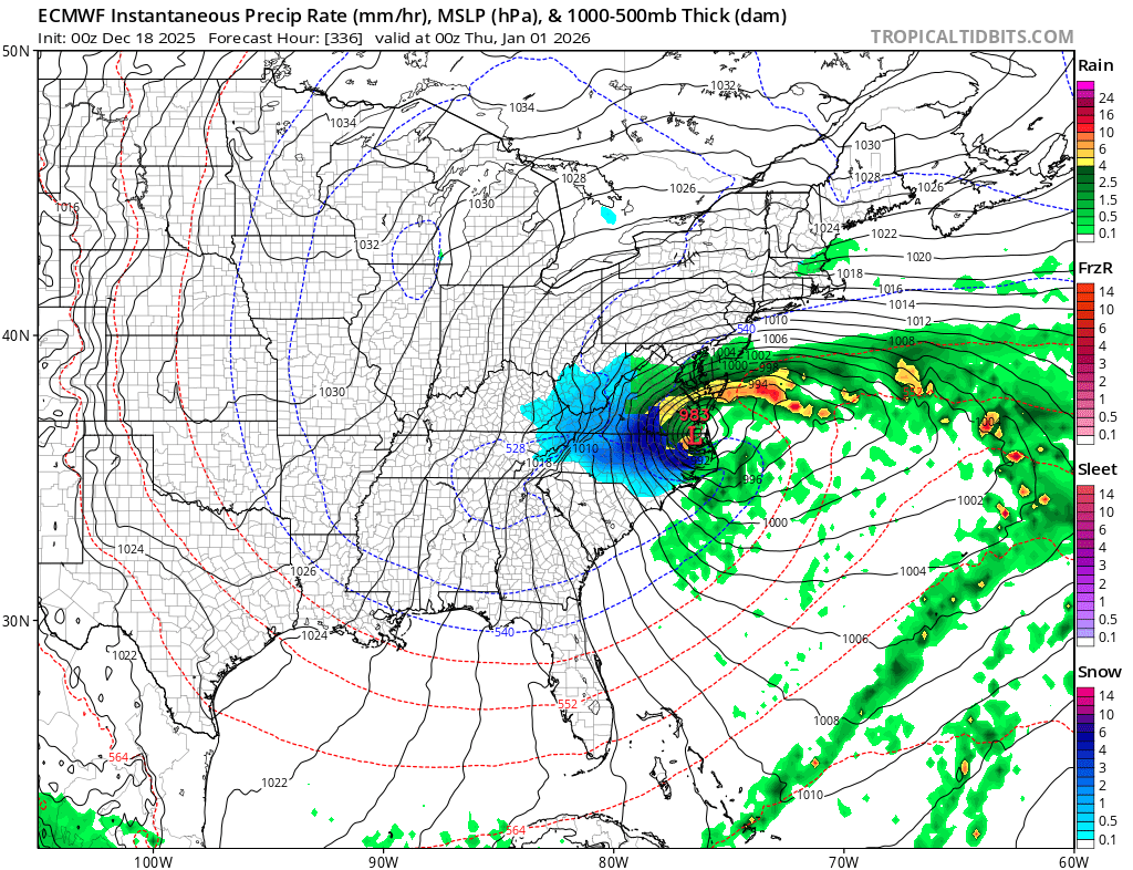
Euro skynet was decent for 12/23 too. Hopefully we can get that one to give us a couple inches.
-
If all you wanted for christmas or Hanukkah was one more global weather model, you got it! AIGFS is now on tropical tidbits. I think this is the “hybrid” AIGFS and not the graph cast GFS? @high risk?
-
.thumb.png.2fca8a1df835ac861b1330e4915c74fc.png)
-
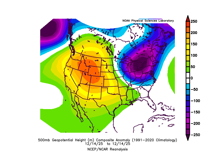
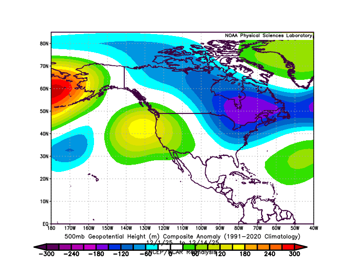
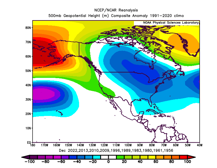
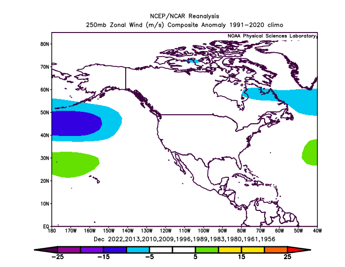
This is going to be one of the strongest -WPO blocks that we have seen for the month of December. But it’s a different configuration of other factors that we have previously seen with December -WPOs in the past. This one has a much more amplified Pacific Jet into the PACNW and BC than we have seen before with the historic flooding in those areas. Plus we have an out of phase +EPO and very strong ridge onto the Western US. The ridge that was out West is shifting further east leading to the moderation in temperatures across the CONUS. Unique December 2025 500 mb and Pacific Jet stream pattern compared to previous very strong -WPO patterns
-

December 2025 regional war/obs/disco thread
Snowcrazed71 replied to Torch Tiger's topic in New England
Man... I never seen someone love the wind so much!! let it blow ... -

E PA/NJ/DE Winter 2025-26 Obs/Discussion
PhiEaglesfan712 replied to LVblizzard's topic in Philadelphia Region
Does this mean an early start to spring? -
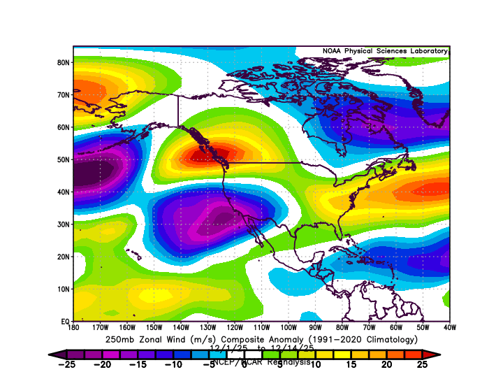
NW US trof gets some help from the East-based -NAO. As you said, without any sort of a block we would be toast with that PAC look.
-
Something has been brewing on all the LR ops between Dec 28-Jan 2 period for a few days now as blocking gets going. Sniffing something out.
-
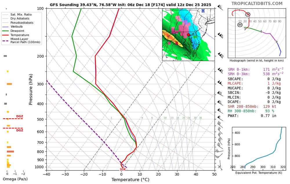
6z Gfs at 318hrs is best case scenario with this pattern.
-
That was a decent run. But I have no idea how good it is.
-
If there is a lot of rain then no big deal. But it’s a real strong LLJ during daytime.
-
Oh yeah, that'll totally happen
-

December 2025 regional war/obs/disco thread
Damage In Tolland replied to Torch Tiger's topic in New England
Pretty damn excited -

Winter 2025-26 Medium/Long Range Discussion
A-L-E-K replied to michsnowfreak's topic in Lakes/Ohio Valley
Zzzzzzzz EPS v ugly, not just for snow but for interesting wx -

Winter 2025-26 Medium/Long Range Discussion
Baum replied to michsnowfreak's topic in Lakes/Ohio Valley
are we still doing 65 on Christmas?.jpeg.b8981bbef2fc70bfbfdd2ccae0e6cf21.jpeg)
-

December 2025 regional war/obs/disco thread
SouthCoastMA replied to Torch Tiger's topic in New England
AIGFS now on TT looked a bit snowier than the 6z GFS overall -
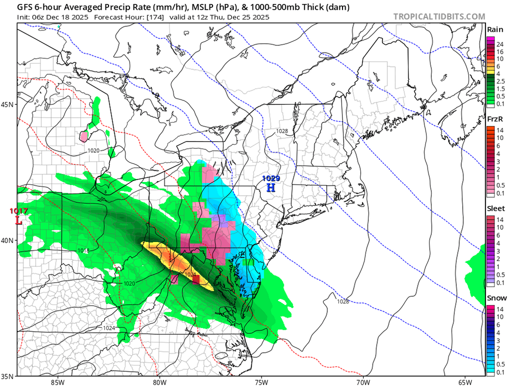
Just gunna' post that the 6z Gfs has a couple of threats and the run hasn't ended. I think as the operational models detect that block, we'll start to see threats showing up along the cold air boundary.
-
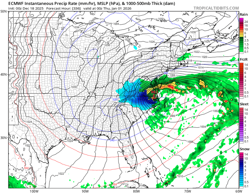
GFS showing some mixed precip possible for the northers heading into Christmas Day.
-
Meanwhile, could really blow tomorrow.


.png.d2d82a1b3b192460228467e49a5ffa21.png)