All Activity
- Past hour
-
Justice Hill placed on IR. Maybe, just maybe, Keaton Mitchell will get his chance to shine, outside of a disjointed handful of plays per game.
-
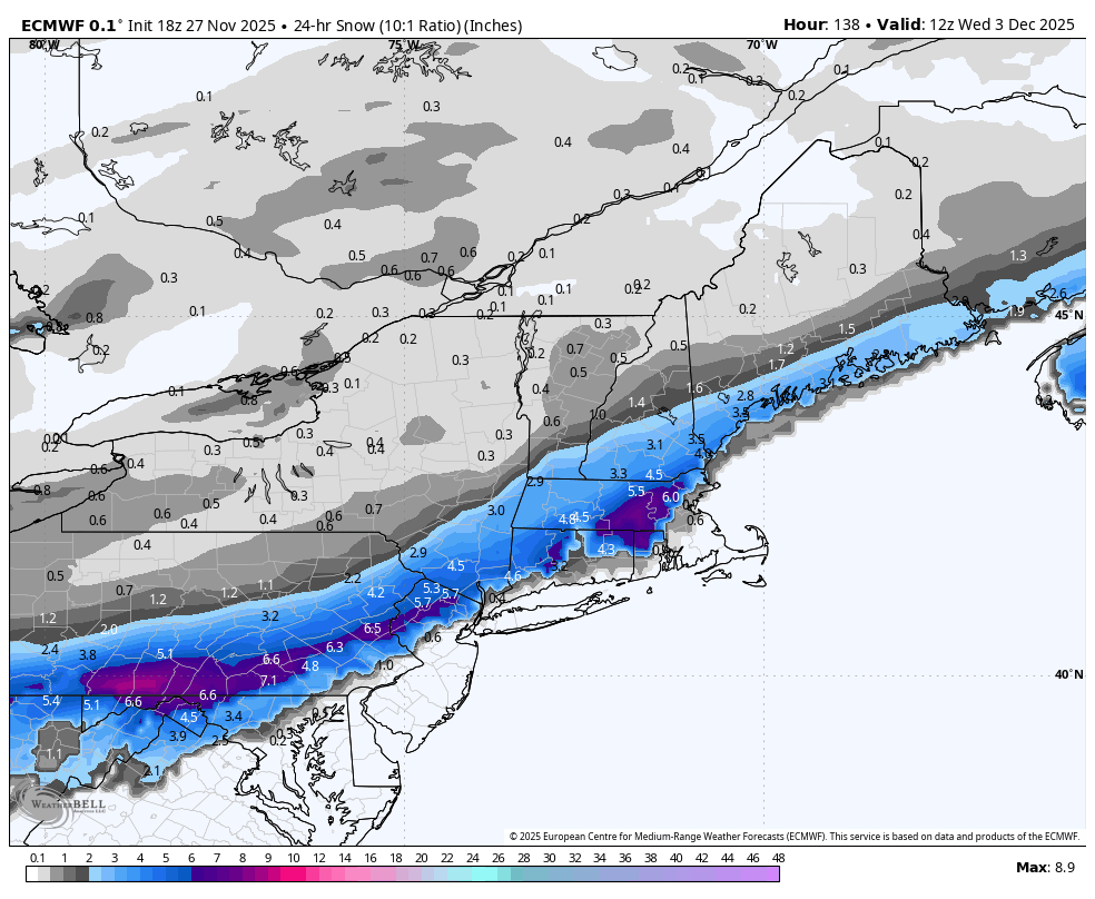
Maybe I’m wrong and maybe I’m bailing too early on 12/2 but I’m not feeling a snowy outcome for I-95. It’s too early in the season, and the antecedent cold air is really not *that* cold. Most likely outcome is mainly rain maybe brief mixing along I-95 and a couple inches far NW. I do think its great we are tracking two threats early on. That alone is a promising sign for this winter. I just don’t think it’s a hit for us this time. Maybe 12/6 hits instead. Who knows at this point. Again, like I said, I’m willing to eat my shoe if I’m wrong.
-

December 2025 regional war/obs/disco thread
WxWatcher007 replied to Torch Tiger's topic in New England
The most important 14 days of the decade coming up for this subforum? -
It’s hilarious. He can’t stand if south of him gets more. But accept 10 miles NW getting 2’ more.
-
Mid season form lol sometimes you guys create your own trends.
-
Already?? We still have 120+ hours to go
-
That’s not a thing. The Hudson valley of New York is not our source region. Southern Canada is where snow pack may make a difference, not Newburgh
-

Central PA Fall Discussions and Obs
Blizzard of 93 replied to ChescoWx's topic in Upstate New York/Pennsylvania
18z GFS & 18z Euro say that most of CTP is still in the game for Tuesday.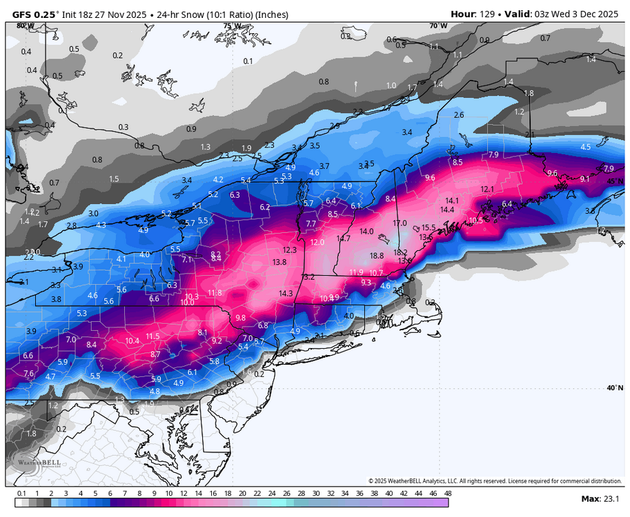

-

December 2025 regional war/obs/disco thread
HoarfrostHubb replied to Torch Tiger's topic in New England
World Series rings Super Bowl trophies snowstorm jackpots these are a few of Ray’s favorite things -
But if I got 18” and you 12” nukes would be sent. Makes sense.
-
A little surprised at how quickly the band sagged south today. It was not slower than modeled, and I may actually get several inches tonight. Seems like the jackpot zone will be SE Cuyahoga into southern Geauga. Bit of a bust up the northeastern shoreline (not that they were ever going to do great, but thought they’d get a little more earlier today)
-
nah we want a decent snowpack in our source region. let it destroy the interior i say.
-
Nice to see Warner Brothers is onboard.
-

December 2025 regional war/obs/disco thread
mahk_webstah replied to Torch Tiger's topic in New England
Over under of 40? -
What? I live on Long Island, why would I want that
-

December 2025 regional war/obs/disco thread
moneypitmike replied to Torch Tiger's topic in New England
I can't believe we don't have model agreement. We're only 6 days out. -

December 2025 regional war/obs/disco thread
Snowcrazed71 replied to Torch Tiger's topic in New England
I wouldn't say that at all. You got two different camps with two different outcomes. Either you're going to worry if you're in Northern New England that it's south of them, or you're going to worry in Southern New England that your rained out. It could go either way. So in other words, if you're going to worry, very very premature at this point. -
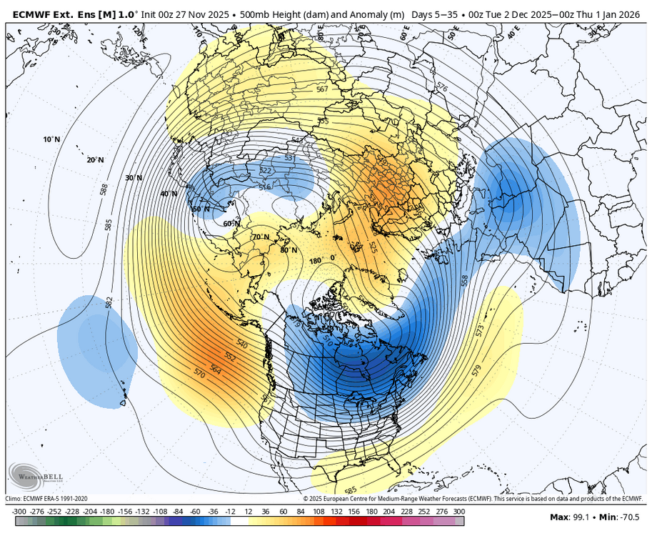
I think this is the bigger issue, we don't have the same cold press timing we had previously. Even on the amped runs its a lot more thread the needle cold. That said, its not worth throwing in the towel yet as I think some snow somewhere is likely unless it stays amped.
-
That's what we've seen this summer and fall. I'd run with it until proven wrong.
-
Worries for some, notbuying until we see some model consistency into this weekend.
-
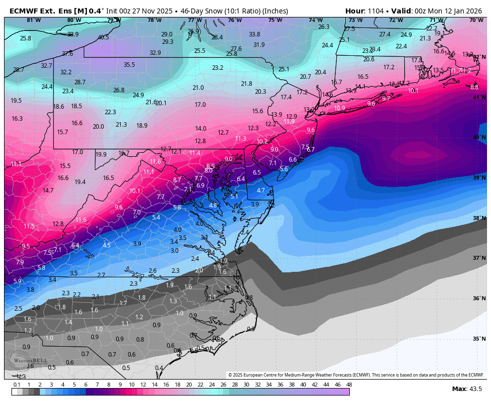
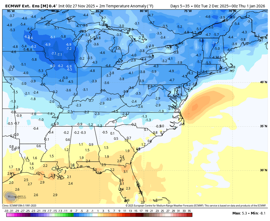
I think it is great to have a system to track in December...it has been awhile....if I get an inch I will be happy. Any accumulation in December is bonus snow. The latest weeklies indicate Tuesday is not our only chance this month. (WB).

-
My gut feeling is a strong amped rainer is the least likely outcome. Weak slider without sufficient cold air for much snow on the north end probably most plausible IMO.
-

December 2025 regional war/obs/disco thread
Sey-Mour Snow replied to Torch Tiger's topic in New England
It’s south and less amped then other guidance but minimal cold to work with for 84 south -
12z euro and gfs were good for dc area. 18z bumped it back north. Let’s see what 0z holds.
-
Euro being so flat is a bit of a red flag still. But there’s still so much time for this system.