All Activity
- Past hour
-
Hit 71 earlier, now 61..but soooo much nicer than yesterday with barely any wind. Yesterday felt chilly here
-
Made it to 70 ..
-

E PA/NJ/DE Spring 2025 Obs/Discussion
Mikeymac5306 replied to PhiEaglesfan712's topic in Philadelphia Region
Euro wants to rain for days and GFS says Nope. -
Yeah I could see 1-2" out east with 4" and lollis to 5 Tolland west. soaker!
-
Just showing what the models have. We know every time a model shows rain you will disagree, but overall the data points to a wet period. Maybe it’ll revert back to your Stein fetish.
-
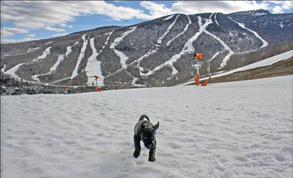
Scott, this picture came up on my Facebook "remember" feed. 10 years ago this week. I remember that this picture made me happy. How time flies! Gene
-
Might be one of those deals where BDR to river west are soaked for 24+hrs while it steins east of there before the whole thing migrates east.
-
I'd be willing to sacrifice some days now, for the UKMET to verify ... so that the word stein is never again floated this summer and/or can be set to ignore
-
EPS, GEPS, and Ukie a total disaster Sunday through Wednesday. Lock it in
-
2006
-
through hr 360 but thats a wet EPS run

-
starting to.. but give it a few more runs.. we might have a very wet period coming up
-
A few posters sure are
-
A GFS blend with the globals may be more likely...not buying the May 2005 redux.
-
Gorgeous. 75 this afternoon right down to the beaches.
- Today
-
Ah darn it...okay thanks.
-
I'm done, lol Ain't no way this is random luck repeating all these times. Something in the atmosphere changed or some quirk this year has made some weird uh...block? I'm not satisfied with no explanation for this
-
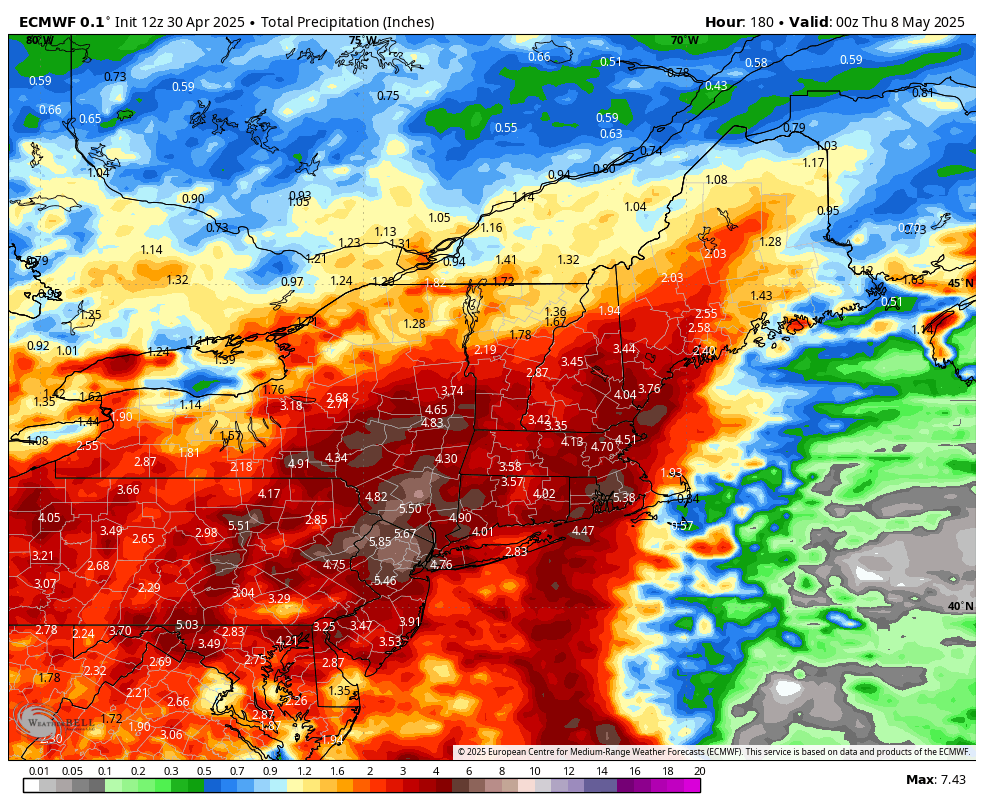
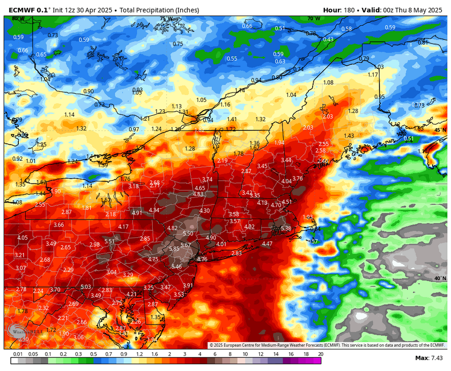
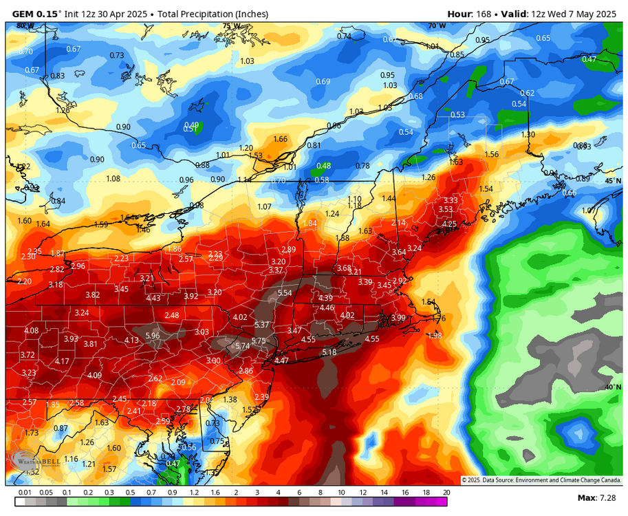
Monitoring for 5-7 Day drought buster Fri May 2-Fri May May 9... no thread from myself as yet but if it looks more likely that there will be 20% areal coverage 5+ in NYC subforum (Poconos-Catskills , to the Ct River and north of I-195, would then thread.
-
Holy shit
-
ukie
.thumb.png.2e422a1fa547c7530702fc470db0a7b1.png)
-
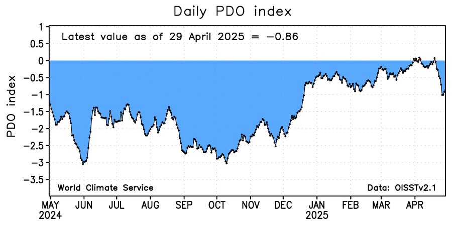
The image below of daily WCS PDO shows it has recently fallen and is at -0.86 as of yesterday. The corresponding NOAA PDO is likely ~~-1.75.
-
Tossing the GFS... looks pretty wet going forward on the others.
-
The usual area of lighter precip NW of I95 is present on the 12z GFS. Eastern VA jackpot.
-
Ukie gone wild next week
-
Despite Chris’ good thoughts and sources, I’m with you and @40/70 Benchmarkand still say 2014-6 was nearly a carbon copy of the late 1950s, a couple of year long +PDO period during a couple year long El Niño with a strong to very strong El Niño peak in the middle of a -PDO regime. This graph you posted says it all. The late 1980s was fairly similar but the opposite situation.


.png.fb6b39827c6934844ee41d3cff7574e6.png)