All Activity
- Past hour
-

E PA/NJ/DE Spring 2025 Obs/Discussion
Birds~69 replied to PhiEaglesfan712's topic in Philadelphia Region
Pretty sure you'll miss out. I'm expecting big ass raindrops with 0.5 in.... Then again, may get screwed entirely. -
were there any signs of a tornado signature at that time? I couldn't track earlier. Looks like a minor spin-up but nice catch
-
Can’t believe Wizzy caught a Tor . Fantastic work kid
-
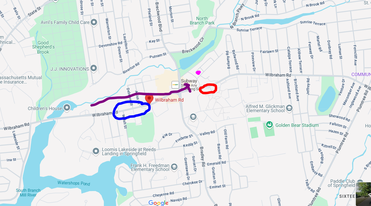
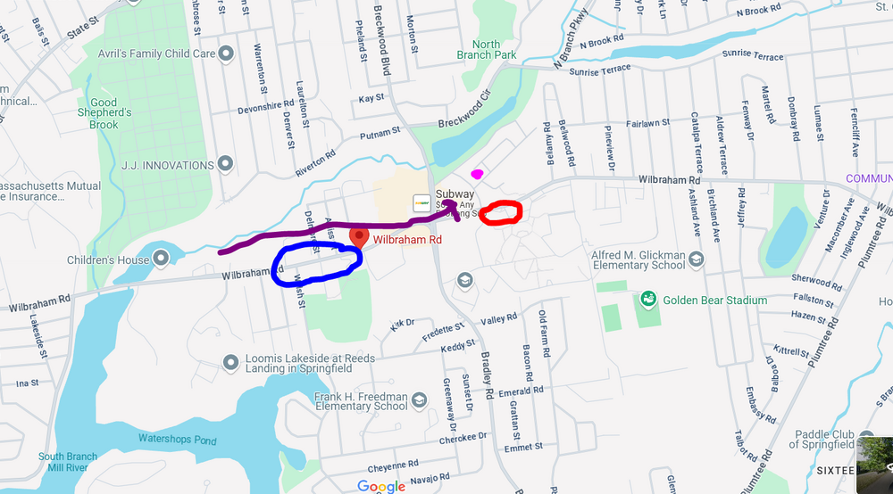
I wish I was able to go down the entire road to see where the damage began but it was closed off. The purple dot was where I was and the red circle is where there were pines down. The arrow shows the track. The blue circle is where the road was closed...I could see something on fire so it had started at least a good 1/2 mile up the road...but not sure what it was like going farther down
-
look at the radar from that time it was definitely a weak tornado
-
ya he needs to send that in.. Radar was matching up pretty well at that time with some rotation.. he was literally in the perfect spot!
-
Yeah, thunderstorm lines seem to max out around here. Baltimore city gets some pretty good action too.
-
We’re about a mile south of that lightning bolt under the reversed U of the Pile. The bow or whatever was certainly flexed to the max here.
-
I still get torn because it happened just as the gust front is going through but it had to be just behind the gust front because precip had started. I'll have to pull back radar archives.
-
A welcome 0.3 so far from getting scraped by the southern edge of two cells so far. Hoping for a flush hit at some point. Had one super-close lightning strike, had to have been within a couple hundred feet
-
Some training setting up along 84?
-
That looks like a spin up?! Regardless of gustnado or tornado, a great capture.
-
Come to think of it that area from Baltimore to Philadelphia always seems to be a hot bed for some of our more impressive severe storms so the bay boundary definitely makes a ton of sense.
-
@weatherwiz first EF0 woooooo hooooo!!!! no doubt that was tornado in front of you I watched it a few times..
-
Pleasant surprise on LI today. Mainly sunny
-
dude thats a Tornado!!!!!!!
-
Nice!
-
.thumb.jpg.6a4895b2a43f87359e4e7d04a6fa0d14.jpg)
Central PA Spring 2025
Yardstickgozinya replied to canderson's topic in Upstate New York/Pennsylvania
Right wrong or somewhere in between I'm gland it was brought up . It's cool to watch the different storm modes occurring within there observed environments. -
I swear the bay pushes a mesoscale boundary just north of the city towards the top side of the Baltimore Beltway. I'm hoping that as we put more mesonet stations in, we can begin to better identify these small scale features that make severe weather forecasting so tricky.
-
hanging tough at 0.00T total for the month, it's a capital T so we good
-
Impressive cell just came through with much needed rain. Maybe my grass seed will finally grow.
-
okx disagreed with the spc

-
Trimmed the video. It happens about 40 seconds in. Like I said, I apologize for the camera disruptions early, I was relocating the camera. Still not sure if this is a gustnado or actual tornado. But whatever it was, I was at the end of its life as where I was at ended the damage.
-
Radar has that west look to it. Almost everyone needs rain but those guys really need it
-
The radar out near the Blue Ridge is looking awesome. Looks like some drought busting. Carroll County is getting nailed too.