All Activity
- Past hour
-
00z ai and 6z ai to a degree as well. Starting to see fantasy events being spit out in LR OP models. The Jan 6-10 frame has me excited personally .
-

Central PA Winter 25/26 Discussion and Obs
mahantango#1 replied to MAG5035's topic in Upstate New York/Pennsylvania
-
How does a storm like that miss us lol
-
I think he whit 70 by Valentines Day.
-
If this isn't a dry slot, I don't know what is.
-
6z GFS gives us something to look at
-

December 2025 regional war/obs/disco thread
mahk_webstah replied to Torch Tiger's topic in New England
Can you say more? -
Central PA Winter 25/26 Discussion and Obs
mahantango#1 replied to MAG5035's topic in Upstate New York/Pennsylvania
Crap is like cement. A plastic shovel doesn't stand a chance trying to clean up this crap. -
Wounded Duck Strikes Back: Dec 26 & 27th Winter Storm Obs
mahk_webstah replied to WxWatcher007's topic in New England
An inch maybe slightly more here. Small refresher to be part of the ice base of the pack after Monday -

E PA/NJ/DE Winter 2025-26 Obs/Discussion
Ralph Wiggum replied to LVblizzard's topic in Philadelphia Region
10.45" snow thru Dec 27. I've always considered December snow as 'bonus' snow as it is still outside of our prime climo period. Suffice it to say, we are ahead of schedule wrt our seasonal snowfall here in Ivyland, PA. We haven't been in this situation in a long long time. -
CT cleaned up nicely
-
Winter Storm Warnings are canceled for the immediate Metro area.
-
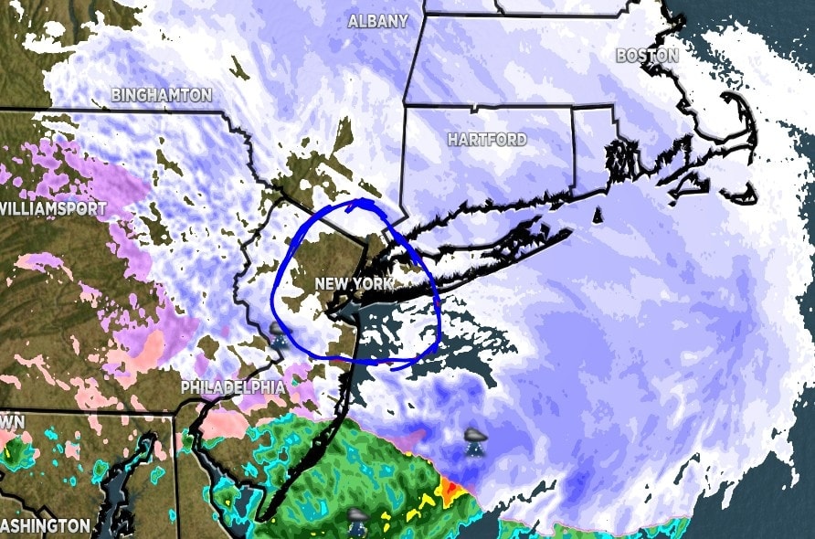
This particular discussion is only about Manhattan, specifically Central Park (despite its notorious poor snow depth reportings). My interpretation is the storm was a bust. Some could argue, in a broad sense, that the storm was not a bust. Strangely, all models came on board about 5 days ago that this would be an all snow event. After 2 days in a row reaching the 40s (or more), the temperature miraculously cooled down just before the clipper like system was to arrive (cold air being one of the ingredients for snow). The only thing peculiar was that the main dynamics of the storm would be north and east of Manhattan. Historically, this is not a good recipe for an all snow event. However, I was optimistic for a good snowfall, based on the model consensus. EVERYBODY, or so it seemed, was saying that Central Park was going to receive a significant snowfall. I had not seen one of the models 00z run on 12/26/2025, which depicted a lighter amount. Instead, I was noticing throughout the day on Friday, that after the overcast became solid, had begun thinning, and pretty much cleared at times, in advance of the storm. Based on experience, 98 times out of 100, if the overcast breaks or the sun becomes visible hours before the storm, it will be a bust. With the 2 out of the last 100 times occuring within the last 10 years. You can use that information for now casting. For now casting, you can pretty much ignore the models and start going on instinct and various real time indicators on what is actually occurring. This system will be discussed and argued, many arguing over semantics or defintion. Some have already said that this system "dry slotted". I will disagree. To me, a dry slot occurs when a storm occludes, becomes intense and mature, and forms the standard comma shape. The intensity of the storm draws in dry air from hundreds of miles away. This was not the case. One of the key ingredients for snow, cold air" was advecting into the system ahead of the storm. Cold air, as we know, is drier. The dynamics of the system was not as intense in this area. Again, the main dynamics were to remain north and east of Manhattan. Some warned of a "warm nose" that would cut down on snow totals. Though not wrong, if the dyamics were as the models depicted, the warm nose most likely would not have changed the snow to sleet, or rain. The fact is, the precipitation stopped at times after an intial light covering of snow. With very little lift, virtually no dynamic atmospheric cooling. Present HRRR suggests some "back building" of snow into the area, at least through mid morning. This could bring Central Park nearer to the lower end of the 4" to 8" range, which some will say that the forecasts were accurate. I disagree. The dynamics of the storm that were forecast simply missed Manhattan.
-
Boxing Night Snow/Sleet/Ice Dec 26-27 Storm Thread/Obs.
Ralph Wiggum replied to Mikeymac5306's topic in Philadelphia Region
Ended with 1.7" of sleet and snow mixed. -

December 2025 regional war/obs/disco thread
Damage In Tolland replied to Torch Tiger's topic in New England
Euro has snow NYD -

Wounded Duck Strikes Back: Dec 26 & 27th Winter Storm Obs
LSC97wxnut replied to WxWatcher007's topic in New England
Guessing about 3" of pure fluff after taking the pup out for a walk. Still a few flakes in the air, 17.6*. -
Over 8" and still snowing lightly. I'll get out and measure in a few minutes, there's coffee to be finished before shoveling.
-

December 2025 regional war/obs/disco thread
moneypitmike replied to Torch Tiger's topic in New England
We hope. Let's get this rainer out of the way first. -

Central PA Winter 25/26 Discussion and Obs
Voyager replied to MAG5035's topic in Upstate New York/Pennsylvania
Had to poke my thumb through the ice to get to the sidewalk for a measurement with my tape measure. Unofficially, as best as I could tell, I had about 0.75" of sleet and ice. -
6z GFS is one storm after another
-

Wounded Duck Strikes Back: Dec 26 & 27th Winter Storm Obs
The 4 Seasons replied to WxWatcher007's topic in New England
Public Information Statements: https://forecast.weather.gov/product.php?site=okx&issuedby=BOX&product=PNS https://forecast.weather.gov/product.php?site=okx&issuedby=OKX&product=PNS https://forecast.weather.gov/product.php?site=okx&issuedby=ALY&product=PNS CoCoRaHS & CoCoRaHS daily maps: https://www.cocorahs.org/ViewData/ListDailyPrecipReports.aspx https://maps.cocorahs.org/ xmACIS2 (COOP, CoCoRaHS, Climo Sites) Updates around 1130AM: https://xmacis.rcc-acis.org/ NWS 72-Hour Interactive Reports Map & Analysis Map: https://www.weather.gov/source/crh/snowmap.html https://www.weather.gov/crh/snowfall -
Wounded Duck Strikes Back: Dec 26 & 27th Winter Storm Obs
moneypitmike replied to WxWatcher007's topic in New England
Does BOX still have the text report of snow totals? I can find the map version--the table was a lot easier for my brain. -
Hey everyone let me know your final reports for anywhere in NY LHV into the city and LI and central and NNJ, Ocean and north. I went through the last 2 pages but it seems most aren't final yet. Should end up near 8" here.
-
Just can't do both my FB group and here. Merry Christmas. It's a good snow sleet combo here in SC.
-
Wantage NJ. 2.5" snowing very lightly.


