All Activity
- Past hour
-

December 2025 Short/Medium Range Forecast Thread
nrgjeff replied to John1122's topic in Tennessee Valley
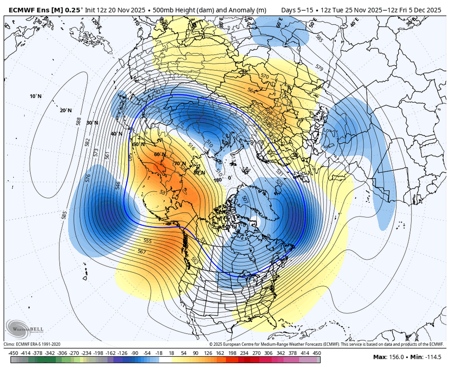
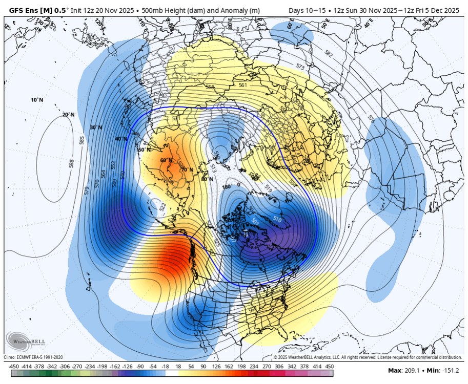
Deterministic models are pure chaos. Ensembles are flopping around but one can at least find some reasoning for that. After the Thanking cold a brief warmer episode is likely because of a little -PNA. However the Alaska ridge persists, so warmth probably won't. In fact by day 15 the EPS and somewhat GEFS hint at cross polar flow. Some support for return to cold mid-December, and perhaps lasting, comes from a retrograding Rossby wave. Since that's a 500mb feature we don't need to debate the SSW. Temps up there are uber warm and want to reflect at 500mb. While I don't believe SSW wrecks cold patterns, it doesn't always favor North America. SSW signal is best for Eurasia. Things like the Rossby wave can turn odds for North America. The weekly charts may be picking up on all this. They go with the warmer week before settling into a colder regime with less back and forth. We'll see. Stuff changes every day. Who knows if all the background forecasts verify? At least the results make some sense this afternoon. -
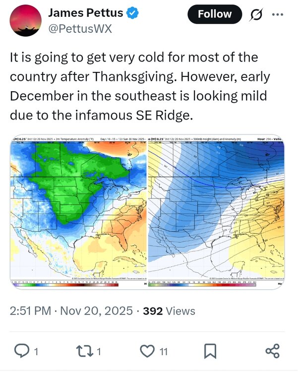
The SE Ridge is kinda like SEC Football. You hate to see it coming, and you know its probably going to win in the end.
-

November 2025 general discussions and probable topic derailings ...
Cold Miser replied to Typhoon Tip's topic in New England
Looks good.
-
Till we actually don’t crap the bed, I expect us to crap the bed lol
-
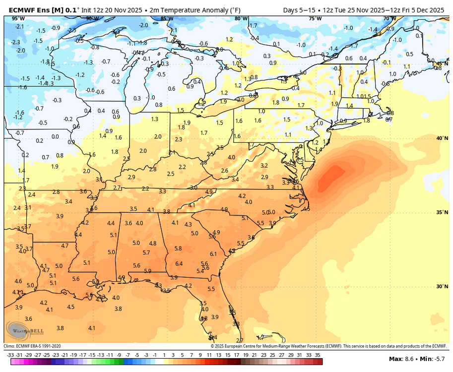
It's always seemed to me looking at the extended that we would cool down briefly after Thankgiving and then warm back up the first week of December then potentially turn much colder by the second week of December. There are some good signals. We shall see...
-
Hey maybe the PDO is tilting towards our favor?
-
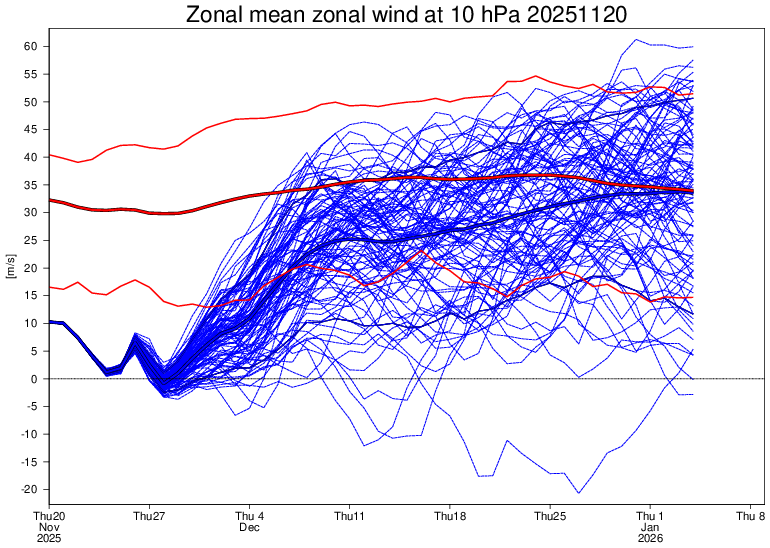
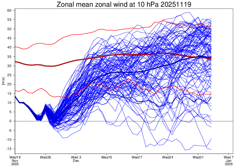
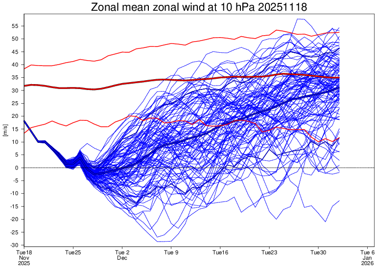
Today’s Euro Weeklies 10 mb zonal wind mean is slightly weaker early and allows most to reverse unlike yesterday. However, afterwards it looks like yesterday’s significantly stronger run: Today’s: Yesterday’s: Two days ago: significantly weaker
-

November 2025 general discussions and probable topic derailings ...
alex replied to Typhoon Tip's topic in New England
For those who complained... our new webcam is finally up! We moved it, now you can see the ice skating rink and my house, with West Mountain in the background. https://www.brettonwoodsvacations.com/webcam/ -
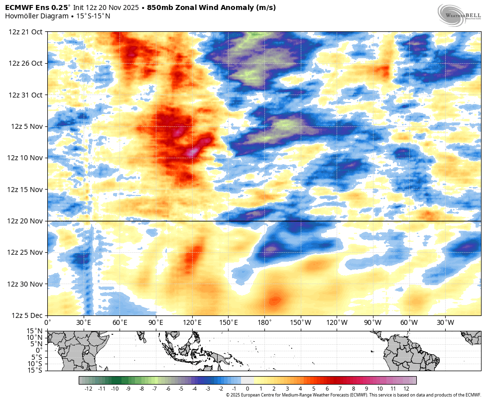
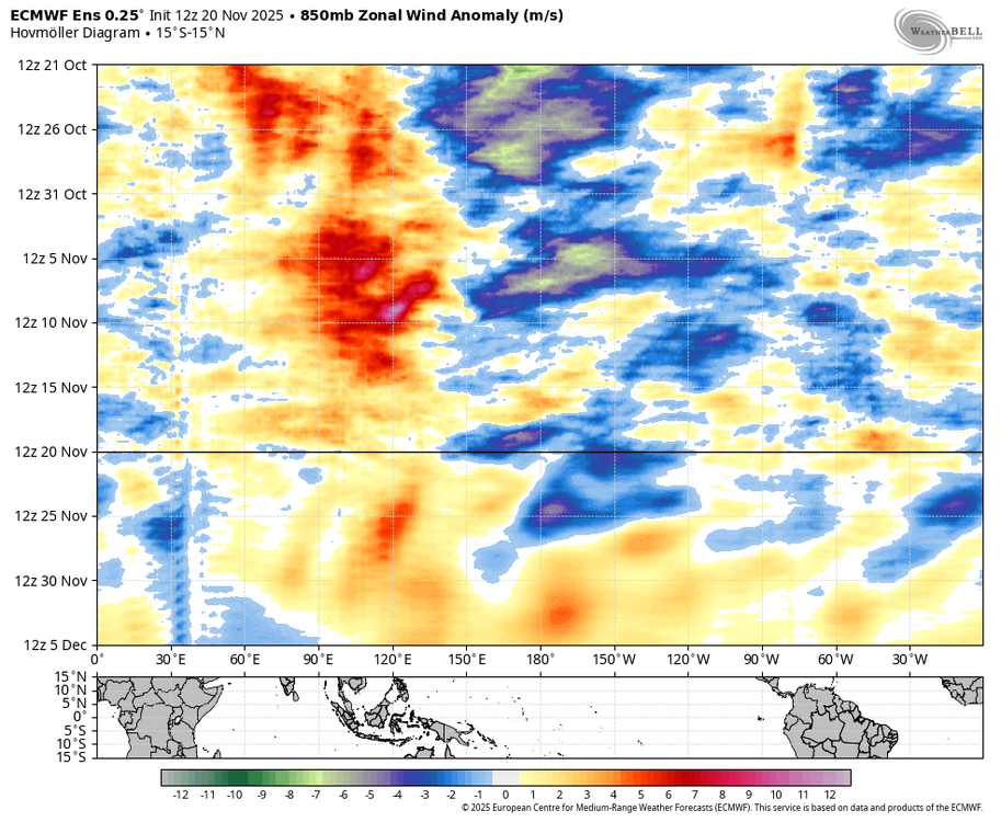
It is probably just picking up a weak signal from the Indo-pacific warm pool. I would be more worried about it if p8 was not propagating as a strong KW. Note the WWB associated with the P8 pass through, which is what we typically see with weakening Nina’s.
-
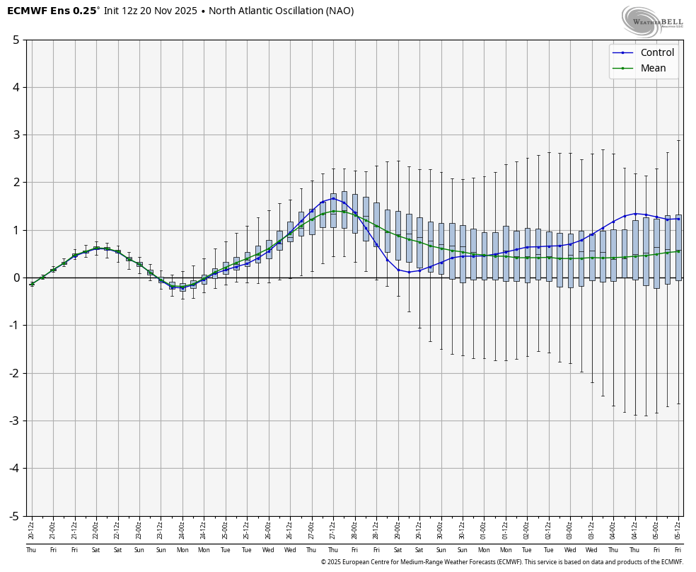
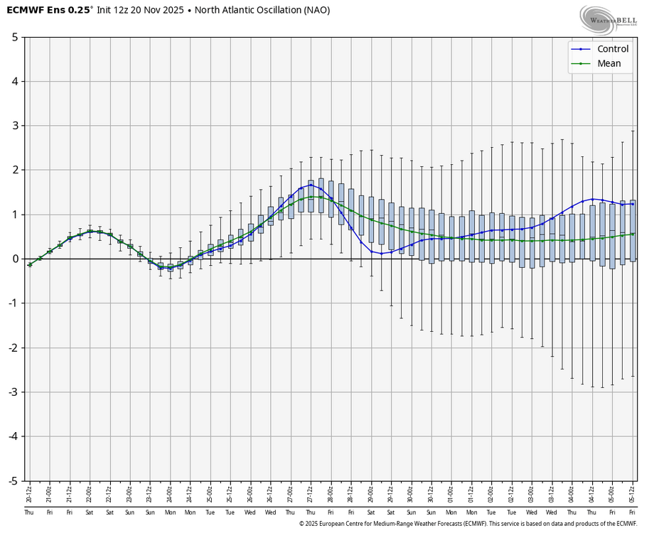
The fly in the ointment right now for the holidays is a lack of a -NAO. It's tough to get a big snowstorm without that feature to hold a storm closer to the coast. I'm not unhappy by any stretch of the imagination though...it beats Pacific Puke with 580dm heights across the entire CONUS!
-

December 2025 Short/Medium Range Forecast Thread
Daniel Boone replied to John1122's topic in Tennessee Valley
The one bias we hope turns out to be the case here is the Euro holding energy back in the SW. -
December 2025 Short/Medium Range Forecast Thread
Daniel Boone replied to John1122's topic in Tennessee Valley
That was my worry when I alluded to SW Trough yesterday. -

Central PA Fall Discussions and Obs
Voyager replied to ChescoWx's topic in Upstate New York/Pennsylvania
This may look like snow, but it's actually hail from a wild severe thunderstorm that hit West Phoenix in Arizona yesterday. This is the entrance ramp to I-10 from 83rd Ave.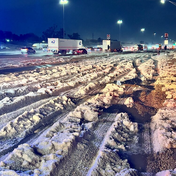
-
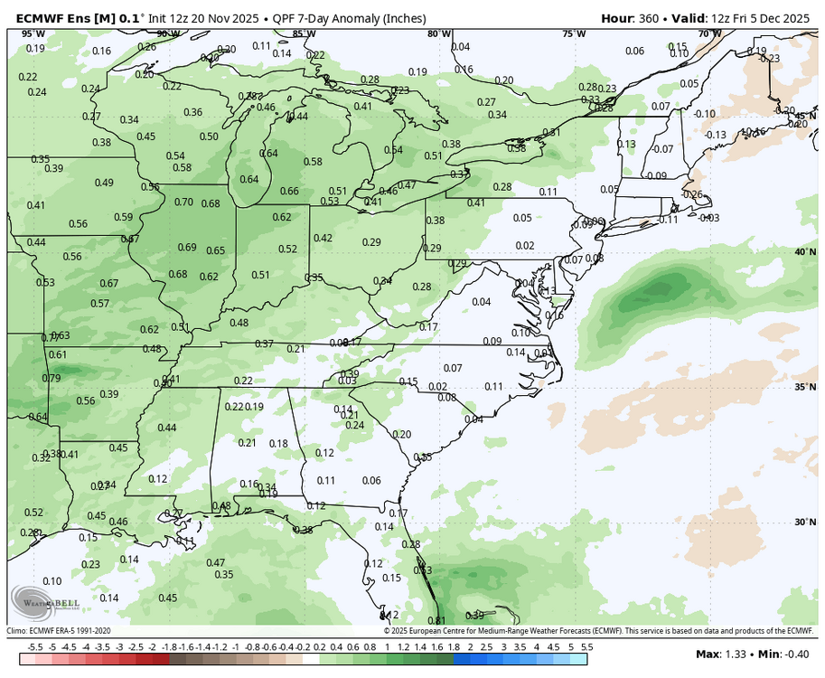
The weeklies have gotten even colder and stormier.
-
Would rather get this out of the way early.
-
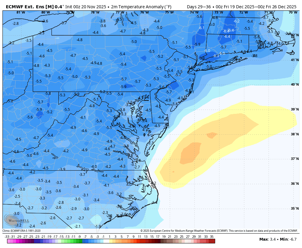
WB latest EPS weeklies centers the coldest period in December around the holidays now with normal precip. Maybe we will be able to do more than dream about a White Christmas this year. Definitely does not look like a torch right now around the holidays.
-
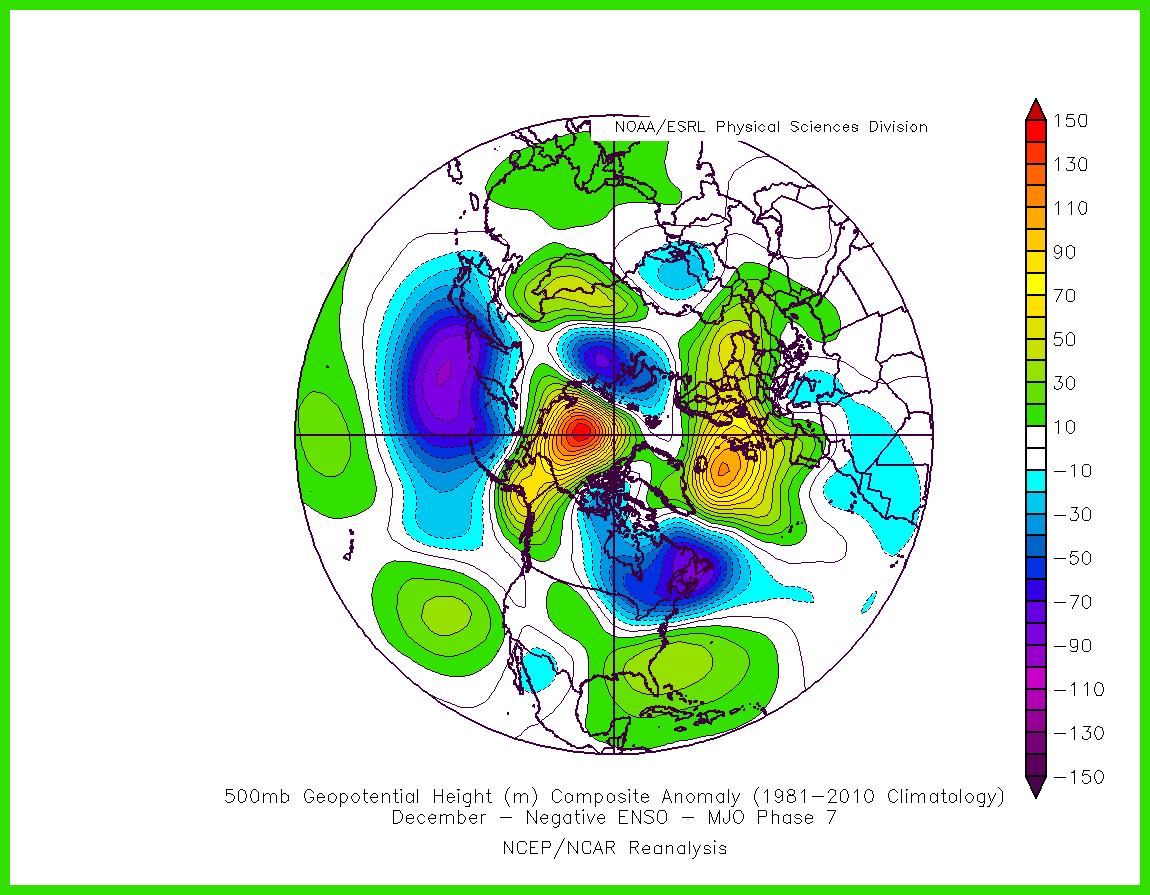
The 5 day forecast mean has a deeper trough in the West and stronger Southeast Ridge than the typical phase 7. That’s why I used the term elements or similarities. Still no change in the dominant storm track through the Great Lakes into early December.
-
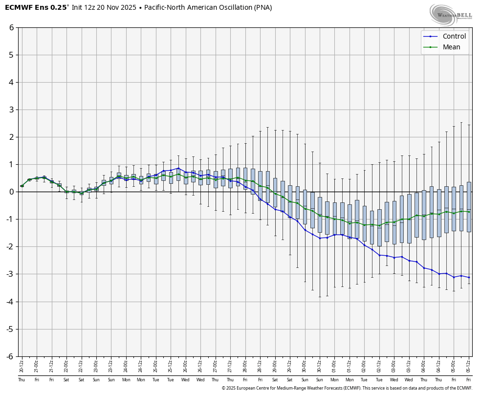
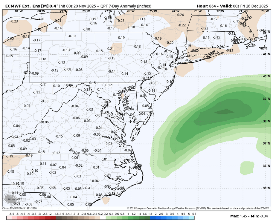
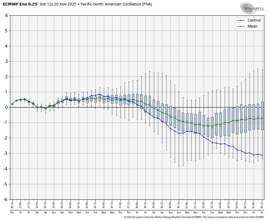
WB latest 12Z EPS: temps average near normal/ slightly above through Dec 5. Precipitation looks like it will pick up toward the end of the period but nothing extreme. Looks like any big storms will track NW of the MA during this time frame with the NAO slightly positive and the PNA slightly negative.
-

November 2025 general discussions and probable topic derailings ...
H2Otown_WX replied to Typhoon Tip's topic in New England
Fixed -
November 2025 general discussions and probable topic derailings ...
H2Otown_WX replied to Typhoon Tip's topic in New England
Yeah, I was thinking that run had some CC infused flavor to it. The southeast ridge was pumped up like a Nino December lol -

December 2025 Short/Medium Range Forecast Thread
jaxjagman replied to John1122's topic in Tennessee Valley
LOL Looks like the quite a few members jumped the train today...lol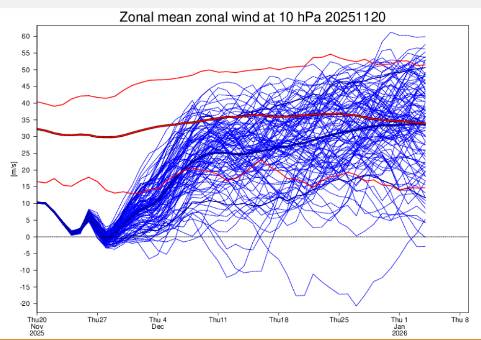
-

December 2025 Short/Medium Range Forecast Thread
Carvers Gap replied to John1122's topic in Tennessee Valley
I mean really this is just a repeat of the start of our past La Nina winters for the past decade, including the model delay of cold air. What I am really interested in is this....With this shakeup on modeling, does it displace the entire pattern cycle by at least 7-10 days IMHO??? That may well leave us cold to start January - maybe. -
Its definitely phase 7.

-
I forget which winter it was recently…maybe 23-24? The EPS was awful all winter long with the MJO, November right through March. It kept showing amplified waves propagating right through phases 8-1-2 in the long range over and over again and it never happened once
-
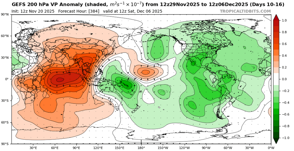
The EPS tends to dampen the convection near the Maritime Continent beyond day 10 too much. For some reason the GEFS tends to do better. That region near 150E will probably have more forcing showing up in future EPS runs as we get closer to early December.