All Activity
- Past hour
-
FWIW, the RGEM at 84hr looks more like the 18z ICON than 0z. The RGEM has a more pronounced shortwave over the Dakotas and the PV is further north. The 0z ICON is much more suppressive with lower heights / the PV through the Lakes.
-
Here's a disagreeable idea.... move north
-
Over performing right now. Massive flakes and already 2+”. Rain may be mixing in occasionally but it’s a vast majority snow
-
-
A half hour ago I finished walking at the park in 35 invigorating degrees. To sort of borrow a phrase from DT, yes, I was the only sick, twisted cold wx freak out there walking. But I was bundled up and had extra energy giving me an extra spring in my step. Winds were calm with clear skies allowing for Gainesville, FL-like ideal radiation. I could even see some cool looking steam fog over water. Dewpoints were only a couple of degrees lower.
-
Who cares about the ICON.
-
this is the type of out-of-the-box thinking we need more of
-

December 2025 regional war/obs/disco thread
moneypitmike replied to Torch Tiger's topic in New England
-

December 2025 regional war/obs/disco thread
TauntonBlizzard2013 replied to Torch Tiger's topic in New England
Storm literally disappeared on the icon -
-

December 2025 Short/Medium Range Forecast Thread
jaxjagman replied to John1122's topic in Tennessee Valley
Kinda looks like Christmas eve,1988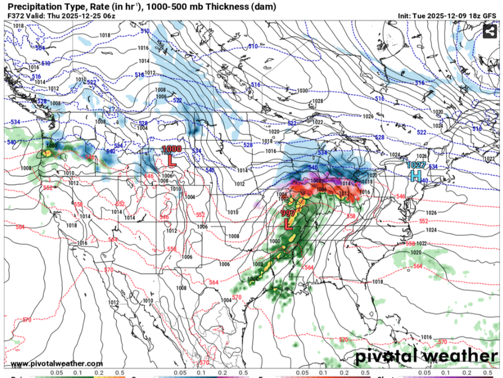

-

Winter 2025-26 Medium/Long Range Discussion
RCNYILWX replied to michsnowfreak's topic in Lakes/Ohio Valley
Pretty much inevitable there would be some form of pattern relaxation. The saving grace from probably not getting into a lengthy torch is the WPO is forecast to remain strongly negative, which keeps cold air discharge going into our source region. The EPO may head back toward neutral heading into Christmas week and then perhaps back to negative thereafter. I think with the likelihood of new snow on top of the melted and consolidated snowpack through this weekend and then the deep freeze for a couple days, if we can avoid a high dew point rain event, snowpack retention should be decent before a true pattern reload commences. Also with the -WPO that means CAA behind fronts should be fairly robust. Milder more zonal patterns often end up cloudy which typically isn't effective at melting much snow this time of year, again unless you get a couple days of high dew points. Even at over two weeks out, I'd lean towards Chicago having its first official white Christmas in a while. Sent from my SM-S936U using Tapatalk -
Laughable changes
-
Looks workable. Would rather there be cold air looming around nearby with room for the southern stream to juice up than be in a suppressive / fast NS dominated pattern all winter. When cold patterns / blocking relax is when we tend to get our biggies
-
Milwaukee area radar
-

The Monday wintry event potential (12/8/25)
SEwakenosnowforu replied to GaWx's topic in Southeastern States
I had a nice dusting this morning in Fuquay-Varina. Nice surprise. I had to sleep and missed it. It was a nice surprise for SE wake!!! -
Such a crap model
.thumb.png.2d793e01b9ab5b778847c181762f2a34.png)
-
First bands all snow so far but the dewpoint is 32.
-
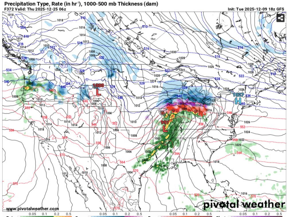
ICON completely lost Sunday's wave
-
Actually, the model in the 500mb progs has been pretty decent overall, but it's not a normal dynamical model, so it doesn't follow the same exact principles and biases that other models do. It is basically one giant analog that uses historical variance and comes out with a progression that makes sense given recent patterns. The issue with the AIFS and AIFS ensemble is it doesn't account for those dynamical inputs that provide more detailed QPF distributions and more advanced ptype algorithms. I use it for a proxy in QPF (Spatial) and the mean 500mb pattern. The rest you have to use your meteorology and some real time context for what could transpire given the forecast pattern evolution. You have to be careful with the AI at long leads as the model will still be subject to variability due to temporal regulation and the idea of chaos increasing in a dynamical fluid (Atmosphere) as we move out in time.
-
Will it know about the damaging effects of the sun angle on snow accumulations?
-
DC would average 20" lol
-
Maybe look up the definition of the word historic. I don't think you're using it correctly.
-
December 2025 regional war/obs/disco thread
moneypitmike replied to Torch Tiger's topic in New England
I was trying to zoom in to see if the plates but my eyes suck. I'll remove the post. -

December 2025 regional war/obs/disco thread
Torch Tiger replied to Torch Tiger's topic in New England
AI bros ftw