All Activity
- Past hour
-
It is some kind of unpleasant out there this morning. 76/74 at bwi.
-

Central PA Summer 2026 Discussion/Obs Thread
pawatch replied to Voyager's topic in Upstate New York/Pennsylvania
With the latest round that come through. I ended up 4.22” it was crazy, just a constant downpour. -
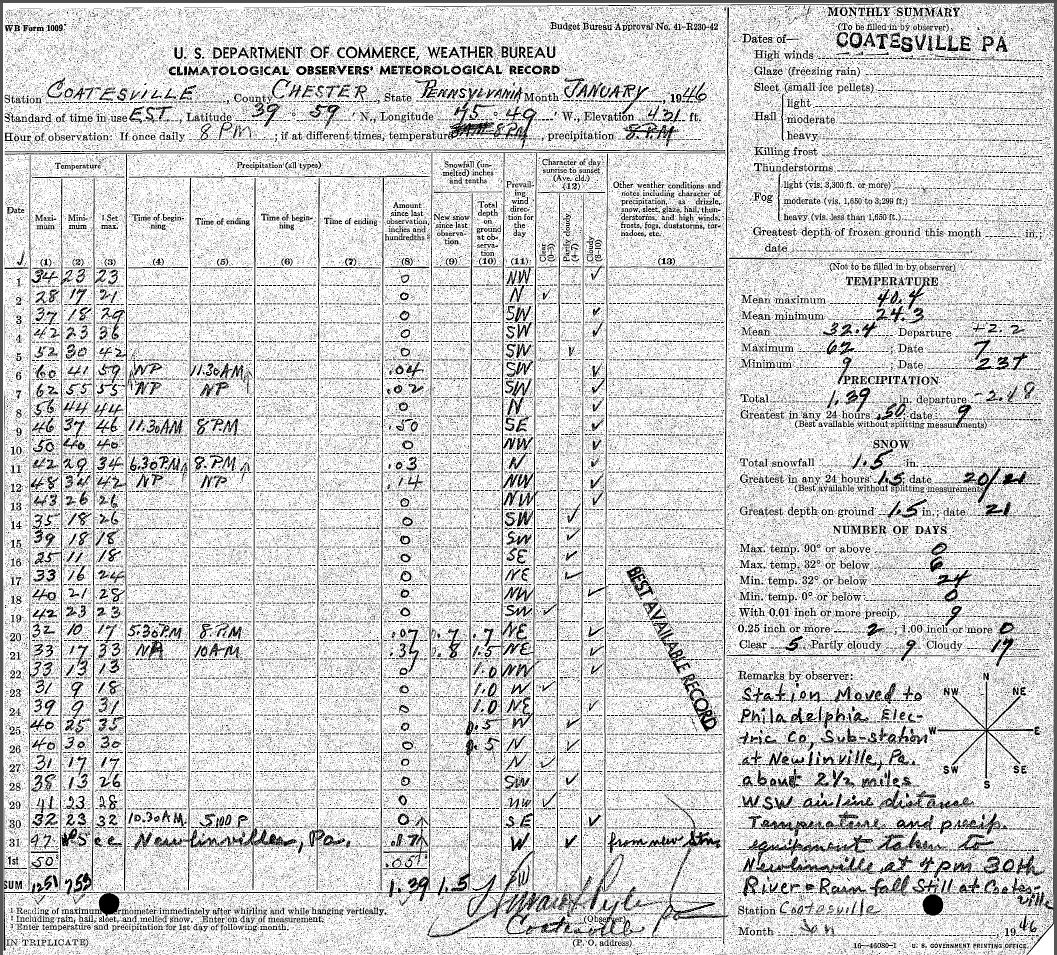
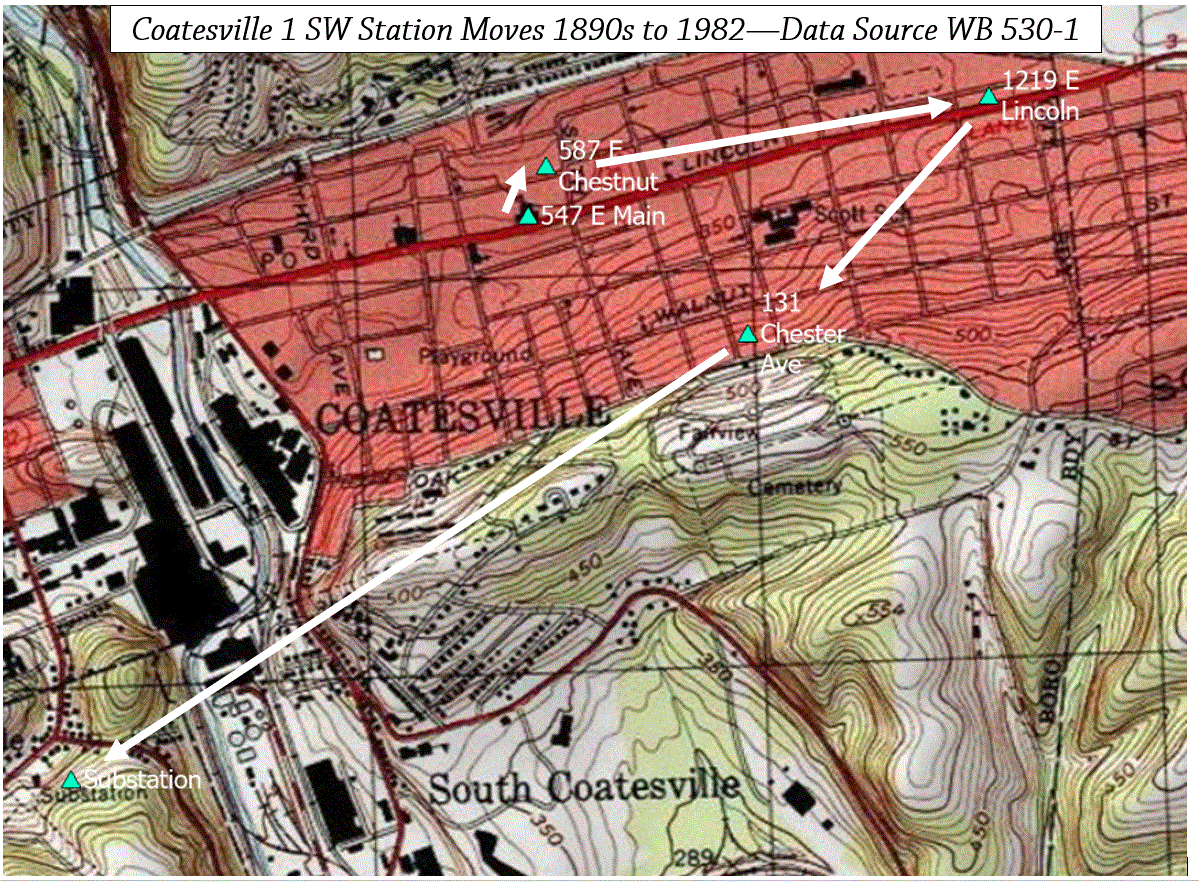
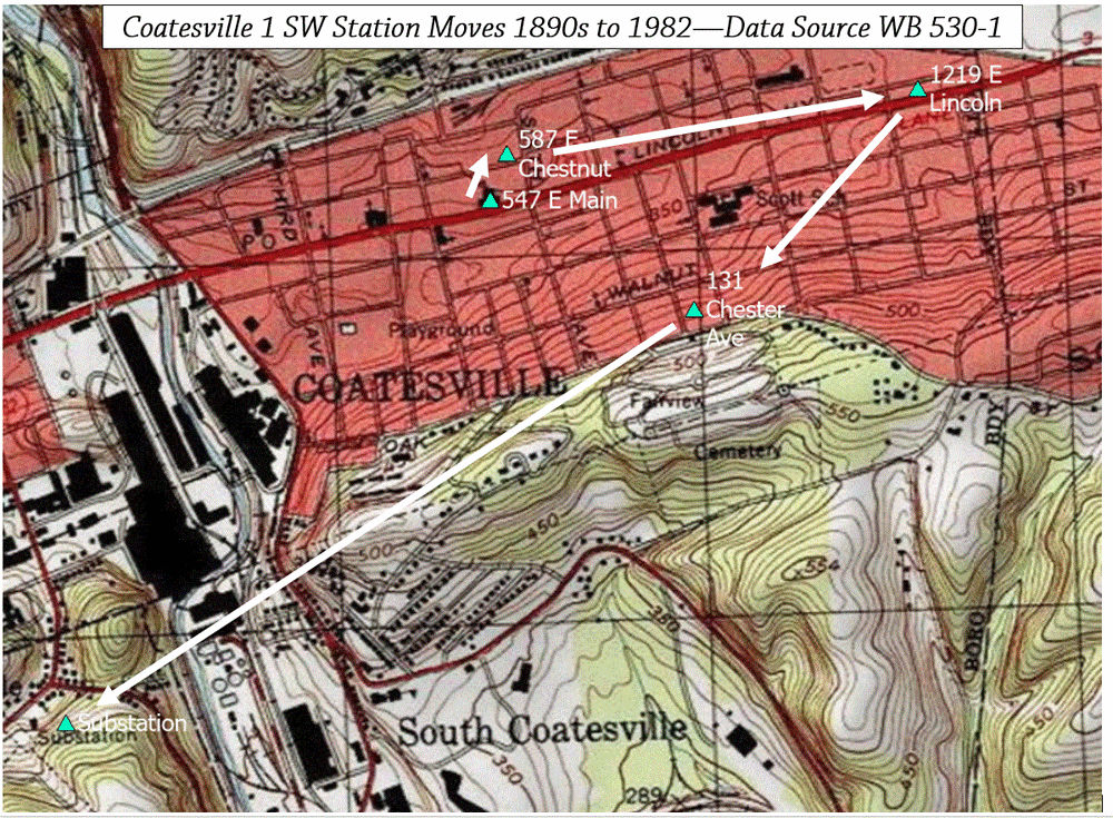
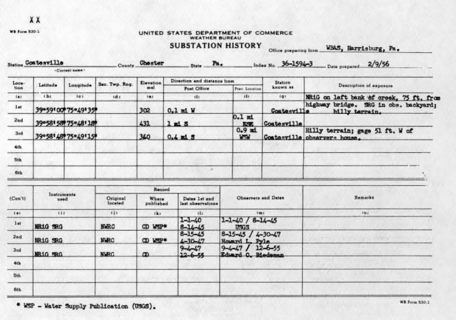
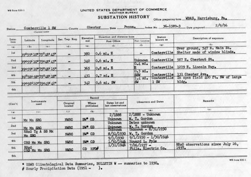
 Observer Pyle made a remark about the station move on the January 1946 record. Then there is a record gap through to October 1948, when the first PECO observation record appears. I don't know if this is a real gap. During the same time, observer Pyle is also taking stream gage measurements.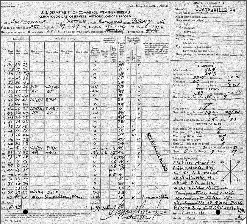
-
3.5
-

Augdewst 2026: Summer's Last Stand
Chrisrotary12 replied to Prismshine Productions's topic in New England
5-6” per hour rain based on your measurements -

Augdewst 2026: Summer's Last Stand
WxWatcher007 replied to Prismshine Productions's topic in New England
Congrats to everyone else on their rain. -
0.76” yesterday
-
Augdewst 2026: Summer's Last Stand
Chrisrotary12 replied to Prismshine Productions's topic in New England
1.08” in 10 minutes based on your 2 posts -
Chris, my Davis @ shop exit 5> 2.38" now, humid as ass lol
-
Augdewst 2026: Summer's Last Stand
Chrisrotary12 replied to Prismshine Productions's topic in New England
1.28” in like last 20 mins -

2026-2027 Super El Nino
GaWx replied to Stormchaserchuck1's topic in Weather Forecasting and Discussion
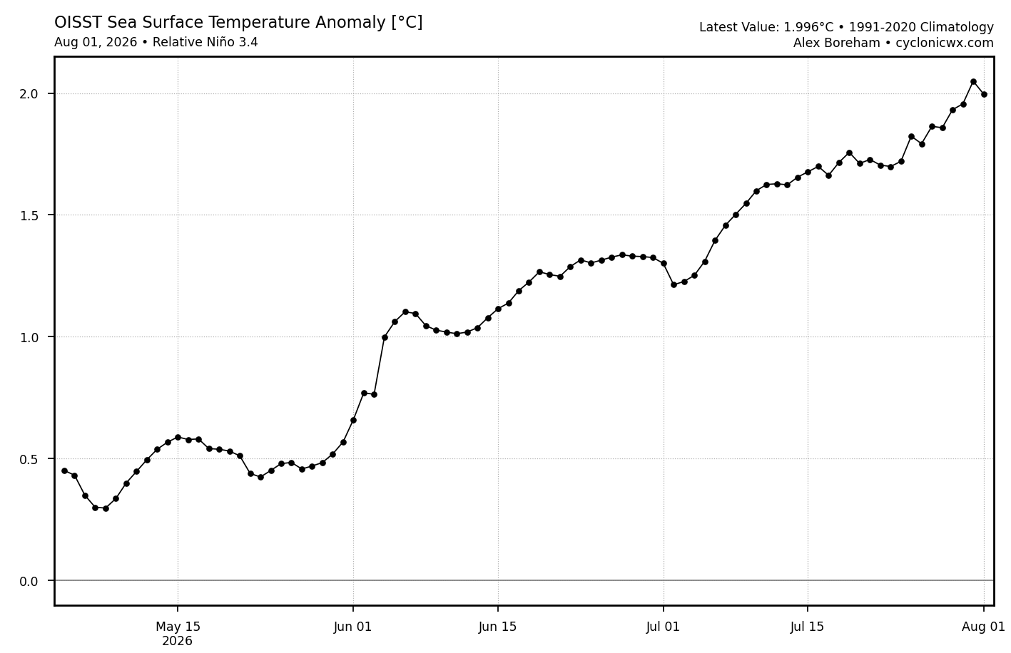
Relative 3.4 (weekly) remains notably lower than what this OISST graph suggests: graph suggests it was ~1.9 last week and NOAA has it at only 1.5 22JUL2026 3.0 1.8 1.4 0.3 29JUL2026 3.2 2.1 1.5 0.2 https://www.cpc.ncep.noaa.gov/data/indices/rel_wksst9120.txt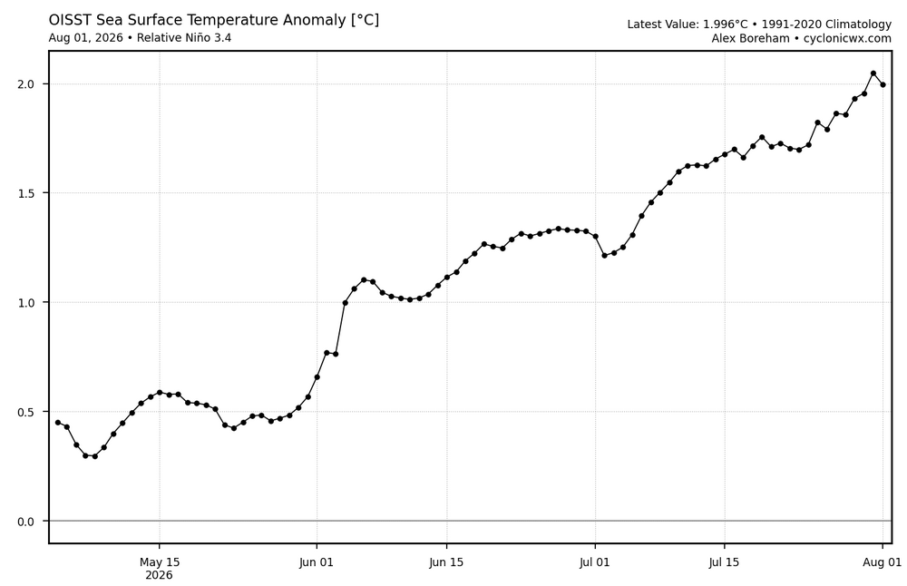
-
Downpouring on and off here, 0.28" total rainfall in Lindenhurst as of 6 AM (definitely higher now)
-

Augdewst 2026: Summer's Last Stand
jlauderdal replied to Prismshine Productions's topic in New England
Low of 75 would be considered cool this time in Sofla. 80 with 75-80 dews typical. Glad to be living here now after 28 years in FLL. -

2026-2027 Super El Nino
bluewave replied to Stormchaserchuck1's topic in Weather Forecasting and Discussion
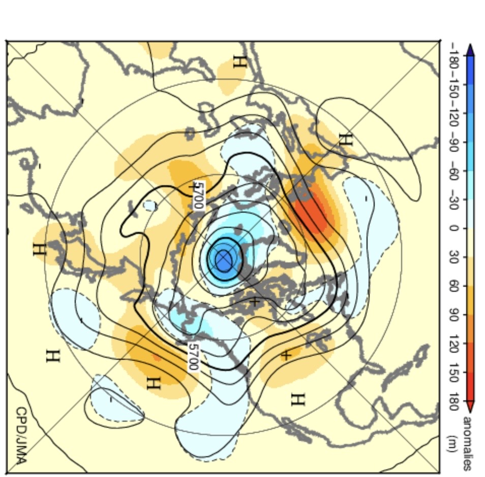
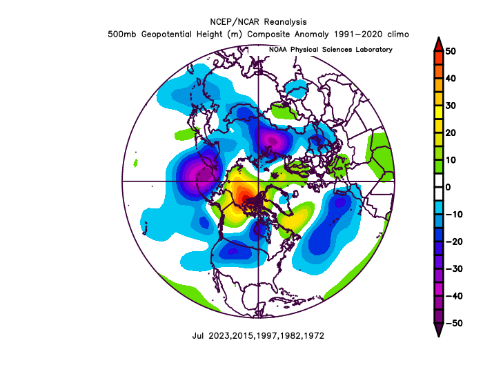
It just came out. One of the strongest July CGT patterns on record. This was the opposite of what we have had with past developing super El Niños. The strong ridge north of Hawaii lead to the big warming there and the steep -PDO drop. Seasonal model runs from May completely missed this pattern. So the main question now is what caused such a strong disconnect between the El Niño tropical forcing and the mid-latitude pattern? While most 2020s years have seen the -PDO peak during the summer and move more toward neutral in the winter, even a lingering 10% to 20% atmospheric -PDO state into the winter would be a first for such a strong east based event. My guess is that if this were to have some influence into next winter, it would probably lead to some type of shift in the state of the Aleutian low complex relative to 1997-1998. Not really expecting the seasonal models to be of much help here. While we know that all past super El Niño events have featured warmer winters in the East, the details of where the strongest ridge axis sets up will provide the finer details. A strong +PDO atmospheric east based super event like 1997-1998 was very warm. This event is even stronger and starting out with more of a -PDO atmospheric state than other developing super El Niños. So we’ll have to monitor if the ridge axis remains further south or east than past super El Niños. But even a traditional super El Niño ridge axis south of Hudson Bay is warm on its own. https://link.springer.com/article/10.1007/s00382-021-05825-6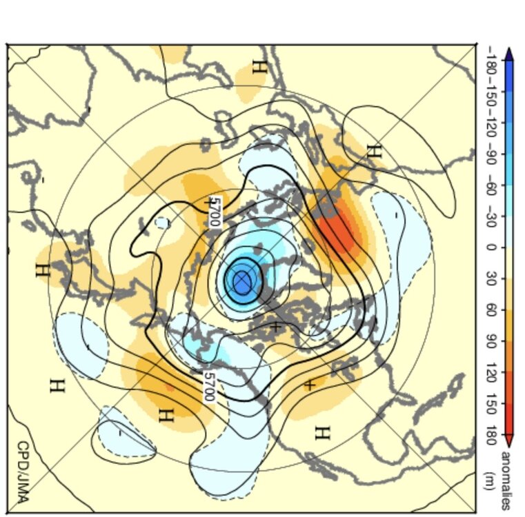
-
Torrential rain here with loud thunder
-
Just training over ASH 2.36" climbing, 74/72
-
If Elias goes, my thinking is the new GM brings in his own manager.
-

Augdewst 2026: Summer's Last Stand
Sey-Mour Snow replied to Prismshine Productions's topic in New England
3.20” a bit of a break now , 4.5” in litchfield county already. -

Augdewst 2026: Summer's Last Stand
VivaManchVegas replied to Prismshine Productions's topic in New England
2.31". Woke up to South East Asian like down poor. -

Augdewst 2026: Summer's Last Stand
codfishsnowman replied to Prismshine Productions's topic in New England
No Parts of Fairfield County have BDL beat -
74f/ 1.28" Shop Davis and counting
-

Augdewst 2026: Summer's Last Stand
TauntonBlizzard2013 replied to Prismshine Productions's topic in New England
Again, we knew. Same damn areas out west. -
Augdewst 2026: Summer's Last Stand
codfishsnowman replied to Prismshine Productions's topic in New England
Finally! Someone with some common sense. I love winter, even when it's Stein -

Augdewst 2026: Summer's Last Stand
dendrite replied to Prismshine Productions's topic in New England
Yeah that’s my 2.5”. 2.60” now. Seems to be winding down. -