All Activity
- Past hour
-
Eps fwiw
.thumb.png.6f79a4dcc08990af3b8b8ef1a1a344cf.png)
-
If they’re showing that a White Christmas is on the table, then yes I’m very interested.
-

December 14th - Snow showers or Plowable snow?
Baroclinic Zone replied to Sey-Mour Snow's topic in New England
Yeah, that and the RRFS are on the “juicer” side, so we monitor today’s runs to see if we uptick some or stay the course. Most modeling has 0.2” up to around my area. -

December 2025 regional war/obs/disco thread
Ginx snewx replied to Torch Tiger's topic in New England
Looks like prolonged snow -

December 14th - Snow showers or Plowable snow?
ineedsnow replied to Sey-Mour Snow's topic in New England
It would be nice to get a inch or two of fluff here.. but this looks mainly south.. congrats to the ones who haven't seen snow yet!! -
Beautiful sunrise. Red sky in the morning, a sailor's warning. Definitely has that "it's gonna snow" feeling in the air
-
Still expecting 1” only. Boom is 2, bust is flizzard
-

December 14th - Snow showers or Plowable snow?
SouthCoastMA replied to Sey-Mour Snow's topic in New England
Euro AI juiced up the last two runs. .5 up to Taunton -

December 2025 regional war/obs/disco thread
Damage In Tolland replied to Torch Tiger's topic in New England
Xmas week look on all modeling has icestorm written all over it. Frigid SE Canada with waves running along boundary south -
December 14th - Snow showers or Plowable snow?
Damage In Tolland replied to Sey-Mour Snow's topic in New England
Turning into 2-4” from 90 south -

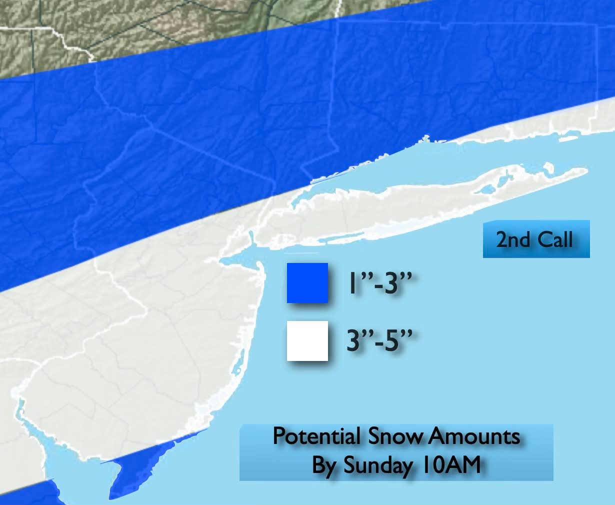
Minor snowfall sunday 12/14/25 1-4” possible
MJO812 replied to WeatherGeek2025's topic in New York City Metro
John Marshall
-
Appears to be.
-
One more Arctic outbreak before the pattern moderates.
-
The cold this year hits deeper into my bones vs previous years. It's probably because im getting older but still
-

12/14: Sunday funday? Will the south win again?
DDweatherman replied to TSSN+'s topic in Mid Atlantic
Yeah the 6z euro getting the 2” to my yard is an accomplishment for sure. My hopes were solely resting on the high resolution (and also low performing at times) models. -
December 2025 regional war/obs/disco thread
Ginx snewx replied to Torch Tiger's topic in New England
Add GFS GEFS EPS Christmas week, if the cold is locking the the weather will be rocking -

December 14th - Snow showers or Plowable snow?
tavwtby replied to Sey-Mour Snow's topic in New England
I wouldn't be shocked if someone in SE areas of SNE saw 6" of fluff, column will be plenty cold in the DGZ for so good growth, a few more tics north we can all be in business -
It's literally gone from being able to see the cloud deck to our east to a few flurries to 1-2" and back. Almost game time so buckle up buttercup
-
December 14th - Snow showers or Plowable snow?
Ginx snewx replied to Sey-Mour Snow's topic in New England
6z Euro and blended models fluff it up.png.cbcf8079294cbc4968e63ba67736c324.png)
.png.1a65876edb976fefbae2f7ed549398f2.png)
-
Looks like we might be getting a little snow later on this evening the decorations should look nice outside in the morning
-

Central PA Winter 25/26 Discussion and Obs
mahantango#1 replied to MAG5035's topic in Upstate New York/Pennsylvania
-
I’ll be happy with 1 the way this has oscillated for us
-
Minor snowfall sunday 12/14/25 1-4” possible
MJO812 replied to WeatherGeek2025's topic in New York City Metro
RRFS A.thumb.png.6cd898c190c7005b897ae93673f7f676.png)
-
0z euro has Christmas Eve snow
-
December 14th - Snow showers or Plowable snow?
Damage In Tolland replied to Sey-Mour Snow's topic in New England
Great trends overnight

.png.edcf3f9b730ea3a1162939f59e5cb768.png)


.thumb.jpeg.f5c6ba9d911ec96b3b124f8606aee58e.jpeg)


.png.a0d3ba9afc8dcdfef5fae7f6f48b2ef7.png)


