All Activity
- Past hour
-
Correct me if I'm wrong, but on the current and future radar loop, it looks like the heaviest rain will fall north of the flood watch zone.
-
Not thrilled about this given how saturated the ground is and the significant damage the Alexandria area endured two Friday’s ago.
-
Woot woot. It's the second run in a row with a tropical system in this range. I'm sure it'll be rock solid for the next 30+ runs.
-
Pleasant.
-
Wtf?
-
Final squally/gusty line was intense IMBY after 830. gonna find branches down in the nhood tomorrow. Power didn't flicker though
-
can we please have another pure music off-topic thread/dump? @Stormtracker? =)
-
Widespread hundies
-
Wind Advisory now up from midnight tonight through early Sunday morning? URGENT - WEATHER MESSAGE National Weather Service Baltimore MD/Washington DC 840 PM EDT Fri May 30 2025 DCZ001-MDZ004>006-008-011-013-014-016>018-503>508-VAZ038>040-051-053- 054-501-502-505-506-526-527-310845- /O.NEW.KLWX.WI.Y.0016.250531T0400Z-250601T1000Z/ District of Columbia-Frederick MD-Carroll-Northern Baltimore- Cecil-Southern Baltimore-Prince Georges-Anne Arundel-Charles-St. Marys-Calvert-Northwest Montgomery-Central and Southeast Montgomery-Northwest Howard-Central and Southeast Howard- Northwest Harford-Southeast Harford-Greene-Madison-Rappahannock- Culpeper-Fairfax-Arlington/Falls Church/Alexandria-Northern Fauquier-Southern Fauquier-Western Loudoun-Eastern Loudoun- Northwest Prince William-Central and Southeast Prince William/Manassas/Manassas Park- 840 PM EDT Fri May 30 2025 ...WIND ADVISORY IN EFFECT FROM MIDNIGHT TONIGHT TO 6 AM EDT SUNDAY... * WHAT...West winds 15 to 30 mph with gusts up to 50 mph. * WHERE...DC, and portions of central, north central, northeast, northern, and southern Maryland, and central, northern, and northwest Virginia. * WHEN...From midnight tonight to 6 AM EDT Sunday. * IMPACTS...Gusty winds will blow around unsecured objects. Tree limbs could be blown down and a few power outages may result. PRECAUTIONARY/PREPAREDNESS ACTIONS... Winds this strong can make driving difficult, especially for high profile vehicles. Use extra caution. Secure outdoor objects. && $$ DHOF
-
1938/1635. let's taboo/catastrophe and get it over with. another 50-200 between hopefully
-
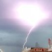
Finally a good flash and crack of thunder. Storm in Baltimore is expanding east and north.
-

May 30th 2025 Severe Weather Potential
SEwakenosnowforu replied to kayman's topic in Southeastern States
I called it today. Bust! Atmosphere worked over hard lastnight. Too much cloud covetr today. -
I have had 5 flashes and some thunder in the distance. That is about it.
-
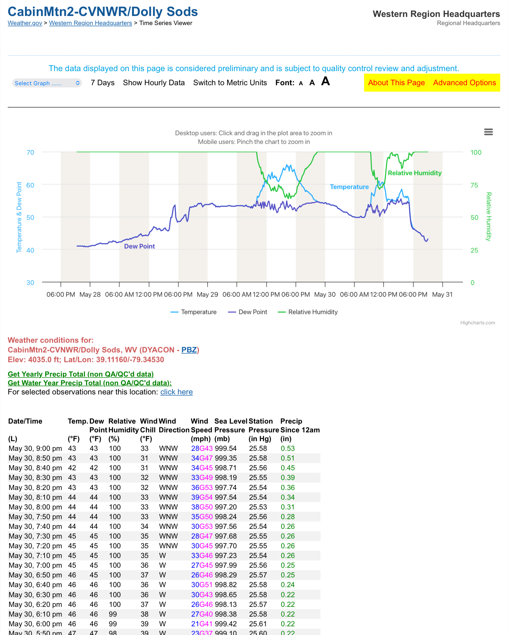
1.62” at my place. Officially over 9” for the month. What a turnaround.
-

2025 Severe Weather General Discussion
SomeguyfromTakomaPark replied to Kmlwx's topic in Mid Atlantic
The storm that is warned now near beltsville had some nice wind when it came through takoma park. -
Just got a loud bolt out of nowhere here in Columbia.
-
Can see the precip that will come through late tonight blossoming in WV.
-
Looks like a lot of the cells are weakling rapidly
-

2025 Spring/Summer Mountain Thread
Met1985 replied to Maggie Valley Steve's topic in Southeastern States
That's what the heck im talking about! Spring can suck it! -
Rotation in the line near White Oak/Hillandale. Increase in lightning as well. TOR warned now.
-
Mostly just a steady rain here in 21057. Just some lightning every once and a while .17 so far
-
Moving over here since no longer severe seemingly. Pouring here in Colesville again. Local stream gauge after the last round was already pushing 6ft. Guessing it dropped a bit during the lull but it should shoot back up with this line of heavy rain.
-
We’re very over due for .. 1) Strong Direct cane hit 2) Tors thruout region 3) Snow
-
 DCA _ NYC _ BOS ___ ORD _ ATL _ IAH ___ DEN _ PHX _ SEA 2.2 2.3 2.6 0.5 2.1 1.3 0.7 1.8 0.7 June
 -
a quick .33", then this:
- 926 replies
-
- 5
-

-
- severe
- thunderstorms
- (and 2 more)