All Activity
- Past hour
-
Point of view is the epicenter of the heaviest rains at this time, slowly moving ENE, but honestly hard to get a perfect idea of motion as it spirals. Soon the heavens will open up on the Western Shore.
-

July 2025 Discussion-OBS - seasonable summer variability
winterwarlock replied to wdrag's topic in New York City Metro
My heat index was over 120 two days so I disagree -

July 2025 Obs/Disco ... possible historic month for heat
CoastalWx replied to Typhoon Tip's topic in New England
Pushing 90 here. Lots of clouds and showers. -

2025 Atlantic Hurricane Season
WxWatcher007 replied to BarryStantonGBP's topic in Tropical Headquarters
And even with such low ACE, the two landfalling systems brought catastrophic impacts to relatively localized areas of the country. -
July 2025 Obs/Disco ... possible historic month for heat
CoastalWx replied to Typhoon Tip's topic in New England
You've been saying that for weeks and I have a burnt lawn to show for it. -
You are right about the humidity. It's overcast out and I'm still sweating profusely just sitting in a chair outside.
-

2025-2026 ENSO
PhiEaglesfan712 replied to 40/70 Benchmark's topic in Weather Forecasting and Discussion
I mean, it was only fitting that the torch winter of 2001-02 ended with an early season heatwave in mid-April, as a cherry on top. -

July 2025 Discussion-OBS - seasonable summer variability
FPizz replied to wdrag's topic in New York City Metro
87/80 -

July 2025 Obs/Disco ... possible historic month for heat
TauntonBlizzard2013 replied to Typhoon Tip's topic in New England
Next 7 days look pretty meh. Lots of clouds and showers -
About to get juicy in your yard. kudos to the GGEM on Chantal. Led the way on the inland track.
-

E PA/NJ/DE Summer 2025 Obs/Discussion
BBasile replied to Hurricane Agnes's topic in Philadelphia Region
Haven't been following the accuracy of the models, but Mt Holly stated that the models have been underestimating rainfall totals and coverage. -
Barry and Chantal are reminders that under the right conditions tropical systems and their remnants can bring catastrophic impacts.
-
It's been a tropical rainforest here in the lowlands for the past several hours. Steady heavy rain.
-

July 2025 Obs/Disco ... possible historic month for heat
HoarfrostHubb replied to Typhoon Tip's topic in New England
July 4th was much busier here. -
Pretty wet day for the easterners
-
July 2025 Obs/Disco ... possible historic month for heat
HoarfrostHubb replied to Typhoon Tip's topic in New England
Wife and I went kayaking on our local lake. Saw 2 (maybe 3?) loons, a great blue heron (hadn’t see one there before) and the bald eagle. Other than a couple of distance swimmers and a few kayaks, it was pretty empty. Much different than July 4th when it was super busy. -
E PA/NJ/DE Summer 2025 Obs/Discussion
BBasile replied to Hurricane Agnes's topic in Philadelphia Region
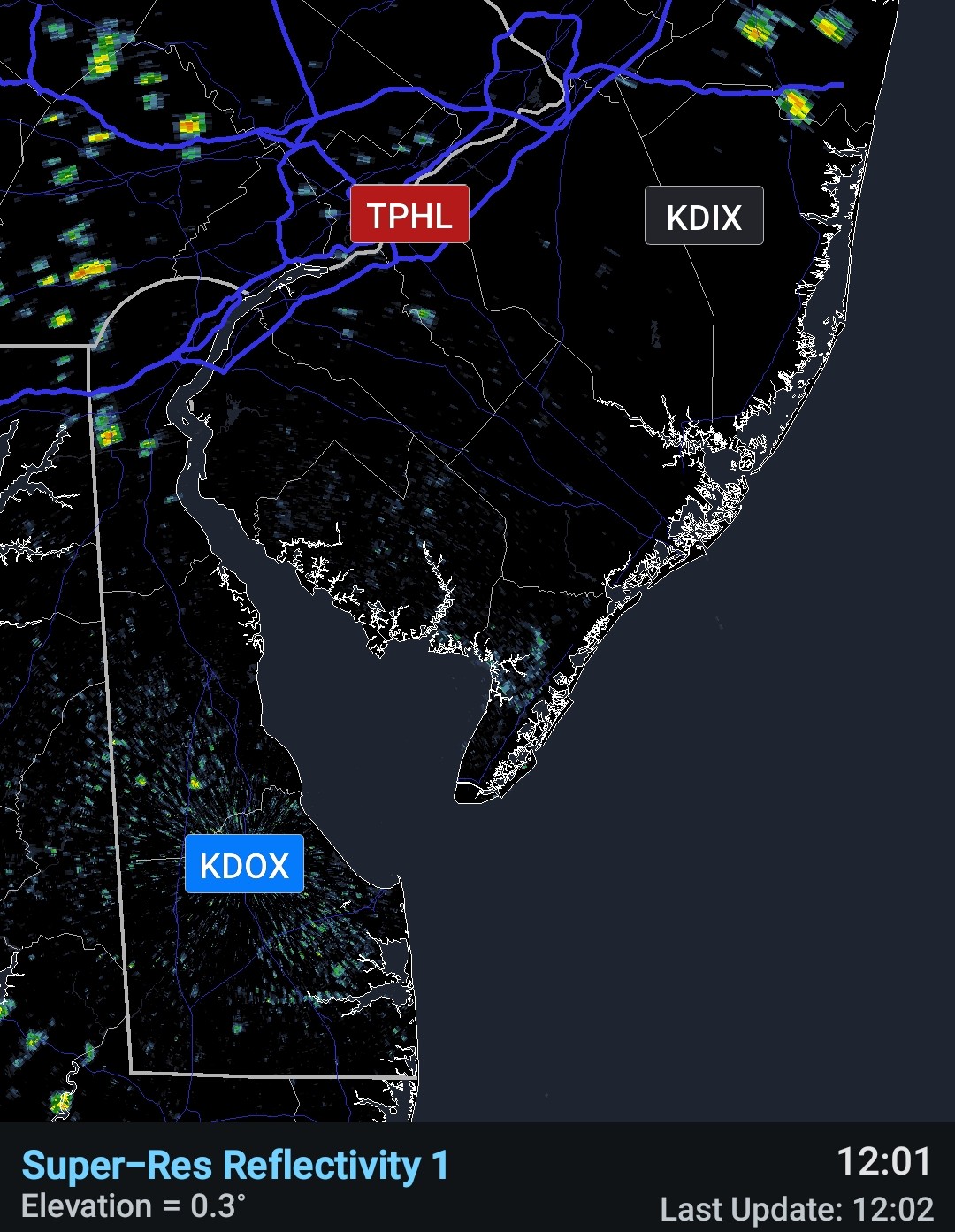
Please don't break, KDOX! Please don't break, KDOX! lol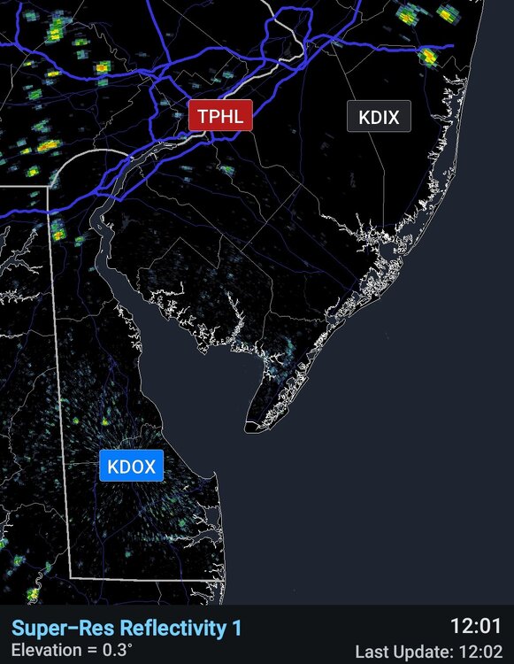
-

July 2025 Discussion-OBS - seasonable summer variability
forkyfork replied to wdrag's topic in New York City Metro
90/79/106 -
Grasses down here are greener than emerald treasures in the old Egyptian tombs that are newly discovered that looters have never gotten to. This is not July 7 Central Texas. This is APRIL 7 Central Texas. BEWARE the rain BLOB just to the north. It's sagging south and here we go again, gonna get Kerr Countied. Stay far away from all creeks. The Ground is saturated. Every bit of precip will run off and pile up. I got a bad bad left knee. I can't run from the rising waters. They will casually carry me away, it's been really nice knowin' y'all as the Jebman becomes the Floodman.
-
There was relentless zonal and semizonal flow that entire winter, start to finish. It acted like a huge chinook across the entire CONUS. Thanks in part from the very strong +EPO and also the SPV went raging strong, shrunk and moved directly over the North Pole, once that happened it was lights out
-
It’s even worse closer to the lake. I at least got a couple .25” in 10 minutes type showers the past couple weeks just east of GRR. It’s been hot enough we lose that much to evaporation every day though.
-

2025-2026 ENSO
Stormchaserchuck1 replied to 40/70 Benchmark's topic in Weather Forecasting and Discussion
That was a "no chance" Winter. Things weren't even really that close. There were a few -NAO periods, but they linked up with the SE ridge because -NAO/+EPO can actually be the worst Winter pattern ever because it's dry. -
As bad as 97-98 and 11-12 were, I think the worst of all time was 01-02. If there was ever a winter that was over before it even began, that was the one. Not only was it an absolute torch from November through March, it was also dry as all hell
-

July 2025 Discussion-OBS - seasonable summer variability
Brian5671 replied to wdrag's topic in New York City Metro
Looks nasty in that department over the next 10 days for sure--70+ dewpoints and heat -

July 2025 Obs/Disco ... possible historic month for heat
weatherwiz replied to Typhoon Tip's topic in New England
Yeah timing not particularly favorable and instability will gradually wane during the evening. Probably going to be another big nowcasting day...the mesos have been extremely awful here in terms of convection. Will have to do a good ole fashion synoptic analysis in the morning and try to highlight local boundaries...that's where we'll see convection probably fire early afternoon (albeit isolated). Shouldn't have an issue reaching the convective temp tomorrow.