All Activity
- Past hour
-
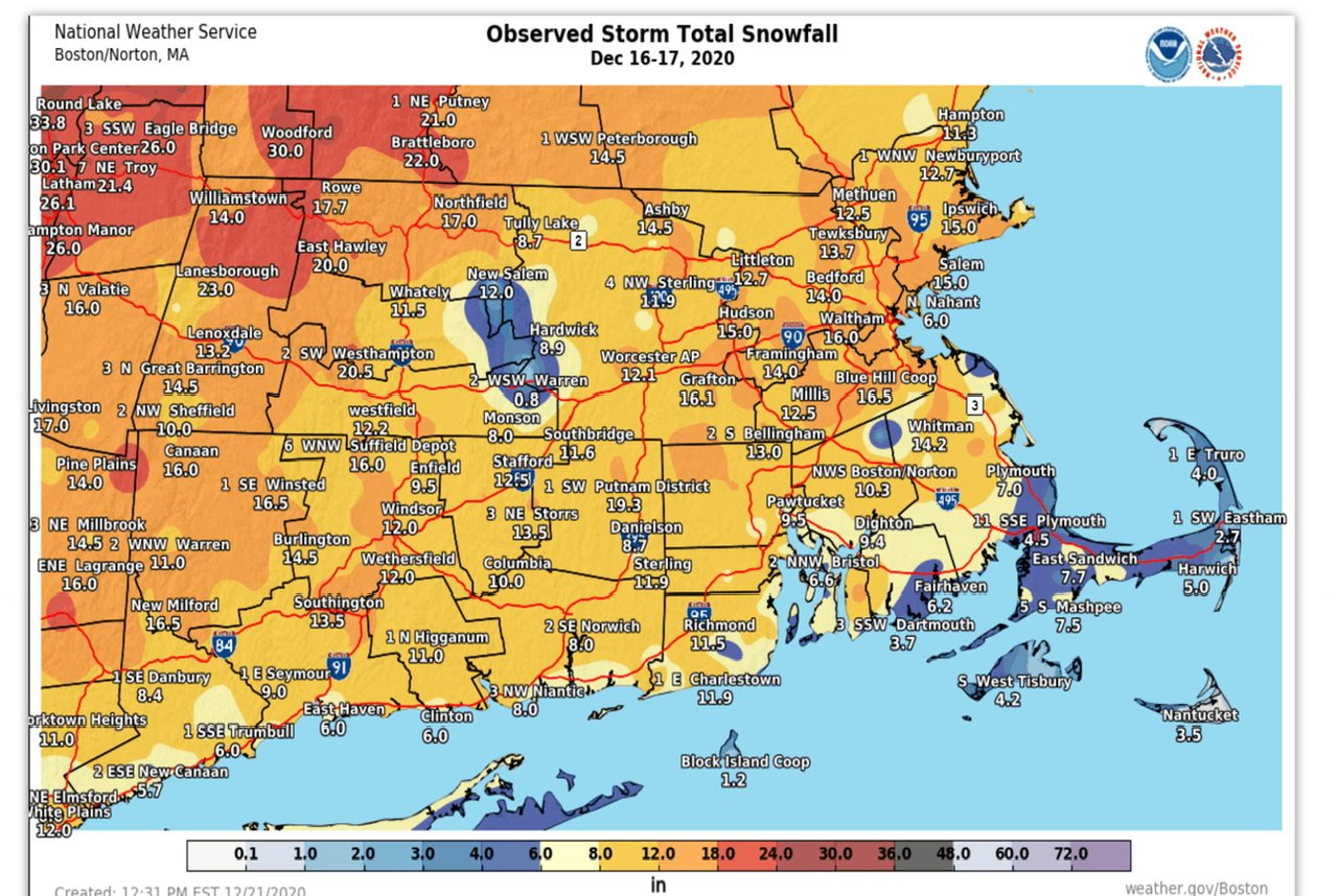
1962-63 is one of the legendary winters ever here and many other places. It featured a QBO falling deeply negative from fall into winter. Was a weakish La Nina. It had an SSW event. The PDO was negative. The PDO is currently negative. October 1962 was warm, but finally got cold around October 19th. This year was warm, and it finally got cold here and frosted on October 20th. A strong cold front passed in early November and brought light snow to the region, there was even a dusting in lower elevations. After that cold front and snow event, the temp warmed and the warmest temperatures of the month were mid month and late month, as temperatures yo-yo'd a bit. The first few days of December were very warm, then the bottom fell out and December ended -7. The 60s were extreme, but since 2013/14 we've gotten closer to it's weather patterns. Just in a somewhat warmer world. We went years without extreme cold after 1996 and into the early 2010s (nothing sub zero). Since then we've seen sub zero cold invade multiple times and it's back to happening at least 2 to 3 of every 5 or so years. Weather is never exactly the same but large scale patterns will always come back. Like we will eventually get another blizzard or very anomalous snowfall event. A widespread 14-20+ inch type event. The gulf, Texad and deep south have had such events in this enhanced winter pattern we've been in since 2013/14 brought back the subzero weather that had disappeared.
-

November 2025 general discussions and probable topic derailings ...
WinterWolf replied to Typhoon Tip's topic in New England
Ya, It sucks. It always shows warm…no matter what. Throw it in the trash. -
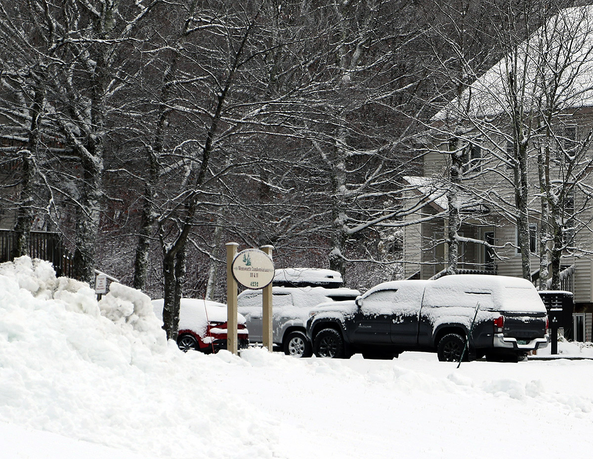
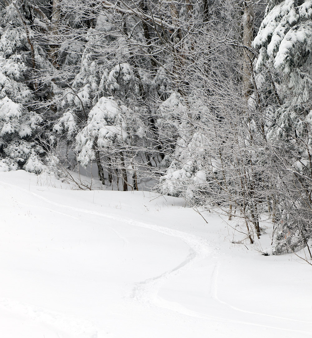
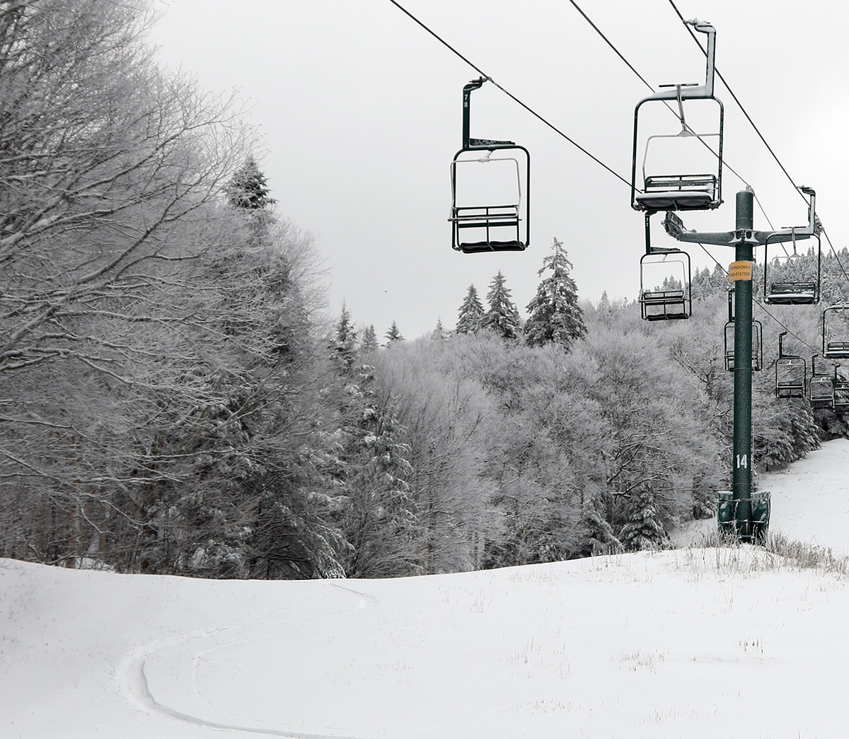
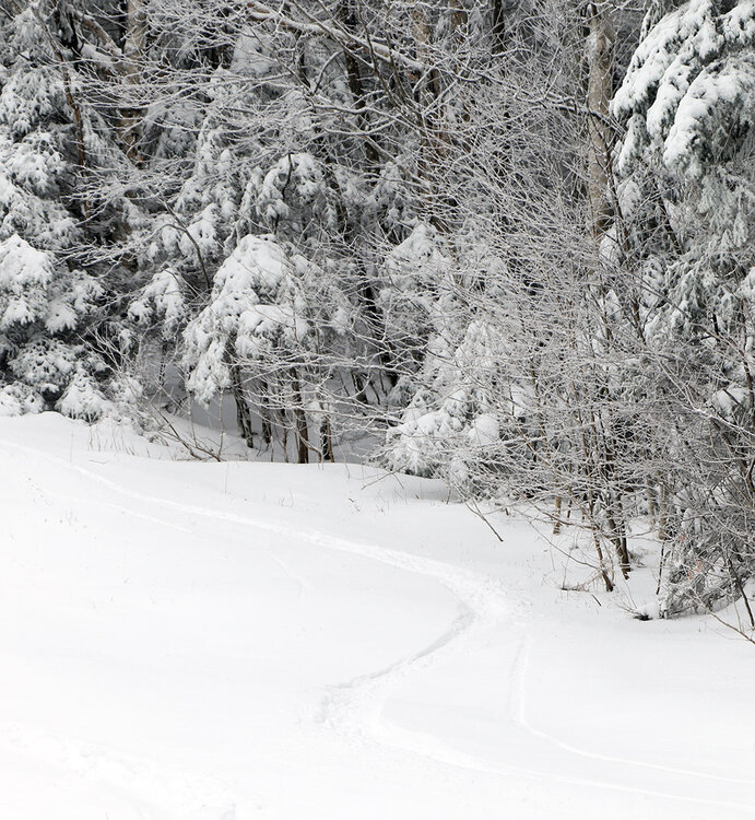
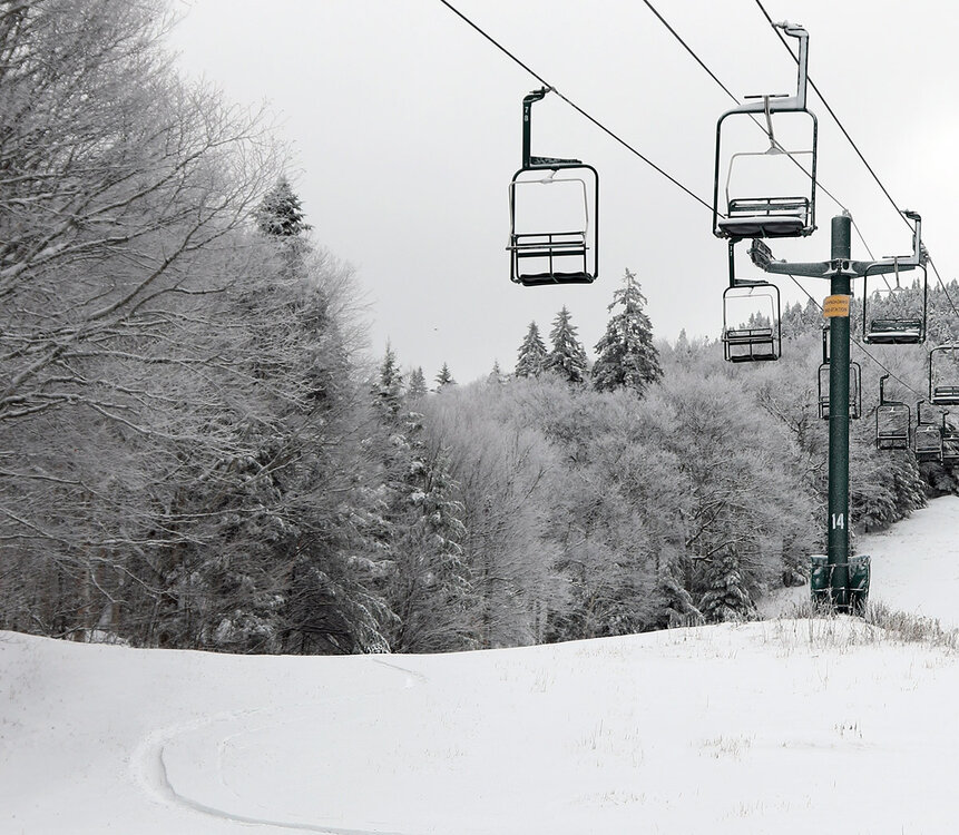
The clipper system affecting the area yesterday into today dropped another round of snow in the mountains and we even saw snow transiently accumulating in some of the lower valleys. This system was similar to the last one that affected the area on Friday into Saturday, but temperatures seemed to be a bit colder on the back side this time around. This morning when I checked the view on Bolton Valley’s Base Lodge Webcam, the accumulations appeared to be a bit more robust than last time around. Seeing hat, I knew there would be plenty of snow for using skins right from he base, so I geared up for a ski tour and headed up to the mountain. While the snow line was still fairly high with this system, the local ~2,000’ peaks around us in the Winooski Valley were coated with white for their top ~300’ of vertical, so that suggested that the snow level had dipped just a bit lower than what we’d seen over the weekend. Heading up the Bolton Valley Access Road, I saw the first traces of snow around 1,200’ just like Saturday, but Timberline showed a decent covering down to its 1,500’ base, and up in the Village at 2,000’ I found 3-6” of snow, which was more than what had accumulated Saturday morning. Temperatures were cooler today than they were on Saturday, and even at 2,000’ the temperatures were easily below freezing. The cooler temperatures meant that the powder was of much higher quality than what’s we’d seen over the weekend, and with some base snow already in place, the quality of the powder skiing took a big leap forward from where it had been. Compared to what was available on Saturday, today was simply easy breezy midwinter-style powder skiing. All you had to do was lean in and carve. When checking snow depths today, I couldn’t really differentiate the new snow from the old snow that was already present from the last system, but the updated elevation-based snow profile is below. In the list, the first depth values are what I found on Saturday, and the second depth values are what I observed today. Nov 1 --> Nov 6 1,000’: 0” --> 0” 1,200: T” --> T 1,500’: T-1” --> 1” 2,000’: 1-4” --> 3-6” 2,500’: 4-6” --> 5-9” 2,800’: 7-11” --> 9-12” 3,150’: 7-11” --> 10-16” With every one of these storms that passes through and drops snow, the potential increases for this to be the start of the winter snowpack. With typical November temperatures, I wouldn’t expect the higher elevation snow to melt too quickly, so we’ll just have to see if there are any warm spells or big rainy systems in the future that might be able to put a dent in the snowpack.
-

November 2025 general discussions and probable topic derailings ...
Torch Tiger replied to Typhoon Tip's topic in New England
it's warmer for DJF than it showed late summer through October. Far and away. Doesn't mean much, but more than it did then. -
Yesss I'd love to see another 2013-2014 winter!!!!
-
This is a banter thread so people basically talk about anything and everything lol
-
My maples are dropping their leaves quickly while other trees are still holding onto the green. Seems like only maples right now.
-
November 2025 general discussions and probable topic derailings ...
WinterWolf replied to Typhoon Tip's topic in New England
That was a great storm here… -
November 2025 general discussions and probable topic derailings ...
WinterWolf replied to Typhoon Tip's topic in New England
CFSV2 hasn’t been too good from what I’ve seen…always shows that same look lol. -
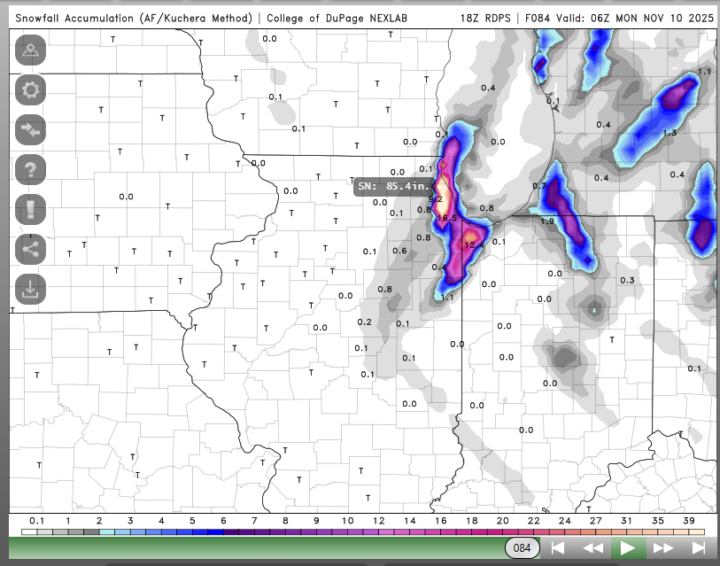
RGEM says congrats, Chicago. This might set some kind of record. /s In all seriousness, Pivotal's output isn't as wild (obvious error in COD's algorithm), spitting out 10" in Chicago thanks to an intense mesolow crashing ashore. NAM and Euro appear to be picking up on a mesolow, as well, but it's a little slower -- coming onshore overnight Sunday. The timing of this early-season lake-effect event favors localized "big dog" totals, as it occurs at night. Plus, lots of deep cold air and a possible Lake Superior connection. Of course, where the bands set up/mesolow forms will be key. Happy tracking!
-
 Meh
Meh
-
Dude, can you please give it a rest and stick to what you’re good at. This is a weather board, there are a million political boards. I think you need snow BAD, you have become mighty grumpy.
-
November 2025 general discussions and probable topic derailings ...
Torch Tiger replied to Typhoon Tip's topic in New England
cansips looks better though. -
2019-20 only had 4.8" at nyc
-
November 2025 general discussions and probable topic derailings ...
Torch Tiger replied to Typhoon Tip's topic in New England
wowzers
-

Central PA Fall Discussions and Obs
Blizzard of 93 replied to ChescoWx's topic in Upstate New York/Pennsylvania
My temperature is really dropping off quickly tonight. Already down to 36 at 9:30 pm. I could be on the way to my coldest morning yet of the season. -
November 2025 general discussions and probable topic derailings ...
WinterWolf replied to Typhoon Tip's topic in New England
Brett meh’d himself to more jackpots and overachieving snowstorms the last 10-15 yrs than you can shake a stick at. Sure it’s been lean the last 3-4 yrs, but before that the mulch beds were getting buried left and right. -
It’s rare that the warm ups exclude us.
- Today
-
4.1" as a mean? Thats not bad at all!
-

November 2025 general discussions and probable topic derailings ...
powderfreak replied to Typhoon Tip's topic in New England
Fangs. It’s snowed in SE MA a few times in the last decade. It’ll do it again. #dealwithit even if your results are Delmarva climo from the 1960s. -
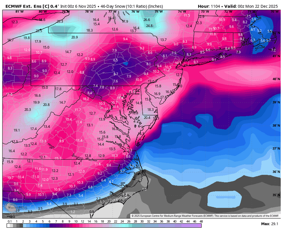
Latest WB EPS weeklies and control. Dreaming of a White Christmas.
-
The Euro weeklies are crazy cold on the control run and very cold on the mean run. The Euro control drops a large amount of snow over the Tenn Valley for December. Now....we have seen the Euro be too cold for December. It is still shoulder season, but we take today's run and run with it.
-
Nov 9-13 may be the only five day interval where some or most people reading this were alive when NYC set its daily record low. After the 9th (1976) two were set in 2017 and two in 2019 (probably on same nights rather than two consecutive nights in each case). Two out of three of the winters following these unusual record lows were of course good ones, 2019-20 closer to average by recent standards. Add to this the 2012 snowfall event and this is one of the few times of year to outperform the classic climate of the past in terms of producing cold weather and snow. Not that this necessarily would affect the 30-year average, I suppose there have also been intervals that were well above normal to compensate. The ones that come to mind are a bit earlier such as 1975, 2022 and 2024.
-
November 2025 general discussions and probable topic derailings ...
WinterWolf replied to Typhoon Tip's topic in New England
Parts of Nova Scotia gets a lot of rain too in the winter. Cape Breton is the snowy spot there…that’s where you want to be. But Halifax doesn’t average much more than alot of places in SNE. So depending where you are in NS means alot. -
November 2025 general discussions and probable topic derailings ...
WinterWolf replied to Typhoon Tip's topic in New England
Bro…you can’t remember shit. You say things that aren’t even close to being accurate. Thanks to Scott for backing me up. And I even forgot about December of ‘20..that was a big hit…double digits. So again your statements are not even close to legit. Sure it’s been a rough stretch of late, but that’s how it goes. Your area had one hell of a run before the bottom fell out…and you got buried in Jan ‘22. So stop with “it doesn’t snow in November and December BS.” The goods will be back…take that to the bank.