All Activity
- Past hour
-
Don’t do it
-
Records: Highs: EWR: 87(1945) NYC: 84 (1945) LGA: 83 (1945) JFK: 76 (1991) Lows: EWR: 19 (1982) NYC: 13 (1923) LGA: 23 (1982) JFK: 22 (1982) Historical: 1886: Denver, CO set their all-time March record low at -11°. (Ref. Wilson Wx. History) 1891: Washington's greatest late March snow of 12 inches occurred. (Ref. Washington Weather Records - KDCA) 1894: The minimum temperature for the date is 21 °F in Washington, DC. (Ref. Washington Weather Records - KDCA) 1902: Tennessee registered its record maximum 24 hour precipitation as 11.01 inches of rain fell at McMinnville. (Ref. Wilson Wx. History) 1907: High pressure off the southeast coast pumped unseasonably warm air from the southeast to the Mid-Atlantic. Many cities reported record high temperatures for the date including: Richmond, VA: 91°, Charlotte, NC: 90°, Wilmington, NC: 90°, Savannah, GA: 89°, Norfolk, VA: 89° & Salisbury, MD: 89° and Asheville, NC: 86°. (Ref. Wilson Wx. History) 1917 - Thane Creek, AK, reported a snow cover of 190 inches. (The Weather Channel) 1920 - The worst tornado disaster of record occurred in Chicago IL as a tornado killed 28 persons and caused three million dollars damage. (David Ludlum) 1921: A cold front caused temperatures to plummet 20 degrees in 20 minutes in parts of New Jersey. Temperature drops as dramatic as 55 degrees in 18 hours were also observed. (Ref. Wilson Wx. History) 1935: On this date through March 31st, a great dust storm descended on Amarillo, TX reducing visibility to zero for a six-hour period.(Ref. Wilson Wx. History) 1942: A spring snowstorm hit the Mid-Atlantic States. Baltimore, MD reported a March record snowfall of 22 inches while Washington, D.C. checked in with 11.5 inches; also a March record. (Ref. Wilson Wx. History) 1945: The maximum temperature for the date is 84 °F in Washington, DC. (Ref. Washington Weather Records - KDCA) 1955: Spring snow in FL lays down one inch in Marianna and 1/2 inch in Tallahassee (Bob Ryan's 2000 Almanac) 1963: A decision was handed down in the case of Whitney Barbie vs. United States of America. Barbie sued the U.S. Weather Bureau for negligence in failing to provide warning about 1957's Hurricane Audrey. Barbie's wife and five children were killed after the 12 foot storm surge struck Cameron Parish, LA on the morning of June 27, 1957. It was ruled that the evidence presented did not establish negligence of the part of the Weather Bureau. (Ref. Wilson Wx. History) 1984 - A violent outbreak of tornadoes hit the Carolinas. Thunderstorms spawned 22 tornadoes during the late afternoon and evening hours which killed 57 persons and injured 1248 others. Nearly half the deaths occurred in mobile homes. A tornado from near Tatum SC to southern Cumberland County NC was 2.5 miles in width at times. (The Weather Channel) 1987 - A blizzard raged from southern Nebraska to central Iowa. Snowfall totals ranged up to 17 inches at Blue Hill NE. Winds gusted to 68 mph at Carroll IA. High winds produced snow drifts twenty feet high in western Iowa, and produced wind chill readings as cold as 30 degrees below zero in Nebraska. The snowfall total of 9.4 inches at Omaha NE was a record for the date. (Storm Data) (The National Weather Summary) 1988 - Severe thunderstorms in central Oklahoma produced hail up to four inches in diameter causing 35 million dollars in southern Oklahoma County. Baseball size hail and seven inches of rain caused another eighteen million dollars damage in Stephens County. (The National Weather Summary) (Storm Data) 1989 - Unseasonably warm weather prevailed from the Southern and Central Plains to the Atlantic coast. Eighteen cities reported new record high temperatures for the date. The afternoon high of 81 degrees at Beckley WV was a record for March, and the high of 90 degrees in downtown Baltimore MD tied their March record. (The National Weather Summary) 1990 - A storm system brought heavy snow to the west central and southern mountains of Wyoming, and high winds to the Wasatch Mountains of northern Utah. Snowfall totals in Wyoming ranged up to ten inches at the Snowy Ski Range Area, and the storm pushed the snowfall total for the month at Cheyenne above 37 inches, surpassing their previous record for March of 35 inches. (The National Weather Summary) (Storm Data) 1992: 1.6 inches of snow fell on this date at Syracuse, NY, bringing the seasonal snowfall total to 162.8 inches. (A record to this date) The largest seasonal snowfall record in Syracuse (measured at the airport) was 192.1 inches set in the 1992-1993 winter season. The 2000-2001 season 191.9 inches. This was a new all-time seasonal snowfall record for the location. The old seasonal record was 162.0 inches set back in the winter of 1989-90. (Ref. Wilson Wx. History) 1996: Williamsport, PA recorded 0.8 inches of snow on this day to bring its seasonal snowfall total to 83.9 inches: the city's snowiest winter ever. (A record to this date) (Ref. Wilson Wx. History) 2000: At least two tornadoes hit western Fort Worth near Dallas, TX during the early evening causing widespread damage, killing four people and injuring 48 others. (Ref. Wilson Wx. History) March 28, 2000 (Lake Worth, Texas): Last known hail fatality in the United States, occurred when a 19-year-old male was killed by grapefruit-sized hail while trying to move a new car to shelter. (Ref. Hail Events by Michael Mogil) 2009(27th-28th) The same blizzard described in the March 27th entry also set a TX state 24-hour snowfall record. Follett measured a total of 25.0 inches, erasing the previous 24.0 inch record set in Plainview on 2/4/1956. An estimated 3,400 TX cattle perished in the storm. (Ref. Weather Guide Calendar with Phenomenal Weather Events 2011 Accord Pub. 2010, USA)
-
In the 20s this AM.
-
36 / 8 sunny. Coldest day of the next 10-14 and perhaps well beyond. Mid 40s. Warmer Sunday. Mon / Tue likely the nicest days of the week sunny low / mid 70s. Ridge into the east but Wed - Fri still warm but clouds and showers muddy the potential. Beyond there overall warmer than normal but unsettled. Looming like 1 - 2 inches of rain from Wed - April 7/8th.
-
30/10F with a persistent breeze, good indoors day
-
Huge temp swing. Went from 80 yesterday to 30 degrees this morning. Won't make it out of the 50s today...
-
End of week looking a little interesting.
-
TT did a decent job. DIT not so much
-
Need one of those tents with a stove
-
Get these 30s and 20s WCs outta here
-
This is awesome, what grade levels?
-
Congrats white horse beach
-
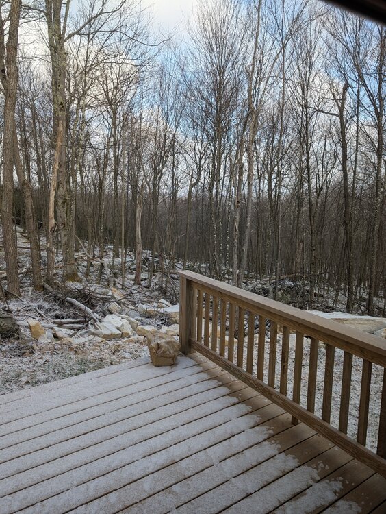
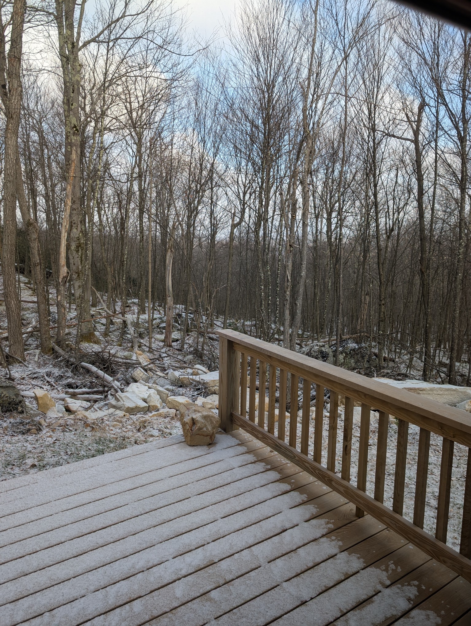
Deck has caved. 24F.
-
Flurries around this morning.
-
Night 1 of 2 chaperoning a school adventure club camping trip in the Whites. Low of 9.5°F outside according to the weenie thermo I brought. Temp in my tent stayed right between 26-29° all night and with the proper tent and sleep pad, the <0° bag was almost too warm at times. Pack is still anywhere from 8-18" generally. Got that rotting spring look with a bunch of stuff from the trees on top even though it was fresh at the start of the week. Definitely more glacial than soft, at least this morning. Looks like tonight will be warmer but more windy. I think I'd prefer to radiate. Possibly some exciting squalls later on the hike. LFG.
-

Central PA Spring 2026 Discussion/Obs Thread
canderson replied to Voyager's topic in Upstate New York/Pennsylvania
I didn’t know radars could track heat waves. - Today
-

Central PA Spring 2026 Discussion/Obs Thread
Mount Joy Snowman replied to Voyager's topic in Upstate New York/Pennsylvania
Low of 28 with .01” of rain. Cold one for the neighborhood egg hunt today. -
Roads are starting to cave lol. Light snow and 24. Last hurrah?
-
Meant to post this reply earlier but sill sitting here as a draft... I really love this post. It would sound lame to a non-weenie, but this kind of data collection and maintenance must be a huge point of pride. There is something so gratifying about being a steward of records, and thats coming from someone whose observation task involves about a tenth of what yours does, so I can only imagine the feeling of accomplishment. It's honestly why I hope I never have to give it up unnecessarily. So great.
-
WBAL is at bwi and is reporting a 4hr wait for TSA wait. Your boy would be driving or canceling.
-
Closer to home… it’s 24 here.
-
Seems like BWI is the only local airport facing challenges. A colleague was flying out to DEN yesterday. Arrived 3 hours early and the TSA line went out the building and down the departures ramp that the parking shuttle busses use for drop off. Insanity.
-

2026-2027 El Nino
snowman19 replied to Stormchaserchuck1's topic in Weather Forecasting and Discussion
Yea, the only El Niño in the last 45+ years even remotely comparable to this one is 1997-98. Even the 1982-83 and 2015-16 Nino’s weren’t this far advanced in March. If those twin TC’s verify next week, and that’s starting to look likely, IMO, this is a “high-end” strong El Niño at minimum with prospects for a super event going up a lot….. -
22F for the low , current 24/ windchill @20 light breeze
-
31 right now


.thumb.JPG.418e8a9a2902ae687ec35ff4bc0e038e.JPG)


