All Activity
- Past hour
-
Bbbrrrapppppp!! Brapppp bzzzzz
-
I’ve admittedly never been a big DT guy but this is well worth the 22 min watch
-
Weed whacked?
-
You getting whacked CTBlizz?
-
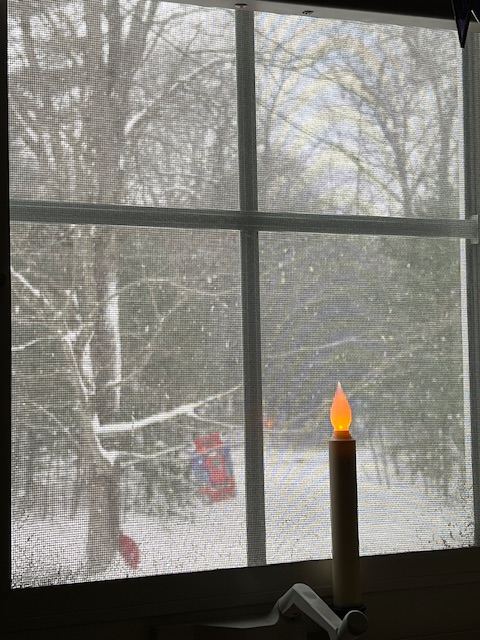
measured 3/8" of snow this morning.
-
I don’t think so, now. Starting to get ice.
-
Big winter for the lakes. The waters are extremely warm.
-
That has been an issue for years. Its really annoying. We need to get back to the winters of coastal storms.
-
35F this morning, been between 34 and 35 since 8pm yesterday. Dense fog. .13" from the event. Only had a little mix of sleet late on 12/4, the rest was rain.
-
Some models hint at some warmth 18-20. I mean what could go wrong here?
-
-
Where are you located?
-

December 2025 Short/Medium Range Forecast Thread
Holston_River_Rambler replied to John1122's topic in Tennessee Valley
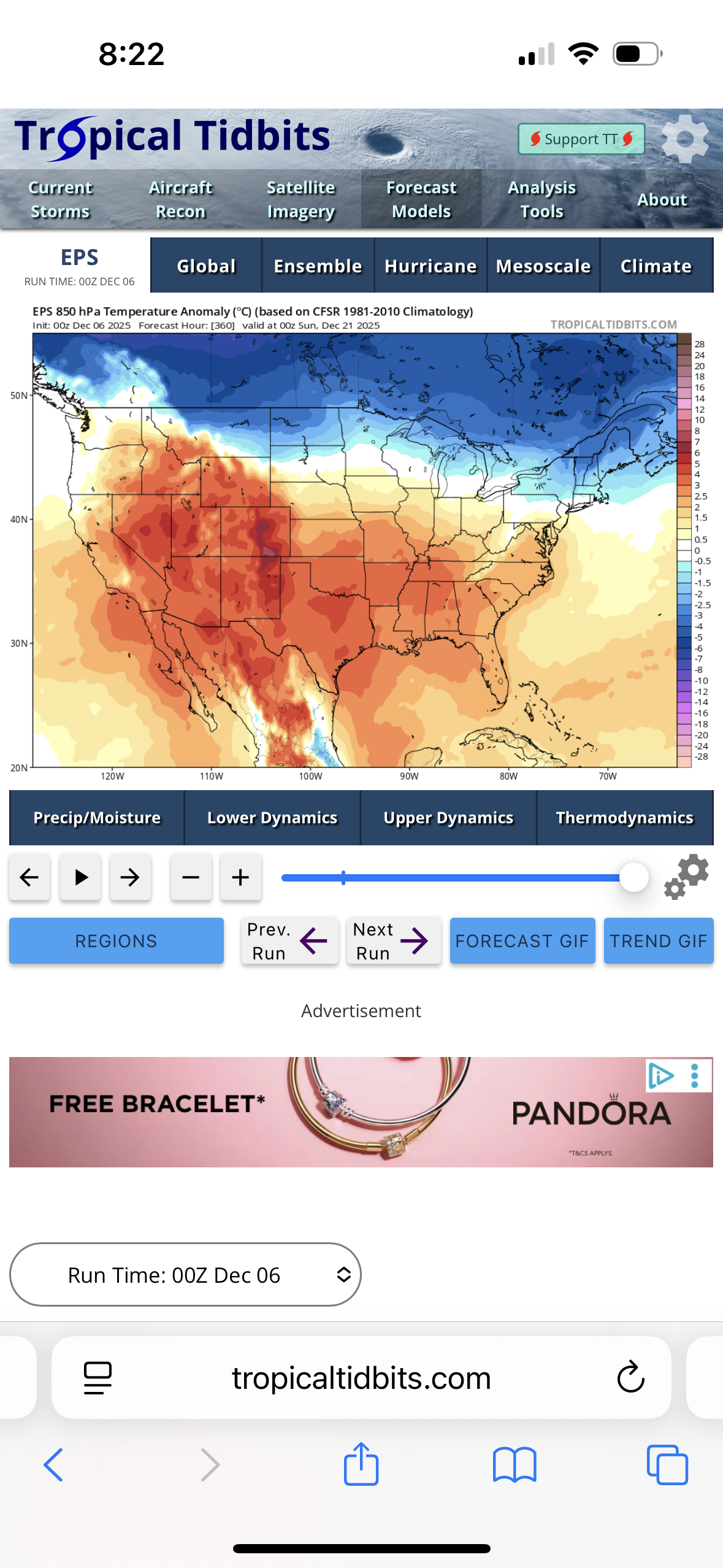
Some ensemble interest on the GEFS for Sunday night into Monday morning: As expected, Euro, not so much: -
Pulses of almost nothing and then bursts of moderate snow for a couple of minutes.
-
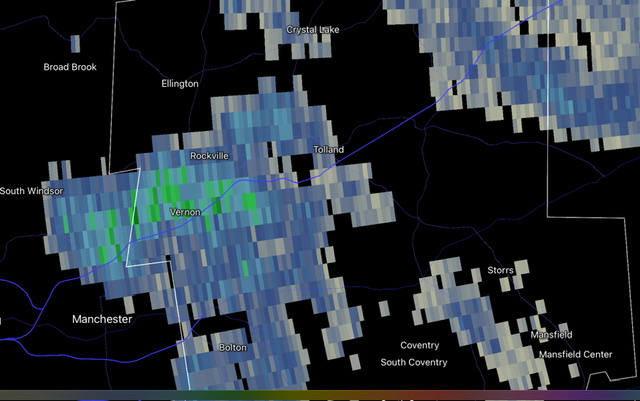
Looks like another band moving into sw CT
-
-
13th definitely has some potential.
-
Yeah it was more of a squall line without wind
-

Richmond Metro/Hampton Roads Area Discussion
WxWatcher007 replied to RIC Airport's topic in Mid Atlantic
Congrats to all that got snow! -
December 2025 Short/Medium Range Forecast Thread
Holston_River_Rambler replied to John1122's topic in Tennessee Valley
Interesting to see the trend for more return flow moisture for the Sunday night into Monday system on the GFS If anything the Euro is getting dryer It still has a little slug of moisture over S Alabama and eastern Georgia, but it doesn't really make it north. To be honest my choice to use 700mb is arbitrary, but is the place I see the biggest difference between the GFS and Euro on relative humidity panels: the 500 mb vort seems slightly more amped on the GFS, but not by much. NAMs and RRFS (thanks John for the heads up about ol Rufus) emphasize a second shortwave connected to the above, dropping in and enhancing upslope without much fanfare for the first shortwave the GFS likes. Here is Rufus and teh second shortwave in all Rufus's pixilated glory. I suspect the GFS is wrong about the first shortwave, since even the NAM in NAMing range isn't too interested, but could be nice for elevation areas in NE TN, SW VA, and especially Western NC if not. I think Carvers pointed out a run of the GFS yesterday that had like 6" in portions of that area. -
Saw this guy hunting rats this morning
-
Been below 40 for about 24 hours here 37 currently. .31” overnight with heavy fog this morning. Brown wet ground . .
-
 Some brief periods of light snow produced a dusting in Larchmont in southern Westchester County.
-
First official car topper of the season. We are so back!! 28F
-

Central PA Fall Discussions and Obs
mahantango#1 replied to ChescoWx's topic in Upstate New York/Pennsylvania
DROUGHT MONITOR (12/04/2025) Minor changes to the latest drought monitor in the Harrisburg area. The majority of the area is still under the "Abnormally Dry" conditions as we continue to remain below average for 2025. IMPORTANT - the Drought Monitor only includes data up to 7 AM Tuesday. The data is reviewed, and the map will be released to the public (and the News 8 Storm Team) on Thursday morning. Any rainfall that occurred after 7 AM on Tuesday (no matter how heavy or light it is) is not included in that respective week's update. We will need to wait until next week's update to include any rainfall after Tuesday morning.