All Activity
- Past hour
-
I went from ACATT to cheering on Mowvember through Thanksgiving. Hope for a couple of big events and a deep winter stretch in late Dec and Jan and then start cheering on sun angle and Morch.
-
One week left and the driest August on record (at DCA) is absolutely in play
-
Maybe the Villages will make a few exceptions for folks
-
………………………………………………. “why winter is even worth it ….…………………………………………… because of …”just hanging out having a great time and seeing the kids just enjoying themselves” …. your same 14 words. Stay well, as always ….
-
winter is exactly the reason why the beach is so much fun in the summer if you could have a summer beach experience any old time, it wouldn't be nearly as much fun
-
It really isn’t anymore . Go into winter with a low expectation and more often than not for the rest of at least my life. That’s how they’ll be . . We’ll all be tracking this winter. But best for most of to expect another bad winter. Especially with that warm Pac pool . That thing is the kiss of death for EC winters.
-
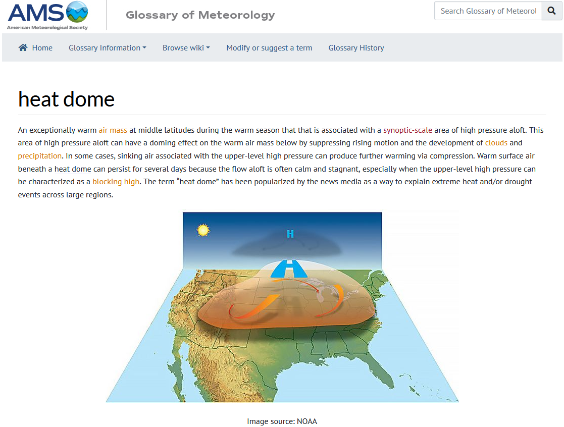
To educate/help the non professional (and I don’t mean not intelligent) descriptive terms like heat dine are preferable to ‘ mid-tropospheric ridges’. When you’re trying to get the public’s attention on heart health would you talk about the potential of getting a ‘widow maker’ or a mycardio infarction. Which one is likely to keep the pedestrian reading? In either case both sides of the equation is equal. it’s actually good to have a person of different opinion in a group as a leavening agent. Providing that all discussions and retorts are civil and not just superficial. For that reason, during a period of time when our sub forum area may face a cold season event I look to read S19’s thought. and forky’s along with, like yourself, other well versed members..if all else fails I just listen to the ballad Turn, Turn, Turn and straighten myself out. Stay well, as always ……
-
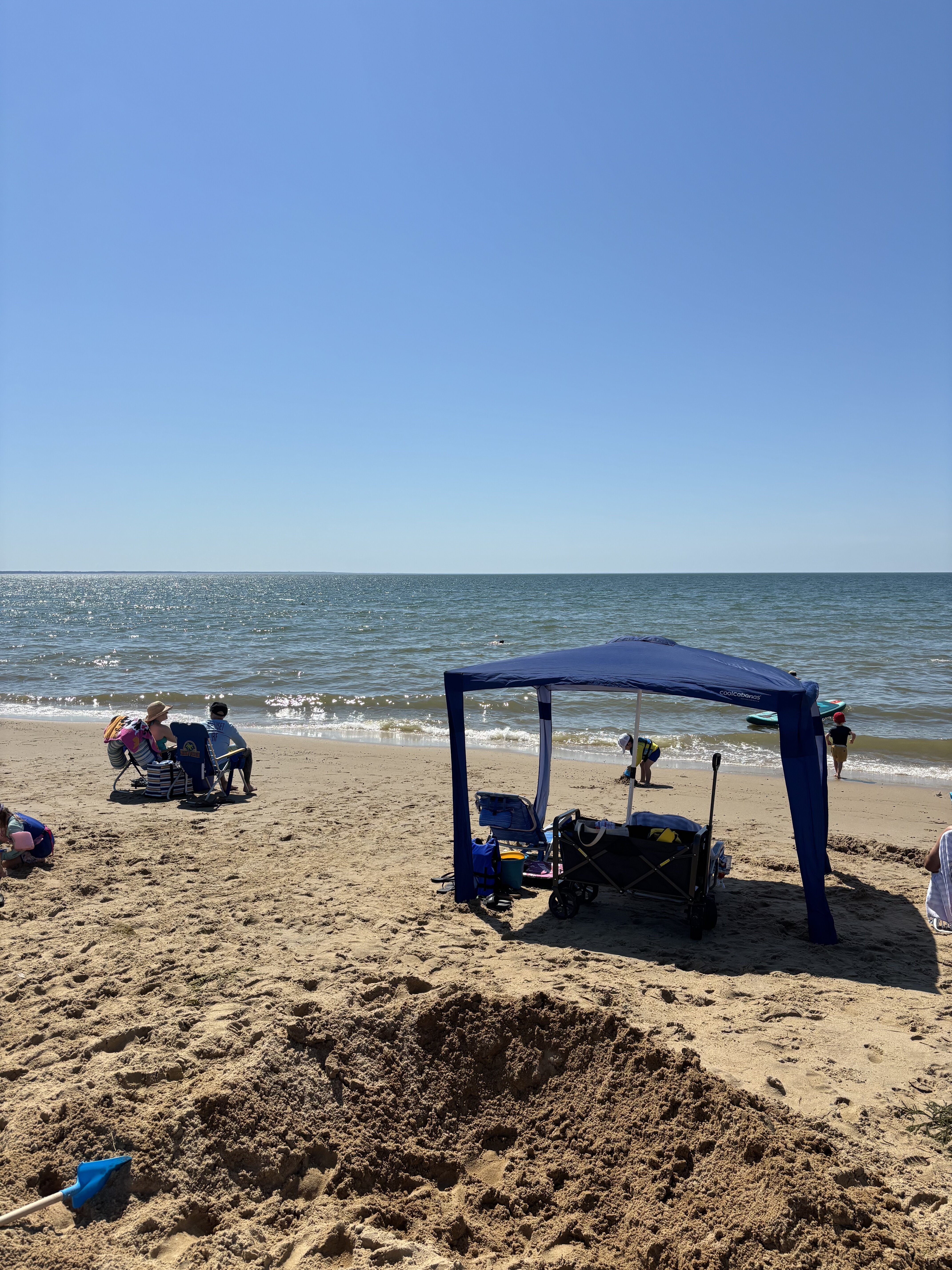
Honest to God. I’m at the beach just hanging out having a great time and seeing the kids just enjoying themselves….makes me wonder why winter is even worth it.
-
 Highs yes and lows will be colder than forecast
 -
Absolute soaking in Albemarle/Charlottesville probably over 1 inch already...
-
I don't know if this has already been posted but this is a great write up to share with others: https://www.weather.gov/media/gyx/DGT/DGT_GYX_08212025.pdf
-
Doesn’t look like it thru Nov
- Today
-
It feels like the front is coming through. The wind suddenly picked up from what feels like the NW and the air feels cooler and drier.
-
Looks like today's storms are going to be very wildly scattered ie a big nothingburger.
-
 Parts of the region could see a shower tonight or early tomorrow as a cold front moves across the region. In the wake of the frontal passage, high temperatures will top out in the lower and perhaps middle 80s tomorrow before the push of cooler air overspreads the region. Following the arrival of the cool air, high temperatures will top out mainly in the upper 70s and lows will fall to lower 60s in New York City through at least Friday. Outside the City, lows in the 50s will be widespread. On account of the cool air, August 2025 will be among the five coolest Augusts since 2000. There will be higher-than-climatological risk of at least one period in September with highs in the upper 80s or perhaps 90s. Summers similar to the current one have had September highs of 90 or above about 10 percentage points above that for all other years. The ENSO Region 1+2 anomaly was +0.6°C and the Region 3.4 anomaly was -0.3°C for the week centered around August 13. For the past six weeks, the ENSO Region 1+2 anomaly has averaged +0.53°C and the ENSO Region 3.4 anomaly has averaged -0.20°C. Neutral ENSO conditions will likely continue into early autumn. The SOI was +15.90 today. The preliminary Arctic Oscillation (AO) was +0.087 today. Based on sensitivity analysis applied to the latest guidance, there is an implied 97% probability that New York City will have a cooler than normal August (1991-2020 normal). August will likely finish with a mean temperature near 74.0° (2.1° below normal). Supplemental Information: The projected mean would be 1.2° below the 1981-2010 normal monthly value.
 -
 Another 86 on the board today. Very dry here so expecting highs to overperform this week
 -

Mid to long range discussion- 2025
WinstonSalemArlington replied to wncsnow's topic in Southeastern States
-
Nah ..I've witnessed plenty of warm and humid stretches through mid Septembers. That bears out in climate, too. We're just in a low amplitude +PNA incoming, one that in my opinion is uncertain as to it's real impact on our temps and DPs. There's a chance we'll end up in a EC paralleling flow regime. Until this arriving trough axis actually gets east of our longitude, "cold" air will attenuate if wait altogether in actually getting E. The ensemble means and operational runs are lowering heights but keeping the trough west of us until late. If add to that to a subtle tendency to also de-amplify troughs when moving their handling through the mid range, it's not hard to see that turning into a Bahama Blue or quasi variant of one as a compromise. If the PNA then resonates and a secondary push takes place ( D way out there...), yeah then it's playing with a gun. There's frost alerts in the Arrow Head of MN... while there is triple digit heat headlines in the PAC NW. That concurrency is an anomaly in an of itself.
-
Must have been auto correct lol. Must have typed wrong, didn’t check, and it autocorrected
-
2 great beach days on the Cape. Don’t end summer.

-
We are in one of our patented streaks where it just cannot rain.
-
Not sure, but I would like to apply for the position.
-

Central & Eastern Pacific Thread
BarryStantonGBP replied to Windspeed's topic in Tropical Headquarters
LMFAOOOOO GOOGLE AI MENTIONED Tropical Depression Ten-E Discussion Number 1 NWS National Hurricane Center Miami FL EP102025 200 PM MST Sun Aug 24 2025 Data from both the ASCAT-B and ASCAT-C scatterometers indicate that the broad area of low pressure located well offshore of the southwestern coast of Mexico now has a well-defined circulation. The deep convection has been forming a rudimentary banding structure over the western semicircle of the circulation. Thus, the system is being designated as Tropical Depression Ten-E at this time. The scatterometer observations indicate that the system is just below tropical storm strength, and the intensity estimate is in good agreement with a Dvorak estimate from TAFB. The initial motion estimate is west-northwestward, or 290/12 kt. A mid-level ridge is expected to remain to the northeast of the tropical cyclone during the next few days. This steering pattern should cause a west-northwestward to northwestward track for most of the forecast period. In 4-5 days, the weakening cyclone is expected turn more westward in the low-level flow. The official track forecast lies between the NOAA corrected consensus, HCCA, model and the Google Deep Mind, GDMI, predictions. The cyclone is currently over warm waters within moderate northeasterly vertical wind shear. Although the shear is predicted to lessen over the next couple of days, gradually cooling ocean waters should partially offset the more conducive wind environment. Therefore, only modest strengthening is forecast, and the NHC prediction is roughly in the middle of the model guidance. Around the end of the forecast period, significantly lower SSTs are likely to reduce the system to a remnant low. FORECAST POSITIONS AND MAX WINDS INIT 24/2100Z 16.0N 109.7W 30 KT 35 MPH 12H 25/0600Z 16.7N 111.4W 35 KT 40 MPH 24H 25/1800Z 17.7N 113.5W 40 KT 45 MPH 36H 26/0600Z 18.7N 115.5W 45 KT 50 MPH 48H 26/1800Z 19.7N 117.3W 45 KT 50 MPH 60H 27/0600Z 21.0N 118.8W 45 KT 50 MPH 72H 27/1800Z 22.4N 120.0W 40 KT 45 MPH 96H 28/1800Z 24.5N 121.5W 30 KT 35 MPH 120H 29/1800Z 25.0N 122.5W 25 KT 30 MPH...POST-TROP/REMNT LOW $$ Forecaster Pasch -
Occasional Thoughts on Climate Change
donsutherland1 replied to donsutherland1's topic in Climate Change
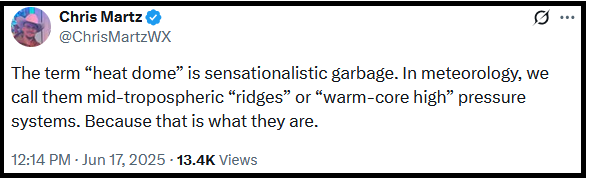
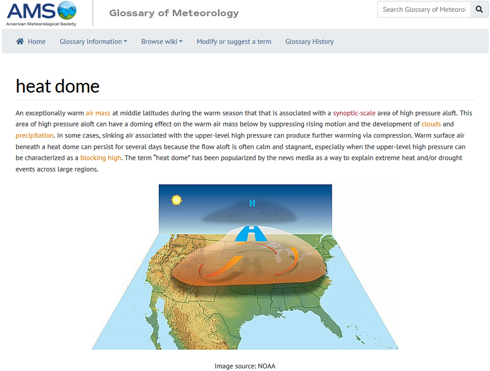
The Reality: "Heat Dome" is a standard term in the AMS Glossary of Meteorology Now, on a more serious note: I suspect that X-post by X-post, one sees the reason he is working out-of-field as a policy analyst for an interest group (not a scientific organization), neither as an operational nor research meteorologist. To work in a profession like meteorology, one can't impose one's personal opinions or preferences on what is a scientific field. One has to apply the evidence, theories, and principles of that field (even if one personally disagrees), until or unless one comes up with a credible, evidence-based alternative that is better than the understanding it would replace. In operational meteorology, it is imperative that meteorologists today be able to explain the climate link for extreme events e.g., how climate change has made extreme precipitation events more frequent and/or more intense, especially on TV or radio. Trashing attribution science to avoid recognizing climate-weather links one personally rejects or treating the evolution of climate as nothing more than an abstract statistic, is disqualifying. In the research area, one must be objective in all areas ranging from framing research questions to interpreting the evidence. Finally, his criticism directed against meteorologists, along with high-profile climate scientists, on X has likely shut doors to professional opportunity at the NWS and large private firms such as AccuWeather. Meteorologists, like most other professionals, work closely together. Someone who would undermine team chemistry would be a problem for the entire team's performance. His social media history can easily be reviewed through Glassdoor, among other social media-scraping applications. Employers won't seriously consider hiring someone who might not fit within an organization's culture, chemistry, and structures. Employers understand the importance of culture, chemistry, and structure to high performance, and the importance of high performance to their organizations' success. They won't knowingly compromise these attributes in their hiring process. Technology has made due diligence far more robust and cost-effective than it once was. Organizations won't gamble with the sources of their success, as they would have too much to lose.
-
DP up to 71.