All Activity
- Past hour
-

Strong Nor'Easter/Hybrid Storm Late September 2026
Brian5671 replied to Rjay's topic in New York City Metro
might the start of a string of nor easters with the nino -

Septorcher 2026 Discussion - Endless Summer
tamarack replied to Damage In Tolland's topic in New England
Yesterday's frost toasted all of the cucurbits, only minor damage to peppers and tomatoes. They're a bit higher, especially the 'maters. Quite the run of sun here, though it ends later today. September here has had the most proportion of available sunshine of any month, slightly more than August. (November and December jockey for least, with the latter currently 'winning'.) -
Strong Nor'Easter/Hybrid Storm Late September 2026
EastonSN+ replied to Rjay's topic in New York City Metro
I still like the February blizzard. -
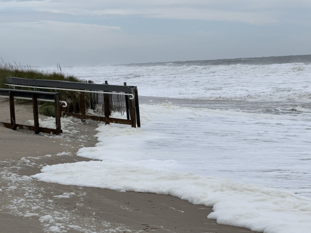
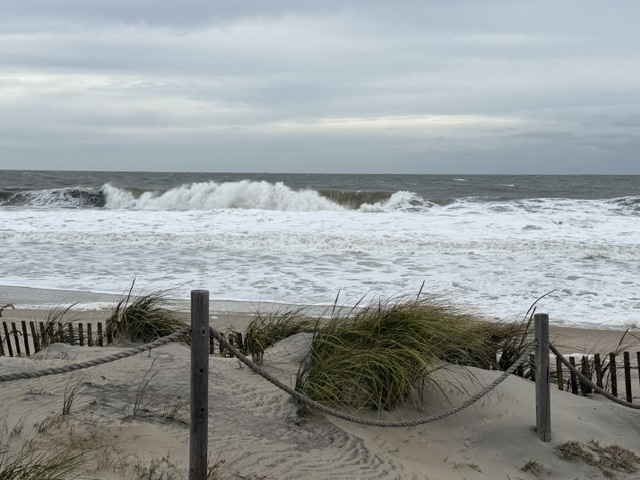
Not too bad presently. It doesn’t feel as windy as yesterday. The last high tide got into the dunes but didn’t damage them.
-
 canadian pharmacies online: best rated canadian pharmacy - best canadian online pharmacy
 -

Strong Nor'Easter/Hybrid Storm Late September 2026
MJO812 replied to Rjay's topic in New York City Metro
This is the most exciting storm in the Atlantic this year. -

Strong Nor'Easter/Hybrid Storm Late September 2026
wthrmn654 replied to Rjay's topic in New York City Metro
Tides are flying up today! At 854 approaching action stage with highest tide all week so far! High tide isn't too 945 am... minor flooding pretty certain this morning.. Very very concerning -
Greensboro got down to 49, Winston-Salem 47. I always think fall is off to a good start when we get below 50 in September.
-

Strong Nor'Easter/Hybrid Storm Late September 2026
Rmine1 replied to Rjay's topic in New York City Metro
According to Uptons point and click, it’s going to be “breezy” for the island. I’m running to Dicks to get a kite -

October Comes Early: Late September Multi-Hazard Hybrid Storm
Typhoon Tip replied to WxWatcher007's topic in New England
It's almost like a TUTT on steroids in some ways. -

October Comes Early: Late September Multi-Hazard Hybrid Storm
qg_omega replied to WxWatcher007's topic in New England
nothing tropical on that look -
 No kidding
 -
buy medicine online in india: online pharma - drugstore online
-
-
Polo might be making another run at sub 900 mb. This satellite presentation speaks for itself with intense lightning data around the eyewall.
-
Rehoboth Beach Cam https://www.visitdebeaches.com/webcams/live-boardwalk-cam-atlantic-sands-hotel-in-rehoboth-beach/
-

Strong Nor'Easter/Hybrid Storm Late September 2026
GaWx replied to Rjay's topic in New York City Metro
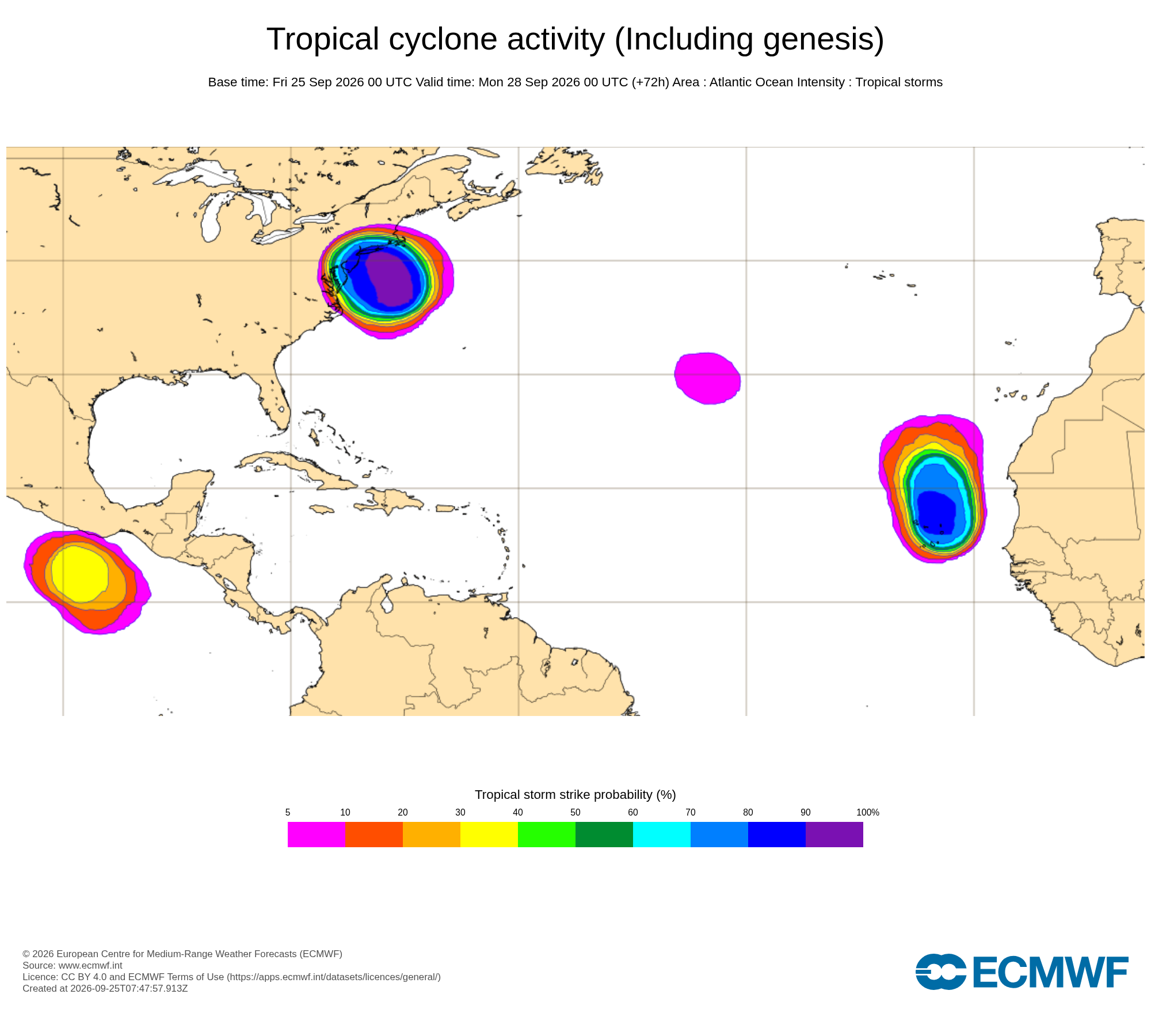
The 0Z Euro ens increased the chance of “tropical cyclone activity” off the Mid-Atlantic coast during the weekend to its highest yet of any run and the highest possible, >90%! Yesterday it wasn’t as high for the weekend as it was peaking at ~80%.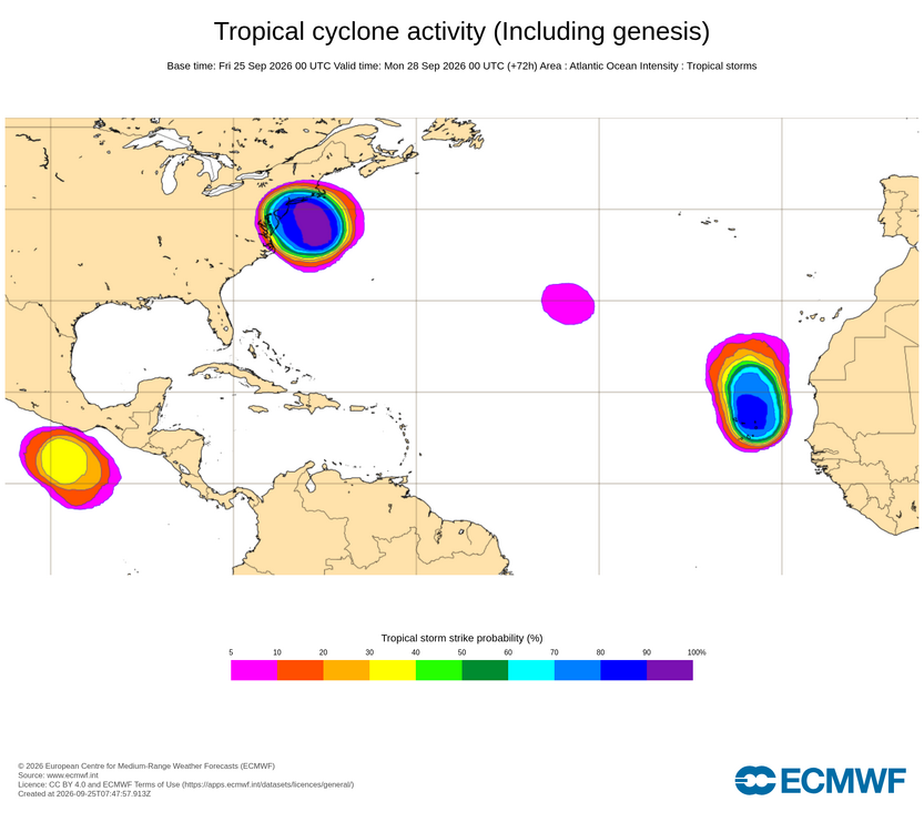
-

October Comes Early: Late September Multi-Hazard Hybrid Storm
Ginx snewx replied to WxWatcher007's topic in New England
^^^'Cept model guidance has gotten stronger -

Strong Nor'Easter/Hybrid Storm Late September 2026
TriPol replied to Rjay's topic in New York City Metro
There's no reason why Long Island shouldn't be under these. -

Strong Nor'Easter/Hybrid Storm Late September 2026
kat5hurricane replied to Rjay's topic in New York City Metro
That guy has been trolling these forums for years. I don't know why anybody engages him. -
Tampa is desperate to avoid 0-3, so I wouldn’t be shocked if we tripped up this week, but hopefully Murray shows something.
-
Walking down to the ocean now in Rehoboth to check out conditions as the tide comes in.
-
OC report: it’s cloudy, breezy, wind advisory for tonight. No rain at least!
-

Strong Nor'Easter/Hybrid Storm Late September 2026
jconsor replied to Rjay's topic in New York City Metro
All of the NJ coast up to Monmouth County (e.g. NWS Mount Holly's territory) is under a High Wind warning: https://forecast.weather.gov/wwamap/wwatxtget.php?cwa=PHI&wwa=high wind warning -
October Comes Early: Late September Multi-Hazard Hybrid Storm
Typhoon Tip replied to WxWatcher007's topic in New England
By small amounts ...some more coherent than others, the guidance were too deep/structurally evolved for what is observed at 12z May or may not be indicative of much. We'll see. We may be disappointed in Now-cast ranges. I'm not completely sold on how far above pedestrian inclemency this will be. I think the lunar tides and surface feed-back should be fun either way. Op ed that no one asked for but ... my original impression of this scenario from 2 or 3 days back was that it was dubiously too amplified in the guidance. Two main reasons for suspecting so ... 1, the total S/W wave mechanics feeding into the region were very weak. As far as I can tell that still seems to be the case. At the time this was a bit of a head scratch as to what was driving this ordeal. The best I could surmise was that this was a very (if perhaps unusually so) non-linear in origin. The circulation mode from the eastern Pac across N/A is technically is in a strong, albeit transient, negative PNAP. The polar branch retreated N very quickly, earlier in the week - so fast it left a weakness pearled out from the S Lake through the mid Atlantic.. Similar to a "pinch cut-off" you see in April climo - but it is doing it amid a higher ambient height medium. You realize, the hydrostats are in the mid 560s during this - we've been close to 90 F at the surface with 566 dm thickness before! Yet, it's so raw.. It's bizarre, maybe some tized aspects going on... Anyway, a ridge from James Bay clear to Florida would be geophysically hard to maintain, particularly when the flow around it is not that strong. So the heights inside 'implode' ... My feel on that is that the models were over assessing this ambient, large scaled mass balancing response, as a total forcer. 2, the other reason is much simpler ... guidance et al tend to shed amplitude as they move events from the extended toward the short lead periods. It's really quite a dependable corrective behavior. It's never been abundantly clear why they do this, but I suspect it has something to do with not yet seeing the emergence of noise/offsets/and interferences that will inexorably arise - they only see the system with the most prominent physical signature out in time. If, then, the prominence is the only thing there is, they are maximizing it. Something like this...