All Activity
- Past hour
-
000 CXUS51 KILN 010531 CF6DAY PRELIMINARY LOCAL CLIMATOLOGICAL DATA (WS FORM: F-6) STATION: DAYTON OH MONTH: OCTOBER YEAR: 2026 LATITUDE: 39 54 N LONGITUDE: 84 12 W TEMPERATURE IN F: :PCPN: SNOW: WIND :SUNSHINE: SKY :PK WND ================================================================================ 1 2 3 4 5 6A 6B 7 8 9 10 11 12 13 14 15 16 17 18 12Z AVG MX 2MIN DY MAX MIN AVG DEP HDD CDD WTR SNW DPTH SPD SPD DIR MIN PSBL S-S WX SPD DR ================================================================================ 1 85 65 75 13 0 10 0.00 0.0 0 12.1 21 230 M M 6 28 240 2 75 51 63 1 2 0 0.61 0.0 0 10.4 17 20 M M 9 1 24 210 3 68 46 57 -4 8 0 0.00 0.0 0 7.2 17 70 M M 2 24 100 4 75 46 61 0 4 0 0.00 0.0 0 3.9 12 330 M M 4 19 300 5 68 46 57 -3 8 0 0.00 0.0 0 7.0 18 40 M M 0 26 30 6 69 43 56 -4 9 0 0.00 0.0 0 4.1 13 150 M M 0 17 170 7 78 49 64 4 1 0 0.00 0.0 0 11.0 23 230 M M 1 29 240 8 75 52 64 5 1 0 0.00 0.0 0 6.4 21 300 M M 1 27 330 9 75 48 62 3 3 0 0.00 0.0 0 5.8 12 160 M M 4 16 110 10 68 54 61 3 4 0 0.04 0.0 0 8.9 17 140 M M 9 1 24 110 11 63 58 61 3 4 0 0.02 0.0 0 7.5 16 110 M M 10 1 21 120 12 79 56 68 10 0 3 0.00 0.0 0 8.2 15 220 M M 7 12 20 200 13 87 66 77 20 0 12 T 0.0 0 11.7 21 240 M M 4 27 240 14 84 62 73 16 0 8 0.24 0.0 0 9.7 16 230 M M 7 18 21 300 15 72 58 65 9 0 0 0.13 0.0 0 8.9 22 240 M M 10 1 29 230 16 71 48 60 4 5 0 0.35 0.0 0 14.6 25 290 M M 10 1 38 290 17 54 38 46 -10 19 0 0.00 0.0 0 8.2 21 10 M M 3 29 360 18 64 35 50 -5 15 0 0.00 0.0 0 5.4 12 160 M M 0 20 130 19 68 38 53 -2 12 0 0.00 0.0 0 1.4 8 170 M M 0 12 140 20 70 39 55 1 10 0 0.00 0.0 0 3.3 9 60 M M 1 11 60 21 69 39 54 0 11 0 0.00 0.0 0 3.8 14 360 M M 0 1 17 360 22 69 42 56 2 9 0 0.00 0.0 0 4.3 13 10 M M 0 16 30 23 68 42 55 2 10 0 0.00 0.0 0 3.3 12 80 M M 1 1 17 80 24 69 43 56 3 9 0 0.00 0.0 0 4.0 9 100 M M 2 18 12 130 25 69 43 56 4 9 0 0.00 0.0 0 2.3 9 160 M M 2 10 150 26 72 45 59 7 6 0 0.00 0.0 0 2.6 8 250 M M 5 11 280 27 71 46 59 7 6 0 0.00 0.0 0 3.5 9 150 M M 6 12 150 28 74 51 63 12 2 0 0.00 0.0 0 3.9 10 220 M M 3 17 230 29 76 52 64 13 1 0 0.00 0.0 0 9.2 22 250 M M 4 28 250 30 68 46 57 7 8 0 0.00 0.0 0 7.3 15 350 M M 4 19 350 31 63 48 56 6 9 0 0.00 0.0 0 9.6 16 100 M M 9 21 110 ================================================================================ SM 2216 1495 185 33 1.39 0.0 209.5 M 124 ================================================================================ AV 71.5 48.2 6.8 FASTST M M 4 MAX(MPH) MISC ----> 25 290 38 290 ================================================================================ NOTES: # LAST OF SEVERAL OCCURRENCES COLUMN 17 PEAK WIND IN M.P.H. PRELIMINARY LOCAL CLIMATOLOGICAL DATA (WS FORM: F-6) , PAGE 2 STATION: DAYTON OH MONTH: OCTOBER YEAR: 2026 LATITUDE: 39 54 N LONGITUDE: 84 12 W [TEMPERATURE DATA] [PRECIPITATION DATA] SYMBOLS USED IN COLUMN 16 AVERAGE MONTHLY: 59.9 TOTAL FOR MONTH: 1.39 1 = FOG OR MIST DPTR FM NORMAL: 3.9 DPTR FM NORMAL: -1.56 2 = FOG REDUCING VISIBILITY HIGHEST: 87 ON 13 GRTST 24HR 0.61 ON 2- 2 TO 1/4 MILE OR LESS LOWEST: 35 ON 18 3 = THUNDER SNOW, ICE PELLETS, HAIL 4 = ICE PELLETS TOTAL MONTH: 0.0 INCH 5 = HAIL GRTST 24HR 0.0 6 = FREEZING RAIN OR DRIZZLE GRTST DEPTH: 0 7 = DUSTSTORM OR SANDSTORM: VSBY 1/2 MILE OR LESS 8 = SMOKE OR HAZE [NO. OF DAYS WITH] [WEATHER - DAYS WITH] 9 = BLOWING SNOW X = TORNADO MAX 32 OR BELOW: 0 0.01 INCH OR MORE: 6 MAX 90 OR ABOVE: 0 0.10 INCH OR MORE: 4 MIN 32 OR BELOW: 0 0.50 INCH OR MORE: 1 MIN 0 OR BELOW: 0 1.00 INCH OR MORE: 0 [HDD (BASE 65) ] TOTAL THIS MO. 185 CLEAR (SCALE 0-3) 14 DPTR FM NORMAL -115 PTCLDY (SCALE 4-7) 11 TOTAL FM JUL 1 229 CLOUDY (SCALE 8-10) 6 DPTR FM NORMAL -132 [CDD (BASE 65) ] TOTAL THIS MO. 33 DPTR FM NORMAL 10 [PRESSURE DATA] TOTAL FM JAN 1 1165 HIGHEST SLP M ON M DPTR FM NORMAL 13 LOWEST SLP 29.31 ON 31 [REMARKS] #FINAL-10-26# 10th warmest October on record
-
72 here. Feels absolutely incredible after finishing up the first round of bone dry leaves. Hopefully a sign of things to come this winter!
-

2026-2027 Record-breaking El Nino
Tallis Rockwell replied to Stormchaserchuck1's topic in Weather Forecasting and Discussion
God I hope it'll come, -
What a summer

-
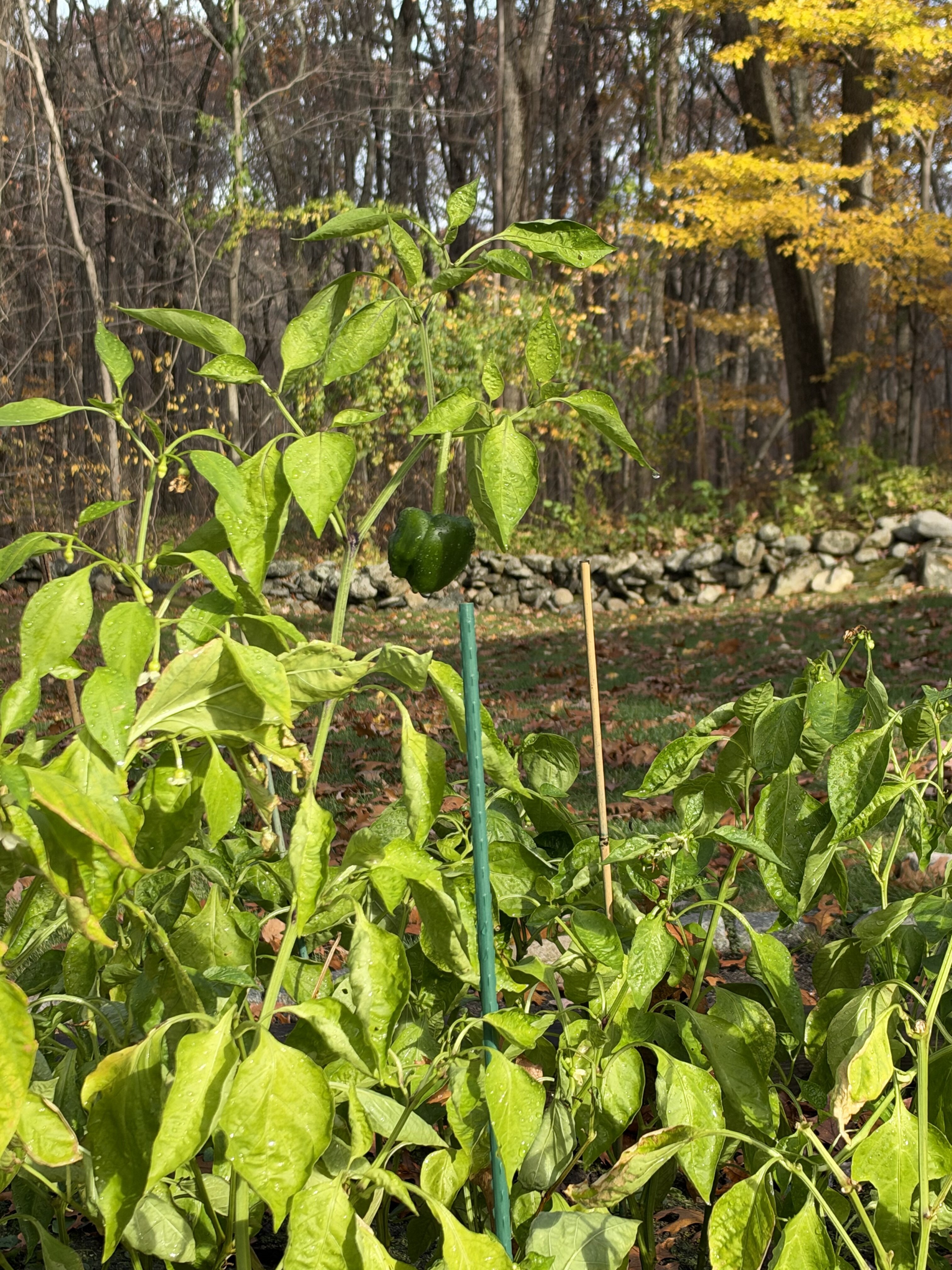
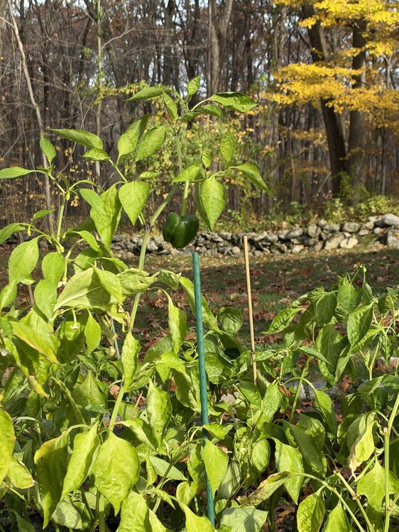
Man… was just out watering the garden and picking peppers.. bees and wasps flying all over the place .
-
Nyc might get more snow than parts of New England when winter is over.
-
El nino is weakening by then Get ready
-

2026-2027 Record-breaking El Nino
GaWx replied to Stormchaserchuck1's topic in Weather Forecasting and Discussion
The wetness in Houston and other S areas in a very strong El Niño typically doesn’t get going reliably til sometime in November. -
Good to see you guys are getting decent precip over the past few days. Up here, I have been screwed with only .02" since Sunday.
-
 kristia changed their profile photo
-
Agreed. I get a feeling it’s going to be one of those year’s with a sudden hard flip too. We did that during the last decent Nino (2018) and it paid dividends. I was wet wading for trout into early Nov and shoveling over a foot just a month later.
-
Much colder times overall however
-
 http://botica24.com/# legit mexican online pharmacy
-
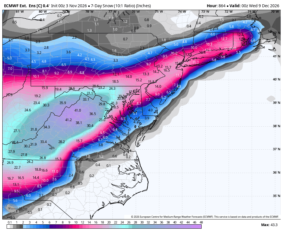
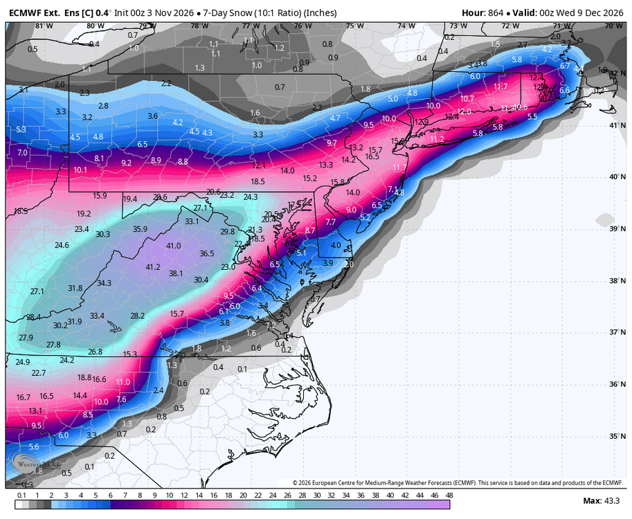
WB latest Euro weekly control....December will be rocking!
-
Looks like it going to be a very late first freeze for most of us.
- Today
-
0.11" here so far. Looking forward to some tor action this evening.
-
yeah, my early question was answered... 72 here. wow. DP's 49 ...not warm exactly but one can still sense a difference, seeing as it's been parchy as of late. I'm curious - btw - what the the GISS layout looks like for October due out here in another week. According to myth, legend ...and well, fact, October came in the warmest October, globally, that has ever occurred since it was determined that CC is an exaggerated hoax in a massive conspiracy ...while at the same time, apparently being actually true. interesting, and wow again... But of particular interest, we have something like 12 of the last 15 days with frost here.. I'm wondering if that meandering 'cooler relative to the whole' region that keeps showing up between Greenland and Indiana might have been situated over New England, because it definitely did come off as a very warm month here. Speculation -
-

2026-2027 Record-breaking El Nino
chris21 replied to Stormchaserchuck1's topic in Weather Forecasting and Discussion
There will be a lot of snow also in the higher elevations of the SE above 3500 feet. It snows in September here, we don’t need arctic air. . -

Mountain West Discussion
mayjawintastawm replied to mayjawintastawm's topic in Central/Western States
0.43" the last 3 days, almost as much as all of October. Keep it going! (but not in SW Colorado) -
makes sense then since I'm east. morning news said Friday would be a washout. guess that continues the seasonal trend of east of 95 getting the goods....
-
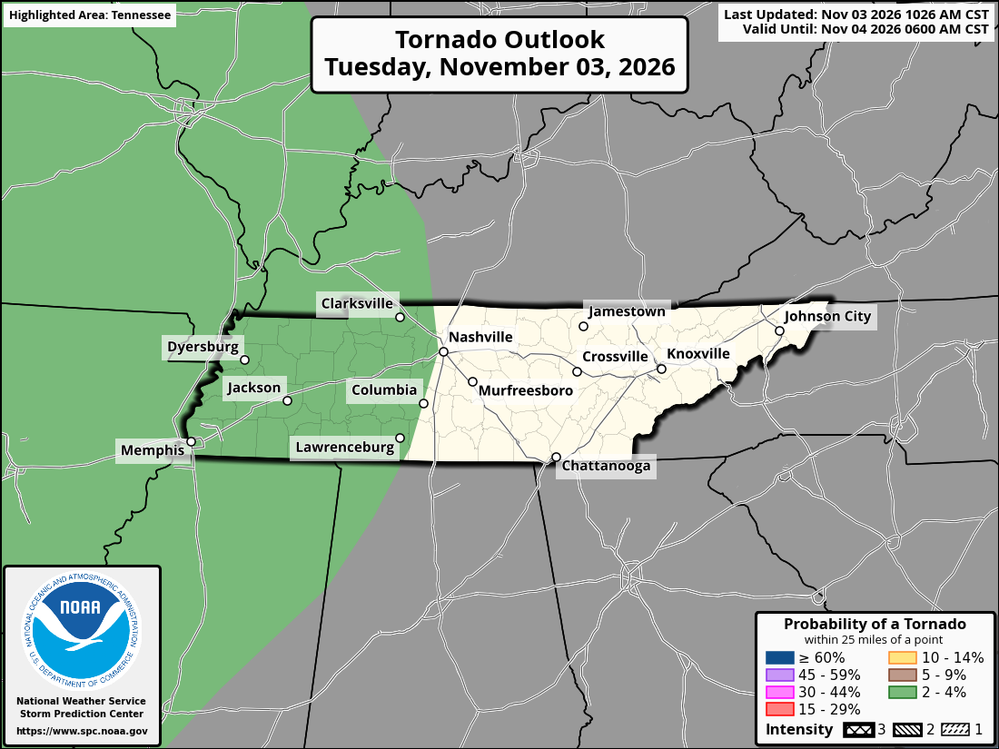
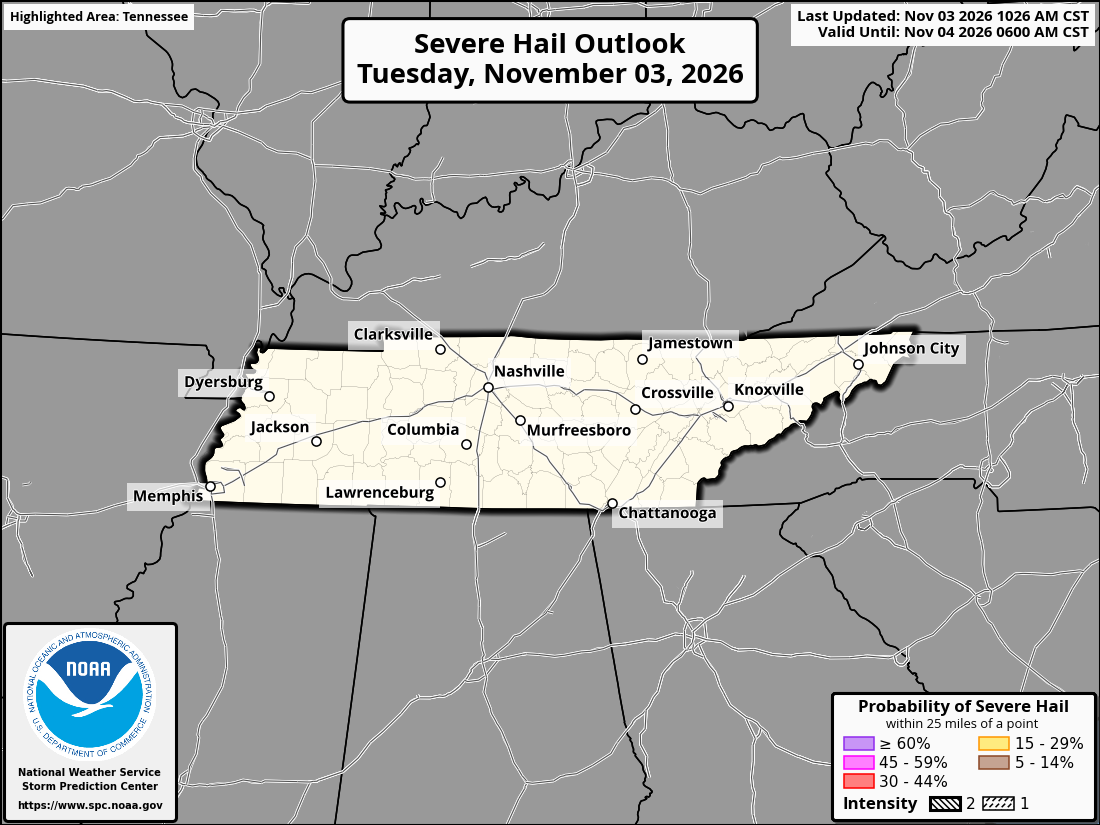
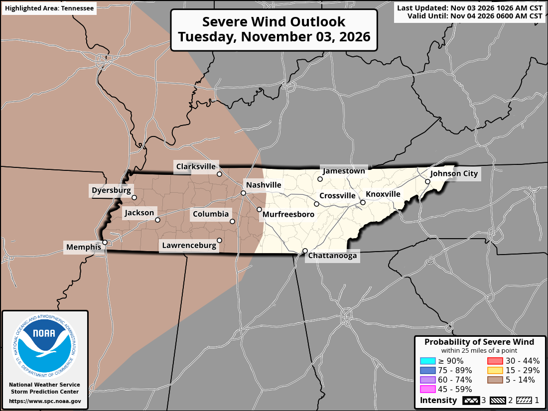
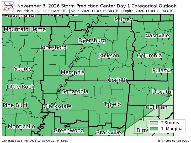
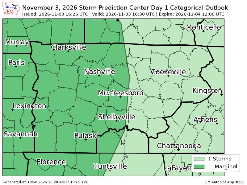
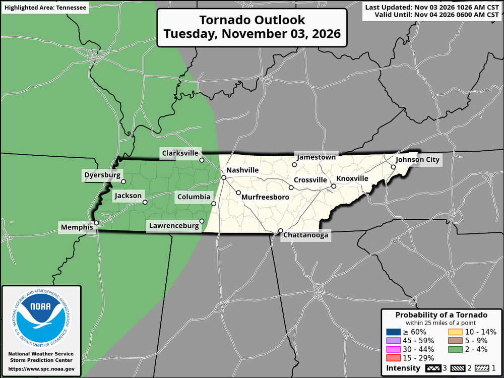
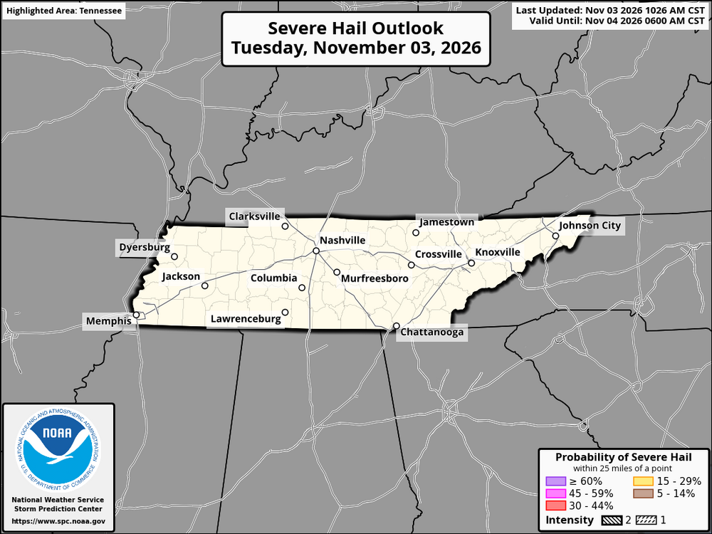
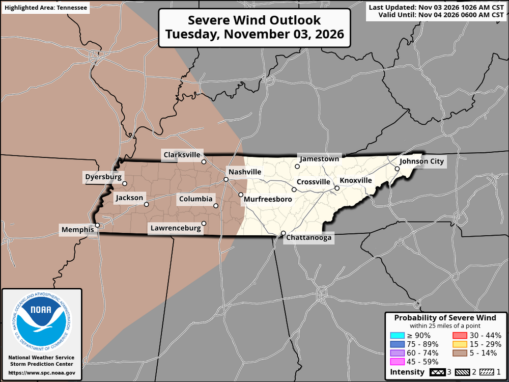
SPC has day 1 marginal risk out primarily for 5% damaging winds and 2% tornado for all of west tn and western portion of middle tn up to and along i65 corridor
-

2026-2027 Record-breaking El Nino
MJO812 replied to Stormchaserchuck1's topic in Weather Forecasting and Discussion
Patience -
2026-2027 Record-breaking El Nino
Tallis Rockwell replied to Stormchaserchuck1's topic in Weather Forecasting and Discussion
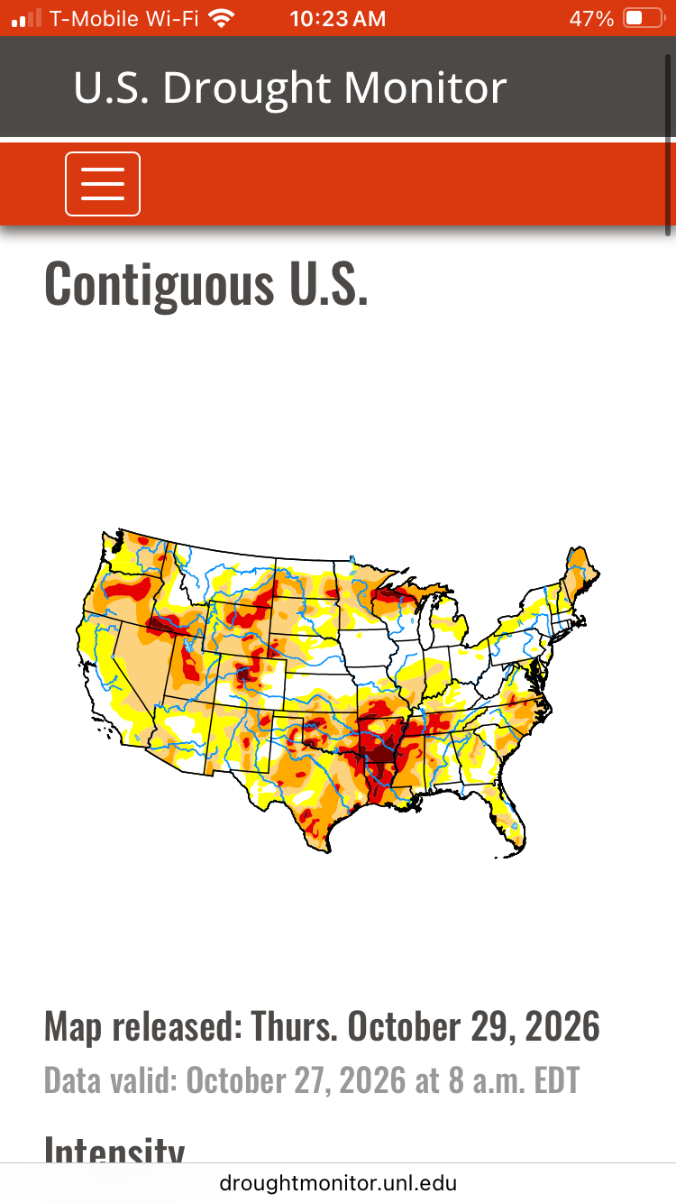
What A FUCKING RIPOFF. Despite being a super hyper-awesome El Nino, we're in a ever-expanding drought. Models keep delaying the "sure to come" El Nino climatology in perpetuity. It's gonna be in September! No October! JK November! Nah it's actually gonna be December! Screw off -
Depeands where you live. Better chance 95 east. Not much west of there.
-
2026-2027 Record-breaking El Nino
GaWx replied to Stormchaserchuck1's topic in Weather Forecasting and Discussion
He should open Ruthless Chris Steak House.