All Activity
- Past hour
-
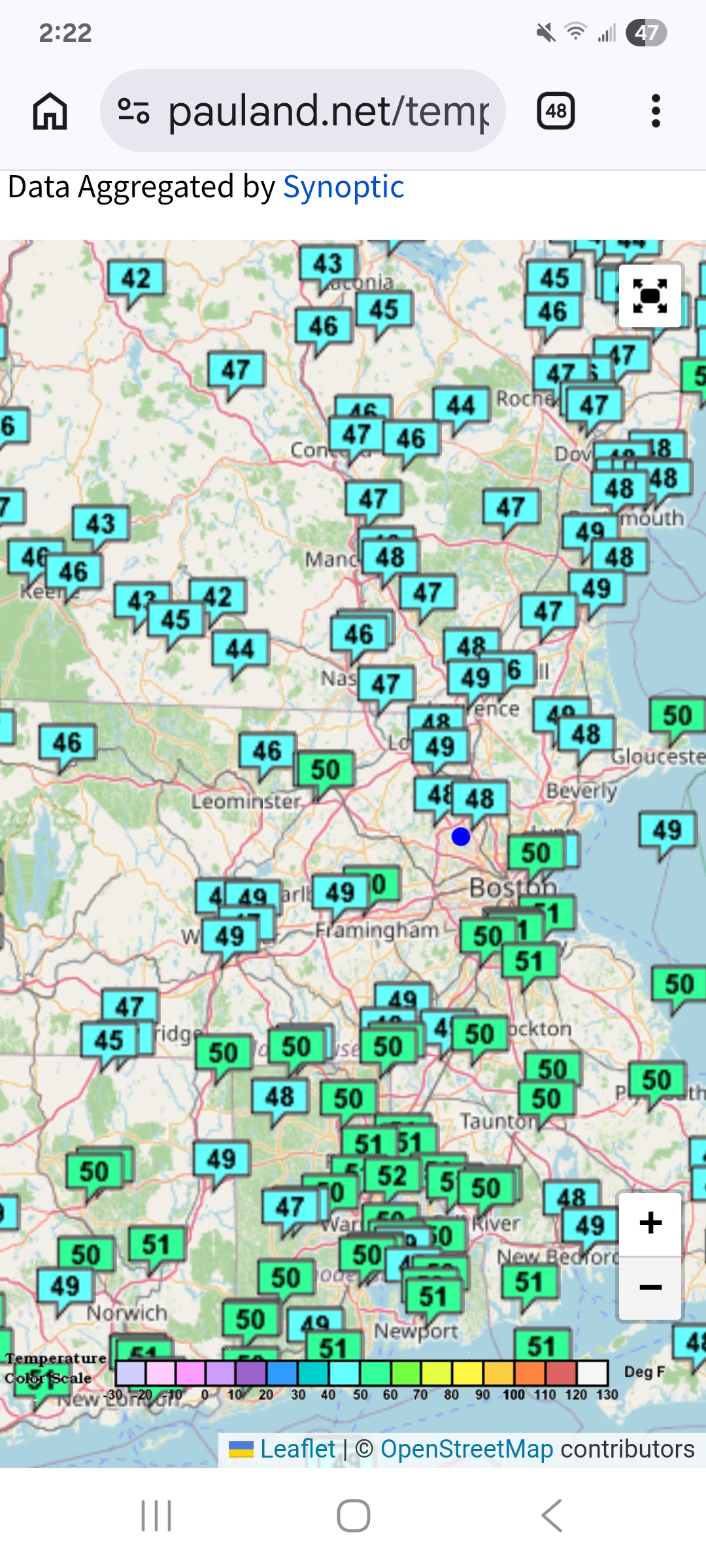
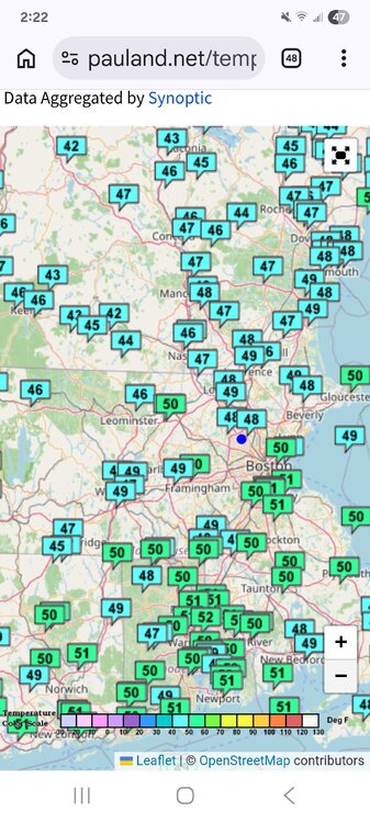
Cold enough. 40s all day here feels like November.
-
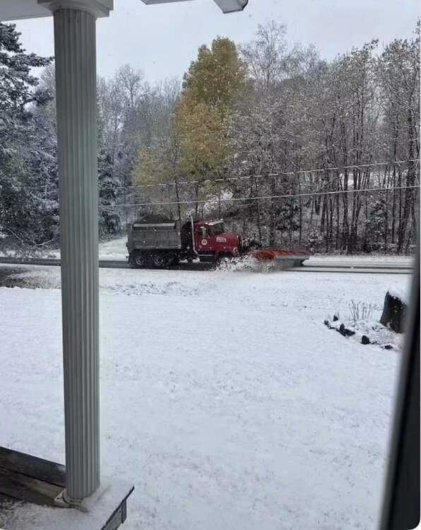
They were plowing up in the county yesterday.
-
 Again, they are so very lucky. Champi continues to intensify. Also, note the very intense meso in the northern eyewall at the end of this animation with the bright purple reflectivity. Amazing...
 -
Pumpkin Picking right now with my son and wife in Freehold NJ 50 degrees
-
2015-2016 last Super El Nino... run it back?
-
youre damn straight. theres been absolutely nothing to see here thus far this fall. absolutely nothing like 2015 thus far
-
No doubt Champi is very intense at the moment. In the above radar, you can see the intense mesos rotating within the eye. The IR tells the rest below. Guam is so incredibly lucky this isn't barrelling due west at just a few ticks higher latitude.
-

2026-2027 Record-breaking El Nino
bluewave replied to Stormchaserchuck1's topic in Weather Forecasting and Discussion
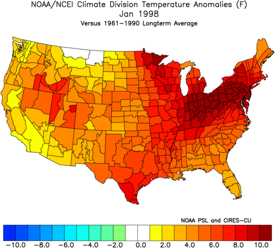
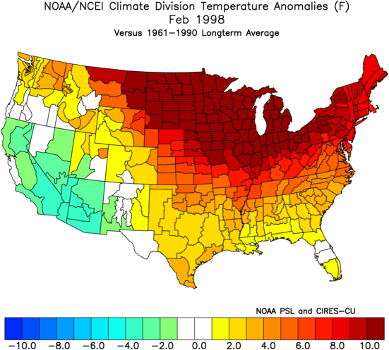
December 1997 started out record warm across the Northern Tier. But it took until January and February for the record warmth to build east. Every super El Niño has a slightly different fingerprint. So the months which have the absolute warmest overall departures can vary a bit among events. Even that winter back in the much cooler 1990s was able to string together three +10 months at various locations. December to March 2015-2016 had two +10 months. December to February 2023-2024 also had two. None of the seasonal models prior to those winters indicated such extreme warmth would occur. As they tend to greatly underestimate the actual warmth with super El Niño events.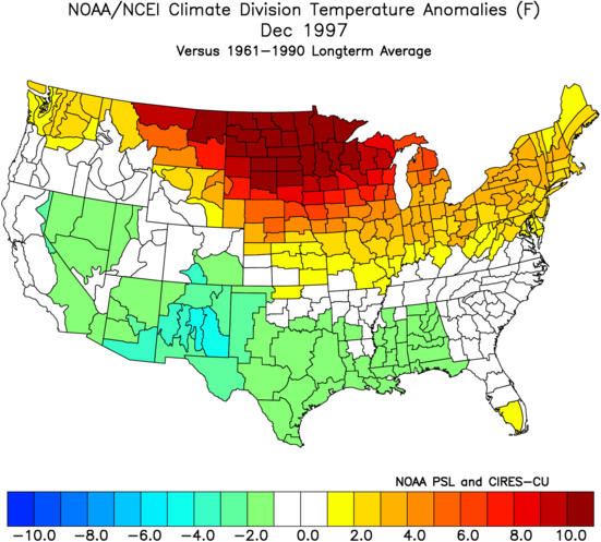
-
Signal for winter maybe?
-
Guam may come out of this very lucky. It looks as if the northern eyewall may only just graze or even miss the southern shoreline. The inner core winds will remain entirely offshore.
-
 https://indigetrx.com/# indian pharmacy online lowest price
 -
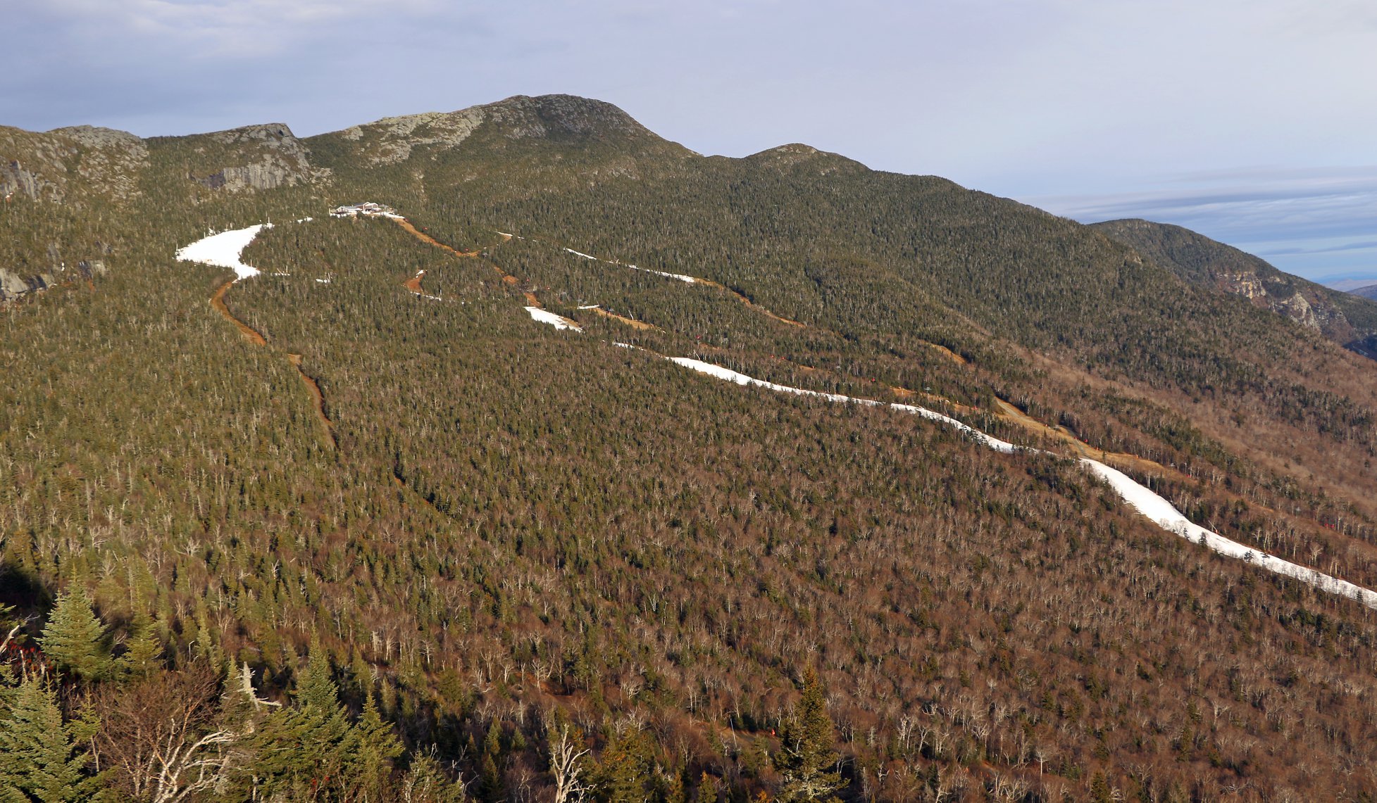
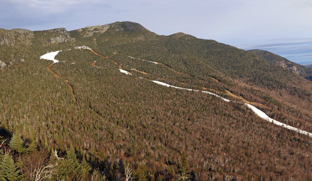
Bizarre. I expected to wake up to an inch or two on mansfield and jay peak, whatwith the NW flow.
-
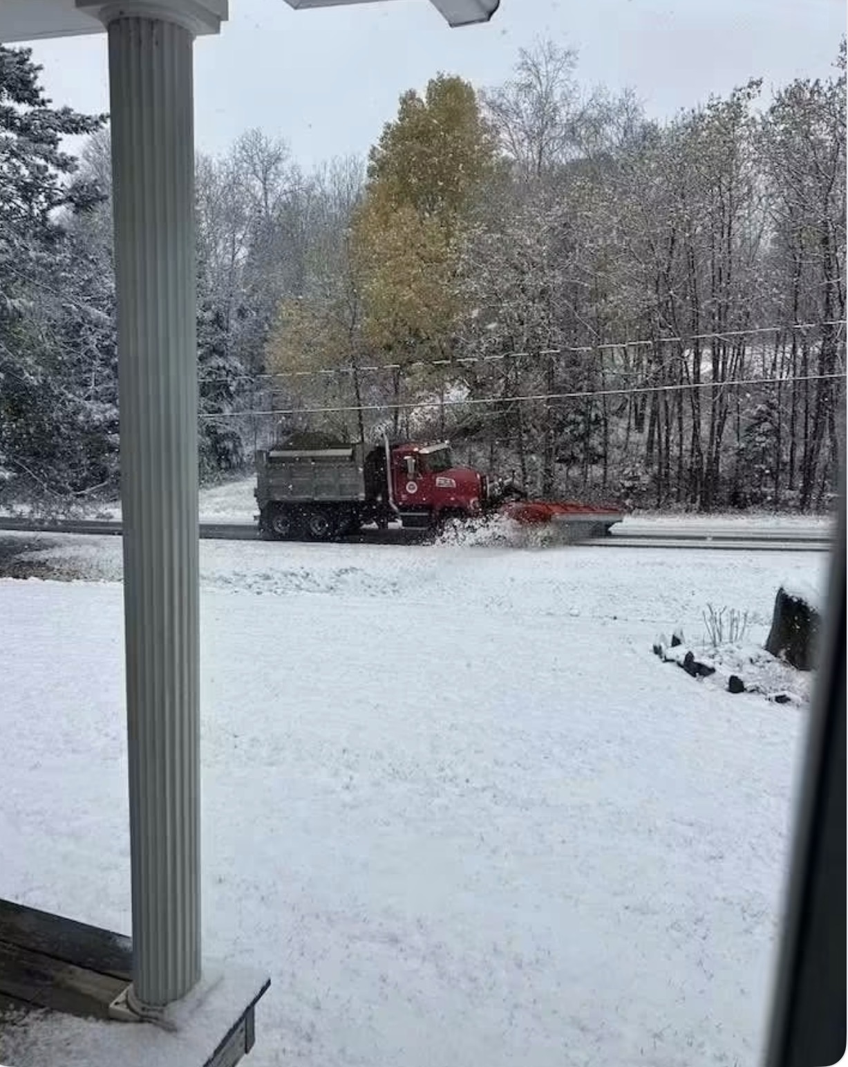
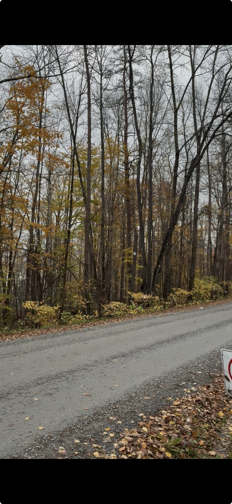
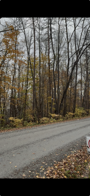
Several rounds of snow showers this morning. Was chilly out. Not sure if you can see the flakes on this grab from a short video I took.
-
I see what you did, the nothing to see here narrative .
-
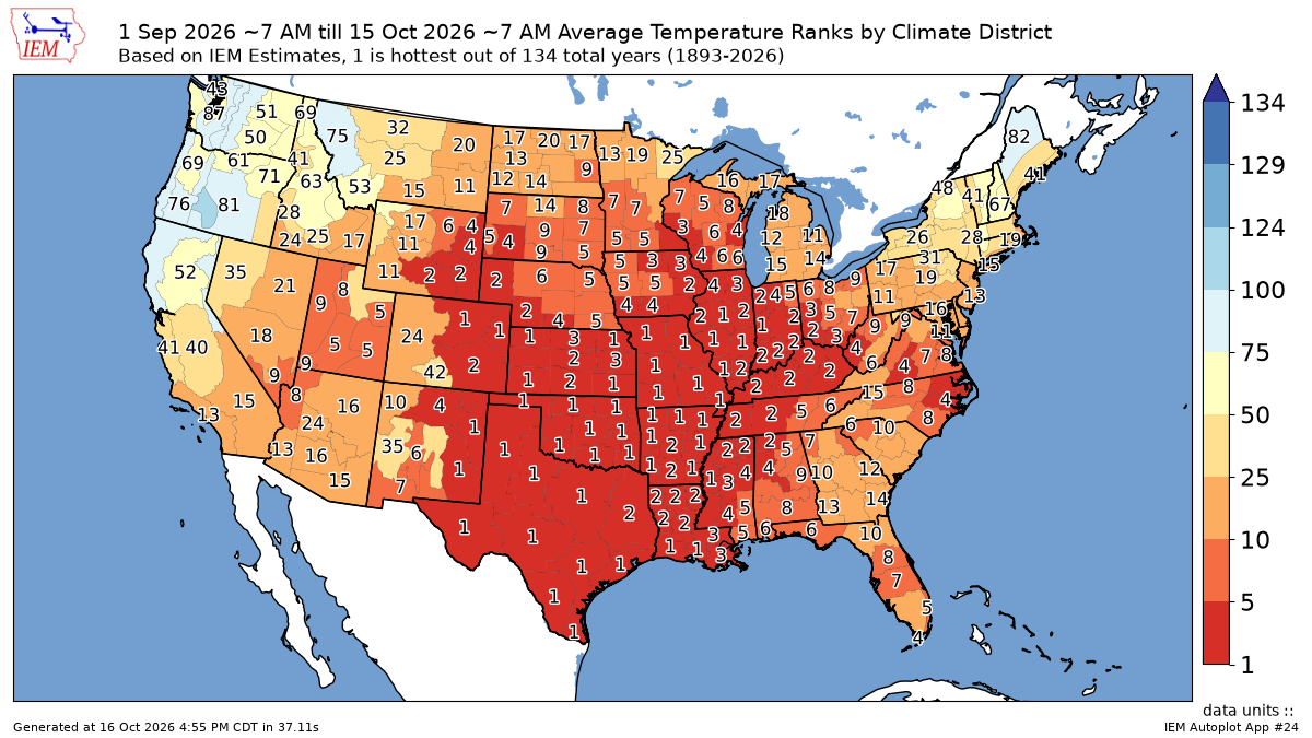
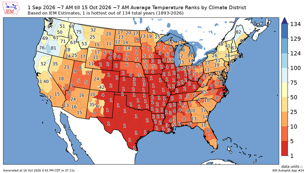
what that map actually tells you is that the central part of a country is getting record warmth from this super Niño. not us. and if you’ve been paying attention over the last several months, we’re gonna ride that into winter. See that big red blob? that was us in 2015. not this year. that also tells you that you’re probably not gonna get a 30 inch snowstorm to save your season so you better have a few smaller events
- Today
-

Occasional Thoughts on Climate Change
Typhoon Tip replied to donsutherland1's topic in Climate Change
Agreed ... To understand the global perspective does represent certain challenges. vastly understated Can't be done really. Quantum Computing may one day be equal to the task, but that's probably a ways off yet. Or so it is thought... On a separate note, QC's advent along human history has a creepy aspect about it. Like if some agency made the plug-in breakthrough to claim ownership of the most powerful device ever contrived by human kind, the ability to peer into the intentions of God, would they even tell anybody they were that agency? uhm... hmm. Let's see, to do so makes them target (oh yeah, thaaat). Very delicate. Plus, we cannot mix that up with the humanity inside humans. Unless of course our naivete is just inherently entrusting the better valor of all people... yeah no problem go for it Ho man. imagine that? The issue with doldrums occurring in the midst of GW is this word called synergy. Synergy, when combined actions and operations synthesize a product that is more than the summation of the individual parts. GW is bad. Doldrums were probably always part of the natural order... But working as team? -
Don’t worry forky, you’ll be fine. Although we might have to start a ‘go fund me’ for bail. As always …..

-
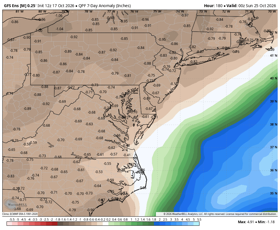
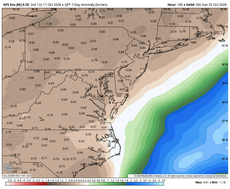
WPC has shifted most of the rainfall off the coast even in areas to our Southeast and South.
-
The college age crew will be rocking those 3 sizes too big hoodies.
-
This has been one of the warmest first half's of fall for the entire CONUS. Weather and climate statistics are just pure numbers which didn’t contain any agendas. Most of the area finished up warmer than average in September against the warmest 1991-2020 climate normals. So even relatively low departures can still be ranked fairly high. The smaller warm departures here still rank as the 13th to 15th warmest September 1st to October 15th. This is due to September and October being two of the fastest warming months near 1° per decade since the 1980s. I get it that since this warming has become so thoroughly normalized, most people including yourself probably don’t recognize a warm pattern anymore unless it’s a top 5 or a top 10.
-
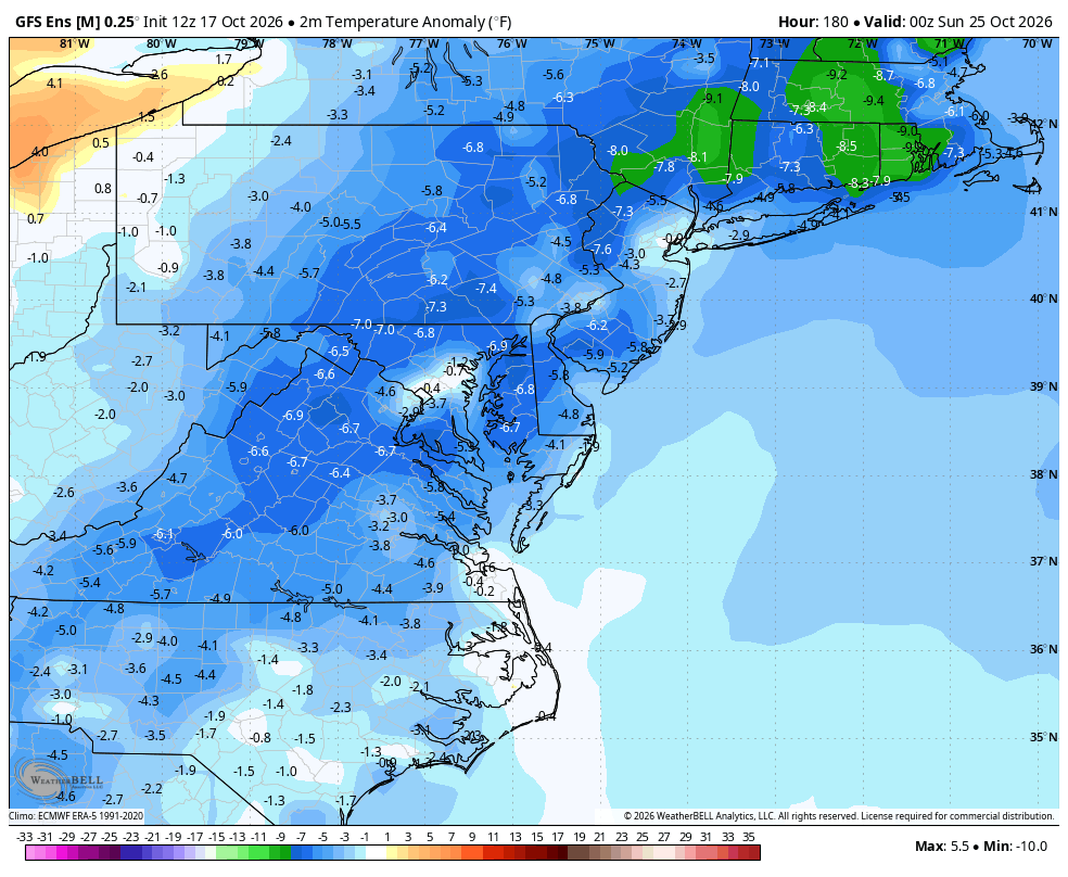
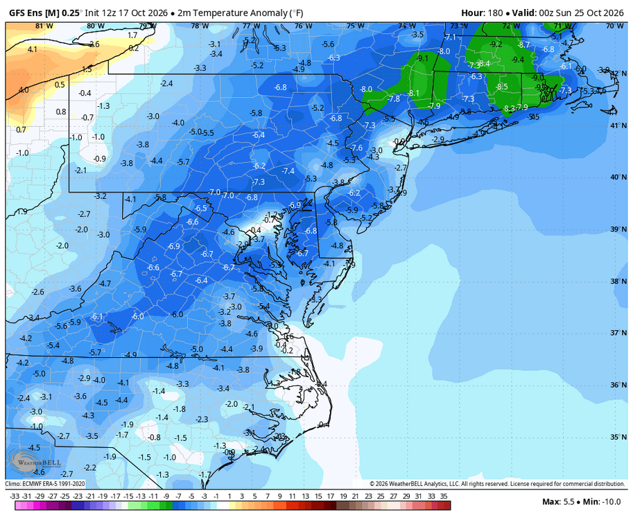
WB 12Z GEFS; looks like the coastal will stay offshore on the latest runs. Cool and dry week ahead for most of us.
-
No surprise there at 2,400'. In town (new Sharon) had a quick downpour at 11 AM, enough to make small puddles and probably some frozen but I was at the Farmington farmers' market with just windy sprinkles.
-

2026-2027 Record-breaking El Nino
GaWx replied to Stormchaserchuck1's topic in Weather Forecasting and Discussion
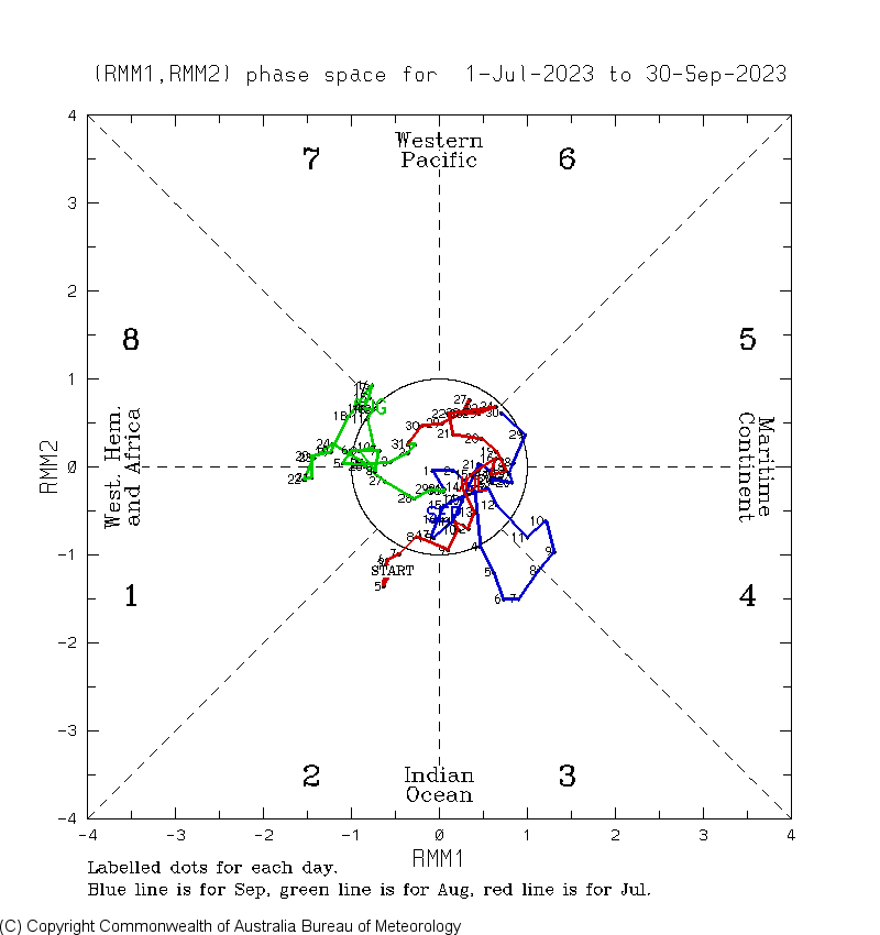
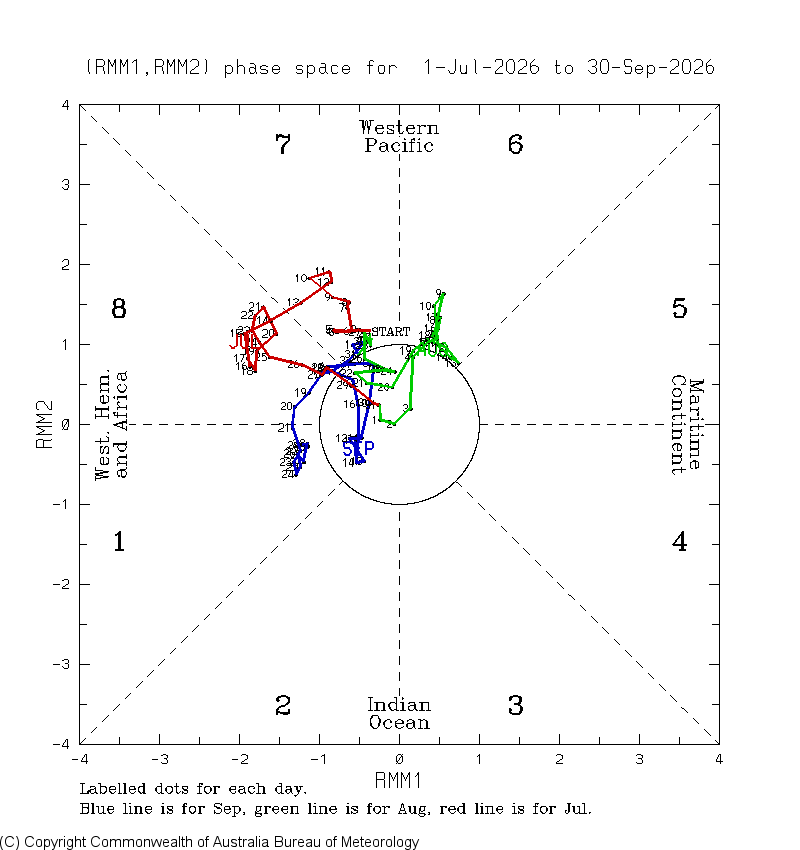
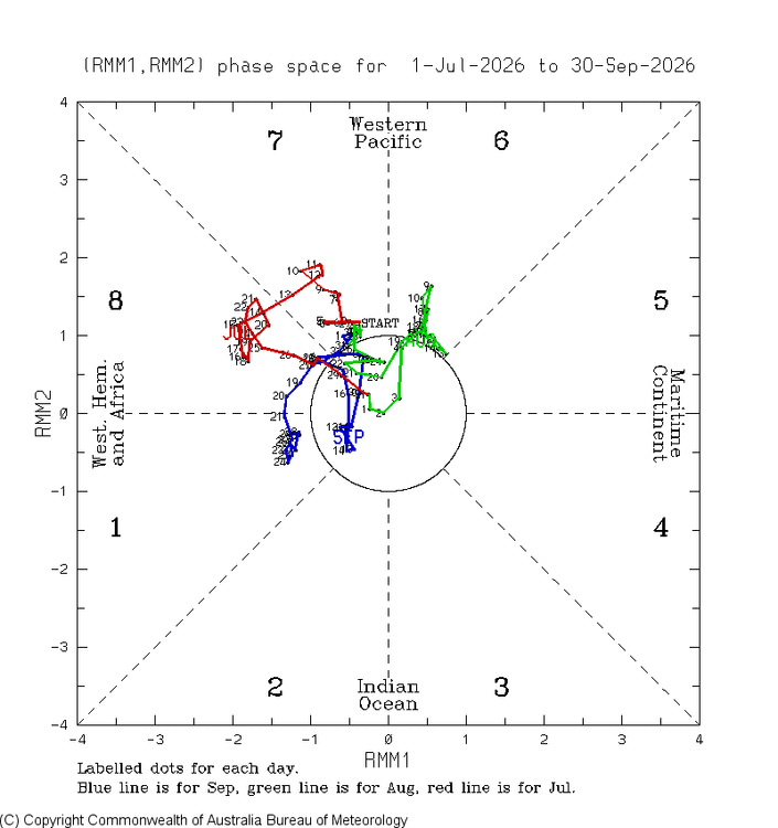
To add to the above, the ‘23 Jul-Sep MJO was much more MC/IO oriented than the nonexistent MC/IO of ‘26: ’23: ‘26: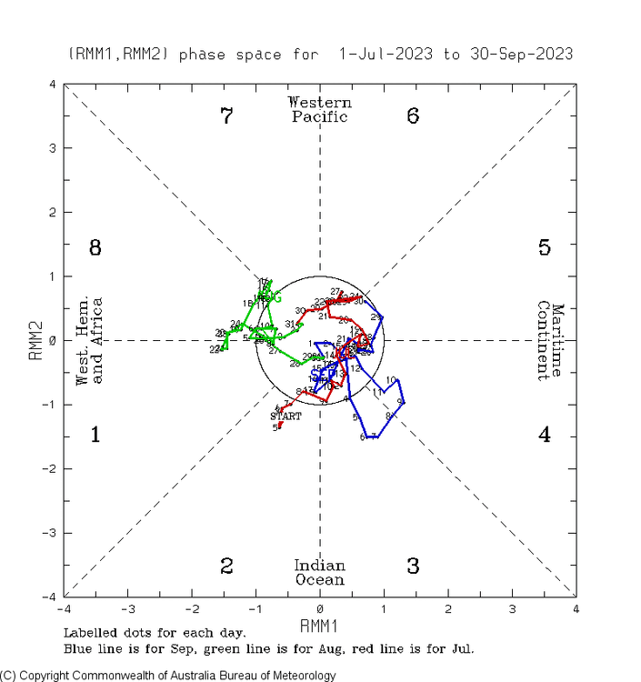
-
2027 or 2028?
-

October 2026 General Discussion
BeastFromTheEast replied to SchaumburgStormer's topic in Lakes/Ohio Valley
next week’s string of upper 60s w/ sun is going to feel like paradise!