All Activity
- Past hour
-
Nice day, 59.2 for the high
-
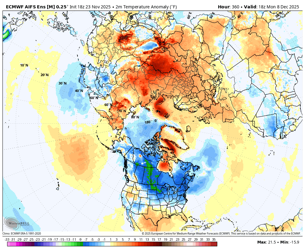
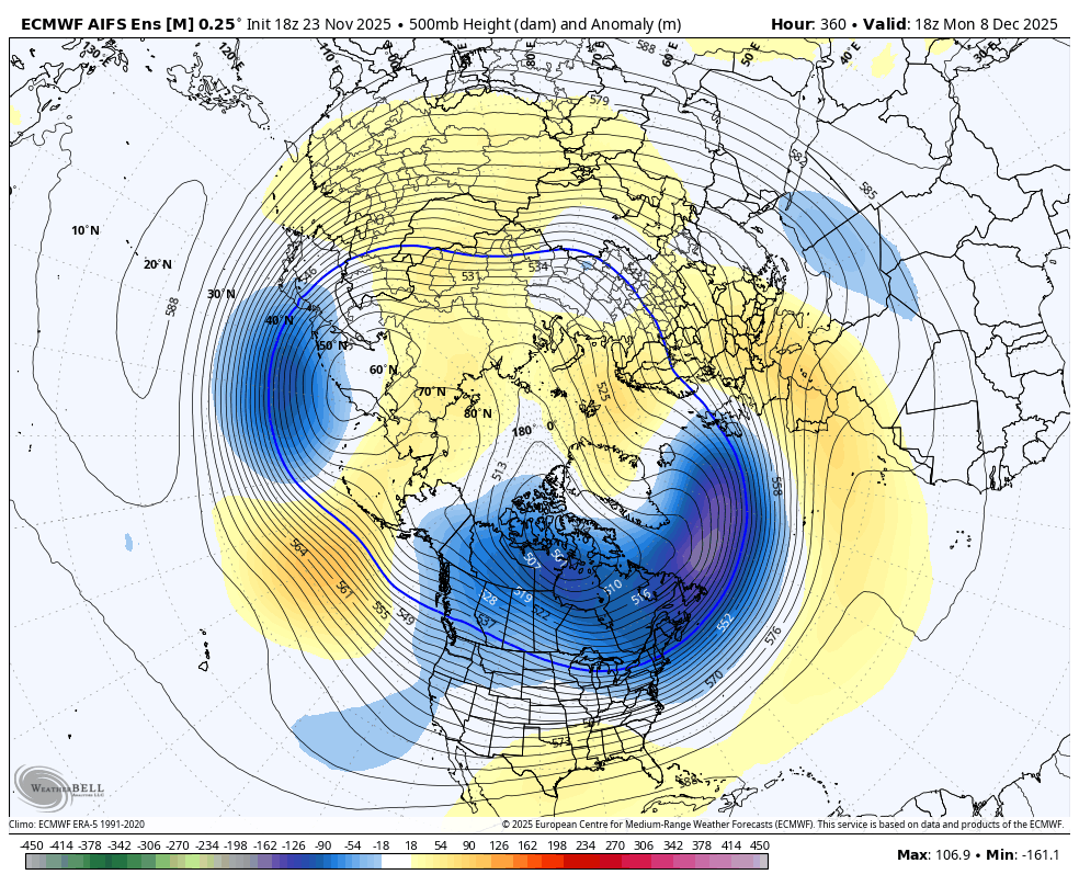
WB 18Z AI EPS at Day 15. I see this as the glass half full rather than half empty; lot of cold air in the Northern Hemisphere to play with come the second week of December. Relax, enjoy Thanksgiving with your families this week, and count your blessings.

-
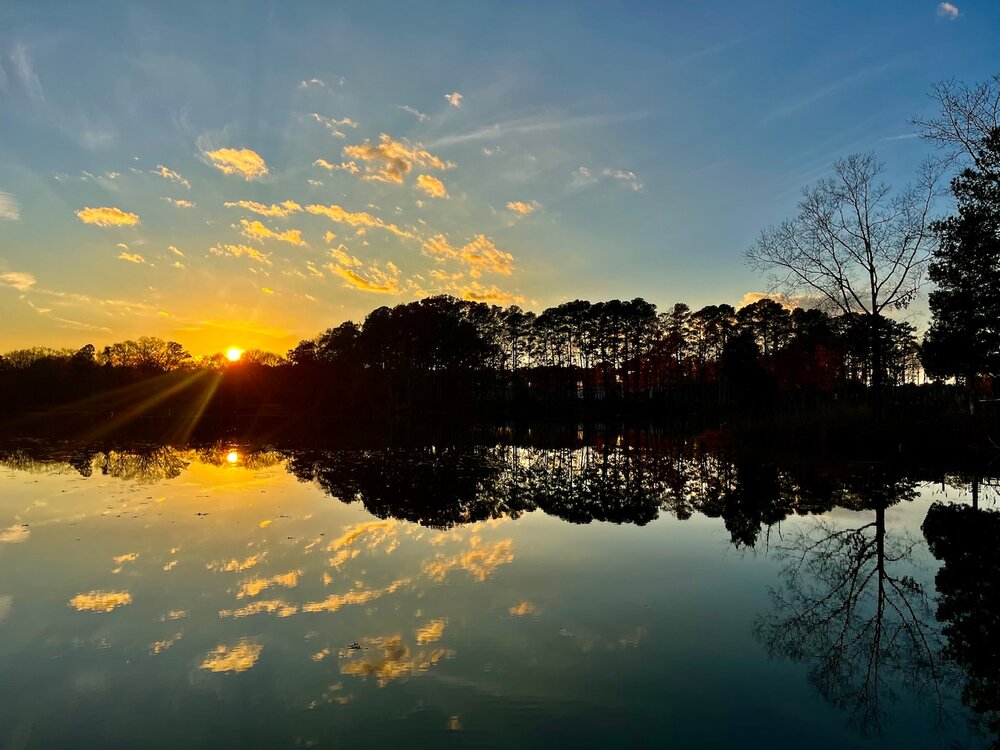
Calm evening on the lower Potomac.
-

November 2025 general discussions and probable topic derailings ...
Childude645 replied to Typhoon Tip's topic in New England
jay looked awesome today, did anyone make it? -
 To go back and forth to our daughter’s school we go on Rte 9 through there
 - Today
-
I turned off the Eagles game and am watching A Boy Named Charlie Brown on MeTV. I’m enjoying my evening much better now.
-
Interesting. I guess most of the marginal areas are struggling in the new normal
-
I took your advice to find out instead of assuming. Since he doesn’t post here, I knew I had to ask him how he’s done with snow in NM. His answer: We’ve done okay ish I would say overall, we have yet to have any snow though. Just had our first precipitation event since early October a few days ago. Earlier this year it snowed on my birthday so that was nice. Our last 4” winter storm warning worthy storm was back in 2015, tho Feb 2021 got close in a few spots. Any accumulating snow is a really big deal down in the Desert Lowlands & people go crazy over it here like they do in the southeast. The climatology here since the early 2000s is roughly about the same as places like Charlotte, NC. It used to snow a lot more here several decades ago but our average has cratered. ———— So, it wasn’t bad like I thought, but by no means has he been racking it up either. It sounds in between. He hasn’t gotten that much, but they normally don’t there.
-
.thumb.png.4150b06c63a21f61052e47a612bf1818.png)
November 2025 general discussions and probable topic derailings ...
HIPPYVALLEY replied to Typhoon Tip's topic in New England
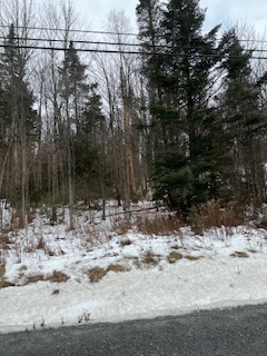
Woodford VT is one of the snowiest places in New England. -

November 2025 general discussions and probable topic derailings ...
Modfan2 replied to Typhoon Tip's topic in New England
No snow down here, just some rain showers… Temp down to 34F now, thinking might be some black ice issues here in the am. -
So what *is* good? And has NWP really regressed that badly in recent years or it is just perception (which I share)? If the former, why?
-
The NYC average was 21.91 inches during the 30 year period from 1970 to 1999. From 2020 to now the average is 15.84. We are not far off. The average was 32.35 from 2000 through 2020. That has skewed the average higher as well as expectations.
-
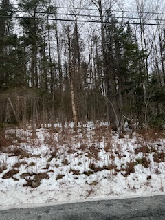
Some snow OTG in the woods of Woodford VT around 2000’ asl
- Yesterday
-
November 2025 general discussions and probable topic derailings ...
HIPPYVALLEY replied to Typhoon Tip's topic in New England
Baby steps. -
The worst for me is the cold/dry. If it won’t snow I’d rather it be mild. Last winter was the worst for that reason-so much wasted cold.
-
Its the RNA pumping up the SE ridge, not the other way around.
-
Let's bring him on and ask him
-
I don’t think met. Eric Webb has been happy with how his abode in NM has done in recent years (since he moved there) based on his posts.
-

November 2025 general discussions and probable topic derailings ...
eduggs replied to Typhoon Tip's topic in New England
The 12z ECM and 18z GFS (with support from the EPS/GEFS) show what we fear along the coastal plain. It's a classic cool/rain to cold/dry and then repeat scenario. That's not unexpected or unseasonable for this time of year. But it's been a nuisance for a few years now, including in the heart of winter. So it would be nice to get a complete breakdown of that repetitive sequence inside 7 days. We've had way way too much rain in recent winters. If a more favorable longwave pattern is always out beyond 10 days, it's just a tease. -
Pacific Jet has been a relentless monster for the NYC metro area for years.
-
Is this a permanent change at the Accuweather channel, or did they give all their OCMs Thanksgiving Week off? BTW, windiest day here in awhile. Helped me test my refurbished anemometer.
-
I won’t speak up for anyone else here, but Sunday fun day has been in effect for me since noonish.
-

December 2025 Short/Medium Range Forecast Thread
Carvers Gap replied to John1122's topic in Tennessee Valley
Bonus post....sorry. This is why the LR is a mess in terms of, "What will it do?" On this map, we have many conflicting signals. We have a second tropical-ish system south of the Yucatan, a low east of Hawaii(good), a PNA ridge(good), a cold front crashing eastward (good), a -NAO (not good), a block and a half over Alaska and the Bering Sea( I can't even remember the Bering Sea rules), a -AO(not good), a GOA low(normally not great), a western Atlantic Ridge (WAR), and cold over the interior of Canada(good). I could make a pretty good case that if the "movie is played forward" that this is has the potential to empty a lot of cold into NA and eventually the EC by the second half of December. Again, if any model is going to sniff out a cold shot at this time of year(December), my money is on the GFS. By my count the 18z GFS has (4) cool or cold fronts which make it to the west side of the Apps. And that is it for a bit...I have been watching things today, and wanted to sit on a few model cycles before posting. Plus, it has been a busy weekend. -
Hats off to you and your team for putting this together!
-
Here’s hoping for the best case scenario - current wave propagates east, lays down tracks for warmer surface/subsurface waters for the next mjo wave going well into 8 and 1 in jan/feb, while confining the nina to east based. Could turn out to be a fun winter if that happened. EPS tries to do this, but GEFS has been better with MJO. We shall see