
All Activity
- Past hour
-

Saturday, July 18, 2026 Thunderstorm/Severe Weather Potential
WxWatcher007 replied to weatherwiz's topic in New England
Might be some flood risk if those storms train in CT. -

2026-2027 Super El Nino
Stormchaserchuck1 replied to Stormchaserchuck1's topic in Weather Forecasting and Discussion
It looks like that Southern Hemisphere version of PNA is coming along pretty nice. TT only has 2m, if someone has global 500mb anomaly for GEFS and EPS can you post the link? 384hr 12z GEFS -

Saturday, July 18, 2026 Thunderstorm/Severe Weather Potential
Cyclone-68 replied to weatherwiz's topic in New England
Not hatched but a 5% tornado threat in NYS -
Is the 2011 tornado damage still visible across the street in the woods?
-
Just can't seem to get the storms around my area for some reason. There have been storms around daily for a couple of weeks now, but I've really had very little rain. And WAY less thunder than a normal July. This should be the wettest month of the year here. Even today we are stuck under the anvil of the large storm cluster over northern Atlanta. It's stabilizing us without giving us any rain.
-

Saturday, July 18, 2026 Thunderstorm/Severe Weather Potential
weatherwiz replied to weatherwiz's topic in New England
To our west but also within CT along the warm front during the afternoon with potential for supercells/isolated tornado risk. Then a line moving through during the evening with localized wind damage threat -
Yeah saw that. I was wondering if that small storm was going to start training but it just went poof over Caroline/Dorchester. The small storm did seem to be associated with the leading line of the smoke moving south east last night.
-

Saturday, July 18, 2026 Thunderstorm/Severe Weather Potential
Modfan2 replied to weatherwiz's topic in New England
For who? -

2026 Atlantic Hurricane Season
vortex95 replied to Stormchaserchuck1's topic in Tropical Headquarters
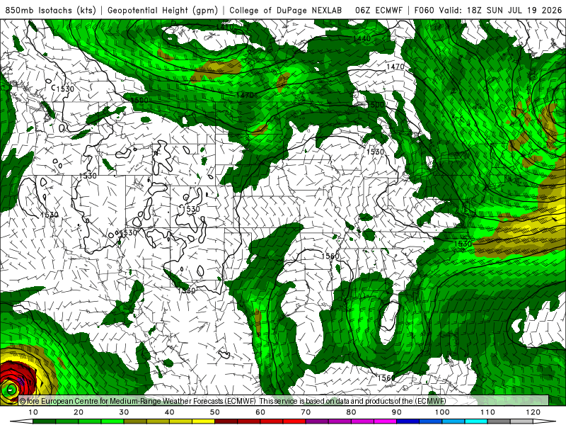
Looking at the ECMWF fcst, it remains cold core aloft for the next several days (see 700 temp 48 hr fcst attached), and at 850 elongated N-S w/ a broad wind field (see 850 winds 60 hr fcst attached). Not much sfc low reflection. I think they may be a case that aloft it is and will stay impressive w/ lots of deep convection/decent swirl, but low-levels struggle to organize. We've seen this before and it looks great on satellite, and some ppl are going, "I can't believe NHC has not declared this yet!" But sfc observations and microwave data show a low-level center ill-defined and/or not tight.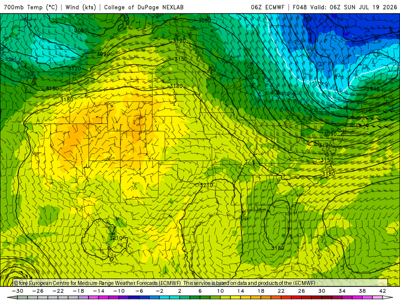
-
Hey Rockingham county, could you share your storms? Thanks
-
I've installed a few battery (only) back-ups. Believe it or not, Briggs and Stratton was the brand I installed. They make battery back up modules for some reason. Anyway, I don't think they are great for a stand alone system. They are super expensive and obviously will run out if there is a long outage (more than a day or 2). But, if your power company charges a higher rate during peak times (3-10 pm), you can program the transfer switch to allow you to use battery power during those times and then charge them with grid power overnight when it's cheaper. So there's that... If money was no option, the perfect system would be a combo of solar and battery. The panels power your house and charge the batteries during the day and you run off battery power for the evenings/overnight. Wouldn't use much grid power during spring/summer/fall.
-
 it's glorious out there right now. heading to Brimfield tomorrow for an antique sweat fest turned wash out no doubt
 -
Showers and thundershowers are possible during the weekend. Some of the thunderstorms could bring flooding downpours and strong winds. The greatest risk is tomorrow night and Sunday. Highs will generally reach the lower 80s through the middle of next week. Additional showers and thunderstorms are possible Tuesday night into Wednesday. The ENSO Region 1+2 anomaly was +3.4°C and the Region 3.4 anomaly was +1.8°C for the week centered around July 1. For the past six weeks, the ENSO Region 1+2 anomaly has averaged +2.80°C and the ENSO Region 3.4 anomaly has averaged +1.52°C. The ongoing strong El Niño will continue to strengthen through the summer. The SOI was -27.09 today. The preliminary Arctic Oscillation (AO) was -0.683 today. Based on sensitivity analysis applied to the latest guidance, there is an implied near 55% probability that New York City will have a warmer than normal July (1991-2020 normal). July will likely finish with a mean temperature near 78.0° (0.5° above normal). Supplemental Information: The projected mean would be 1.5° above the 1981-2010 normal monthly value.
-
Smoke has vanished in Vienna.
-
Saturday, July 18, 2026 Thunderstorm/Severe Weather Potential
weatherwiz replied to weatherwiz's topic in New England
18z HRRR pretty ominous -

Central PA Summer 2026 Discussion/Obs Thread
canderson replied to Voyager's topic in Upstate New York/Pennsylvania
A SPC 45% damaging wind probability is … high Next Tuesday to me even looks like a higher chance of severe. Have a Death Cab For Cutie concert at Merriweather Tuesday night and already and making plans to not go. -
 84/47 ... lot of mid 40s dps. Our source tomorrow is behind a warm boundary smearing through circa 10am to 2 ... after which we sector wedge 88/72's like lower Michigan - maybe. Getting from here to there seems like a warm over instability op tonight.
 -
Yeah, northern edge has pushed south into eastern PA and NJ. WV looks relatively clear. But a firehose of smoke pointed right at central MD
- Today
-
 Stuck in a holding pattern. NY airspace closed. Probably some douch bag's son is late for a golf lesson.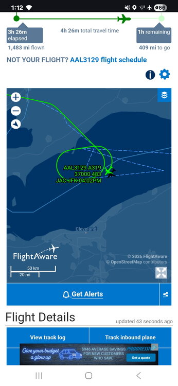
-
Looks like MD has the worst of the plume on vis sat.
-
Ratcheted up quickly. $500 dollar voucher was the initial offer.
-
Big time boom or bust potential tomorrow. It all hinges on how fast can we clear out after the warm front lifts through
-
Enhanced severe risk as well
-
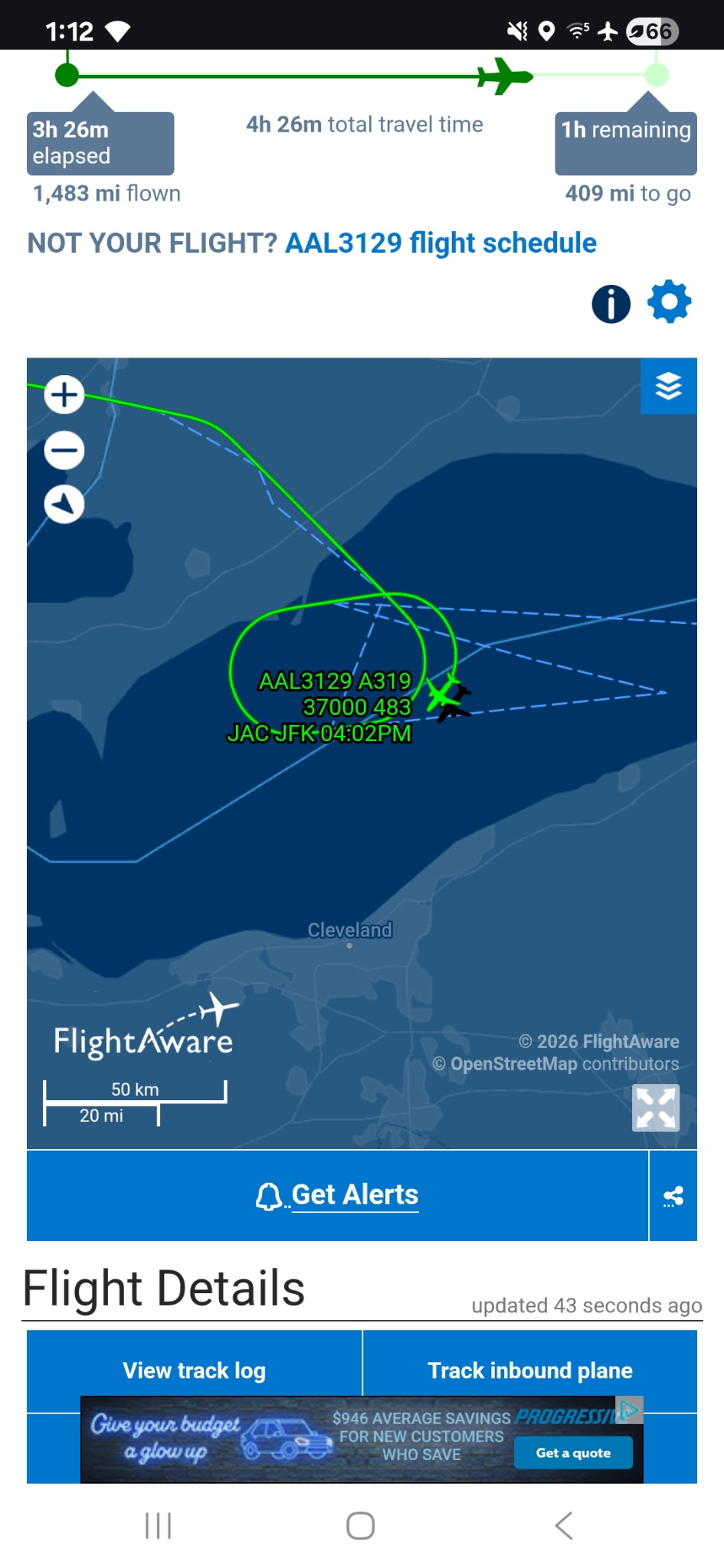
Flood watch issued for most..city on west













.thumb.jpeg.f5c6ba9d911ec96b3b124f8606aee58e.jpeg)
