All Activity
- Past hour
-

Central PA Winter 25/26 Discussion and Obs
Voyager replied to MAG5035's topic in Upstate New York/Pennsylvania
We did have some moderate snow a little while ago, but I think the heavy band down near Allentown is putting us into a subsidence zone. -
some of us are confused that you have a red tag identifying you as a meteorologist....this would indicate at least a BA. i understand you don't learn everything in school, and maybe you specialized in tornados for all i know.....otherwise i don't find you offensive.
-

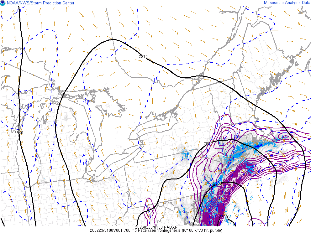
“Cory’s in NYC! Let’s HECS!” Feb. 22-24 Disco
Torch Tiger replied to TheSnowman's topic in New England
-

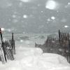
"Don’t do it" 2026 Blizzard obs, updates and pictures.
Damage In Tolland replied to Ginx snewx's topic in New England
Beast is upon us -
Obs in houston?
-
“Cory’s in NYC! Let’s HECS!” Feb. 22-24 Disco
Torch Tiger replied to TheSnowman's topic in New England
0z hrrr absolutely slays...slays our hopes and dreams -
Eyeballing like 5-6" on the ground already in lindenhurst, all old snow is mostly melted here besides snow piles. That weenie band was dropping 2-3"/hr rates for a little while there. Winds maybe been gusts to 30 mph max so far
-
absolute cinema. this will be special for the area
-

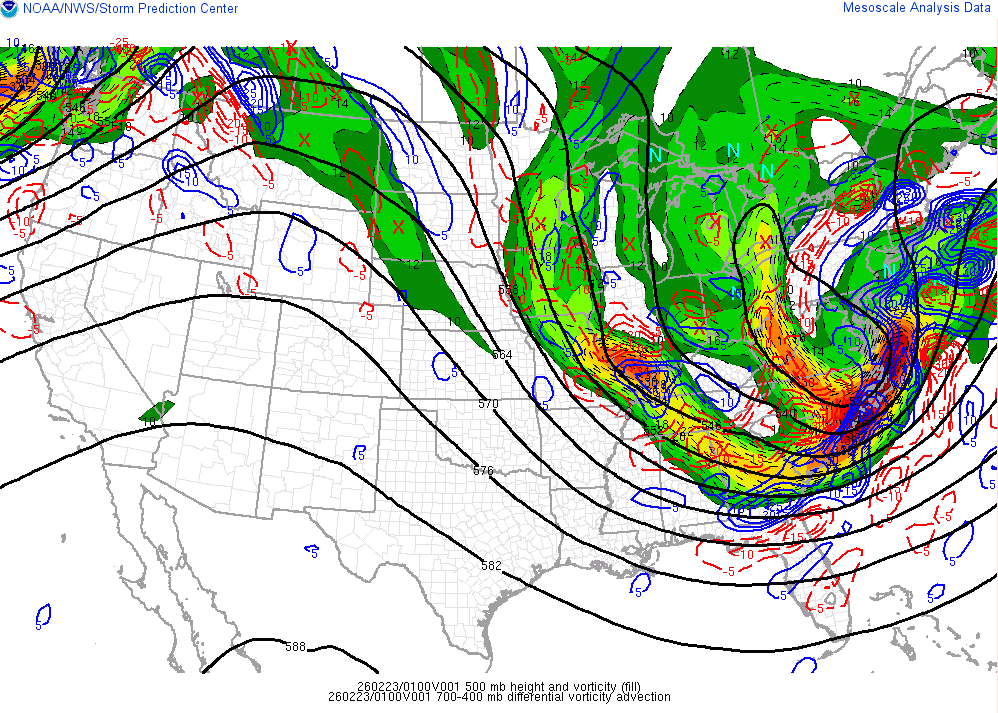
Feb 22nd/23rd "There's no way..." Obs Thread
stormtracker replied to Maestrobjwa's topic in Mid Atlantic
We got plenty of time -

"Don’t do it" 2026 Blizzard obs, updates and pictures.
WinterWolf replied to Ginx snewx's topic in New England
Yup, We just don’t know….. -
[emoji849]
-
Yeah I've been following him, I was wondering who was pulling over every 5 miles and getting out of the car with a tape measure.
-

Blizzard of 2026 Storm Thread/OBS
CoolHandMike replied to Mikeymac5306's topic in Philadelphia Region
Mine were still mostly under a glacier until as late as yesterday. I probably could have pulled them up through what was left of the old snow, but had other priorities yesterday and today, so they yet remain. I've got 4 x 50' strands wound around all the shrubbery in my front yard still. (They haven't been on since mid-January though.) -

Blizzard of 2026 Storm Thread/OBS
BroadWing3544 replied to Mikeymac5306's topic in Philadelphia Region
At least 6" here in Glen Mills. Looks like a decent band may be coming through. -
Euro will reclaim its throne! .
-

"Don’t do it" 2026 Blizzard obs, updates and pictures.
dendrite replied to Ginx snewx's topic in New England
Yeah ripping N flow with shit dynamics (locally) and mid level dry air lurking to the north won’t get it done here -
Yeah, actually the intensity slacked off a bit here from before. It was solidly moderate, but now lightened up some. So close, but yet so far...
-

Central PA Winter 25/26 Discussion and Obs
MAG5035 replied to MAG5035's topic in Upstate New York/Pennsylvania
Accumulating snow has finally resumed here for the first time in the last like 10-12 hours as that renewed surge of steady precip backing west has reached the I-99 corridor. Winds are up too, with a high gust of 26mph (NNW). Temp down to 30ºF -

"Don’t do it" 2026 Blizzard obs, updates and pictures.
Sey-Mour Snow replied to Ginx snewx's topic in New England
Band from long island drop 8" already in central long island.. It's moving in now albeit probably only 2" per hour rates -
"Don’t do it" 2026 Blizzard obs, updates and pictures.
Damage In Tolland replied to Ginx snewx's topic in New England
Expect the unexpected -
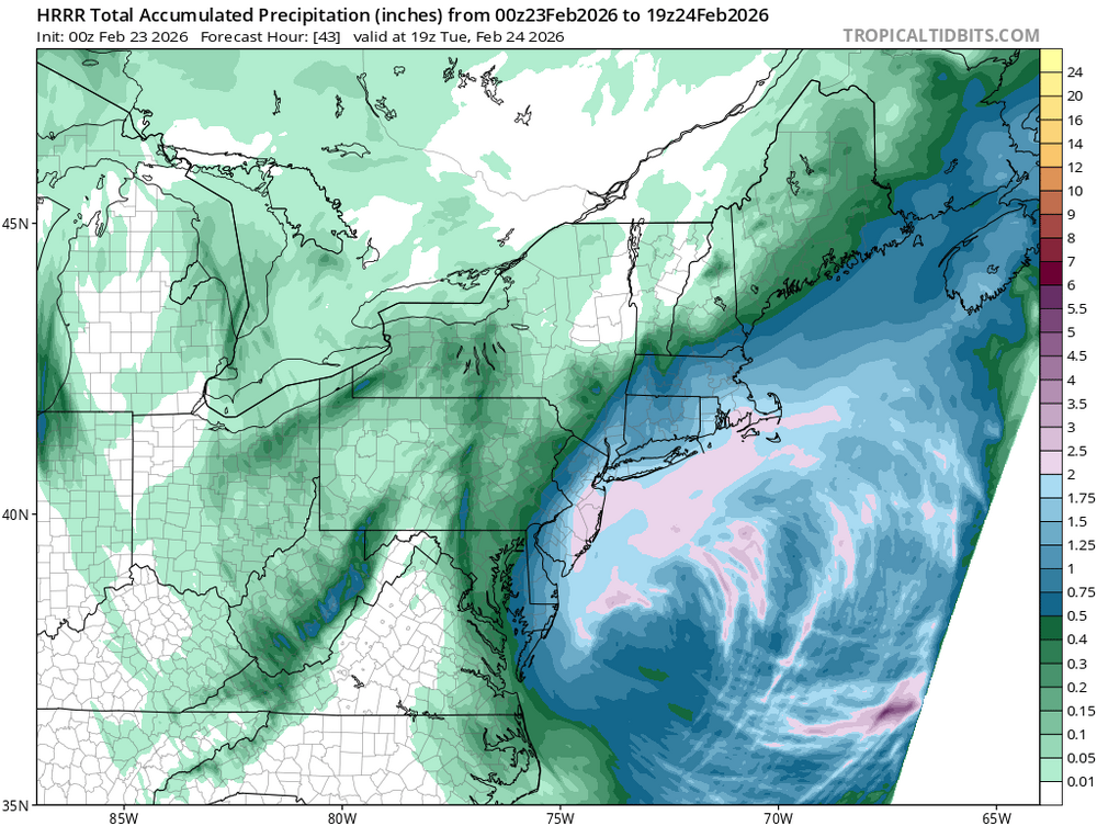
18.5" MAX over my house in Manahawkin, NJ. HRRR prints out another 20" here in south jersey. I only have 2" so far so I hope I cash in when these bands start pivoting.
-
I mean yeah, my 10-16 forecast tonight and 2-4 tomorrow sure as fuck isn't going to verify. This was clearly going to be a legit COASTAL storm, favoring places east and NE. Hopium is powerful shit. Maybe someone can explain how the MA beaches get more blizzards in the last 10 years instead of complaining about generic margins, and don't tell me its all NINA climo. That's lazy.
-
Feb 22nd/23rd "There's no way..." Obs Thread
weatherbook replied to Maestrobjwa's topic in Mid Atlantic
2.5" in Oakton.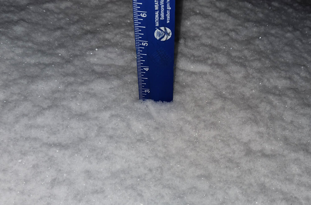
-
3" here in CT