All Activity
- Past hour
-
These storms are just scraping by to my north and offshore..the season of haves and have nots has just begun. Maybe we can squeak out another quick pop up downpour or two like yesterday!
-
2 tornado reports in Illinois
-
-
What time frame we looking at the rain starting?
-

2026-2027 Super El Nino
Stormchaserchuck1 replied to Stormchaserchuck1's topic in Weather Forecasting and Discussion
How did the JMA initialize the current Nino (I know it has a west or central-based configuration in the Winter)? -
Shirtless, pantless and many packs of dude wipes on standby!
-
18z NAM looks like shit.
-

2026-2027 Super El Nino
michsnowfreak replied to Stormchaserchuck1's topic in Weather Forecasting and Discussion
Looks 2009-10ish. Interesting both jamstec and cansips are far from a warm winter. -
2026-2027 Super El Nino
Stormchaserchuck1 replied to Stormchaserchuck1's topic in Weather Forecasting and Discussion
Just letting you guys know, this was a >+1 PDO. The new thought in the weather community is that global warming is skewing PDO negative, etc, the warm pool near Japan isn't going away. While SSTAs are warmer, the PDO is a 50/50 index, and the big warmth along the west coast of North America was responsible for strong +PDO in 15-16. -
Very lucky that I will make it to July with hardly any heat this year!
-
Depending on instability there's a definite tornado threat here
-
You were desperate for rain less than a month ago. Be glad it's not 100.
-
Would absolutely trade you.
-
64F/ .16"
-
-
We love violence
-
Tomorrow and Tuesday will be cooler days. Rain is likely on tomorrow into tomorrow night. Some locations could experience a thunderstorm. The potential exists for a general 0.50"-1.50" rainfall. No excessive heat appears likely through at least June 25th. A warming trend could commence during or after the next weekend. Some of the guidance suggests that hot weather could return to conclude June. The ENSO Region 1+2 anomaly was +2.6°C and the Region 3.4 anomaly was +1.3°C for the week centered around June 3. For the past six weeks, the ENSO Region 1+2 anomaly has averaged +1.95°C and the ENSO Region 3.4 anomaly has averaged +0.98°C. The ongoing El Niño will continue to strengthen through the summer. The SOI was -5.98 yesterday. The preliminary Arctic Oscillation (AO) was +0.096 today. Based on sensitivity analysis applied to the latest guidance, there is an implied near 87% probability that New York City will have a warmer than normal June (1991-2020 normal). June will likely finish with a mean temperature near 73.9 (1.9° above normal). Supplemental Information: The projected mean would be 2.5° above the 1981-2010 normal monthly value.
-
Nam is 1 to 3" all in less than 6 hours
-
Wow!! Finally cashing in. That's great!
-
I had ~0.05” yesterday evening, which brought me up to ~4.4” MTD.
- Today
-
.thumb.jpg.6a4895b2a43f87359e4e7d04a6fa0d14.jpg)
Central PA Summer 2026 Discussion/Obs Thread
Yardstickgozinya replied to Voyager's topic in Upstate New York/Pennsylvania
Yes, apparently, if the sun can break through, that'll be key in that possible evolution. -
61 degrees midday with steady rain on first day of astro. summer is something I do like, but I must admit it also feels wrong. Checking Chicago-area climo for June 21-22, this kind of first day of summer happens maybe once a decade. The last four years have all had heat right around the solstice. The last year with a notably cool and rainy spell around the solstice was 2018.
-

Central PA Summer 2026 Discussion/Obs Thread
canderson replied to Voyager's topic in Upstate New York/Pennsylvania
Oh sorry I meant the axis loos like it might miss a decent part of our region with the bulk of precip with the SW to NE axis. The WC games in Philly and NJ tomorrow will be interesting -
Looks like heaviest rains Monday and Tuesday Rt 2 north?…As long as I see .50” or more down here I will be happy
-
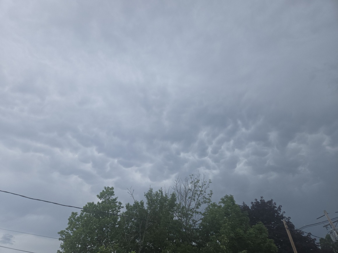
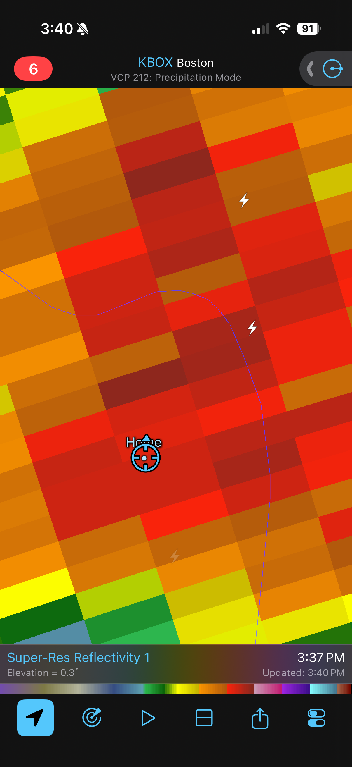
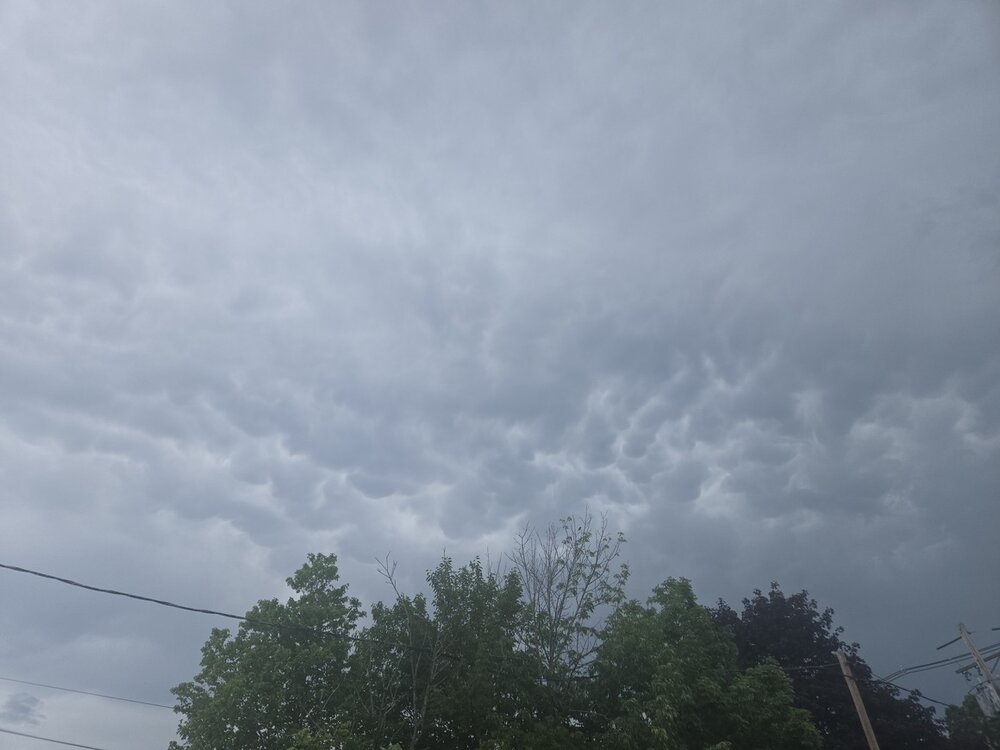
Have had 3 absolutely house shakers. Huge positive discharges .


.thumb.gif.f92b16c631a1d15d405ed77b33f0710d.gif)