All Activity
- Past hour
-
I like how its a more traditional coastal look than just moisture flow from the gulf
-

Nov 28-30th Post Turkey Day Wintry Potential
ChiTownSnow replied to Chicago Storm's topic in Lakes/Ohio Valley
Seems like the higher end totals may depend o solely on instability and thunderstorm like advection that happens locally. -
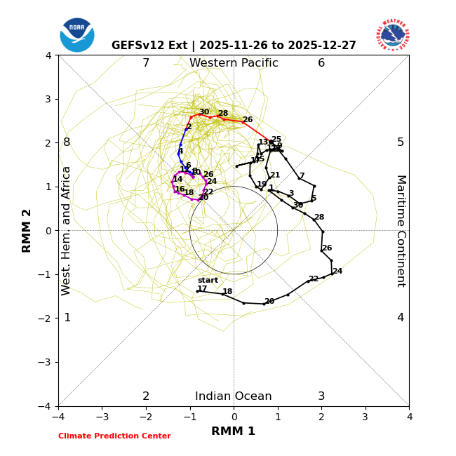
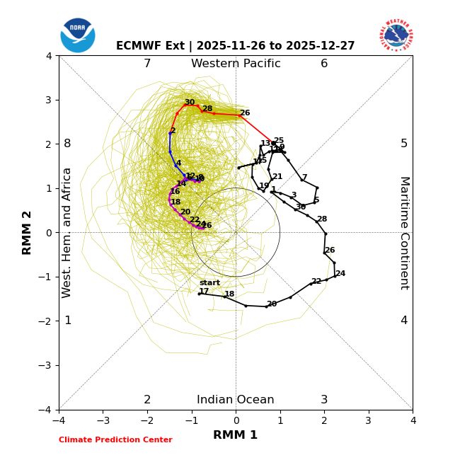
It’s not that they don’t go out far enough. Rather, it’s that that this Tweet’s runs are “bias corrected” versions, which have more often than not not been making the correct adjustments based on my following them. Here are the corresponding non-bc versions, which are very bullish for phase 8 within their runs: GEFS:
-
GEFS is very good.
-
Its exciting if you like cold rain
-

2025-2026 ENSO
Stormchaserchuck1 replied to 40/70 Benchmark's topic in Weather Forecasting and Discussion
90E being +6c anomalies at -130m may definitely precede an El Nino in the next 1-3 years. A few strong Kelvin waves would probably warm the entire ENSO subsurface. -
Happy Thanksgiving everyone! Christmas may come early for us interior peeps next week
-
-
Vort def gets squeezed as it heads east. It’s the classic opposing forces we often see in these types of setups where the downstream WAA/ridge pumping is being offset by the confluence up in Quebec.
-

December 2025 regional war/obs/disco thread
TauntonBlizzard2013 replied to Torch Tiger's topic in New England
CMC still a mess, but definitely came in colder than 00z. Decent trends from non icon models so far -
JUST looking at the CMC and GFS model runs, this does have a 2007/2008 and 2008/2009 feel to it. If so this could be a big winter for the 84 corridor (or at least December).
-
At this time of the year cold air is the most important variable. -EPO is the best pattern for this. This is what the ideal pattern looks like at 500mb: The 12z GFS kind of has the -EPO pattern, although it's a little SW, which may ultimately create a little more of a SE ridge and mixing or rain where the model currently has snow. Pretty close though.
-

2025-2026 ENSO
brooklynwx99 replied to 40/70 Benchmark's topic in Weather Forecasting and Discussion
this just looks like twitter engagement bait. every MJO forecast has another wave propagating into 8… those plots just don’t go out far enough -
December 2025 regional war/obs/disco thread
TauntonBlizzard2013 replied to Torch Tiger's topic in New England
Definitely came in colder than 00z -
May take a few years but they will be back.
-

Nov 28-30th Post Turkey Day Wintry Potential
cyclone77 replied to Chicago Storm's topic in Lakes/Ohio Valley
Can't recall any other warning criteria events here when the winds were from the southeast predominately. Gonna be kind of strange lol. -
Ukmet has a similar look now. Snow to rain for the city, heavy snow interior
-
6z Euro had the change back to snow too fwiw.
-
The GFS looks like one of those AI ensemble members
-
canadian looks colder than 0z run but much warmer than GFS!
-

Nov 28-30th Post Turkey Day Wintry Potential
fluoronium replied to Chicago Storm's topic in Lakes/Ohio Valley
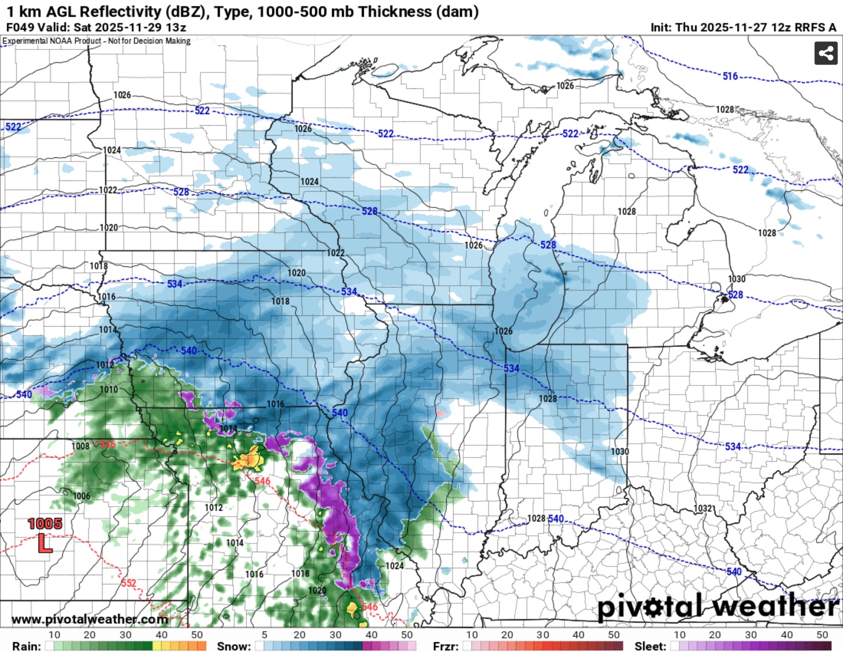
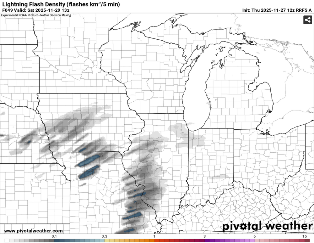
I've never used the RRFS for snow before but it's interesting to see it hinting at thundersnow. I have noticed that the lightning algorithm on the HRRR has been completely worthless for predicting thundersnow (or at least the algorithm CoD uses)
-
-
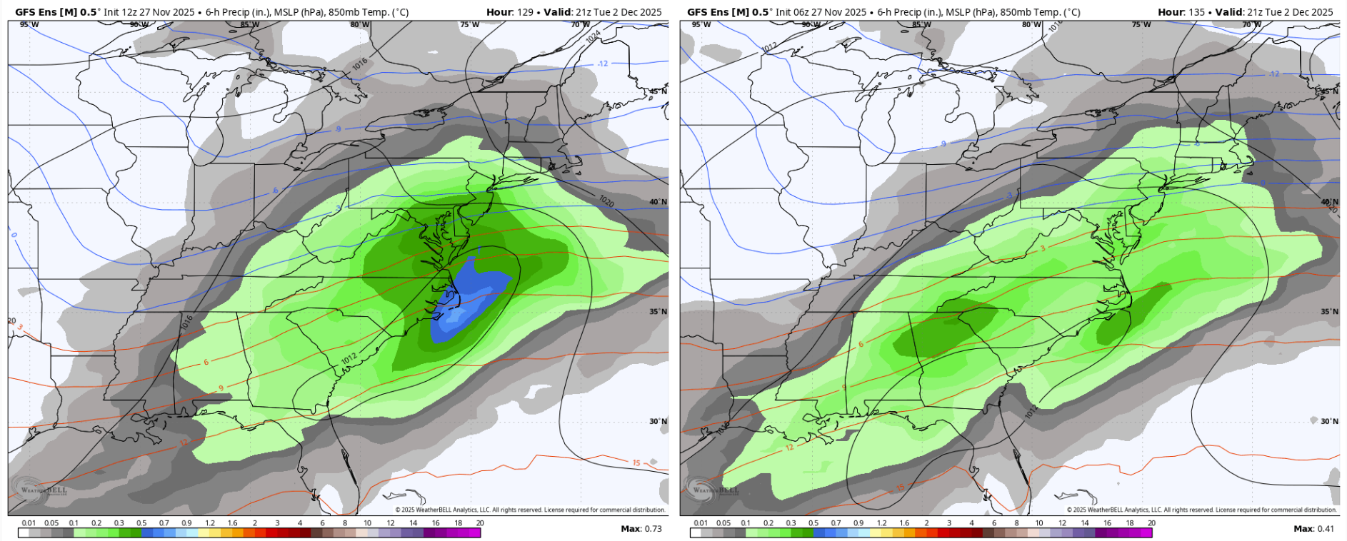
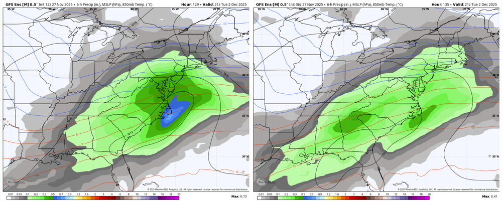
The cmc has upper level energy swing through Tuesday night that changes some areas back to snow. For areas NW of DC it would be a snow to ice to rain then back to snow. Similar to last night's run minus the snow on the backend. Definitely different than the gfs.
-

December 2025 regional war/obs/disco thread
Typhoon Tip replied to Torch Tiger's topic in New England
The pattern recognition/suggestion/modulating favorably into the first week of Dec has been in the scaffolding of the outlook since at least two weeks ago. It’s not suddenly emerging thus challenging … that’s good. Perhaps even reassuring but I could see this robbing 20 someodd percent squeeze limiting things. Interesting testing modeling perf this time vs that leitmotif -

Central PA Fall Discussions and Obs
WmsptWx replied to ChescoWx's topic in Upstate New York/Pennsylvania
Keep it right there. Don't move it an inch.