All Activity
- Past hour
-
This is an interesting random fact. Assuming we dont hit 90F this September, it will be the 7th consecutive September without hitting 90F at Detroit. That has never happened before in the climate record (the previous longest was 6 consecutive years, 1875-1880). The last time DTW hit 90 in Sept was Sept 5, 2018.
-
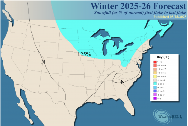
Must be time for a Fall thread. JB's preliminary winter forecast. I'd be happy with it. Sorta lines up with the Cansips, at least temp-wise, and somewhat the Euro seasonal.
.png.8e340af4307eb6926b026cedb629dab9.png.3d6964e2e980a8cf71dd0a669ff560d7.png)
-

2025 Atlantic Hurricane Season
BarryStantonGBP replied to BarryStantonGBP's topic in Tropical Headquarters
-
A Beloved August
-
All i give a shit about is the Ravens game on Sunday night. Let's GOOOOOOOO.
-
Don’t have any, But when I do.
-
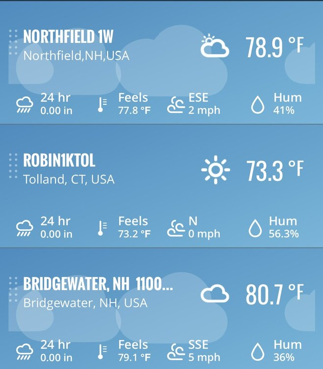
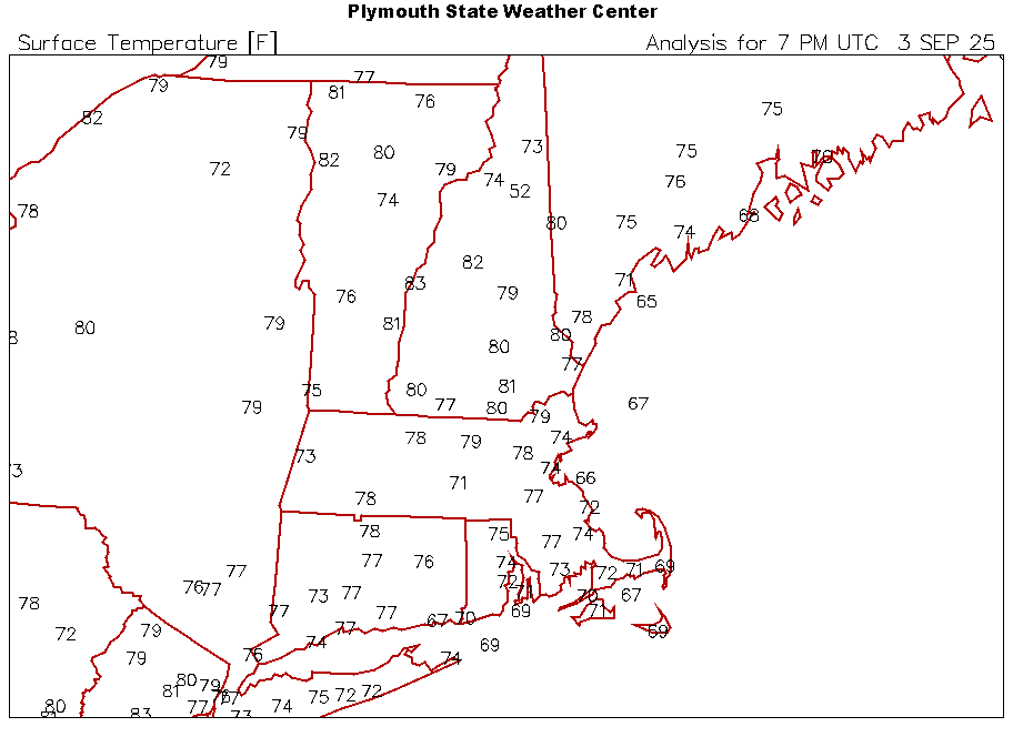
How is ORH 71? Seems like they have drifted opposite lately.
-
call them?
-

Occasional Thoughts on Climate Change
donsutherland1 replied to donsutherland1's topic in Climate Change
Recent research shows that the Pacific–Japan (PJ) pattern, a Rossby wave–driven circulation mode, triggers anticyclonic systems that expand the subtropical high, reducing latent heat loss and boosting solar heating across regions such as the Kuroshio Extension, thereby fueling extreme sea surface warming in the Northwest Pacific. The ridging driving these marine heatwaves often produces atmospheric heatwaves. Both Japan and South Korea recorded their hottest summer on record this year. Shanghai recorded a record 26 consecutive 95° or above days. Climate models project that under continued greenhouse gas emissions, marine heatwaves in the Northwest Pacific are projected to become more frequent, longer-lasting, and more intense. A research summary described a sort of self-reinforcing warming process driving the marine heatwaves as follows: Rising greenhouse gas concentrations in the atmosphere... are driving more heat into the ocean's surface layer. This creates a greater temperature differential with deeper water and less turbulent mixing with colder water at depth, which causes the surface mixed layer to become thinner. Heat entering the ocean becomes trapped in this shallower layer, which further accelerates surface warming. The references to "more heat" at the ocean's surface layer and "colder water at depth" essentially shoot down any volcanic hypothesis. The opposite would need to be true if the volcanic idea had merit. -
+1
- Today
-
What a stretch it has been, One to tell the grandkids about.
-
Honestly, I've posted more about temps in this forum in the past 2 or 3 pages than I have in this or any forum. Lol In the end, there's nothing I can do about it in the large scale, so I don't care or focus on them. I hope it's cold enough to snow as often as possible over 2-3 months out of the year. If not, oh well. There's always whining to ease the pain.
-
71F at ORH
-
Best summer COC stretch of my life. Just spectacular
-
Seeing hints of color around the Hazleton area as well. Nothing of note in the lower elevations yet, though
-
Low of 63, high is current temp of 80. It has gotten very dry here lately. My maples are starting to change a bit as are others in the neighborhood.
-
Forget anomalies. NNE has flat out just been winning overall the 2nd half of summer.
-
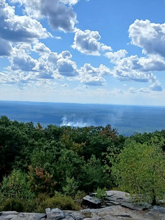
On top of mount wachusett and looks like a fire started not to far away
-

Eastern Tropical Atlantic Wave - 40/80
Wannabehippie replied to BarryStantonGBP's topic in Tropical Headquarters
-
Eastern Tropical Atlantic Wave - 40/80
Wannabehippie replied to BarryStantonGBP's topic in Tropical Headquarters
Still no closed circulation that I can make out on satellite photos. The one behind this one actually looks more impressive. Plus there is still one over Africa that has a lot of convection associated with it. blob:https://www.tropicaltidbits.com/945a622d-62e6-412d-93cd-f03b00964225 -
An aunt that lived in Columbia at the time would tell us about how Hugo shook the lines more than they had ever seen.
-
Seems reasonable enough
-
81/48 Perfect out.
-
Eastern Tropical Atlantic Wave - 40/80
BarryStantonGBP replied to BarryStantonGBP's topic in Tropical Headquarters
-
Euro shreds this storm in the Caribbean


