All Activity
- Past hour
-
I was on my way home and just missed seeing it, but pretty good size hail and. 53" of rain in maybe 15 mins The hail triggered my Ring camera, so got to see it
-
As they should for the majority of the area. Just watch as the storms hit the coast in central NJ hit the water and disappear. I’ll be lucky to see 3 drops. My vehicle was so green with pollen before I had to drag the house out from the backyard and wash it.
-

E PA/NJ/DE Spring 2025 Obs/Discussion
JTA66 replied to PhiEaglesfan712's topic in Philadelphia Region
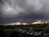
Interesting looking sky off to my SW. Getting a few random drops. Sure looks like it’s getting ready to do stuff. 77F/DP 61F -
Lower Delaware and Southern, NJ with South winds above 20 mph. meanwhile my area and nearby locations with firm SW winds. Interesting.
-
I'll little that down to just any hail. Seems to be hard to come by in the city. But others have said something about the bay.
-
Just saw this. Where I was at the time is probably just a bit in the northwestern side of the location market
-
Adding...of course if you compare all areas vs your tiny area. You're going to get a sense that hail is "tons more common" but you need to compare your slice of land to a similar sized plot to get any accurate apples to apples comparison.
-
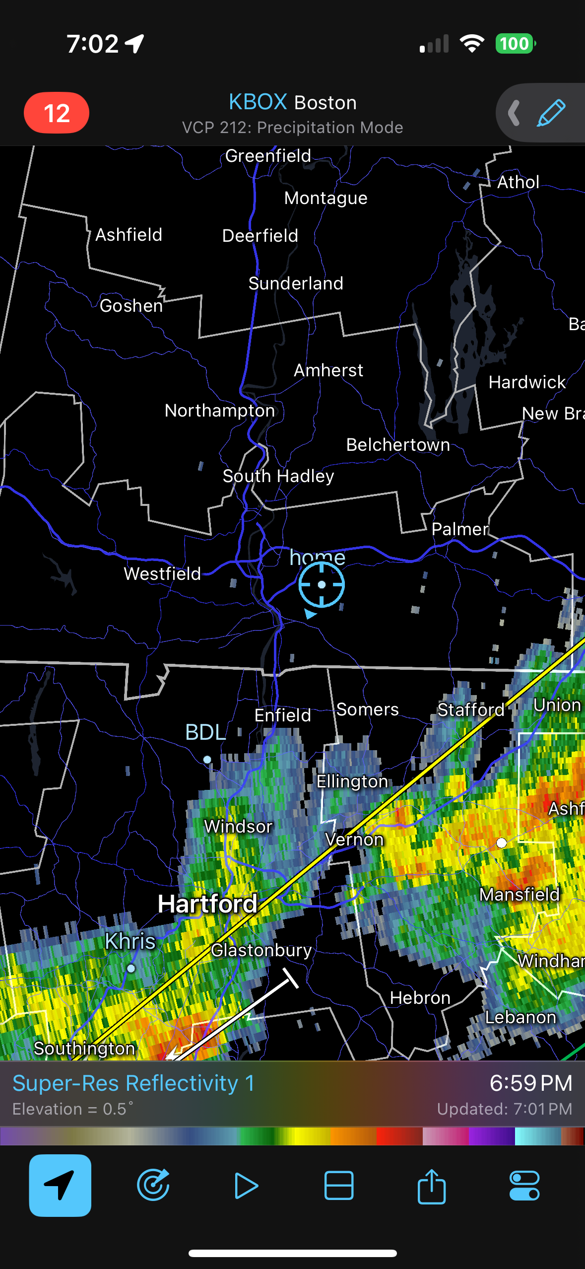
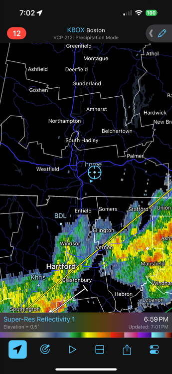
Short range models are not that enthused for tonight around here from local sources, yet I see storms firing NE of me near Wilmington and Woodbury, NJ. The Delaware rain forcefield is in full effect below the C&D Canal.
-
Large hail is a rare event in ANY given location. You're biased because it's your backyard. Think about why the SPC probabilities are "within 25 miles of a point" The probs are never "damaging wind at your exact location" Even factoring in the city boundaries, it is not a lot of geographical space.
-
Might have been a gustnado
-
Burping TORs?
-
Certainly, looked like one.
-
Wow, yeah, I think that spike coming off the cell at the 4 o clock position is a classic indicator of very large hail.
-
Rain train setting up south thankfully. Uncongrats @ineedsnow
-

E PA/NJ/DE Spring 2025 Obs/Discussion
Birds~69 replied to PhiEaglesfan712's topic in Philadelphia Region
Pretty sure you'll miss out. I'm expecting big ass raindrops with 0.5 in.... Then again, may get screwed entirely. -
were there any signs of a tornado signature at that time? I couldn't track earlier. Looks like a minor spin-up but nice catch
-
Can’t believe Wizzy caught a Tor . Fantastic work kid
-
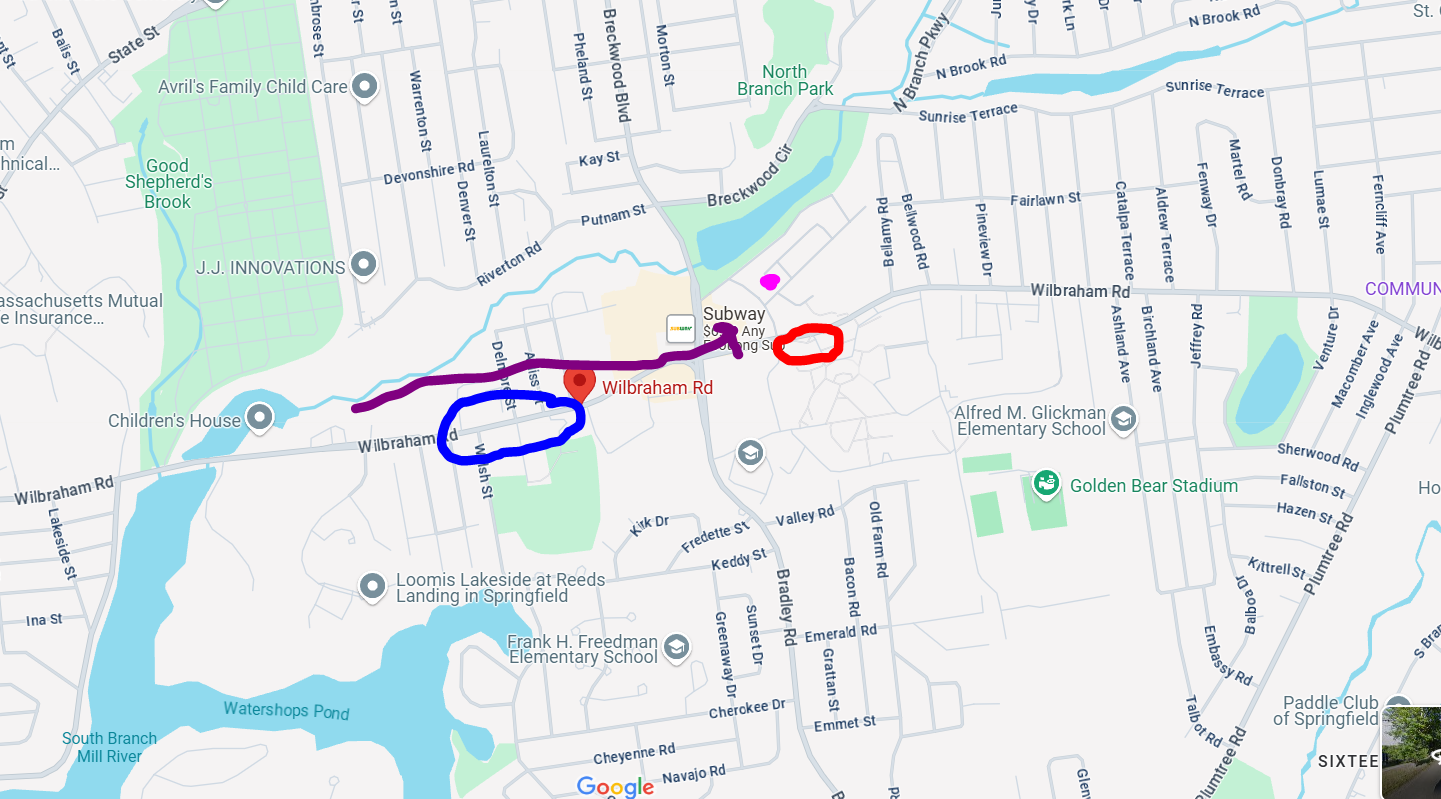
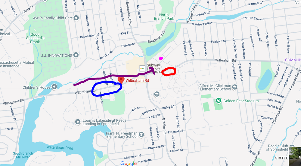
I wish I was able to go down the entire road to see where the damage began but it was closed off. The purple dot was where I was and the red circle is where there were pines down. The arrow shows the track. The blue circle is where the road was closed...I could see something on fire so it had started at least a good 1/2 mile up the road...but not sure what it was like going farther down
-
look at the radar from that time it was definitely a weak tornado
-
ya he needs to send that in.. Radar was matching up pretty well at that time with some rotation.. he was literally in the perfect spot!
-
Yeah, thunderstorm lines seem to max out around here. Baltimore city gets some pretty good action too.
-
We’re about a mile south of that lightning bolt under the reversed U of the Pile. The bow or whatever was certainly flexed to the max here.
-
I still get torn because it happened just as the gust front is going through but it had to be just behind the gust front because precip had started. I'll have to pull back radar archives.
-
A welcome 0.3 so far from getting scraped by the southern edge of two cells so far. Hoping for a flush hit at some point. Had one super-close lightning strike, had to have been within a couple hundred feet
-
Some training setting up along 84?