All Activity
- Past hour
-
SN/IP mix. you get the best of both. I have always liked that combo.
-
A few thoughts while we wait for 12z models: 1) be wary of Kuchera maps, as they may over estimate ratios with the warm nose causing the snow to be wetter 2) the front end think of WAA snow often over performs in terms of snowfall rates, but the sleet line moves north faster than modeled. Areas that are expecting mostly sleet may get 1-3" of snow to start. We will need to wait until the hires NAM is in range late Thursday to start to get a feel for this progression 3)a changeover is inevitable for all but perhaps our most northerly posters, but watch the backside for a changeover back to high ratio snow, particularly if the LP is able to track more to the South 4) watch trends in the track of the low pressure and transfer to the coast today and tomorrow, don't get to sucked into details/totals as we still have 4 days + to go
-
Yep. Let’s just get the models to show the same thing they have been for today.
-

January 2026 regional war/obs/disco thread
HoarfrostHubb replied to Baroclinic Zone's topic in New England
Needs some work to giv eme anything meaningful. Still a lot of time, but that's a big press to overcome -

Possible Record Breaking Cold + Snow 1/25 - 1/26
rclab replied to TriPol's topic in New York City Metro
Now ‘not wanting to be in the bullseye’ six days out finally makes sense to me. Stay calm, as always ….. -

Texas 2026 Discussion/Observations
aggiegeog replied to Stx_Thunder's topic in Central/Western States
We are looking at a massive winter storm stretching from the Southern Plains to the East Coast. The front arrives during the day Friday turning rain to freezing rain and sleet through the day as it marches SE across the state. The freeze line may stall somewhere over SE TX until Sat night but away from the coast it could advance quicker than modeled. Along I-20 >2" QPF is modeled most falling in <25F temps. Question is depth of the cold air for precip types for the northern 1/3 of the state. With the surface high shifting more west and stronger on recent models we should expect the 850mb 0C line to shift south. I expect snowfall totals to max at near 2' north of I-20 with widespread heavy amounts along and north of I-20. As you move south of I-30 more sleet will mix in with freezing rain becoming the main type from the Hill Country through Deep East TX. Some freezing rain likely reaches the coast by Saturday night. This will be a long duration event with onset being Friday and not ending until Sunday morning. Following the precip we look to get a reinforcing shot of cold air dropping lows to near 0 north of I-20 early next week. I am gonna watch for possible smaller systems to work in next week but nothing clear on that front yet. This is very similar to the first phase of 2021 but thankfully at this time it does not look to have that kind of staying power. -
That ice map is awful and would rival our 1994 disaster
-
I'd be okay with a sleetfest here in Central VA, as long as we get warning level snow first. Would be great to keep the snowpack around as long as possible.
-
I think he's more right than wrong. Phones know
-
Yup. What the models showed yesterday with it being mostly NS energy meant a quicker storm with that sliding by first with its WAA that everyone worried about being smushed. If the NS and SS merge then it slows it all down, allows it to crank, and while the WAA gets more robust it also has a longer SE/E fetch off the oceans. A strong HP to the north helps but thats only at the very low levels for the coastal plain. Upstairs the warm layer will smash in to the fall line. Feb 04 a good example. Was a nice storm for DC but had sleet for hours until ULL swung thru
-
I was just wondering about this last night - thanks for going back and finding it. I seriously remember being at dinner on Valentines Day and checking the 18Zs (yes, really), and even though it looked fine, you could feel what was about to happen as ECMWF shifted south. So if we make it through today... maybe I can actually start feeling some confidence in this thing? P.S. My friend the MOGREPS, so this isn't just a banter post:
-
Okay, since this is medium/long range discussion, I didn't see an issue showing what the forecasters are thinking.
-
No, it petty much is. Though arguably it’s a mix of that and a colder/better oriented scenario 5.
-

January 2026 regional war/obs/disco thread
Snowcrazed71 replied to Baroclinic Zone's topic in New England
A nail biter for sure ( well, at least for us in SNE ). The next few days will be telling. Thanks for you insight. -
Is the 6z Euro your "greatness" scenario, or is it not there yet? If not, what do we need to trend towards?
-
At this point, I'd take cold rain over some of the freezing rain modeled. Cliff diving will be reserved for an historic ice storm, not a miss. I wonder if there's value in having a prep thread for this system. I know if you're reading this board, even as a layman like me, you probably have a better idea than most about what to expect. But this is probably going to be a long event without power in the cold for a swath of people who have no other heat source, and may not have the amassed clothing and other accoutrement, to say nothing of experience, to deal with it. Even lurkers here might benefit from a common sense list of things to think about.
-


-
I’m not going to lie I love where we are at. I’m a little nervous about mixing down at UVA but as long as we don’t see any crazy north shifts today everyone should be fine for a (primarily) cold smoke. All the models have pretty much trended exactly how we want them too as well. Only thing is id love it if we don’t keep pushing this storm back!
-
January 2026 regional war/obs/disco thread
Snowcrazed71 replied to Baroclinic Zone's topic in New England
Hmmmmmm.... Could it be....... -

E PA/NJ/DE Winter 2025-26 Obs/Discussion
coastal front replied to LVblizzard's topic in Philadelphia Region
Great trends overnight but now the threat of mixing def exists for me. 2016 at this lead time looked like 10”-20” of cold powder and I ended up getting 11” with rain and a dry slot. -
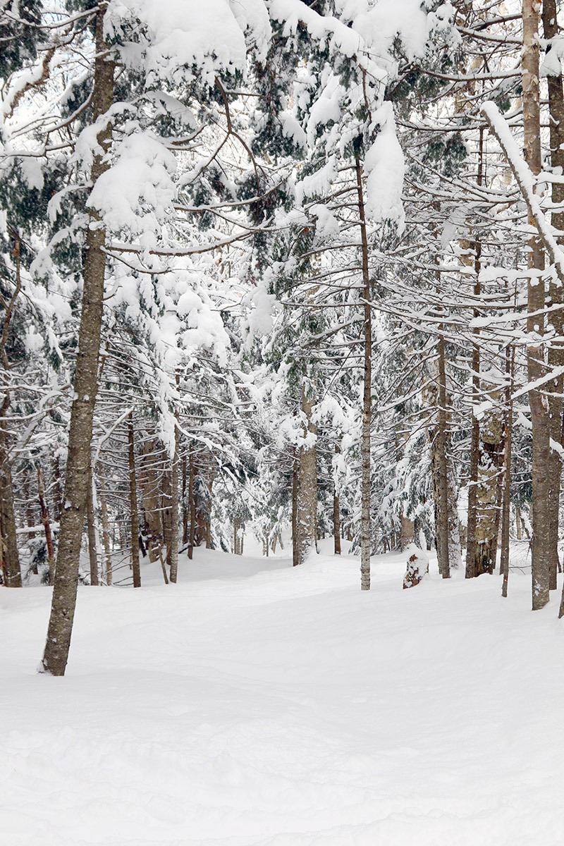
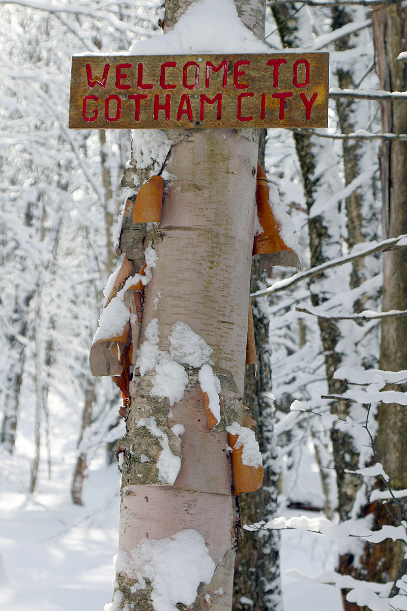
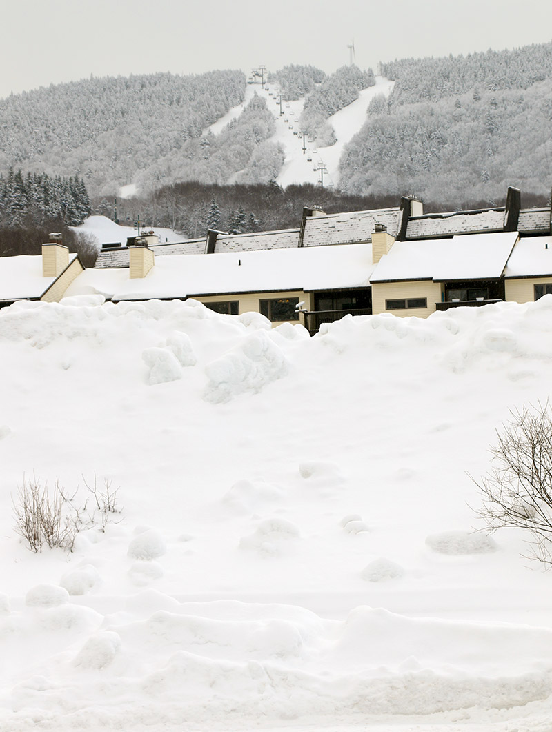
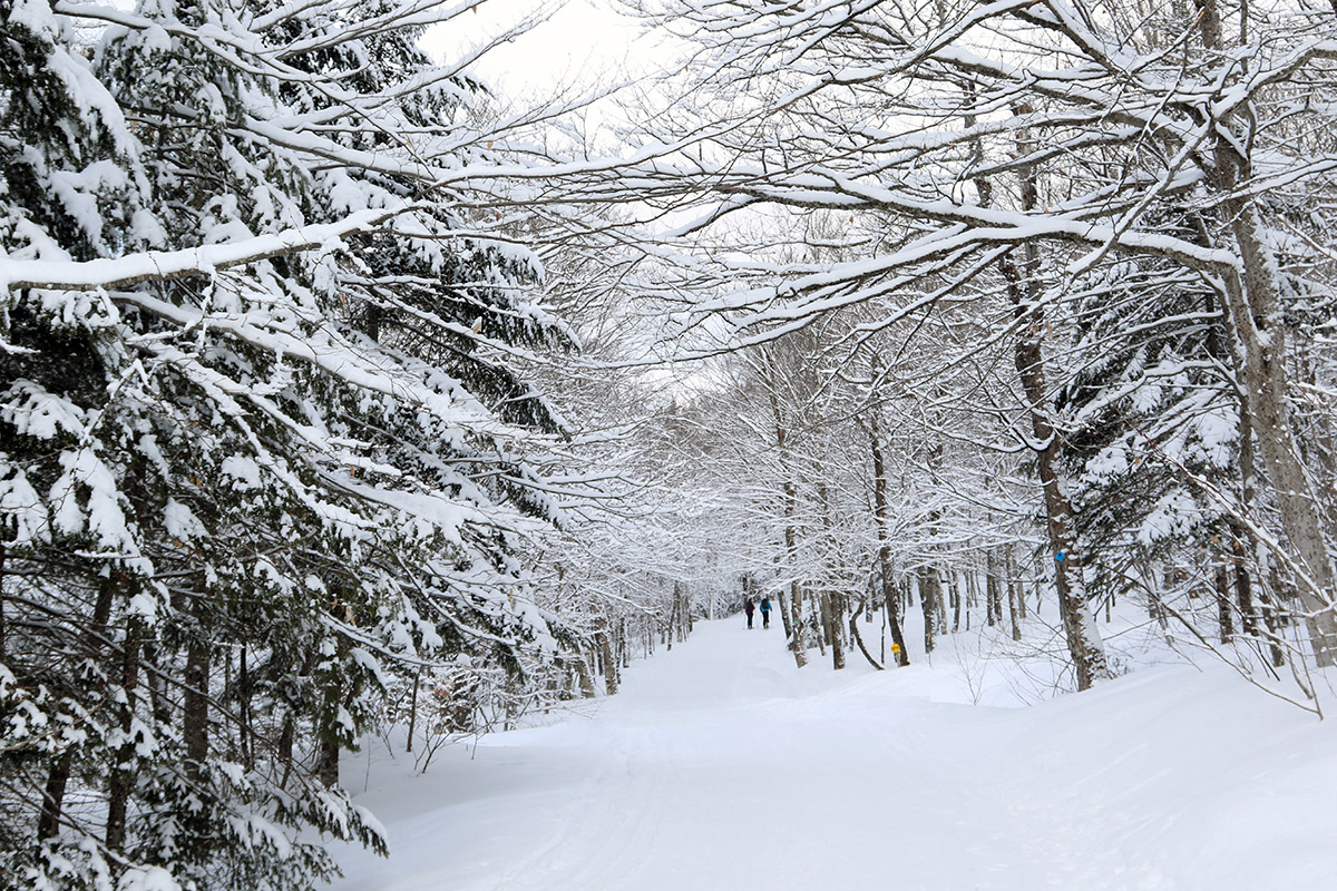
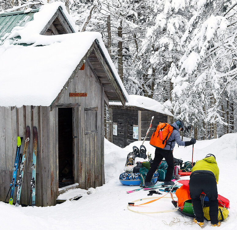
I hadn't had a chance to get out yesterday's mountain report, but I'm posting it now - conditions should be fairly similar today with the cold temperatures keeping everything well preserved. Although we’re currently between defined weather systems here in Northern Vermont, snow continues to fall, with a few tenths of accumulation down here in the valley and a couple of new inches reported up at Bolton Valley. In sessions on the mountain over the past few days, I’ve found the powder conditions to be quite respectable, especially at 2,500’ and above, and with temperatures remaining fairly comfortable today in the 20 F range, it seemed another outing was in order. The Village parking lots filled up by mid-morning yesterday, requiring my older son and I to do a bit of shoveling to create a parking spot, so I headed out a bit earlier today to make sure I wouldn’t need to park down at Timberline. Based on the rate at which parking spots were filling up this morning, it was feeling less busy than yesterday, and that’s not too surprising because visitors from out of state frequently use the holiday Monday as a travel day vs. a ski day. Today I was shooting for a smaller tour than yesterday, but I also wanted to spend a decent amount of time above that ~2,500’ level where the deepest/best powder conditions have been found. So I headed up the Bryant Trail to the Bryant Cabin, then continued my ascent with a traverse above Gardiner’s Lane that topped me out around 2,800’ in fairly short order. I made my descent through a fun combination of four or five different glades, with a big chunk of that being through some of the terrain in the JJ’s area. I also made it out to Gotham City and skied the Alchemist glade. I was initially a bit leery about skiing Alchemist, since it faces somewhat south and is below that 2,500’ level, but it wound up delivering some excellent powder turns. Its pitch and tree spacing fit the available powder very well, and the entire eastern section of terrain was untouched, so it was first tracks through there. I’d say relative to the past few days, there was an interesting transition in conditions today that I hadn’t expected – that demarcation line for the best skiing at around 2,500’ has definitely begun to blur. The additional snow probably altered things a little, but between the powder settling and the subsurface drying out and appearing to become more frangible, the quality of the powder skiing above 2,500’ dropped down subtly, and the quality of the powder skiing in the 2,000’ to 2,500’ elevation range has come up somewhat. The skiing is still the best where the powder is deepest at those higher elevations, but I’d say it was quite good everywhere in the 2,000’ to 2,800’ range I skied today, with those subsurface changes appearing to play a big role.

-

January 2026 regional war/obs/disco thread
jbenedet replied to Baroclinic Zone's topic in New England
Overnight - The EC-AIFS has trended further south but also a lot more amped. the other major guidance has trended north and more amped. There’s been an improved consensus. I think it’s most telling to see the EC-AIFS amp up but that doesn’t translate to a track further north. This is important. I like the 6z EC-AIFS - its current depiction and QPF as a baseline from here. -
My man, we don’t need weather app screenshots. Put them in banter if you really need to.
-
The Euro is doing exactly what we wanted it to with my breakdown yesterday. It’s managing to get help with the NS and have a legit HECS on the table.
-

January 2026 regional war/obs/disco thread
40/70 Benchmark replied to Baroclinic Zone's topic in New England
Imagine if this had happened 40 years ago, before the Hadley Cell swallowed the world....that 30" in VA would be in GA!!!