All Activity
- Past hour
-
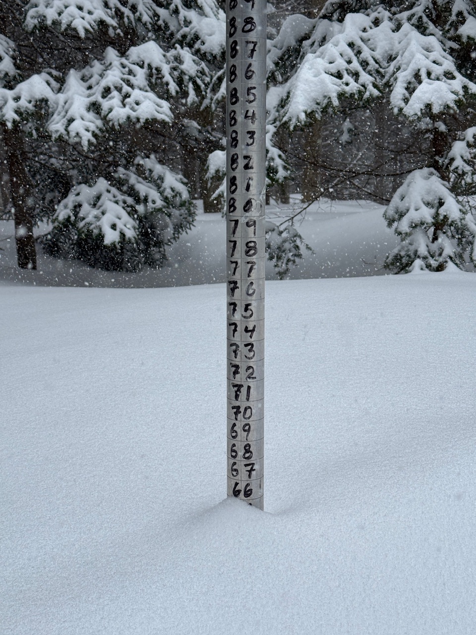
I was up there for the whole event. 180 miles of snowmobiling. Can't let off on the throttle in 50+ inches without getting stuck. https://photos.app.goo.gl/VGDwQMYsqnwMXVTy6

-
40.6° -SHRA
-
Agreed, there is a meager amount of MUCAPE hanging around and with EL's near -35C. Which, if storms can fire, should be able to produce lightning. 850-500 lapse rates are around 8C/KM which isn't half-bad. The storms could be quite "pulsey" as well as the LFC-EL shear is pretty weak, only about 15 kts (Pink lines).

-
.thumb.jpg.6a4895b2a43f87359e4e7d04a6fa0d14.jpg)
Central PA Spring 2026 Discussion/Obs Thread
Yardstickgozinya replied to Voyager's topic in Upstate New York/Pennsylvania

-
Gusts really starting to pick up here
-
Ocean gale in full force today, 49 degrees and windy from the south.
-
It would be a good day for a snowball fight.
-
If only there was a wiki on Alek-speak. My favorites are “dab” and “jelly”.
-
Made it to 69 ahead of the clouds moving in
-
I hope it trends worse....last thing I want is to end up blogging for another marginal situation that doesn't produce. I'm content to be done.
-
That's how it looked here before the Monday cutter.
-
Can confirm. My snow climo is 2 inches less than DCA, but there are plenty of days especially in the spring with CAD/NE winds where it's sunny here and 20-30 degrees cooler with mist in DC. A bit of elevation keeps the summer nights less hot as well, at least in the western half of what would be called Central VA. Lynchburg's average July low is 5 degrees cooler than DC's despite an overall warmer climate. It's still hot and humid, but I think it's preferable to NoVA/DC.
-
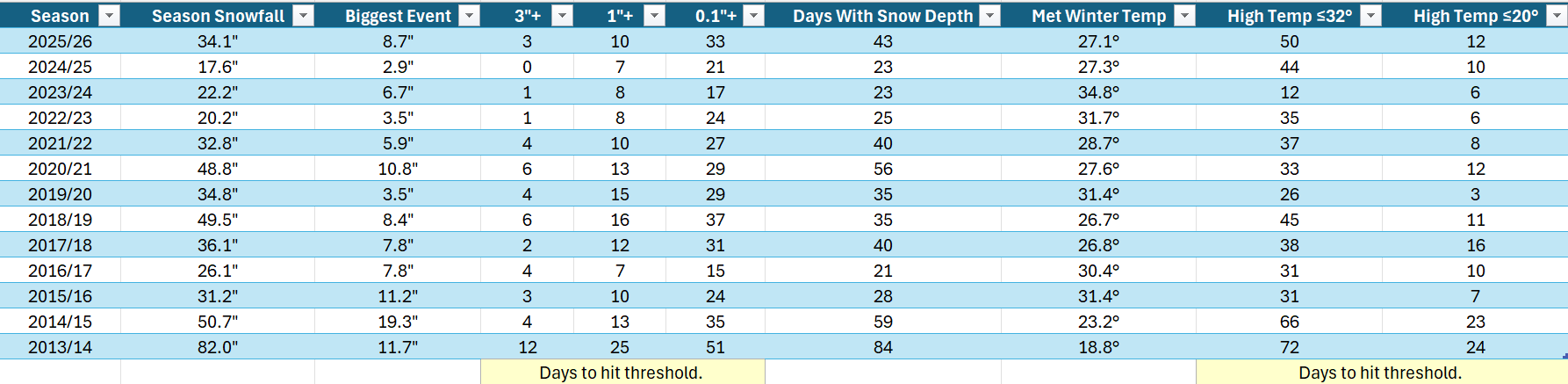
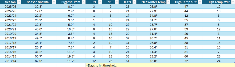
bump with an update through yesterday...
-
I’d like to see the secondary develop more and get more of a CCB versus relying on timing of cold and Precip.
-
Eh sell for now
-
finally Weymouth snow. None of this silly fluff bullshit
-
It sucks ass
-
This month was the easiest forecast in a while. Persistence + jet 300 miles north due to seasonal progression.
-
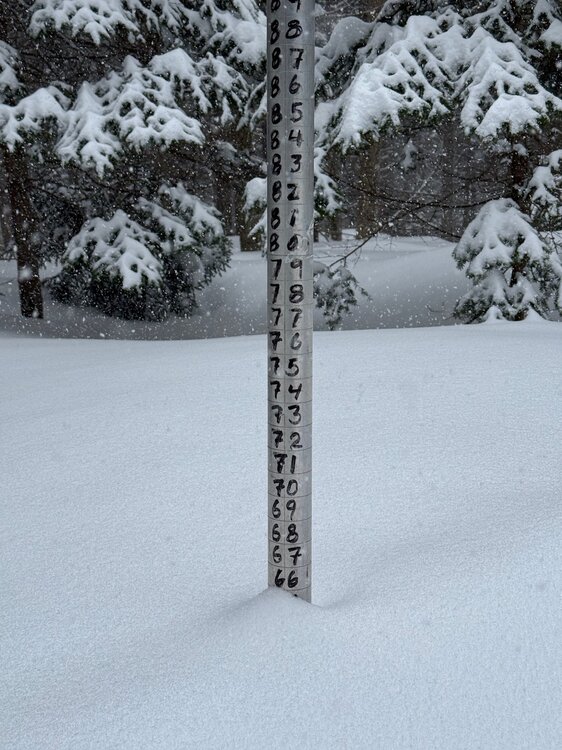
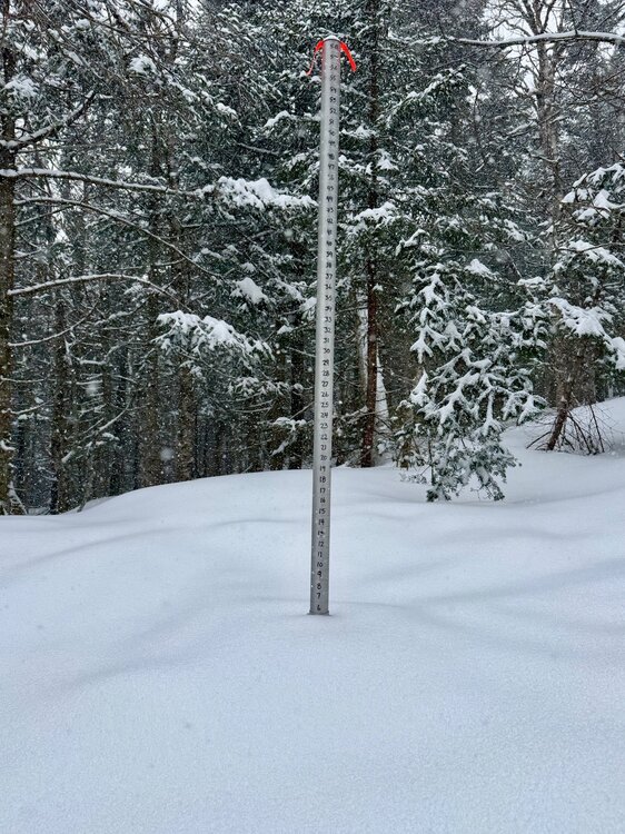
6” in 3 hours at 3,000ft. Still heavy snow.
-
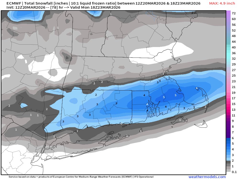
Hoping for some thunder later tonight. Seems to be some general consensus for a band of showers during the dinner hours, and then a second round of more scattered but also heavier cells closer to midnight. Lapse rates will sharpen a bit as the shortwave swings through, so I don't think that we can rule out some lightning.
-
This has moved through pretty fast. We really have ripped though.
-
Lots of support for SNE snow Monday morning
- Today
-
We're just gonna have to get a +3SD ridge with SW flow punching underneath before these models finally, reluctantly stipulate to warming up N-E of the Mason Dixie ... That Euro run's an abomination. 85 in PHL and 35 in BOS and just holds like that for 4 days probably happens
-
Yes sir. Wish we could score a last one here…especially if it refuses to get nice. 53 degrees here now..not that bad, but it’s cloudy.