All Activity
- Past hour
-

2026-2027 Record-breaking El Nino
GaWx replied to Stormchaserchuck1's topic in Weather Forecasting and Discussion
Today’s SOI is at ~-26. That’s the 33rd straight -SOI. The 30/90 day averages are at -17.5/-20.3: https://www.longpaddock.qld.gov.au/soi/ -

Central PA Summer 2026 Discussion/Obs Thread
canderson replied to Voyager's topic in Upstate New York/Pennsylvania
Yea but you’re 128 years old. -

2026-2027 Record-breaking El Nino
LakePaste25 replied to Stormchaserchuck1's topic in Weather Forecasting and Discussion
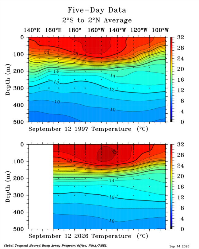
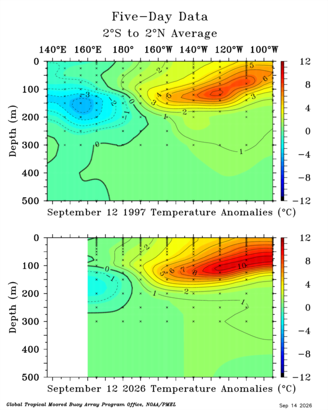
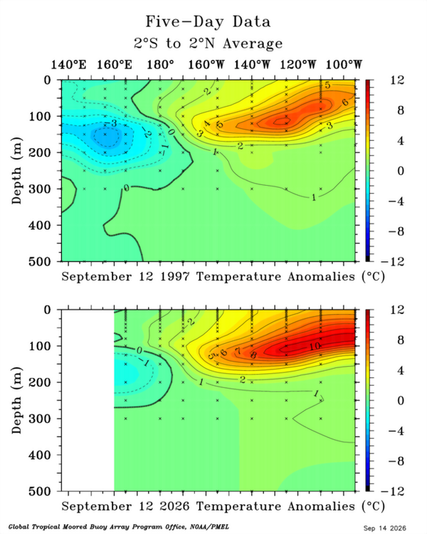
Further east and a much greater volume of warm water than 1997 with the 30C isotherm approaching 140W: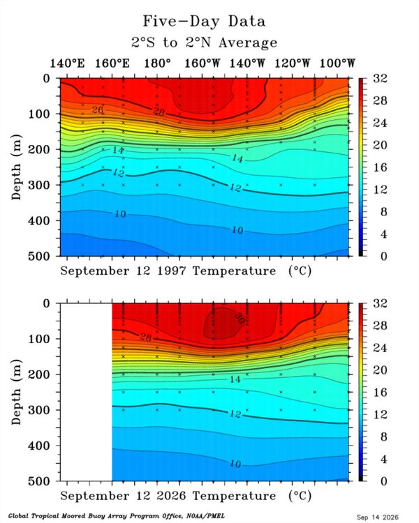
-
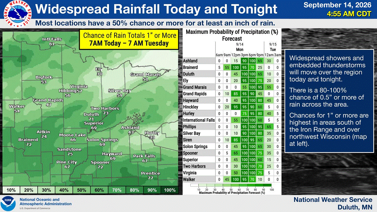
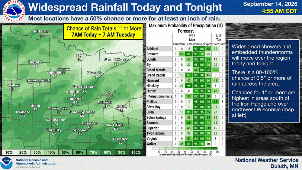
Upper 20's-30's across NE MN. Very chilly mid Sept morning. Now let it rain
-
2026-2027 Record-breaking El Nino
GaWx replied to Stormchaserchuck1's topic in Weather Forecasting and Discussion
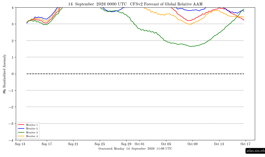
The AAM yesterday finally for the first time this month exceeded an impressive +3 per the following image after several early Sep runs had had that occurring by Sep 7-8th. The delay is typical due to a + bias of the CFSv2. This is saying it will hit an extreme level of +4+ in only ~5 days (~Sep 19th), which is the earliest in its forecast that I’ve ever seen it reach it, and that it will stay +4+ at least through Sep 24th. I’ll keep following these graphs to see if that actually occurs: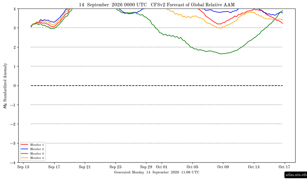
-
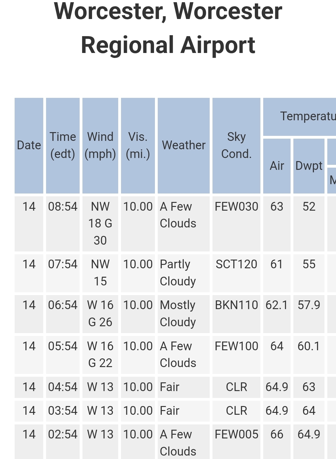
Nice breeze this AM blowing away some of the souptember feel. Should be nice DPs until the end of the week. Enjoy!
-

Septorcher 2026 Discussion - Endless Summer
kdxken replied to Damage In Tolland's topic in New England
Boom. And down we go.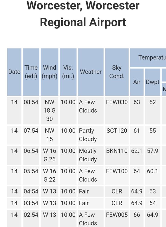
-
2026-2027 Record-breaking El Nino
GaWx replied to Stormchaserchuck1's topic in Weather Forecasting and Discussion
It was initialized at +4.6 for the full Sept averaged out. The mean then has +3.9 for Oct averaged out. There’s no requirement that the highly volatile 1+2 fall immediately for both of these to verify well. -

Mountain West Discussion
mayjawintastawm replied to mayjawintastawm's topic in Central/Western States
About the warmest early morning low I can remember at my house, 72 today. DIA had a low of 74. May go lower tonight before midnight, otherwise it'll break the warmest low record for the date by 11 degrees! Would also tie the record for the second lowest all-time minimum. -

Septorcher 2026 Discussion - Endless Summer
Brian5671 replied to Damage In Tolland's topic in New England
Dry day here is good for the flood cleanup that's ongoing. -

2026-2027 Record-breaking El Nino
forkyfork replied to Stormchaserchuck1's topic in Weather Forecasting and Discussion
do you really think it's going to immediately start falling -
 https://northrxcanada.com/# canadian drugstore online
 -
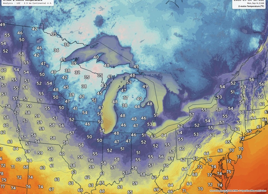
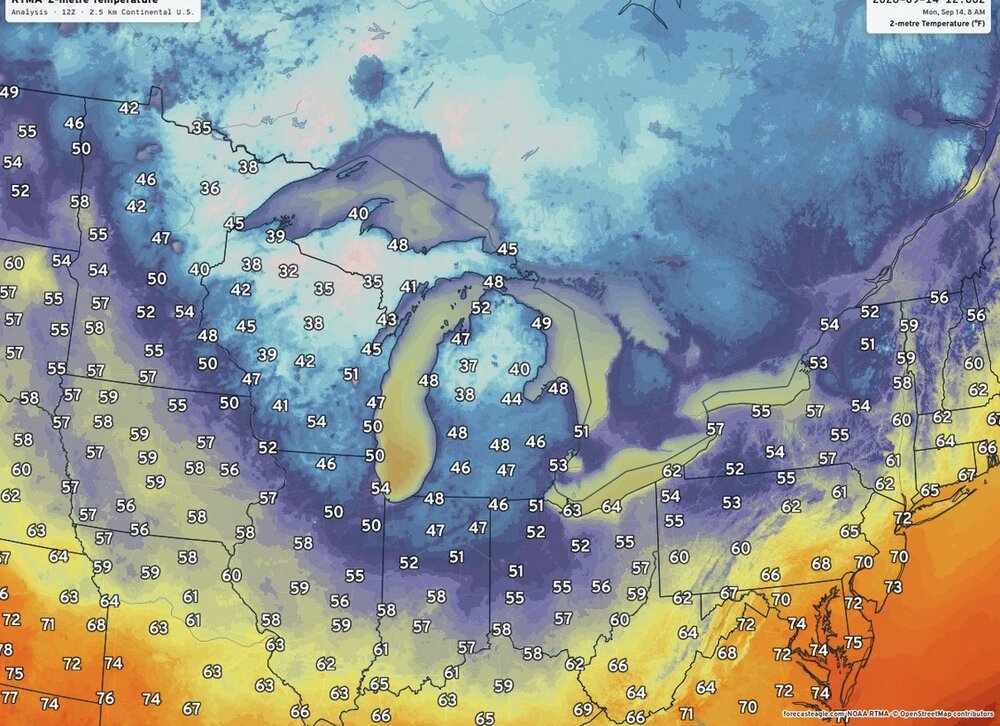
First chilly morning of the coming Fall season over the Great Lakes region.
-
http://indiagenericstore.com/# indian pharmacy online
-

2026-2027 Record-breaking El Nino
A-L-E-K replied to Stormchaserchuck1's topic in Weather Forecasting and Discussion
ready 4 that WAD life -
legit chilly in the apartment this morning after falling asleep with all the windows open, first real season is changing moment
-
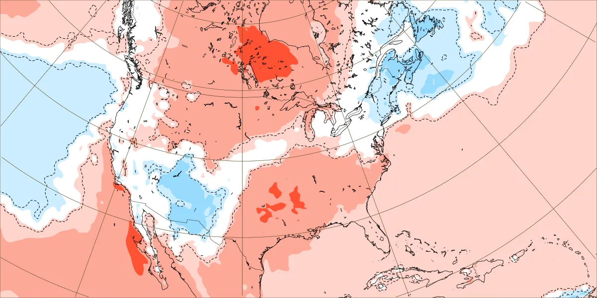
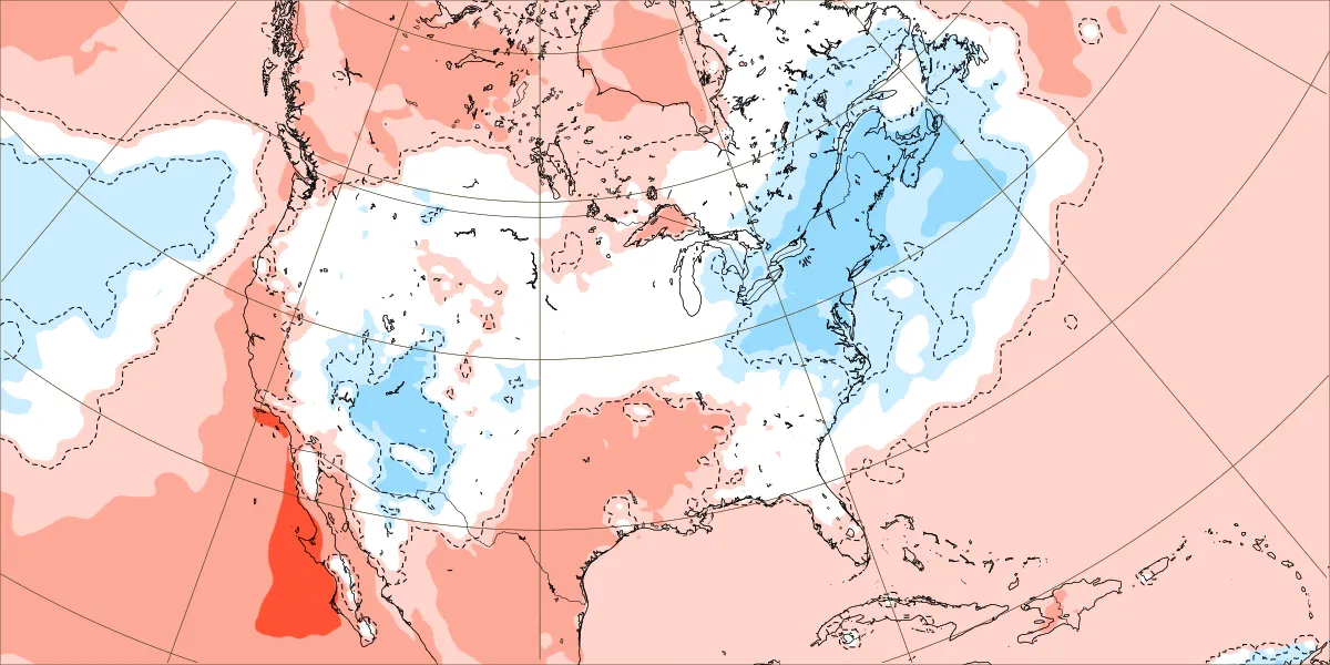
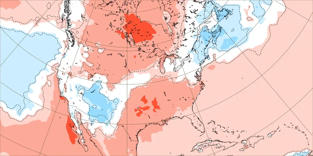
The cool down for late September continues to look less impressive following the record near 600dm ridge this week. EPS new forecast September 21st-28th Old forecast September 21st-28th

-
I swear, next year we're getting 80-degree lows in September, and probably DCA's average low will exceed 70.
- Today
-
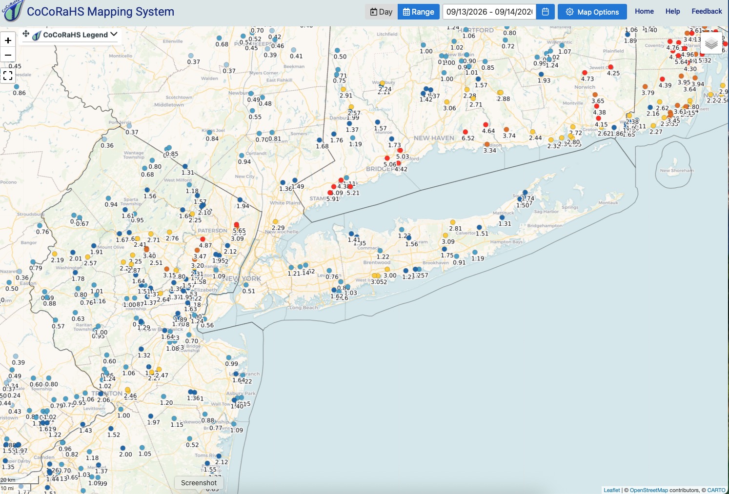
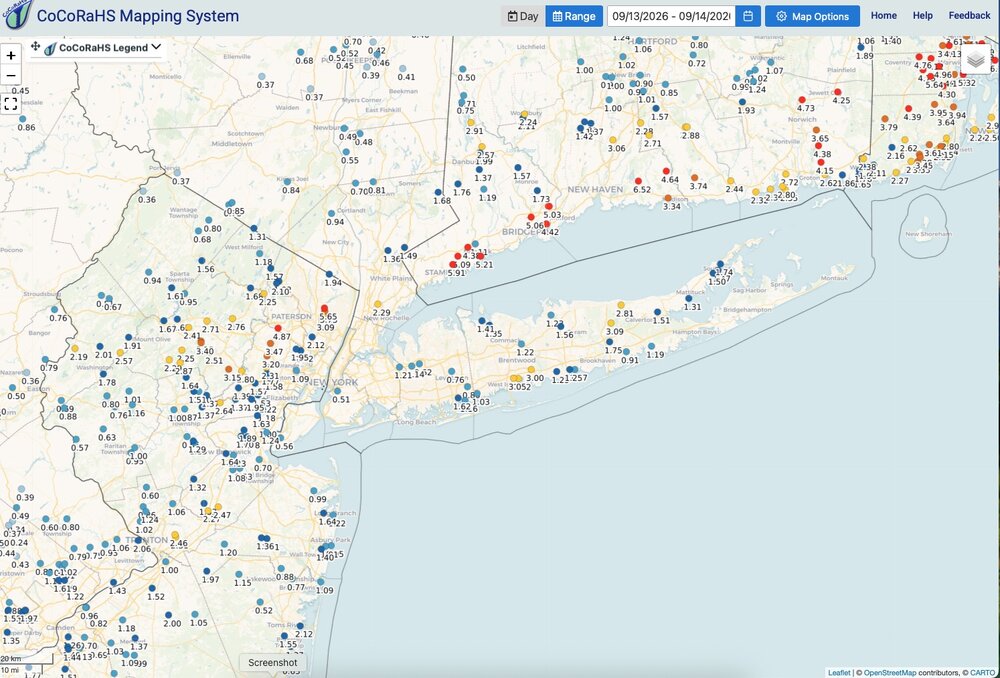
Finished with 1.63" rainfall here. Month: 3.26". Y.T.D.: 44.43", making a run at a 50"+ year. Heaviest rainfall totals from NENJ across Connecticut coast and into R.I. Isolated spots on L.I. got drenched with 3" totals. Nice this morning with a gusty breeze, low dp's and temperatures in the 50's for overnight lows across interior NNJ. Low of 58 here.
-
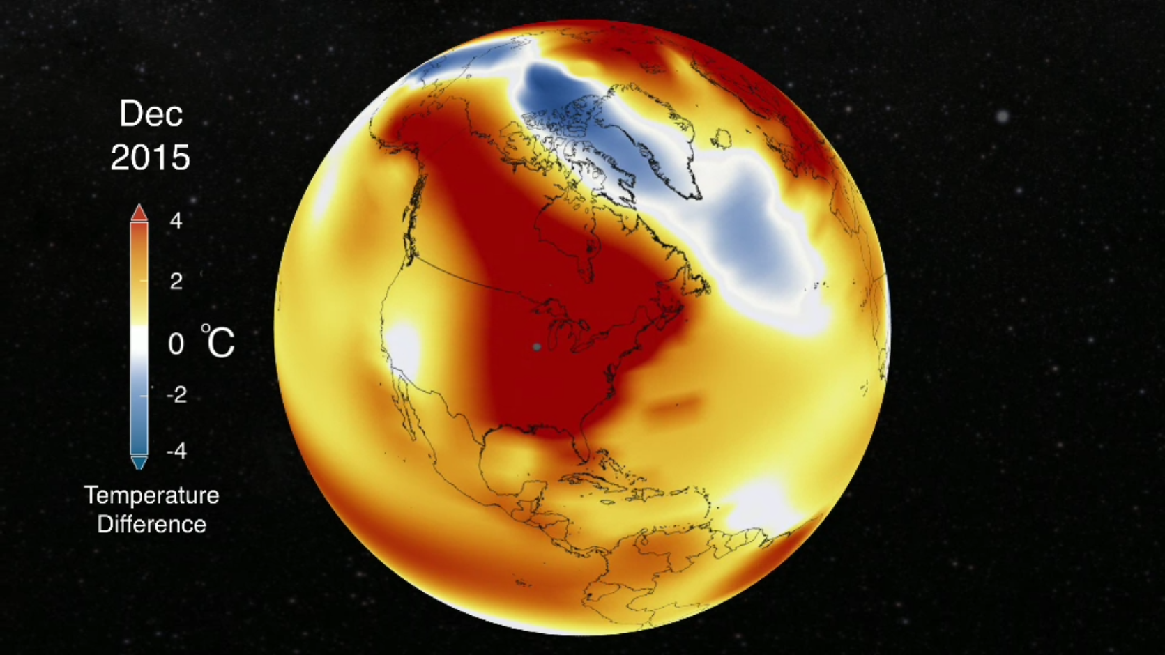
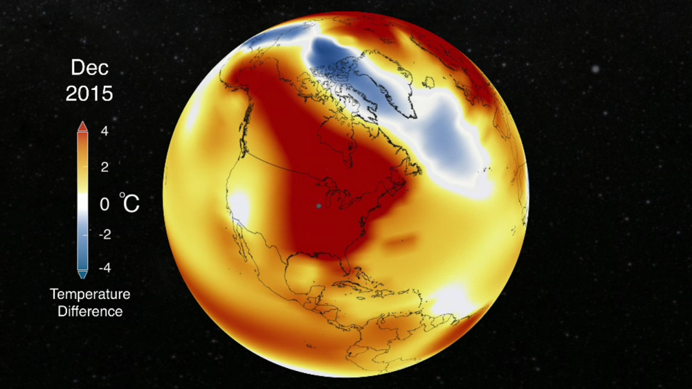
I don't think December will be representative of the balance of the season.
-
There's not much to work with here. I think Feb-March will be a better window perhaps.
-

Septorcher 2026 Discussion - Endless Summer
tamarack replied to Damage In Tolland's topic in New England
Looking from my 0.23" total, 1.92" seem like 'about 2'. -
Last 50s (59°F or below) EWR: Jun 16 — 58°F NYC: Jun 16 — 57°F JFK: Jun 16 — 58°F LGA: Jun 2 — 55°F Last 40s (49°F or below) EWR: May 31 — 46°F NYC: May 23 — 49°F JFK: May 31 — 48°F LGA: May 12 — 48°F Last 30s (39°F or below) EWR: Apr 21 — 35°F NYC: Apr 21 — 34°F JFK: Apr 21 — 34°F LGA: Apr 21 — 37°F
-
Funny you ask that - I was thinking randomly about October 2018 when it hit 90° multiple days in the lower elevations and I have pictures of me fly fishing with no waders like 2 weeks before Halloween. Also an El Niño year. A month and a half after wet wading, we had the big behemoth snowstorm of Dec 8/9 hit WNC. I remember the flip being harsh and the leaves still being in the infancy phase of changing colors as we flipped to Thanksgiving temps.
-
You know it's nearly fall in Colorado when one morning (this morning) the AC comes on before 7am, but I might need heat tomorrow morning.