All Activity
- Past hour
-
just a few outage's out there.
-
Snow 38⁰
-

December 2025 regional war/obs/disco thread
WinterWolf replied to Torch Tiger's topic in New England
Really…it’s been frigid for pretty much 3 weeks. Sure…not much snow, but it’s been cold consistently. -
December 2025 regional war/obs/disco thread
WinterWolf replied to Torch Tiger's topic in New England
Honestly, the AI did ok last week with the general idea. It seems almost the same this week with this one too. Sure it’s still a crap shoot, but the machines did ok last week in the end…I mean it did snow. -
That needs to get addressed.
-

December 2025 regional war/obs/disco thread
Kitz Craver replied to Torch Tiger's topic in New England
Nice bitter cold outside again… Just after the cyclone…Again -
Big time wishcasting for Boston here, but I’m intrigued by that region of snow back by the Quabbin. Unable to take a look at modeling or dynamics for that feature right now, will that have enough juice to make it east?
-
December 2025 regional war/obs/disco thread
WinterWolf replied to Torch Tiger's topic in New England
Only 3.5 weeks away…are you being facetious? Or are you serious? I mean it seems a bit weird. -
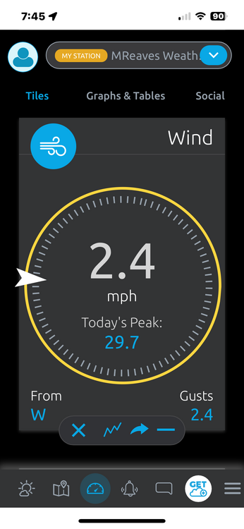
The wind was just about as strong as I’ve seen today. I spent most of the day in a conference room at the Waterbury State Office Complex with a wall of windows staring directly down the Winooski valley in JSpin’s general direction. The wind felt like it was shaking the windows and it pushed rain water in. My PWS recorded its highest gust ever at 29.7 mph. Sucks to have lost such a nice beginning but it’s snowing now.
-
December 2025 regional war/obs/disco thread
WinterWolf replied to Torch Tiger's topic in New England
It’s gonna be like last Sunday…it’ll snow, 2-3” or so. Has the same sig/feeling. -
Happy Anniversary !
-
Wow, nice. Just some flurries here this evening.
-
Somehow I picked up 0.65..... didnt pay much attention to radar last night..
-

Winter 2025-26 Medium/Long Range Discussion
Chambana replied to michsnowfreak's topic in Lakes/Ohio Valley
Seeing this huge lull in the winter season after the hot start, really just puts into perspective how truly legendary the great winter of 2013-2014 truly was. -
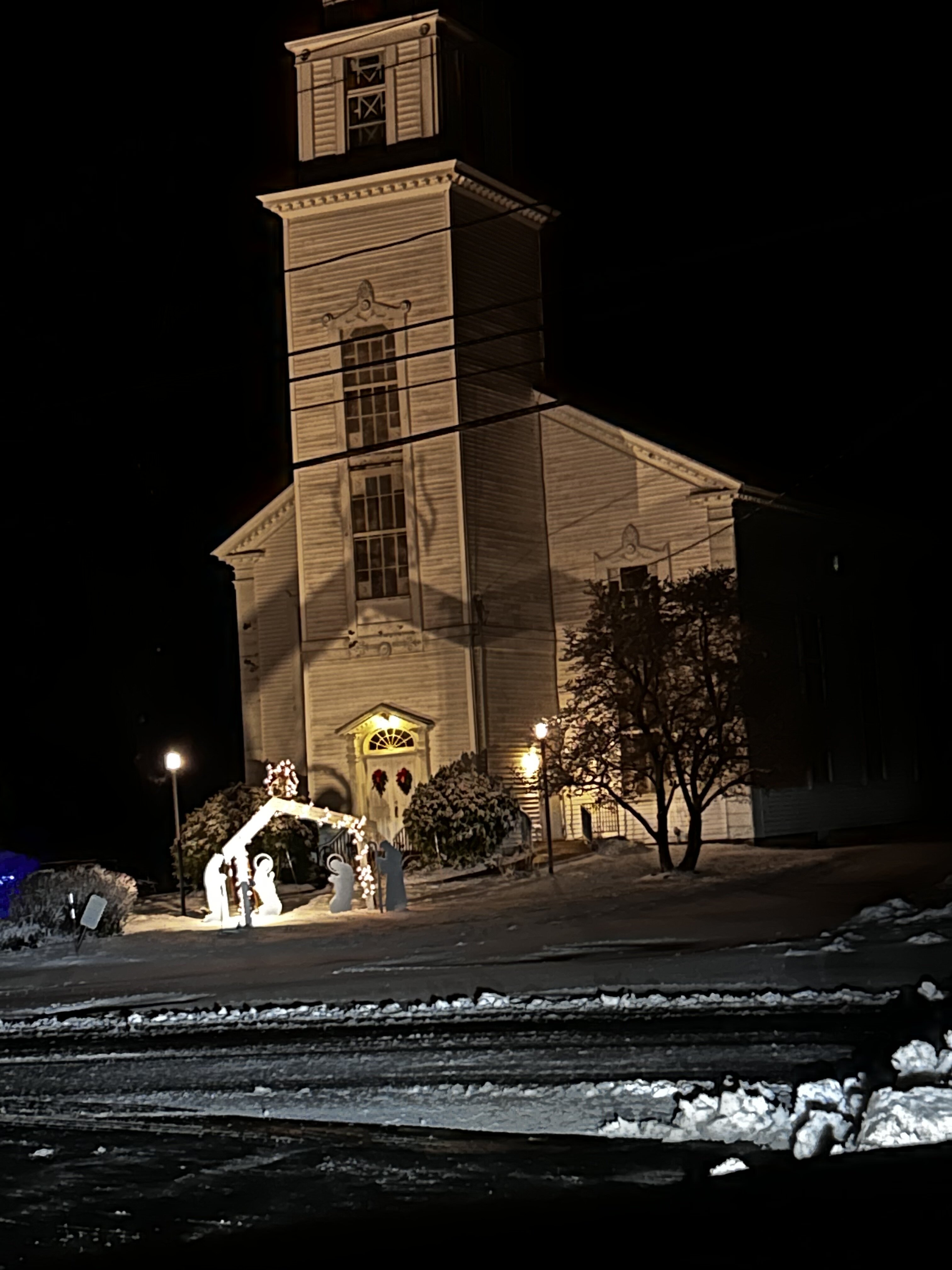
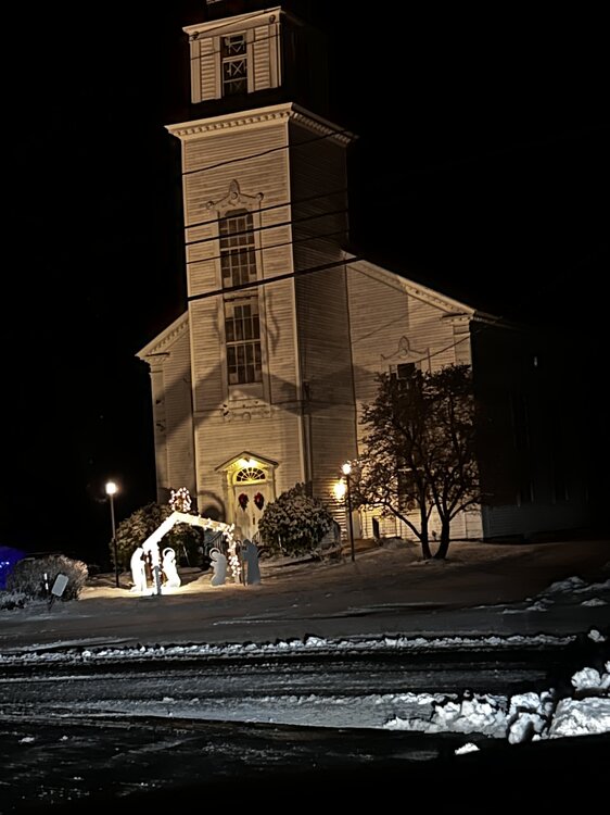
looks nice in the center of town
-
Agreed. A hostile PAC can be temporarily overcome by a great block anchoring in a high pressure to our north and pushing a low to our south. Won’t be the type of pattern where snow has staying power but a well timed wave could still absolutely produce and possibly produce big if just right. Cards on the table for the 12/31-1/3 timeframe but we’ll see
-
Happy Anniversary to you both! Here's to many, many more
-
I’m in washingtoville right now but when I left my side of Middletown about an hour ago it was coming down pretty good with close to 1” otg
-
All snow ripping here, coated up fast
-

Possible Light Snowfall (1" - 3") on Tuesday Dec 23
CPcantmeasuresnow replied to Northof78's topic in New York City Metro
I think the us in here that live in the north may get an inch or two out of it. -
My PWS is poorly sited for wind. It’s too close to the house and gets blocked from several directions. All that said, this is the strongest wind I’ve measured since I’ve had it, almost 30 mph.
-
I think i see snow flakes and a deer staring at me staring at it with my flashlight
-
Down to 30, snow showers and flurries. Whitened things up a bit on cold surfaces.
-
From full snow cover to 55° with 1.3" of rain and now it's 30° with accumulating light snow and back to full cover including a slushy buildup in the street. Heckuva day
-
Lol! Yes. We should save this. What do you call a torch?? 1 or 2 days about 4 to 6 degrees above normal?