All Activity
- Past hour
-
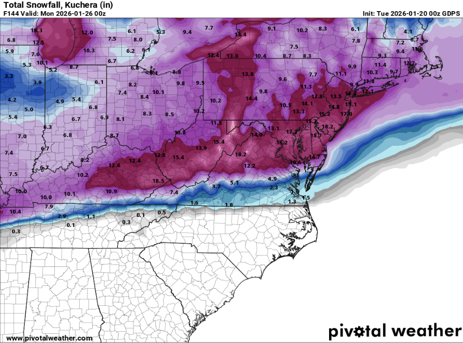
CMC with another batch developing 144 lol
-

E PA/NJ/DE Winter 2025-26 Obs/Discussion
MJO812 replied to LVblizzard's topic in Philadelphia Region
-
If @Ji lived in Raleigh he would say “I want 18 to 0 in one run
-
-
Possible Record Breaking Cold + Snow 1/25 - 1/26
MJO812 replied to TriPol's topic in New York City Metro

-
And the cold after… this would be generational because we havent had a storm like this since 93 where there has been prolonged cold after a storm. .
-

Central PA Winter 25/26 Discussion and Obs
paweather replied to MAG5035's topic in Upstate New York/Pennsylvania
CMC looks great! -
It might be following more climatology since that is what usually happens?
-
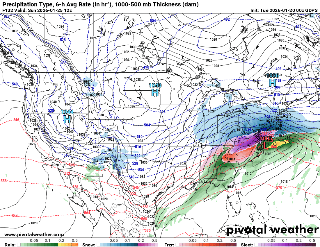
All in all. The Canadian is similar to it's 12z run. 1-2+ inches of ZR over a lot of the area, heavy sleet over areas just NW of that zr, and Kentucky wins the snow awards.
-

E PA/NJ/DE Winter 2025-26 Obs/Discussion
Ralph Wiggum replied to LVblizzard's topic in Philadelphia Region
BOOM!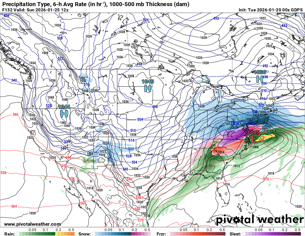
-
i'm going to go crazy
-
Classic!
-
E PA/NJ/DE Winter 2025-26 Obs/Discussion
Ralph Wiggum replied to LVblizzard's topic in Philadelphia Region
CMC was a foot+.....GFS was 6-12 -
Old met down here mentioned that 10 years ago on 1/25/16 we got rocked during the broncos vs patriots afc championship game. Let’s run it back again this weekend folks!
-
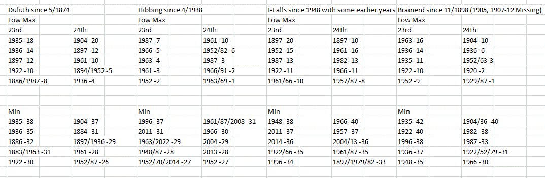
I compiled records for my area for the 23rd-24th. I'd say, as of tonight's model potential, that low max records have a good chance of falling. Friday am lows may reach top 5, but there may be a light wind keeping temps up a little with mixing. But with HP centered over the W Lakes Sat am, radiational cooling will drop temps under calm conditions pretty fast, especially at sunrise where a 3-5 dF drop could occur. If, perchance, the winds are calm Friday am, too, expect the same.

-
Do we know that though?
-
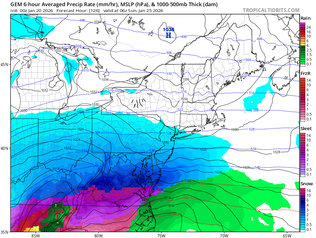
Ggem surface reminds me of 1996 with the initial extension of the trough to the north of the wave ip into KY before the transfer to the coast and an arctic high in the way.
-
Calm down. Take a deep breath lol
-
That hodograph lol... violent tornadoes incoming
-
Possible Record Breaking Cold + Snow 1/25 - 1/26
MJO812 replied to TriPol's topic in New York City Metro
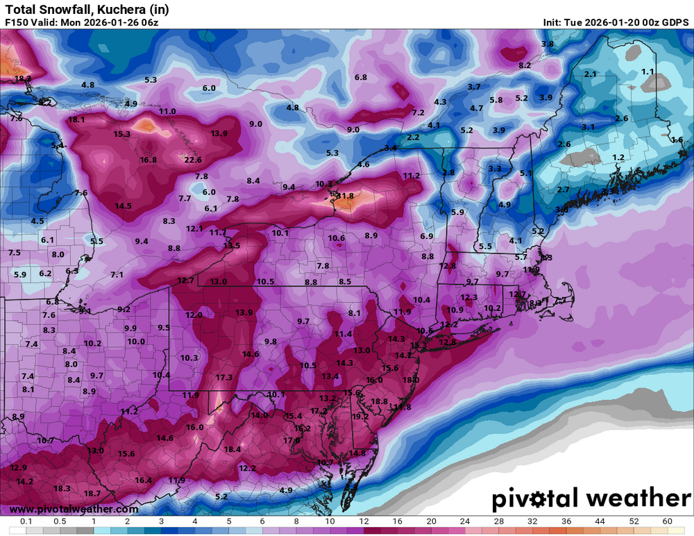
Very high ratios snow also. -
And juicier. The duration and qpf is just silly. .
-
I mean this is fine

-
Starting to think it’s finally time I read the Northeast Snowstorms book this week.
-
Check please. .
-

Possible Record Breaking Cold + Snow 1/25 - 1/26
Franklin0529 replied to TriPol's topic in New York City Metro
Pants tent material right there. Good God