All Activity
- Past hour
-
Not happy about that.
-
 Highs: TEB: 85 * erroneous 93 readning EWR: 85 PHL: 85 NYC: 84 LGA: 84 New Brnswck: 84 JFK: 83 ISP: 83 TTN: 83 BLM: 81 * missing most data ACY: 81
 -
I'm worried as well...
-
Yep it's about to get really soggy
-
Moved daughter into Bryan College Friday. Perfect timing for the fall temps. It looked like fall most of day with the clouds & fog. Yesterday was perfect with mostly cloudy most of the day. Finally got some good rains which helped settle the dust. Unfortunately I have come down with a bug & have slept most of day. Hopefully this fall wx continues.
-
The July 30 mb QBO was released today at -19.99 (nothing surprising).
-

2025-2026 ENSO
KakashiHatake2000 replied to 40/70 Benchmark's topic in Weather Forecasting and Discussion
oh i see interesting thank you -

2025-2026 ENSO
Stormchaserchuck1 replied to 40/70 Benchmark's topic in Weather Forecasting and Discussion
It's a Hadley Cell expansion phase. The Hadley Cell has also been expanding in the Atlantic, and it looks like this is a long term phase (similar to cold-ENSO) that has lasted about as long as the current -PDO cycle (since 1998, +AMO has been since 1995). The Hadley Cell would have to shrink, allowing for more mid-latitude low pressures, which is usually more associated with +ENSO. Some have correlated it to the Solar, by which there may be a few year lag. We had record low sunspots 2003-2022, but an active solar cycle has occurred over the last 2 years. - Yesterday
-
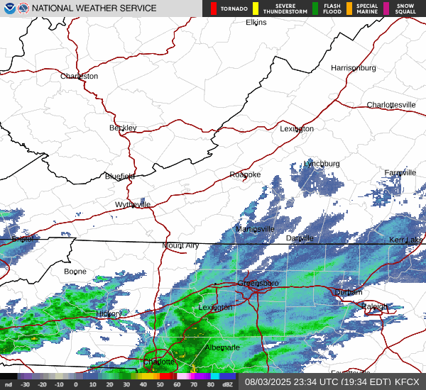
Current radar looks like...dry air is eating into our snowfall
-
2025-2026 ENSO
KakashiHatake2000 replied to 40/70 Benchmark's topic in Weather Forecasting and Discussion
so what happens when it goes away what would be in replace of it or would it go to a +pdo -
Just ate dinner on the deck. Mr. J said it feels like September. Told him it smells like it to. I attribute that to all the trees stressed from our past low precipitation July.
-
sunrise looked the same here this morning..
-
2025-2026 ENSO
KakashiHatake2000 replied to 40/70 Benchmark's topic in Weather Forecasting and Discussion
oh i see gotcha interesting thank you stormchaserchuck1 -
Wild. Warmer in ME, where we are currently under wildfire smoke gloom
-
2025-2026 ENSO
Stormchaserchuck1 replied to 40/70 Benchmark's topic in Weather Forecasting and Discussion
If we are at the peak now, it may take some time to wind down. It started in 1998, so we are approaching 30 years. The thought is that it should start to come down over the next few years.. although it could break the historical trend and last longer. -
Low of 66. Lowest since early June. With the wind, it actually felt cold. Beautiful day. High of 81. Dew points in the mid 60's felt so nice.
-
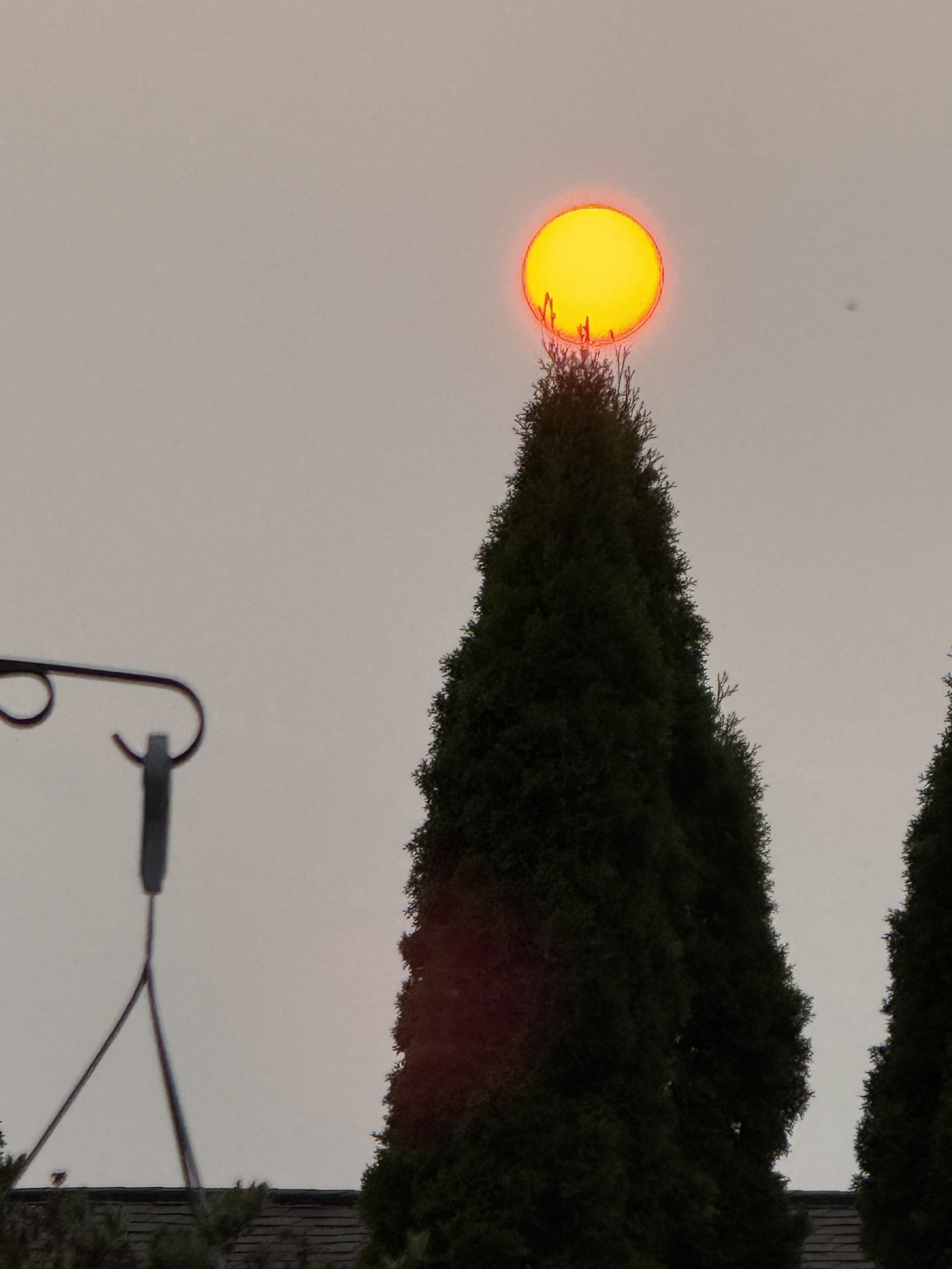
Merry Smokemas!
-
PDO +time. Notice how its correlation increase the further in the year you go. Pretty uniform. Usually indexes aren't that uniform It seems to make a big jump August-October. Those maps are default positive phase (with both sides factored in), so a negative PDO would be opposite of those maps.
-
MJJ 2025 ONI (rounded to nearest tenth): -0.1C MJJ 2025 RONI: -0.40C
-
Great shot
-
2.7 for this event. .56 of it in a steady light rain today.
-
2025-2026 ENSO
Stormchaserchuck1 replied to 40/70 Benchmark's topic in Weather Forecasting and Discussion
RONI should be pretty comfortable La Nina though? Like a -0.8 to -0.9 peak. That's similar to a 1950 year having ONI of -0.8/9. RONI has led for H5 correlations over ONI the last 3 Winters, at least. -
2025-2026 ENSO
KakashiHatake2000 replied to 40/70 Benchmark's topic in Weather Forecasting and Discussion
how long has this -pdo cycle last im guessing longer than the 30 year span of the 1940s-1970s -
Quite the sunset tonight with the smoke