All Activity
- Past hour
-
Disclaimer: I'm not the expert at upper level analysis by any means But this doesn't look quite like the "HECS" look that supports a low that strong though its a very good pattern This is -EPO, -NAO, with a neutral looking PNA with the ridge offshore. The -EPO delivers arctic air while the -NAO stops the storm from cutting NW. But for a truly historic storm it would seem like we'd need the ridge a few hundred miles east which would push the trough southeast over the TN valley and phase with the subtropical energy and create a stronger storm. This looks like it would support, at the upper potential, an overrunning event like Jan 2010 or... Dec 2018 (you all would love that if it had been 100 miles north) with widespread double digits totals, but not the 18-24"+ totals that would be "historic".

-
6z ICOn was setting up nicely too.
-
I know, that's why I posted. It shifted south.
-

Rise of the Machines: January 18-19 Winter Storm Obs Thread
CoastalWx replied to WxWatcher007's topic in New England
Man I’m just staring outside. Boy did I need this. This is pristine winter. -

January 2026 regional war/obs/disco thread
Sey-Mour Snow replied to Baroclinic Zone's topic in New England
Yes and regardless what model, Richmond is ground zero right now, some of the means are unreal.. Still 5.5 days out plenty of time to pull her north.. -
Uuuugh
-

Rise of the Machines: January 18-19 Winter Storm Obs Thread
moneypitmike replied to WxWatcher007's topic in New England
Fatties that would make Pickles rich are coming down at a good clip. -

January 2026 regional war/obs/disco thread
ORH_wxman replied to Baroclinic Zone's topic in New England
Yeah I was looking at 06z which was pretty ugly. Obviously that doesn’t mean the threat is gone but it truly is basically AI and Ukie versus other guidance right now. -

January 2026 Short/Medium Range Thread
Holston_River_Rambler replied to John1122's topic in Tennessee Valley
Here's a comparison on weatherbells graphics of the 6z Euro and 0z Euro: Note the shortwave the higher res Euro picks up diving in through the Dakotas. That would work to keep some suppression in play -
Currently NWS forecast for this storm for Magnolia Delaware Saturday A chance of snow. Partly sunny, with a high near 23. Chance of precipitation is 30%. Saturday Night A chance of snow. Mostly cloudy, with a low around 9. Chance of precipitation is 30%. Sunday A chance of snow. Partly sunny, with a high near 21. Chance of precipitation is 40%.
-
January 2026 regional war/obs/disco thread
Sey-Mour Snow replied to Baroclinic Zone's topic in New England
00z GEFS was a broad light to mod hit from Norfolk to Portland Maine -
Stolen from the southern forum. Just out to 144, of course
.gif.ab774c3fb5ea878764f67d094b66986c.gif.d2c814c40a8e0cb2ccd164c61568399a.gif)
-
January 2026 regional war/obs/disco thread
Sey-Mour Snow replied to Baroclinic Zone's topic in New England
I agree that trends don't look good if you toss the AI models with the cold press from Canada.. However, I do like how consistent the AI's have been. Also PD2 is a pretty damn close analog and we know how that trended north last 48 hours.. Also the ops have been occasionally showing some hits.. Have to start getting some more op hits, looks like it's all about how the SW vort ejects and phases in.. -
January 2026 Short/Medium Range Thread
Holston_River_Rambler replied to John1122's topic in Tennessee Valley
6z Euro: Ticked north a bit: 6z: 0z: -
I was so confused when I woke up and saw snow outside before I remembered that yesterday happened
-
January 2026 regional war/obs/disco thread
ORH_wxman replied to Baroclinic Zone's topic in New England
GEFS didn’t show anything for the overrunning setup. They were suppressed. -

Rise of the Machines: January 18-19 Winter Storm Obs Thread
radarman replied to WxWatcher007's topic in New England
That back edge has actually been producing good snsh this morning. Big fluffy flakes. It is so wintery rn -

Rise of the Machines: January 18-19 Winter Storm Obs Thread
Snowedin replied to WxWatcher007's topic in New England
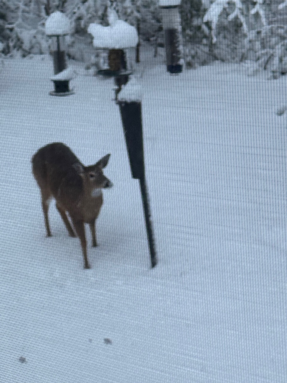
Big ol deer out beneath the feeders pondering its next move.
-
Who ? Thats what the models show.
-

Rise of the Machines: January 18-19 Winter Storm Obs Thread
Damage In Tolland replied to WxWatcher007's topic in New England
Or were awake -
Very consistent
-
Rise of the Machines: January 18-19 Winter Storm Obs Thread
Damage In Tolland replied to WxWatcher007's topic in New England
AI’s say yes! -
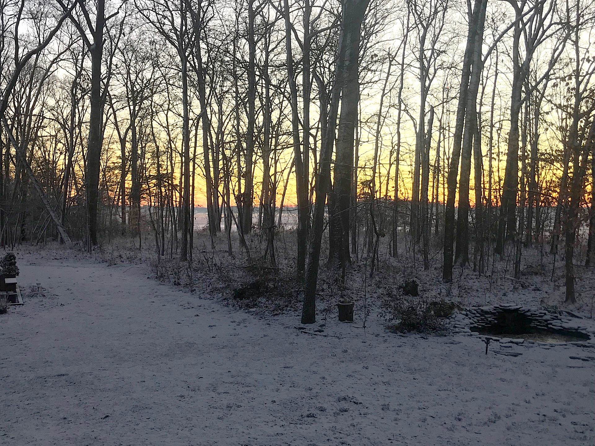
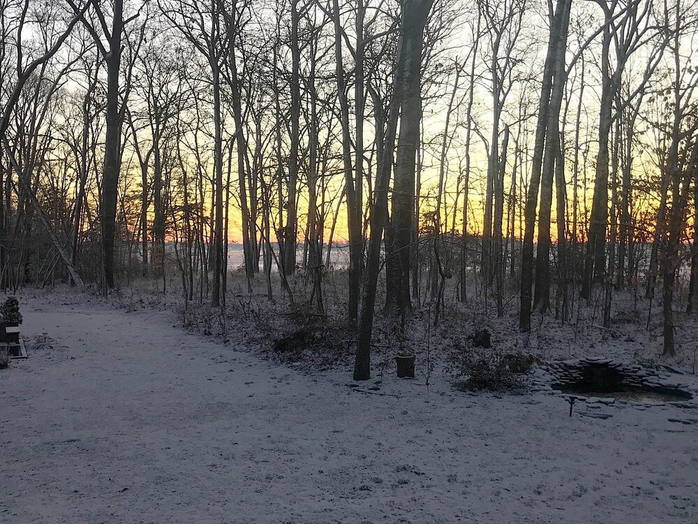
Sun about to come up. 16 degrees. Not quite a half inch.
-
They changed their minds again
-
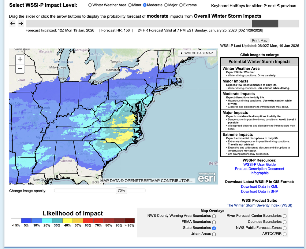
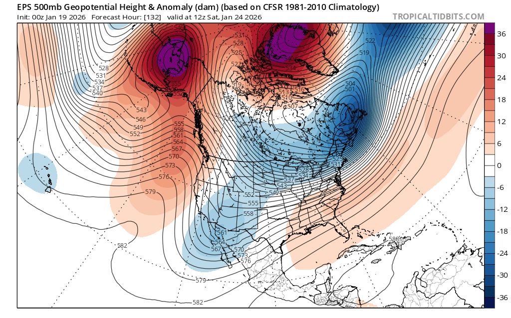
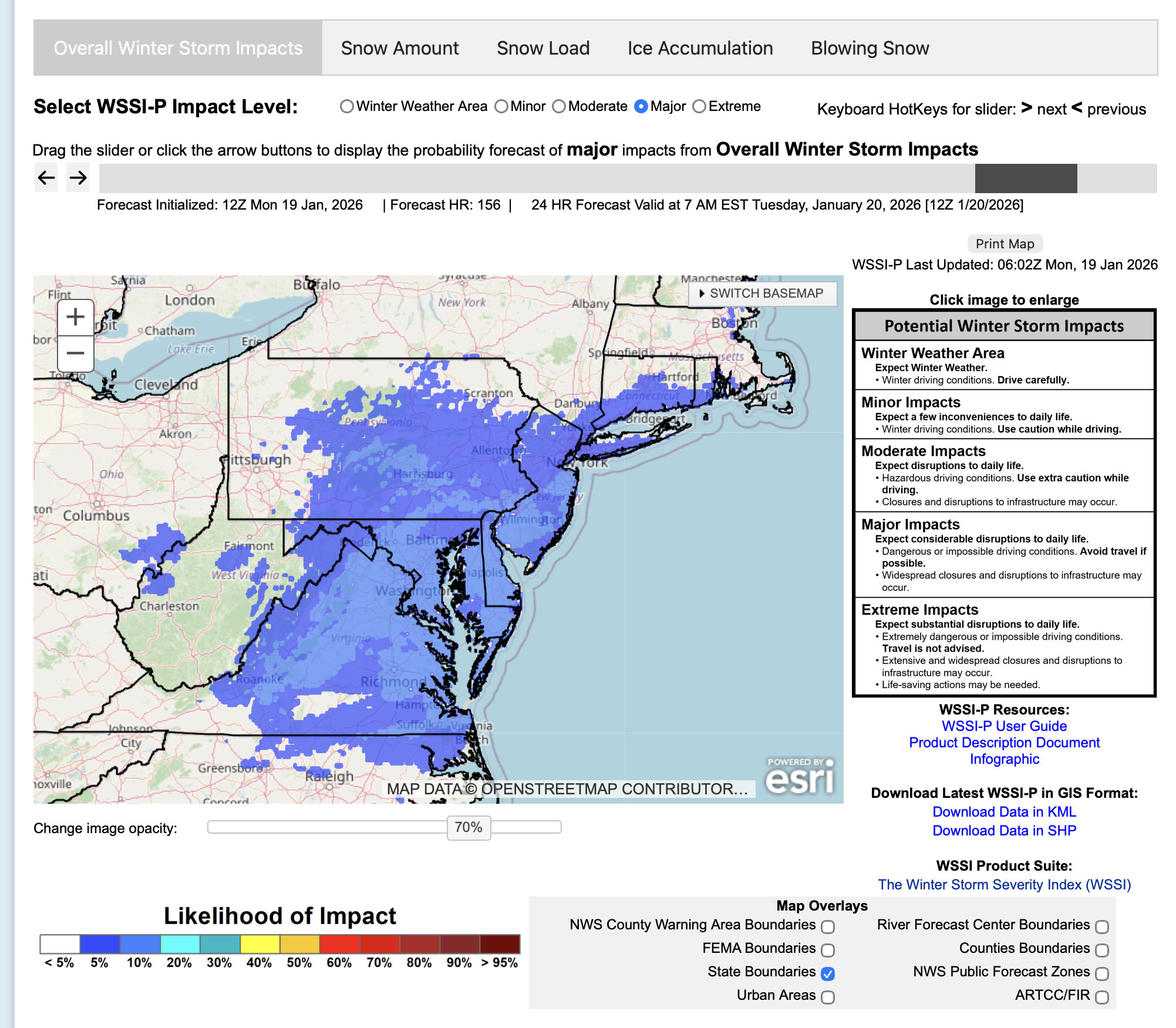
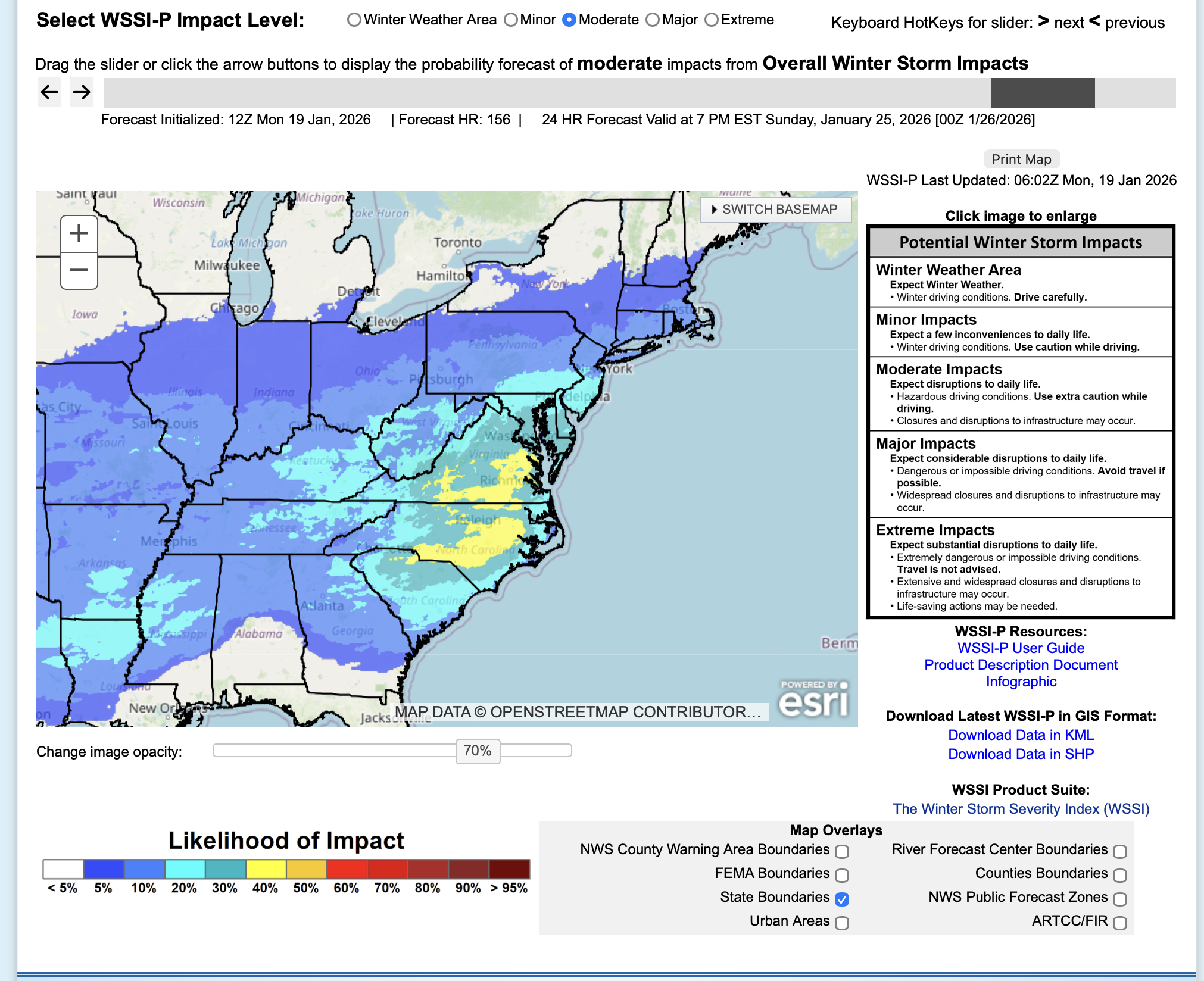
PLEASE USE with caution--- others here prior to this have already spoken, but there is hope here for a pretty good powder snowstorm next weekend... very cold air in advance... depends on the confluence zone at 5H (for now imo think we' re on the north edge of 4+ NYC) AI's through 06z/19 cycles are north of the following probabilistic for this coming weekend: Think (just my opinion) it only a matter of a day or so that the NWS WPC advertises a probable major winter storm in the eastern-southern USA. Since our recent AI communication w Bluewave and others prior flagging me on AI better performance... not always best but needs stronger weighting consideration, even in its relative modeling infancy. The MAPS below are self explanatory for this coming weekend. One is MAJOR impact... VERY-VERY low probs right now PA/NJ/LI. The other is moderate (max prob axis south of Mason-Dixon).. and this is 5-6 day in advance. Enjoy your snow cover... and coming imo, possible infrastructure impact coldest air-- since Jan 19?