All Activity
- Past hour
-
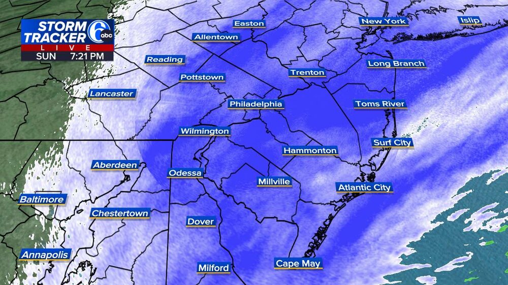
7pm Snowfall Reports: NWS NY: 2.5" Newark, NJ: 2.0" Islip, NY: 2.0" Central Park, NY: 1.8" JFK: 1.7" LGA: 1.7" Bridgeport, CT: 0.8"
-

"Don’t do it" 2026 Blizzard obs, updates and pictures.
WxWatcher007 replied to Ginx snewx's topic in New England
Beat me to it -

Feb 22nd/23rd "There's no way..." Obs Thread
SomeguyfromTakomaPark replied to Maestrobjwa's topic in Mid Atlantic
Kinda decent here now at least it’s accumulating. -

Central PA Winter 25/26 Discussion and Obs
canderson replied to MAG5035's topic in Upstate New York/Pennsylvania
My mulch is turning white! -
Pouring snow here. I’d say an inch in the last hour. Eyeballing of course. I’m close to 3”. 31F.
-
serious question....how reliable are these? i alway see people slamming them....
-
First time I ever saw thunder snow. Was 9 years old. Epic.
-
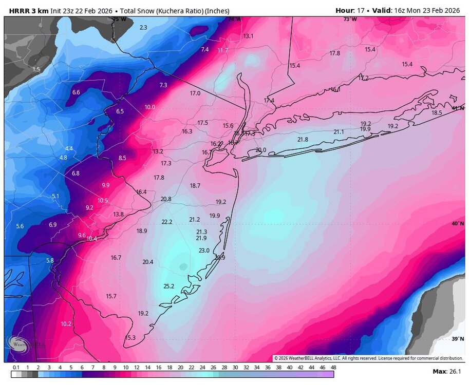
2/22 23z hrr through 18h (12pm) Snow
-
I am halfway up the mountain. He lives along spring creek. .
-

Blizzard of 2026 Storm Thread/OBS
BroadWing3544 replied to Mikeymac5306's topic in Philadelphia Region
Around 2" here in Glen Mills (about fifteen minutes southeast from West Chester) -

"Don’t do it" 2026 Blizzard obs, updates and pictures.
Sey-Mour Snow replied to Ginx snewx's topic in New England
Mesoscale Discussion 0115 NWS Storm Prediction Center Norman OK 0624 PM CST Sun Feb 22 2026 Areas affected...New York City into Southern New England Concerning...Heavy snow Valid 230024Z - 230530Z SUMMARY...A long-duration moderate/heavy snowfall event will increasingly impact NYC into parts of southern New England this evening into Monday morning. 1-2 inch per hour snowfall rates will be likely, particularly after midnight EST. DISCUSSION...Recent regional radar imagery from the northern Mid-Atlantic/southern New England shows a band of moderate to heavy snow moving slowly northward into Long Island. Already, recent surface observations reported 1 inch in the last hour at Islip, LaGuardia, and JFK. This band should continue to impact parts of southern New England this evening. The highest snowfall rates will at least initially remain near the coast. With time, the 994 mb low analyzed off the Mid-Atlantic coast will deepen, particularly after 11 pm/midnight EST. This will eventually promote a broader zone of stronger isentropic ascent that will promote more widespread moderate/heavy snow farther north. Surface winds will also concurrently increase with the deepening of the low. Blizzard conditions will be possible late this evening into Monday morning. -

Feb 22nd/23rd "There's no way..." Obs Thread
Solution Man replied to Maestrobjwa's topic in Mid Atlantic
I like the back building hopefully that thing forms to our West let’s see what happens -
Greenday?
-
-
eyeballing around 3 here; snowing good but not horrendous. i could see us getting 10-12. about what i could handle anyway.
-
20 degrees here with heavy snow. Drinking a Coors light off draft with around half an inch and we are currently getting hammered with snow and Coors light! Hope everyone here is enjoying!
-
eyeballing 2" in mclean mountain
-

The February 22-23 Late Season Miracle: JV Disco/Banter Thread
Maestrobjwa replied to bncho's topic in Mid Atlantic
I actually did log off for awhile as I had a church-related gig -
Making my way westward now. Snow intensity instantly picked up as soon as I entered Camden County. Seems like Atlantic County is in a bit of lull for now until later tonight.
-

"Don’t do it" 2026 Blizzard obs, updates and pictures.
Brian5671 replied to Ginx snewx's topic in New England
about an inch-picking up in intensity and wind starting to increase -
HRRR increased amounts
-

"Don’t do it" 2026 Blizzard obs, updates and pictures.
FRWEATHA replied to Ginx snewx's topic in New England
Snowing lightly here. -

Central PA Winter 25/26 Discussion and Obs
Jns2183 replied to MAG5035's topic in Upstate New York/Pennsylvania
It was always going to happen to someone due to the area between both bands having all moisture vacuumed up. Can't cool the column. Let's remember 2009 and 2016 for how insane the cut off is in these storms. Sent from my SM-S731U using Tapatalk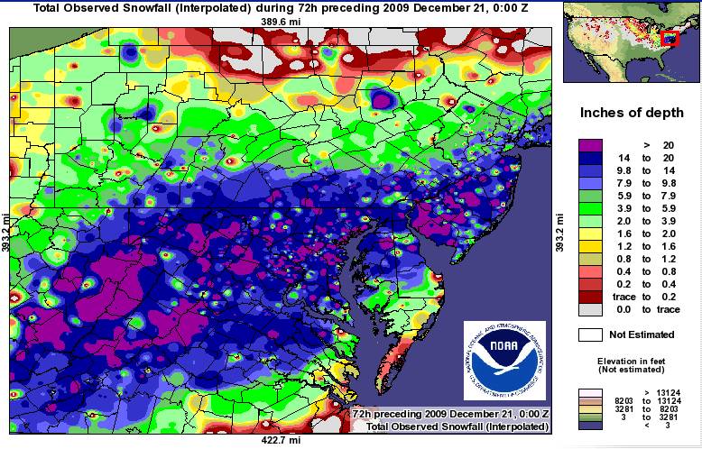
-
You said 2.5" "new" not sure what all the kerfuffle was about?
-

"Don’t do it" 2026 Blizzard obs, updates and pictures.
butterfish55 replied to Ginx snewx's topic in New England
First flakes here in TBlizz land. Can we do 24"?


