All Activity
- Past hour
-

February 2026 OBS & Discussion
donsutherland1 replied to Stormlover74's topic in New York City Metro
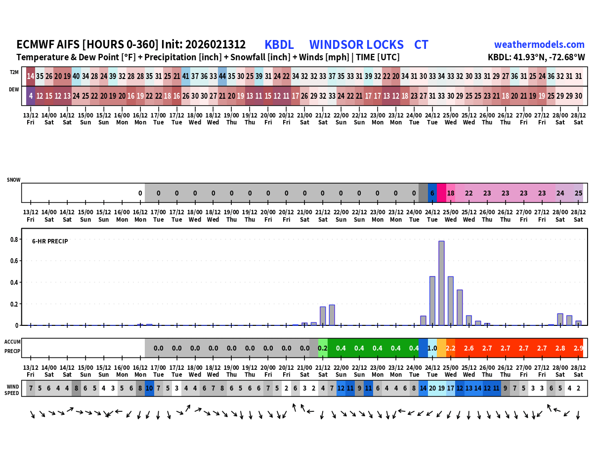
Today at the New York City Subforum: In reality, although the ECMWF-AIFS has brought back a moderate snowfall for Monday, the lack of ensemble support (at 0z), forecast temperatures, and its own unusual inconsistency over the past two days argues that its solution should be taken with a dose of skepticism. One should wait for additional support. For now, a light precipitation event remains possible. A moderate snowfall seems unlikely in the New York City area.
-
FYI mens half pipe is live and is sick. You can rewind on Peacock
-
Speedo? Yeah no
.thumb.png.2be6172032b1a8534ce83d595576f2cb.png)
-

Winter 2025-26 Medium/Long Range Discussion
A-L-E-K replied to michsnowfreak's topic in Lakes/Ohio Valley
problematic look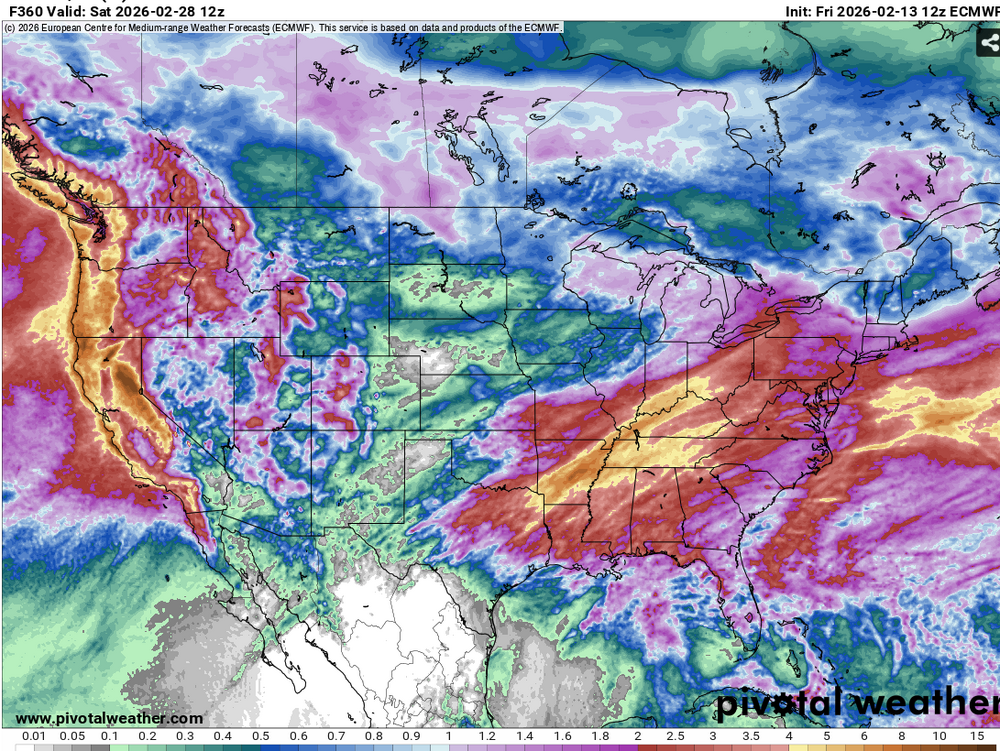
-
WPO is about to tank again. Expect the pattern to get colder again in the east.
-

E PA/NJ/DE Spring 2026 Obs/Discussion
RedSky replied to PhiEaglesfan712's topic in Philadelphia Region
32F feels warm after weeks of Alaska -
WPO is about to tank again. Expect the pattern to get colder again.
-
Frost heaves are starting to get noticeable now.
-
I don't know their names, but I'd bet my retirement it was one of these guys.

-
I have that shield thingy next to my name along with IrishRob and Forky. We’re the traitors like on the show. The Monday storm to me is still very low probability until I see other models jump onboard, it’s very fragile and we’ve seen all kinds of possible phasing setups fail over the last few winters so why would this be any different. We’re going to warm up for a while mid to late month but we have to see if the MJO can throw us a bone and allow for colder conditions to return at the end of the month. There can still be snow if we can time that with a storm.
-
Why would you on February 13? Eps has a stormy pattern ahead.
-
E PA/NJ/DE Winter 2025-26 Obs/Discussion
RedSky replied to LVblizzard's topic in Philadelphia Region
2003 had a cold powder storm in April I measured 6" 15 miles from Philly. This was preceded by two weeks of torch in March -
Here's the coldest for each month, May 1998 on, contrasted with Fort Kent, Jan1, 1976 thru Oct 25, 1985. Month New Sharon Fort Kent Month New Sharon Fort Kent JAN -36 -47 JUL 37 32 FEB -29 -32 AUG 35 28 MAR -25 -32 SEP 23 20 APR 5 -7 OCT 11 7 MAY 21 20 NOV -4 -12 JUN 27 28 DEC -31 -42
-
i suppose emptying the gas for the blowers might have been a mistake. we'll see.
-
SKYNET GONE WILD SNGW

-
Disagree. Extensive snow cover, displaced PV spins off PTV at any time.
-
Thats the design. 0-11” forecasted and couple posters asked me well what’s my prediction and my prediction is the 0-11” model output will verify. That’s what its all about anyway
-

2026-2027 El Nino
BlizzardWx replied to Stormchaserchuck1's topic in Weather Forecasting and Discussion
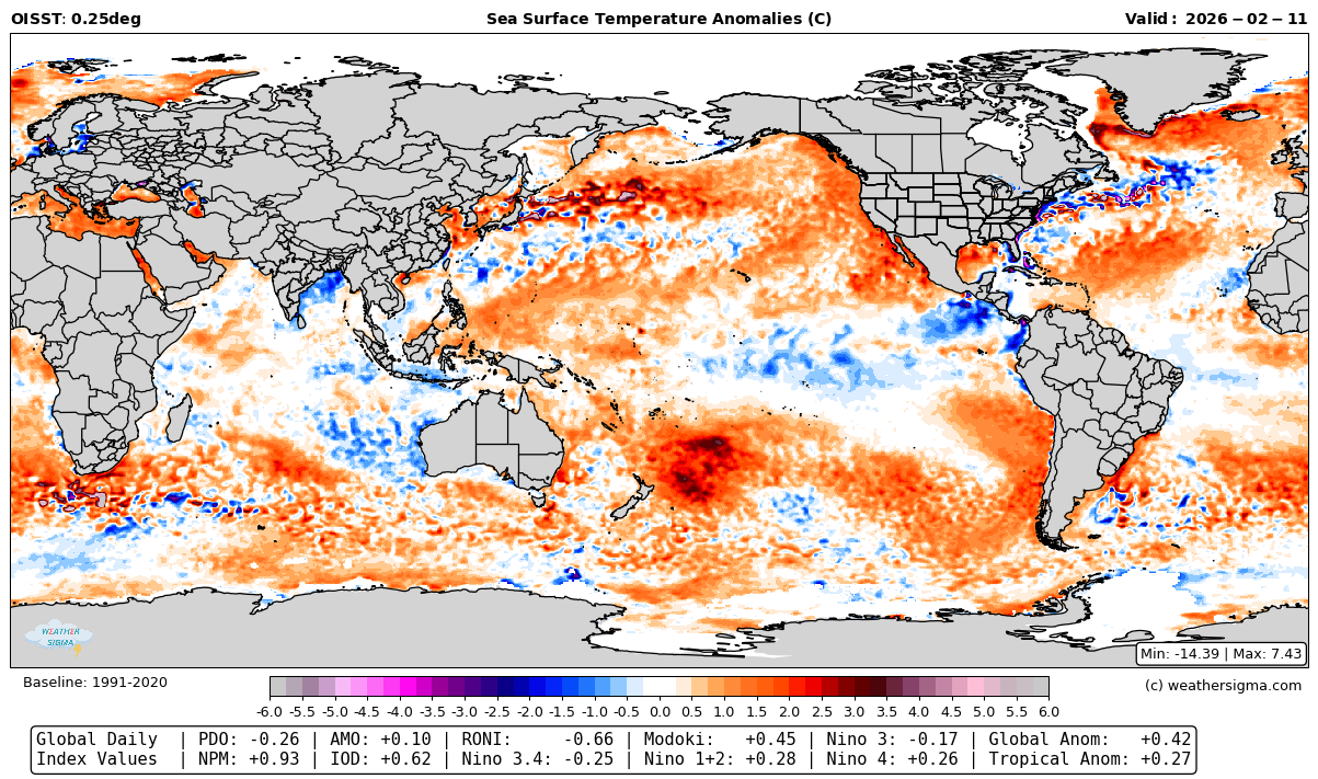
By my calculations, PDO is around -0.25 now. So yeah, I'd say we got a chance to finally break this.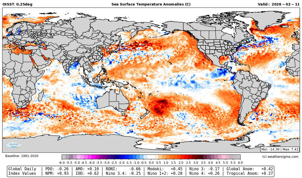
-
@Ji why is snow blue now? It used to be white...they used to make the map grey and snow was white on the maps...you know...LIKE THE COLOR IT ACTUALLY Fing IS!!! Who did this...I want names!
-

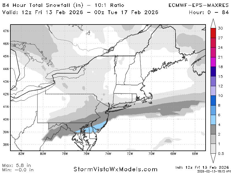
Winter Storm Threat *Technical* Discussion. No Op Run PBP or Snow maps
psuhoffman replied to CAPE's topic in Mid Atlantic
It's a legit window, AIFS loves it, even before it spit out that HECS just now it's been all over it tossing out various east coast snowstorm solutions there. Other guidance hints at it. The 50/50 from the CAPE storm...whatever that ends up being, is the key to our chances with the window around the 24th. -
Better than 6z
-
hmmm interesting - secret agents here now anyways whats your take on the Monday system and beyond ?
-
I can delete posts and pin/lock threads. Guess you can call me a rent-a-moderator.
-
Snowkakke? Ya gotta admit that would be a great thread title on this board
-
you are a moderator ?


.png.334eb30e8dcdbd7e61cf2785f4ae8a58.png)