All Activity
- Past hour
-
History in general is useful, however, I just do not see the benefit from a forecasting perspective where we are trying to understand the upcoming patterns (this forum). I would personally 50 years is ideal, as I am seeing a lot of the 1970s, 80s and 90s repeat since 2018 (actually lived through 80s onward). There is a separate climate change forum where past information is highly relevant and should be discussed, as it can help us prepare for continued change (unless it stops or reverts).
-
Disagree strongly. You can get an amplified storm with only the northern stream. The PNA gives you the track you need for a coastal and the NAO both prevents a cutter and slows down the flow to allow storms to amplify. what we have been missing lately is both the storm track and a blocky flow which allows storms to amplify. This pattern provides that, northern stream or not. Sure we may not get an east coast QPF bomb without some help from the STJ, but we can absolutely see a prolonged period of moderate to higher end events with this pattern. everyone on her know I have no bias when it comes to weather, I’m calling it how I see it.
-

Ice Ice Baby December 28-29 Storm Discussion
dryslot replied to Baroclinic Zone's topic in New England
Same here on the brine, They usually pre treat a day or two before an event. -

Ice Ice Baby December 28-29 Storm Discussion
DavisStraight replied to Baroclinic Zone's topic in New England
My pack is pretty icy, so may survive. -
Temps should start nose diving shortly and then we should start stacking efficiently. Solid coating on all surfaces here so far. Going to be a paste job on the trees as they freeze up.
-

Central PA Winter 25/26 Discussion and Obs
mahantango#1 replied to MAG5035's topic in Upstate New York/Pennsylvania
Just what we need...more freaking wind. -
Lock that up...the 12.5 is right over my new house
-
Man Minneapolis looks to get clocked with a nice snowstorm today. Wish I was there with my non playoff making Vikings team so I can still post about Lamar G III not playing again because of one of the following. IBS, flu, diverticulitis, hamstring, ouchy back or whatever
-
6z EuroAI likes the 10th-11th. We'll see how many more runs it can hold. Lol
.thumb.png.3c89241fb9ff3677a20d77f5f2357305.png)
-
I agree with using the latest 30 years as a valid forecasting tool, and those data sets are vitally important. I also think we should have readily available longer term data sets to fully understand climate shifts over the last couple of centuries, including how man made factors are contributing to the documented warmth. It's a climate vs. meteorology debate, and both are important.
-

Ice Ice Baby December 28-29 Storm Discussion
HoarfrostHubb replied to Baroclinic Zone's topic in New England
My town uses the liquid brine stuff on the main roads, but then the greenish colored salt mix on our side roads. They will probably be plowing during the rain anyway, digging up our wrecked road -

January 2026 regional war/obs/disco thread
Typhoon Tip replied to Baroclinic Zone's topic in New England
I think we need to consider the 6-7-8 a pattern arrival event That's going to be an H.A. implication ( I suspect ...) as nearing the 5th, all ens systems agree in the rather abrupt guard change in the N. Pacific. The entire circulation medium out there essentially product reverses, like on a temporal dime when considering planetary wave distribution. Really fast... intra-weekly time scale. If that happens - first of all - that's likely to cause increased model performance problems. Furthermore, the implications of sending a such a violent signal down stream, the western N/A ridge will be in a period whence the 'correction vector' will be pointed toward more amplitude - hint, I think more than is currently in the cinemas. It's a wave # number/distribution argument. When you supplant the regions N of HA with as much total height anomaly reversal (lowering in this case) like these charts below are showing ( using the GEPs but they are all doing it ), there will physically necessitate height growth into western North America... More than 50% ...closer to 80% of this mass field alteration takes place in < 5 days. I would be reeeally leery about any depictions down stream over eastern N/A. And by that, more amplitude is actually favored. When I say correction vector that's just an expression I use to mean corrections that are inevitable in the guidance will likely lean in a given direction... That all times around the 7th for some sort of emergence E of the nations midriff longitudes.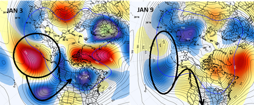
-
Snowing hard now. Not much has stuck yet but it’s starting to turn white in the street. If this band can stick around for a while, this will start adding up quick. .
-
Or maybe just regurgitating the Euro. Lol
-
15 this morning
-
That would be an absolute nightmare lol.
-
I'll take anything honestly. I'm not picky. This is the first time in almost a decade I have off for the holidays (12/31 to 1/5). I'd like to have some stress free snow.
-
I get the post. If we were going to make a forecast, why would we leverage 1840? Anything beyond 30 years will not help us make a seasonal or event forecast.
-
Was watching the Ken Burns Revolutionary War series last night and they got to the winter of 1779-80. Hudson so frozen over you could just walk to New Jersey. Can you even imagine?
-
I can see both of your points. Don is coming more from a letter of the law perspective and you from the spirit of the law. The NAM was trying to show a dry slot and a warm nose between 700-800 MB. While the NAM didn’t get the exact locations of the warm nose and dry slot correct for areas further east, it was correct in the idea that there would be lower accumulations south and west of NYC. The globals really didn’t do well with these features from around NYC and points south and west. I tried a blended approach trying to follow the spirit of what the NAM was trying to say vs the general heavy snowfall signal from the remaining guidance. So this is why earlier in this thread I went 3-5” for EWR-NYC-LGA-JFK and 5-8” for Northern Nassau out into Suffolk. I wasn’t taking the exact NAM run but trying to incorporate what is was implying about lower snowfall risks closer to NYC and points south and west. It would be great if they could replace the NAM with model that is more stable from run to run and show a good solution for the entire region. While maintain the ability to resolve the finer details than a more broad brush global models approach. Perhaps in the future we can develop an AI bridge type model that can incorporate all the models for a great areawide forecast.
-
I don't know. I feel that all recordable history events are valid and relevant. I am in the minority that average temperatures should factor in from whenever we first started recording. We use maximum and minimum temperatures from inception...
-
In Boston (proper) the 12/30/2000 was a horrific Blutarski 0.0 bust, so paired with the March storm (which was still impactful but not the son of '78 we were promised) they were kick-in-the-nuts bookends to the season.
-
I have minimal interest in anything less than a 4-6”+ event. I like snowstorms a lot more than I like snow lol. Hopefully this winter includes something substantial for this area.
-
-3°F this morning.
-

Ice Ice Baby December 28-29 Storm Discussion
wx2fish replied to Baroclinic Zone's topic in New England
I think the state has been reducing usage to some degree. I think they are trying to get contractors to use less overall too.


.png.4b240fb32e524ead4e975e41c368242d.png)


